Best time to visit
Year‑round, weather permitting. In winter, sections can be icy—bring traction if conditions are slick. In summer, go early or late for softer light and a quieter trail experience as the Svartifoss route gets popular in peak hours.

Sight · Vatnajökull National Park
Pretty gorge waterfall on the Svartifoss trail, best from the west
Overview
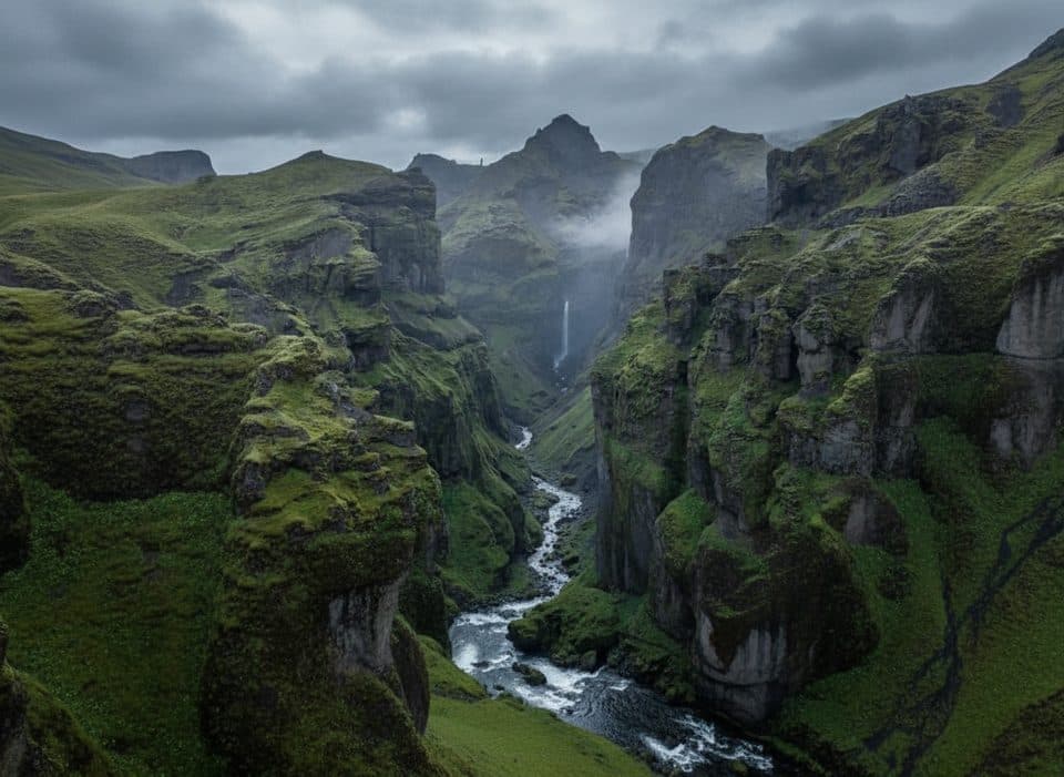
Hundafoss (Dog’s Falls) is a photogenic cascade tucked into a lush, cliff‑lined ravine in the Skaftafell area of Vatnajökull. It’s the first notable waterfall on the popular hike toward Svartifoss, so you’ll pass it on a gentle climb from the Skaftafell visitor area.
Hundafoss is a lovely, low‑effort payoff and a natural add‑on to the Svartifoss hike. It won’t overshadow its famous neighbor, but it’s absolutely worth the quick stop for the ravine views and the sense of the glacier‑carved landscape.
 Parkwolf’s verdictVerdict
Map
Local know-how
Park at the Skaftafell visitor area; parking is paid by card or app.
Take the west‑side spur for the best, more complete view of the falls.
Combine Hundafoss with the Svartifoss loop to see multiple waterfalls.
In winter, carry traction aids; the graded path can ice over.
Cell signal can be spotty—grab a trail map at the visitor centre.
Plan your stop

The highest, rockiest slopes around here are a summer buffet for grizzly bears.
Vatnajökull Tour Guide
Parkwolf is a GPS audio tour guide for Vatnajökull National Park. As you drive, it chimes in with what’s ahead: hidden gems, upcoming stops, history, geology, and wildlife, right through your car’s speakers.
Recorded for this place
Hundafoss, The First Waterfall on the Svartifoss Trail“For anyone hiking from the Skaftafell area up to the more famous Svartifoss, the first waterfall you'll pass is Hundafoss, or 'Dog's Falls'. It's a nice cascade that drops into a steep, green ravine.”
Plays as you drive up to Hundafoss in the Parkwolf Vatnajökull Tour Guide.
More stories near here in the app
“Fantastic app with many points of information… It’s great to just turn on while you’re driving and it gives you an audio tour of the national Park. We love it!!!!”


Guide
Fed by glacial streams, Hundafoss drops roughly two dozen meters into a green, narrow gorge. The official viewpoint looks down into the ravine rather than from the base, which keeps you safe from slick rocks and steep slopes while still giving a satisfying look at the flow and canyon.
Start at the Skaftafell visitor area and follow the clearly signed path toward Svartifoss. Expect an easy to moderate uphill on a wide, well‑marked trail. Many hikers do a short out‑and‑back to Svartifoss or a loop (~4.3 km, ~173 m gain) that also passes Magnúsarfoss and Hundafoss. Hundafoss typically comes up 15–25 minutes from the trailhead, depending on pace.
You’ll get the most complete angle from the west‑side spur; the east side offers only a partial view. There’s no safe access to the base—stick to the designated overlooks.
There are no services at the waterfall. Use the paid parking, toilets, and information at the Skaftafell visitor area before you head out. The path is well signed, but expect slippery surfaces when wet and heed any posted guidance.
This isn’t a wildlife hotspot, but in summer you’ll notice hardy low shrubs and small alpine flowers along the trail, with typical South Iceland birdlife in the woodlands and heaths around Skaftafell.
Wildlife
 22 sightingsGrey SealMost seen around 5 AMSighting map
 258 sightingsHarbor SealMost seen around 11 AMSighting map
 184 sightingsCaribouMost seen around 7 PMSighting map
 62 sightingsArctic FoxMost seen around 8 PMSighting map
 168 sightingsWhooper SwanMost seen around 5 PMSighting map
 68 sightingsAtlantic PuffinMost seen around 7 PMSighting map
Sighting maps show where each species has been reported across Vatnajökull. Wildlife moves, so no sighting is guaranteed.
Keep exploring
 ModerateSjónarnípa Viewpoint Trail (S6)7.5 km · 2.8 hr · 0.8 km awaySvartifoss and a cliff-top glacier overlook in one challenging loop.
 ChallengingMorsárjökull via Morsárdalur19.6 km · 6.5 hr · 0.8 km awayComplete M2 loop from Skaftafell to Morsárjökull’s glacier-lake viewpoint
 ChallengingKristínartindar Trail (S4)17.9 km · 7 hr · 0.8 km awayA demanding 17.9 km loop from Skaftafellsstofa to Kristínartindar’s steep summit ridge, with glacier views throughout.
 ModerateSvartifoss Waterfall (Skaftafell)3.9 km · 1.5 hr · 0.8 km awayA short, sustained climb from Skaftafell Visitor Centre to Iceland’s basalt-framed waterfall.
 ModerateSvartifoss–Sjónarsker–Sel (S2)5.8 km · 2 hr · 0.8 km awayBasalt falls, big views, and turf houses in one tidy loop
 EasySkaftafellsjökull Glacier4.1 km · 1.5 hr · 0.8 km awayEasy circular glacier trail with interpretive stops and close Skaftafellsjökull views
 Campground · 0.7 km awaySkaftafell CampgroundBig, well-situated basecamp for hikes and glacier adventures
 Visitor center · 0.8 km awaySkaftafellsstofa Visitor CenterThe hub for trail info, exhibits, and a warm pre-hike coffee
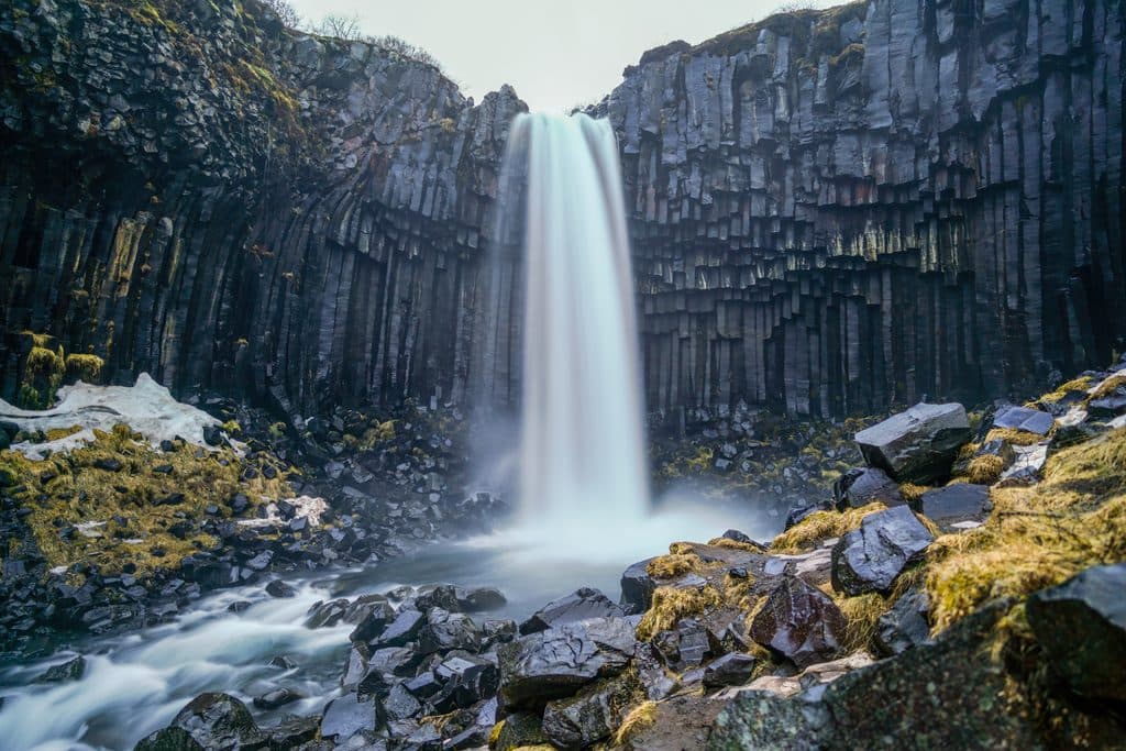 Sight · 0.9 km awaySvartifossBasalt-column waterfall via a short, rewarding Skaftafell hike
 Sight · 3.2 km awaySkaftafellsjökull ViewpointEasy walk to a glacier lagoon with booming, ash-streaked ice
 Sight · 4.1 km awaySkeiðarárbrúTwisted bridge girder and big glacier views on the sandur plain
 Gas station · 5.2 km awayFreysnesOne-stop fuel, food, and tour meet-up near Skaftafell
 Sight · 5.3 km awaySvínafellsjökull ViewpointShort walk to a blue-ice glacier tongue and lagoon
 Sight · 6.1 km awayKristínartindarBig-view summit loop over Skaftafell’s glaciers and falls
Parkwolf’s Vatnajökull ranking
The audio tour guide for the drive, plus offline maps, trails, and wildlife heatmaps for when the signal drops.