Heinabergsdalur (Vatnsdalur) E4 Loop in Vatnajökull National Park

Vatnajökull National Park

Heinabergsdalur (Vatnsdalur) E4 Loop

A ridge loop over a valley once dammed by glacier ice

Photo: Hansueli Krapf, CC BY-SA 4.0, via Wikimedia Commons

Length
17.5km
Time
6.5hr
Elev. change
652m
Difficulty
Challenging
  • Loop
  • Dogs allowed
  • High point 706 m

Hear the audio tour

Heinabergslón: Ice and Changing Rivers

Overview

About Heinabergsdalur (Vatnsdalur) E4 Loop

Why go

  • Icebergs, lagoon and glacier views at the start, with a high ridge above the valleys.
  • A route with striking glacial landforms and a vivid flood history.

Heads up

  • A long, challenging day with 835 m of climbing.
  • A required glacial river crossing with no reliable current crossing guidance.

Map & elevation

The route

Loading the Vatnajökull map
Full map
Elevation54–706 m
TrailheadHeinabergslón car park64.29780, -15.65062
Keep this map with you offline in the Parkwolf app

Plan your hike

Before you go

Parking

Start at Heinabergslón car park, reached by an 8 km gravel road from Route 1 between Skálafell and Flatey. At the junction about 5 km in, take the left branch toward the lagoon. The park recommends a four-wheel-drive vehicle because the road is difficult for ordinary city cars; it is not serviced in winter. A year-round chemical toilet is at the car park.

Safety

Dalá must be crossed. Current water levels and safe-crossing details are not available, so assess conditions at the river and turn back if it is unsafe. The full route is challenging, with 835 m of climbing.

A park ranger sits on a dash-mounted phone, talking, as Parkwolf’s Tour Guide plays “Army Cutworm Moths: A Grizzly Bear Buffet” on Grand Loop Road below Dunraven Pass in Yellowstone
Parkwolf Tour GuideThe highest, rockiest slopes around here are a summer buffet for grizzly bears.

Vatnajökull Tour Guide

Your drive to Heinabergsdalur (Vatnsdalur) E4 Loop, narrated.

Parkwolf is a GPS audio tour guide for Vatnajökull National Park. As you drive, it chimes in with what’s ahead: hidden gems, upcoming stops, history, geology, and wildlife, right through your car’s speakers.

Recorded for this trailhead

Heinabergslón: Ice and Changing Rivers
0:00 / 0:34
“Heinabergslón is coming up, with floating ice below Heinabergsjökull glacier. For a short visit, enjoy the shore and take the interpretive path from the car park; the longer valley hikes are separate, demanding outings.”

Plays as you drive up to this trailhead in the Parkwolf Vatnajökull Tour Guide.

More stories near here in the app

  • Heinaberg: The Farm Walk
  • A Char’s Gravel Nursery
  • A Fish Feels the Water Move
  • A Spring Outfit from Worn Feathers
  • 298 audio storiesacross Vatnajökull’s roads, triggered by GPS as you drive
  • Wildlife heatmapsfor Grey Seal, Harbor Seal, Caribou, and 13 more
  • Works offlinemaps, 92 trails, 75 places, and audio download before you lose signal
  • CarPlay readysimple controls built for the drive
★★★★★
“Fantastic app with many points of information… It’s great to just turn on while you’re driving and it gives you an audio tour of the national Park. We love it!!!!”
JMJamesApp Store review
Download Parkwolf on the App StoreGet Parkwolf on Google Play

4.7 from 8,600+ ratings

Trail guide

Hiking Heinabergsdalur (Vatnsdalur) E4 Loop

A demanding full-day loopHeinabergsdalur (Vatnsdalur) E4 is a 17.

Heinabergsdalur (Vatnsdalur) E4 is a 17.5 km loop from the Heinabergslón car park, through Heinabergsdalur, over Vatnsdalsheiði and Geitakinn, then back to the lagoon. Allow six to seven hours for 835 m of climbing. The park rates it challenging, and that full-day commitment is the point: this is for hikers who want a long mountain route through the glacier-shaped country around Heinabergsjökull, not a quick stop at the lagoon. A separate, shorter E4 cycling route heads into the valley and back; it is a different outing, not the hike's distance.

From the lagoon to the ridgeThe circuit starts beside Heinabergslón, a glacier lagoon below Heinabergsjökull, then heads…

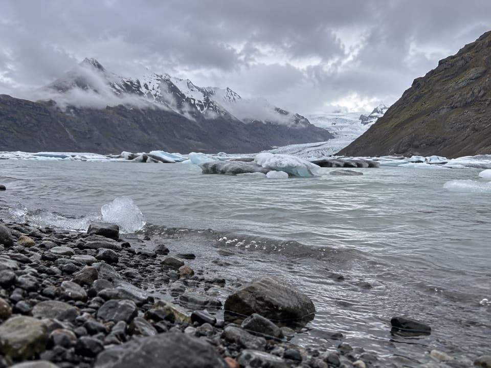
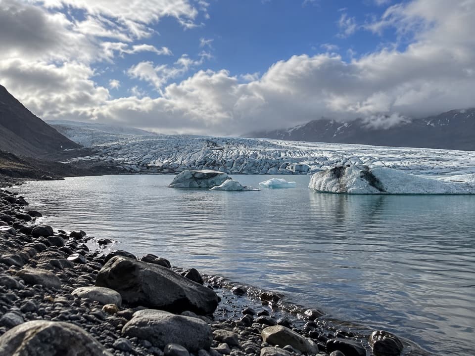
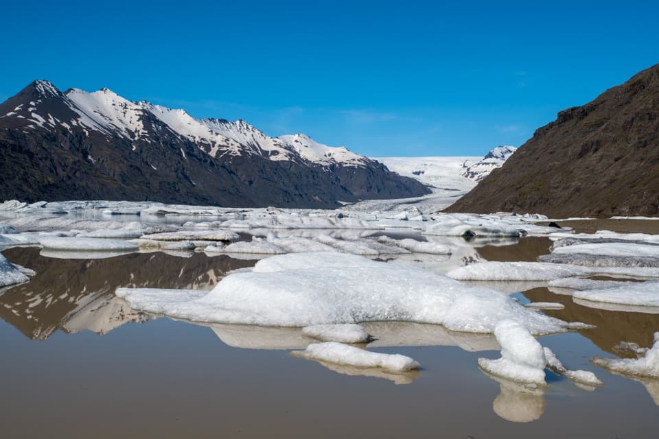
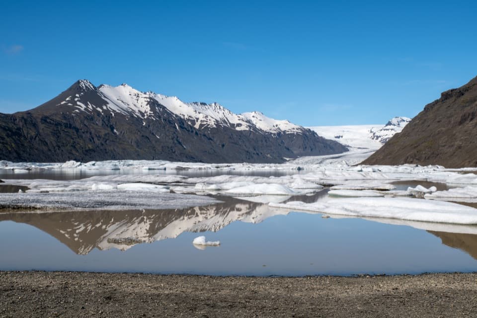
The circuit starts beside Heinabergslón, a glacier lagoon below Heinabergsjökull, then heads inland toward Heinabergsdalur. You have to cross Dalá on the way into the valley. The route reaches Vatnsdalur and Vatnsdalsheiði before the return over Geitakinn; the complete E4 closes back at the same car park. A hiker's account describes the view from the pass up Heinabergsjökull toward the ice cap. At the lagoon, include the ice-streaked water below the glacier in a wide photo; a low angle can catch its reflection when the surface is still.

The river crossing and the effortDalá is the key decision on the route.

Dalá is the key decision on the route. The crossing is required, but current water levels and safe-crossing details aren't available, so conditions on the day matter more than a fixed plan. The park classifies the E4 as challenging; its 17.5 km and 835 m of climbing make this a serious day even before stops. The route information doesn't break down the footing section by section, so don't expect a promise of an evenly built path. If the river is unsafe, turn back rather than committing to the high route.

Landforms left by the iceThe route's points of interest include old shorelines, water-eroded rock, kame terraces, dike…

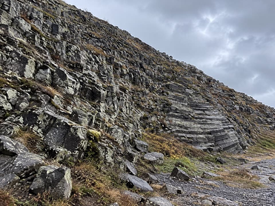
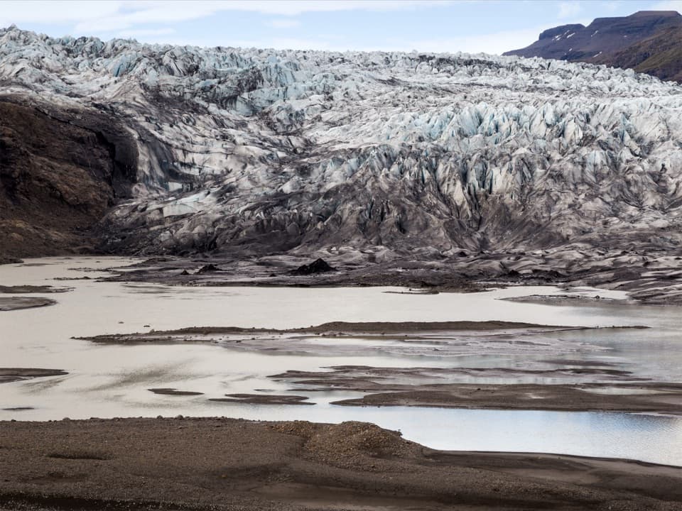
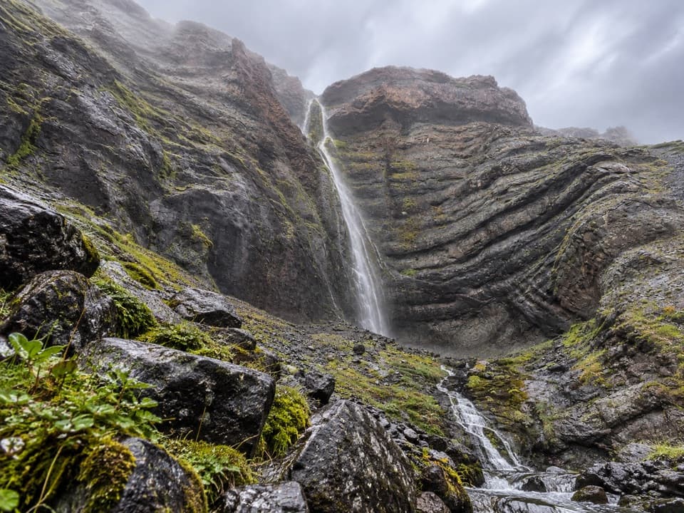
The route's points of interest include old shorelines, water-eroded rock, kame terraces, dike intrusions, waterfalls and canyons. Kame terraces are shelves of sand and gravel deposited beside glacier ice; the old shorelines and water-cut rock show how much the valley has changed as the ice and meltwater moved. The views tie those details together: the glacier is close enough to explain the steep valley, the lagoon at the start and the rough channels below the route.

A valley shaped by floodsHeinabergsjökull once blocked the entrance to Vatnsdalur.

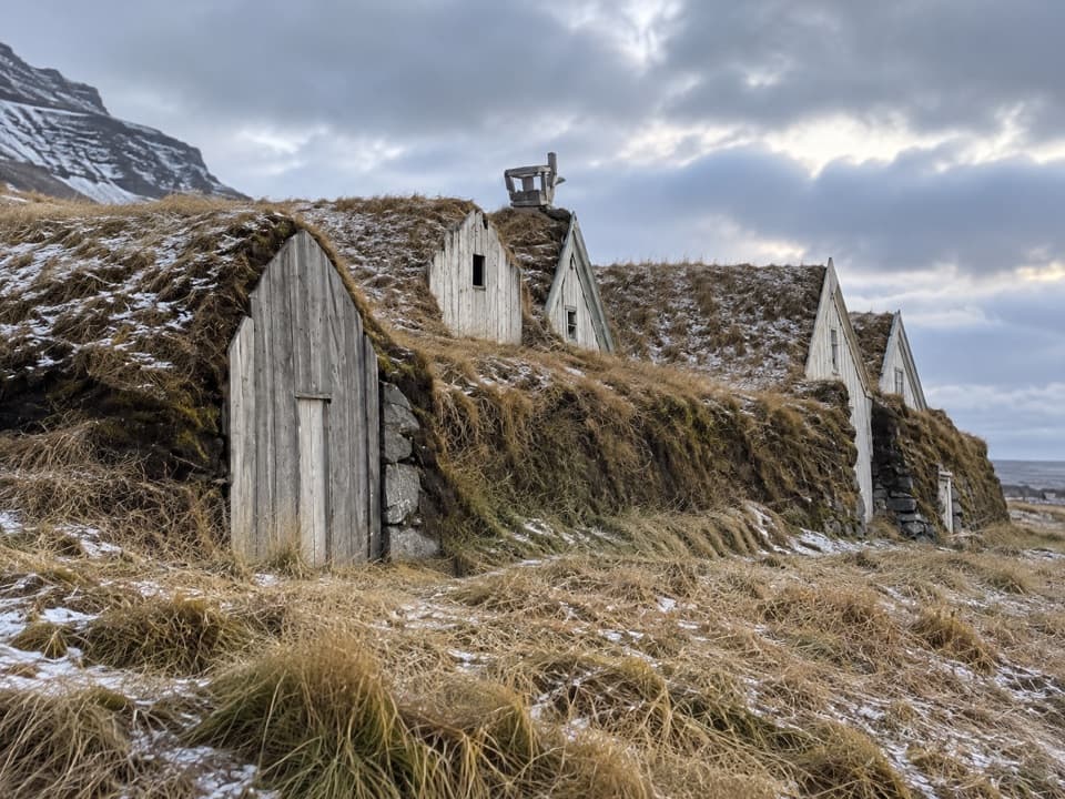
Heinabergsjökull once blocked the entrance to Vatnsdalur. The glacier was at its largest around 1887, damming water that could burst through Vatnsdalur and down Heinabergsdalur. The first major flood in 1898 inundated much of the lowland; floodwater and sandstorms later contributed to the abandonment of several farms. The basin you cross is part of that story, not just a viewpoint on the ice.

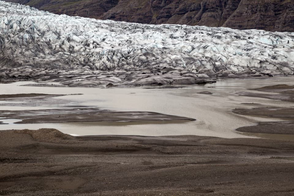
The glacier is still changing the regionRetreating ice exposes fresh land and shifts glacial rivers, creating new sand flats and…

Retreating ice exposes fresh land and shifts glacial rivers, creating new sand flats and moraines where vegetation and wildlife settle. Reindeer are often seen in the Heinaberg region from autumn through spring, though a sighting is never guaranteed. Dogs and other pets are allowed on park trails; keep them from disturbing vegetation or wildlife and clean up after them.

Getting to HeinabergslónThe car park is reached by an 8 km gravel road from Route 1 between Skálafell and Flatey.

The car park is reached by an 8 km gravel road from Route 1 between Skálafell and Flatey. At the junction about 5 km in, take the left branch toward Heinabergslón. The national park recommends a four-wheel-drive vehicle because the road is difficult for ordinary city cars; the road is not serviced in winter. A chemical toilet is available at the car park year-round, while visitor services are seasonal. If you want a shorter walk, the separate interpretive path beside the lagoon is the better fit.

Wildlife

Wildlife in Vatnajökull

All Vatnajökull wildlife maps

Sighting maps show where each species has been reported across Vatnajökull. Wildlife moves, so no sighting is guaranteed.

Keep exploring

Near Heinabergsdalur (Vatnsdalur) E4 Loop

See it all on the map

Trails that start nearby

Places near the trailhead

Parkwolf’s Vatnajökull ranking

Top-rated trails in Vatnajökull

All 92 trails
  1. 1Svartifoss–Sjónarsker–Sel Loop (S2)Moderate · 5.8 km
  2. 2Dettifoss and Selfoss – West BankEasy · 2.5 km
  3. 3Svartifoss TrailModerate · 3 km
  4. 4Skaftafellsjökull Glacier TrailEasy · 4.1 km
  5. 5Múlagljúfur Canyon TrailModerate · 3.9 km
  6. 6Kristínartindar S4 Summit CircuitChallenging · 17.9 km

Take Parkwolf to Vatnajökull.

The audio tour guide for the drive, plus offline maps, trails, and wildlife heatmaps for when the signal drops.

4.7 from 8,600+ ratings

Download Parkwolf on the App StoreGet Parkwolf on Google Play