Vestari-Sauðahnjúkur (S5) Trail in Vatnajökull National Park

Vatnajökull National Park

Vestari-Sauðahnjúkur (S5) Trail

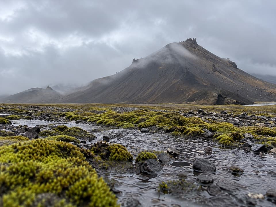
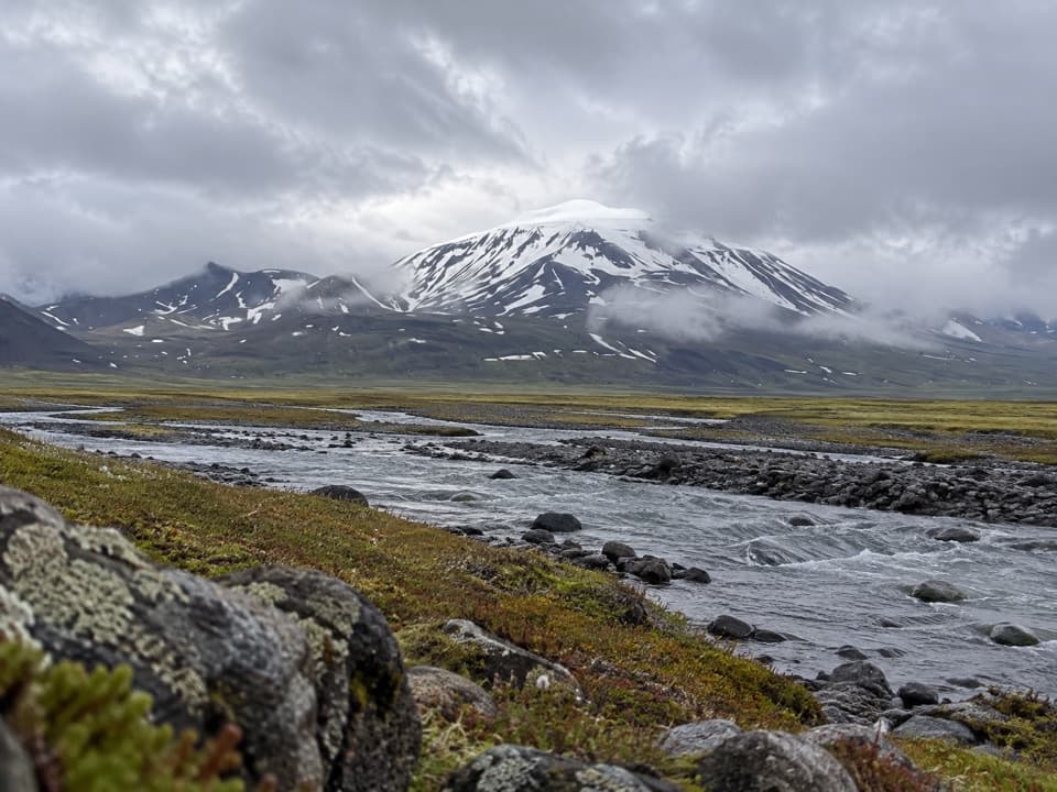
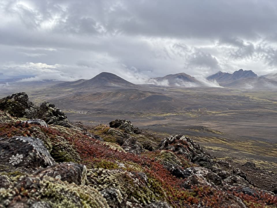
A short highland climb with a view over Brúarjökull.

Length
2km
Time
1hr
Elev. change
87m
Difficulty
Moderate
  • Dogs allowed
  • High point 966 m
Parkwolf audio tour298 stories across Vatnajökull’s roads

Overview

About Vestari-Sauðahnjúkur (S5) Trail

Why go

  • A quick climb to broad views of Brúarjökull and Kverkfjöll.

Heads up

  • The short ascent is still rated challenging.
  • Remote access depends on seasonal highland roads.

Map & elevation

The route

Loading the Vatnajökull map
Full map
Elevation879–966 m
TrailheadCar park next to Vestari-Sauðahnjúkur64.80381, -15.71668
Keep this map with you offline in the Parkwolf app

Plan your hike

Before you go

Parking

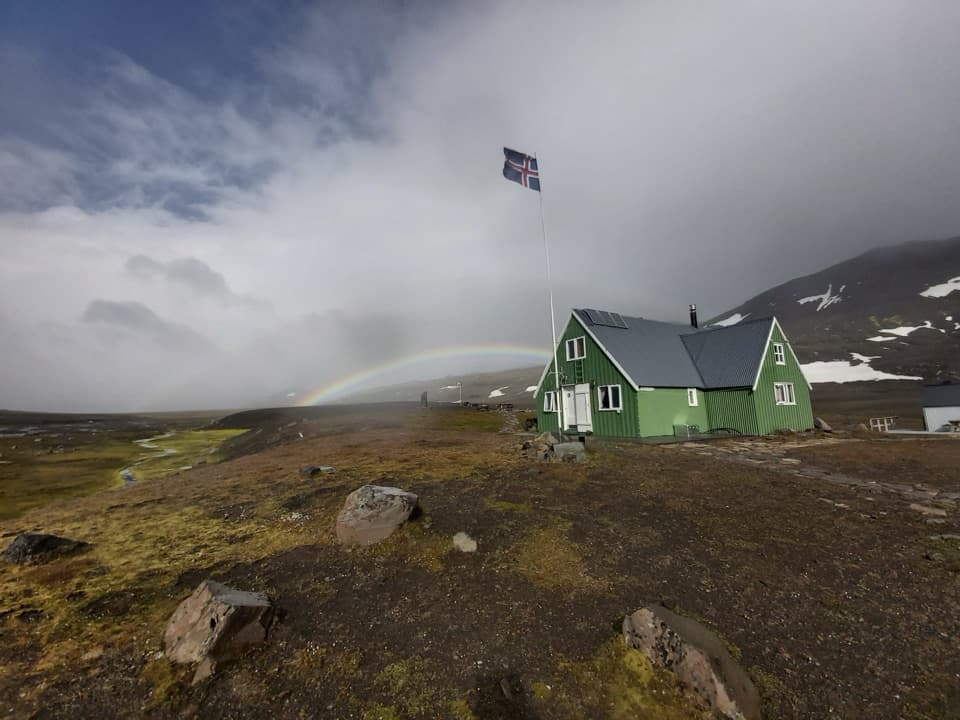
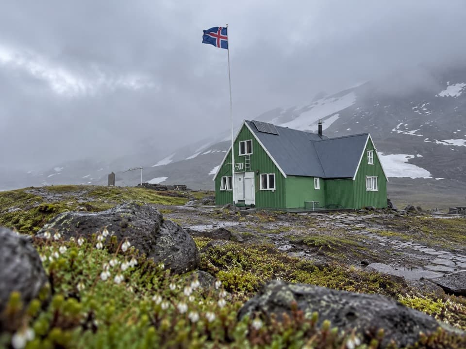
Start at the park-listed car park beside Vestari-Sauðahnjúkur. It is a remote Snæfell highland access reached by mountain roads; confirm which approach is open and check current road status before driving. Parking capacity and fees were not found.

Safety

The park rates the 1 km ascent challenging, with 120 m of gain. Highland weather and road conditions can change quickly; check access before driving. Keep dogs on leash and stay on the marked path.

A park ranger sits on a dash-mounted phone, talking, as Parkwolf’s Tour Guide plays “Army Cutworm Moths: A Grizzly Bear Buffet” on Grand Loop Road below Dunraven Pass in Yellowstone
Parkwolf Tour GuideThe highest, rockiest slopes around here are a summer buffet for grizzly bears.

Vatnajökull Tour Guide

Your drive to Vestari-Sauðahnjúkur (S5) Trail, narrated.

Parkwolf is a GPS audio tour guide for Vatnajökull National Park. As you drive, it chimes in with what’s ahead: hidden gems, upcoming stops, history, geology, and wildlife, right through your car’s speakers.

More stories near here in the app

  • The Snipe's Bending Bill
  • Snæfellsskáli: Beneath the Ice-Capped Volcano
  • Bread Baked Under the Ground
  • Patterns Cut into Christmas Bread
  • 298 audio storiesacross Vatnajökull’s roads, triggered by GPS as you drive
  • Wildlife heatmapsfor Grey Seal, Harbor Seal, Caribou, and 13 more
  • Works offlinemaps, 92 trails, 75 places, and audio download before you lose signal
  • CarPlay readysimple controls built for the drive
★★★★★
“Fantastic app with many points of information… It’s great to just turn on while you’re driving and it gives you an audio tour of the national Park. We love it!!!!”
JMJamesApp Store review
Download Parkwolf on the App StoreGet Parkwolf on Google Play

4.7 from 8,600+ ratings

Trail guide

Hiking Vestari-Sauðahnjúkur (S5) Trail

A short summit out-and-backVestari-Sauðahnjúkur (S5) is a marked 2 km (1.

Vestari-Sauðahnjúkur (S5) is a marked 2 km (1.24 mi) out-and-back in Vatnajökull’s Snæfell highlands: 1 km up to the 1,004 m summit, then the same path down. The park estimates about one hour, lists 120 m of elevation gain and rates it challenging. It’s a good pick for a compact summit walk; just don’t confuse the short mileage with an easy stroll.

The view is the pointFrom the summit, the park identifies views across Vesturöræfi, Hálslón reservoir, Brúarjökull,…

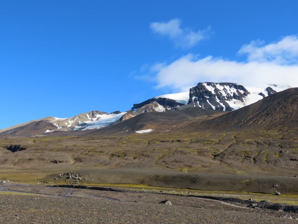
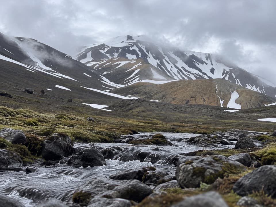
From the summit, the park identifies views across Vesturöræfi, Hálslón reservoir, Brúarjökull, Kverkfjöll and the highlands north of Vatnajökull. Brúarjökull’s surges and retreats shaped the wider plateau, leaving features such as the Töðuhraukar earthen mounds, eskers and glacial ridges. This is a good place to see the glacier and the terrain it has helped shape in the same sweep.

Get the highland access rightThe S5 begins at a car park beside the hill.

The S5 begins at a car park beside the hill. The park describes Snæfell access as a seasonal mountain-road trip; confirm the approach and current road status before driving, since highland road conditions can change quickly. Dogs are allowed on leash under the park-wide rule. The S5 page names a car park but lists no services there.

Wildlife

Wildlife in Vatnajökull

All Vatnajökull wildlife maps

Sighting maps show where each species has been reported across Vatnajökull. Wildlife moves, so no sighting is guaranteed.

Parkwolf’s Vatnajökull ranking

Top-rated trails in Vatnajökull

All 92 trails
  1. 1Svartifoss–Sjónarsker–Sel Loop (S2)Moderate · 5.8 km
  2. 2Dettifoss and Selfoss – West BankEasy · 2.5 km
  3. 3Svartifoss TrailModerate · 3 km
  4. 4Skaftafellsjökull Glacier TrailEasy · 4.1 km
  5. 5Múlagljúfur Canyon TrailModerate · 3.9 km
  6. 6Kristínartindar S4 Summit CircuitChallenging · 17.9 km

Take Parkwolf to Vatnajökull.

The audio tour guide for the drive, plus offline maps, trails, and wildlife heatmaps for when the signal drops.

4.7 from 8,600+ ratings

Download Parkwolf on the App StoreGet Parkwolf on Google Play