Honolua Ridge Trail in West Maui Scenic Drive

West Maui Scenic Drive, HI

Honolua Ridge Trail

A two-mile ridge walk to Puʻu Kaʻeo and a Sugi grove.

Length
2mi
Time
2hr
Elev. change
397ft
Difficulty
Moderate
  • High point 1,644 ft
Parkwolf audio tour65 stories across West Maui Scenic Drive’s roads

Overview

About Honolua Ridge Trail

Why go

  • A named lookout and a planted Sugi grove
  • Native maile and ʻamakū among introduced arboretum trees

Heads up

  • A very long on-foot approach from public access
  • Published access and segment distances conflict

Map & elevation

The route

Loading the West Maui Scenic Drive map
Full map
Elevation1,247–1,644 ft
TrailheadHonolua Ridge Trail Start at Mokupeʻa Lookout20.97968, -156.62052
Keep this map with you offline in the Parkwolf app

Plan your hike

Before you go

Parking

Public access is listed at Kapalua Village Center or D.T. Fleming Beach, followed on foot by the Mahana Ridge approach to the upper trail start. The upper neighborhood is gated and the uphill private road is not a car entrance. Current access information describes the round trip to the upper trailhead as 20-plus miles, while older estimates are shorter; verify the current route before going.

Safety

The public approach is a long walk and published distance estimates differ sharply. No drinking water is confirmed on the upper segment; carry enough water and food for the full walk-in and return, and verify current access before setting out.

1 active West Maui Scenic Drive alert

  • CautionWest Maui daytime lane closures on Routes 30 and 340, Oct. 26–30Expect daytime single-lane closures on Route 30 near Honokōhau and Route 340 between Waiehu and Waiheʻe on scheduled weekdays Oct. 26–30; follow traffic control and allow for alternating traffic.Official details
West Maui Scenic Drive alerts
A park ranger sits on a dash-mounted phone, talking, as Parkwolf’s Tour Guide plays “Army Cutworm Moths: A Grizzly Bear Buffet” on Grand Loop Road below Dunraven Pass in Yellowstone
Parkwolf Tour GuideThe highest, rockiest slopes around here are a summer buffet for grizzly bears.

West Maui Scenic Drive Tour Guide

Your drive to Honolua Ridge Trail, narrated.

Parkwolf is a GPS audio tour guide for West Maui Scenic Drive. As you drive, it chimes in with what’s ahead: hidden gems, upcoming stops, history, geology, and wildlife, right through your car’s speakers.

See the West Maui Scenic Drive audio tour

More stories near here in the app

  • Honolua Bay: Forest and Reef
  • Kapalua Village: The Cardio Loop
  • Mokulēʻia Bay: The Beach Below the Cliffs
  • D.T. Fleming: Beach, Burgers and Ridge Walk
  • 65 audio storiesacross West Maui Scenic Drive’s roads, triggered by GPS as you drive
  • Wildlife heatmapsfor Humpback Whale, Hawaiian Monk Seal, Spinner Dolphin, and 13 more
  • Works offlinemaps, 28 trails, 54 places, and audio download before you lose signal
  • CarPlay readysimple controls built for the drive
★★★★★
“Fantastic app with many points of information… It’s great to just turn on while you’re driving and it gives you an audio tour of the national Park. We love it!!!!”
JMJamesApp Store review
Download Parkwolf on the App StoreGet Parkwolf on Google Play

4.7 from 8,600+ ratings

Trail guide

Hiking Honolua Ridge Trail

What this walk isHonolua Ridge Trail is a roughly 2-mile out-and-back on an unpaved ridge path in the Maunalei…

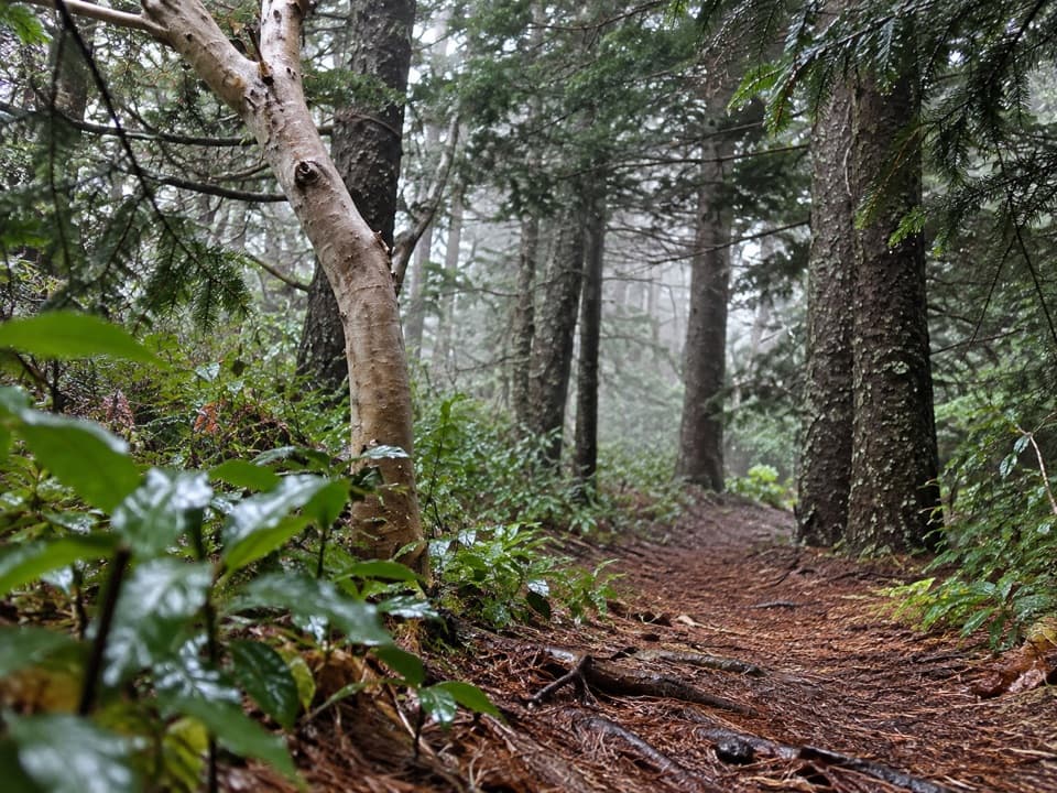
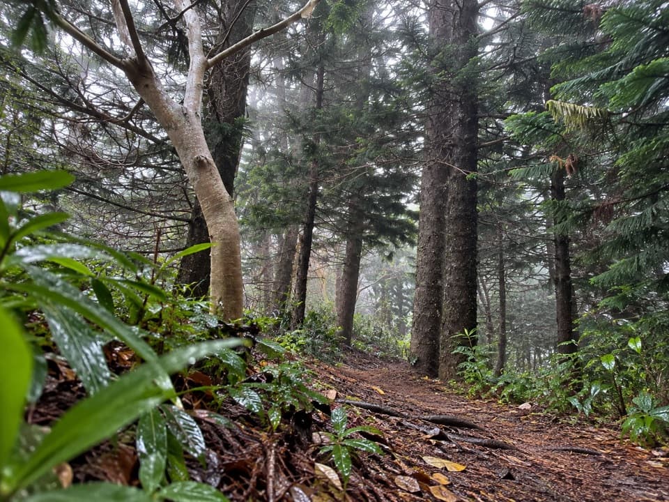
Honolua Ridge Trail is a roughly 2-mile out-and-back on an unpaved ridge path in the Maunalei Arboretum network. From the upper trail start by Mokupeʻa Lookout, it climbs to Puʻu Kaʻeo Lookout and descends toward the Sugi Pine Grove. It suits hikers looking for a planted upland forest and who are already at the upper network; reaching that start from public resort access is a much bigger walk.

The ridge and its distanceThe mapped corridor is just under a mile each way; older trail information lists 1.

The mapped corridor is just under a mile each way; older trail information lists 1.25 miles one way, so treat this section as roughly 2 to 2.5 miles total. Allow about two hours once you reach the upper start. The path climbs to a ridge high point near 1,650 feet, then drops toward the grove; turn around and retrace it. The marked payoff is the lookout and the planted trees, not a long summit traverse.

A planted grove with a storyD.T. Fleming, Honolua Ranch’s plantation manager, created the arboretum after collecting trees.

D.T. Fleming, Honolua Ranch’s plantation manager, created the arboretum after collecting trees. Its plant guide identifies native maile and ʻamakū alongside introduced Sugi (Japanese cedar), Cook pine and other species. At the Sugi Grove, frame the narrow tread between the trunks; it is the clearest defining view on this short ridge route.

Getting to the upper startDo not drive into the gated upper neighborhood.

Do not drive into the gated upper neighborhood. Public access is listed from Kapalua Village Center or D.T. Fleming Beach, on foot via Mahana Ridge. Current access information describes the walk to the upper trailhead as a strenuous 20-plus-mile round trip; older maps and hiking accounts give materially shorter distances. Confirm the current route before setting out. No drinking-water source is confirmed on the upper segment, so carry enough for the full walk-in and return.

Wildlife

Wildlife in West Maui Scenic Drive

All West Maui Scenic Drive wildlife maps

Sighting maps show where each species has been reported across West Maui Scenic Drive. Wildlife moves, so no sighting is guaranteed.

Keep exploring

Near Honolua Ridge Trail

See it all on the map

Trails that start nearby

Places near the trailhead

Parkwolf’s West Maui Scenic Drive ranking

Top-rated trails in West Maui Scenic Drive

All 28 trails
  1. 1Waiheʻe Ridge TrailChallenging · 4.3 mi
  2. 2Kapalua Coastal TrailModerate · 3.5 mi
  3. 3ʻŌhai Loop TrailModerate · 1.2 mi
  4. 4Lāhainā Pali TrailChallenging · 4.8 mi
  5. 5Mahana Ridge TrailModerate · 4 mi
  6. 6Honolua Bay Access TrailEasy · 0.8 mi

Take Parkwolf to West Maui Scenic Drive.

The audio tour guide for the drive, plus offline maps, trails, and wildlife heatmaps for when the signal drops.

4.7 from 8,600+ ratings

Download Parkwolf on the App StoreGet Parkwolf on Google Play