Parking
Use the Lake O’Hara parking lot at the access-road entrance. Private vehicles do not reach the lakeshore; continue by reserved seasonal shuttle or walk 11 km one way on the access road.

Yoho National Park, BC
A cave mouth frames Lake O’Hara on this short shore detour.
Overview
Map & elevation
Plan your hike

The highest, rockiest slopes around here are a summer buffet for grizzly bears.
Yoho Tour Guide
Parkwolf is a GPS audio tour guide for Yoho National Park. As you drive, it chimes in with what’s ahead: hidden gems, upcoming stops, history, geology, and wildlife, right through your car’s speakers.
See the Yoho audio tourMore stories near here in the app
“Fantastic app with many points of information… It’s great to just turn on while you’re driving and it gives you an audio tour of the national Park. We love it!!!!”


Trail guide
Crystal Caves Trail is a 2.1-mile (3.4 km) out-and-back from Lake O’Hara’s shore to a small cave with a view over the water. The shoreline approach heads southeast, then a faint, slightly overgrown path branches right and climbs gently to the cave. A short continuation leads back toward the lake before you turn around. Allow about one to one and a half hours.
Distance is unsettled: the 2.1-mile GPS estimate is longer than the connected tread shown on the map. Plan for the longer figure until the whole route is mapped more closely.
Lake O’Hara is not a drive-up trailhead. Reserve Parks Canada’s seasonal shuttle to Le Relais, or walk 11 km (6.8 mi) one way on the access road from the Lake O’Hara parking lot. That road walk is separate from the cave trail’s distance. Shuttle dates change each year. Le Relais day-use shelter has trail information and simple drinks and snacks during the hiking season; it’s a separate stop from this short walk.
A 1907 Alpine Club of Canada party recorded a stop called Crystal Cave while travelling toward Opabin Pass. They collected specimens and looked back across Lake O’Hara. That old account explains the name, though it doesn’t establish that the modern footpath follows the same line. The cave spur isn’t listed in the park’s public trail information, and permission to enter the cave isn’t established; treat it as an exterior viewpoint.
Wildlife
 21 sightingsGrizzly BearMost seen around 6 AMSighting map
 55 sightingsMountain GoatMost seen around 8 AMSighting map
 61 sightingsBlack BearMost seen around 8 PMSighting map
 66 sightingsElkMost seen around 7 PMSighting map
 26 sightingsMooseMost seen around 6 AMSighting map
 10 sightingsBald EagleMost seen around 7 AMSighting map
Sighting maps show where each species has been reported across Yoho. Wildlife moves, so no sighting is guaranteed.
Keep exploring
 EasyLake O’Hara Shoreline Trail2.8 km · 1 hr · At the trailheadA short lakeside loop to pink quartzite and Seven Veils Falls.
 ModerateLake Oesa Trail6.4 km · 2.5 hr · At the trailheadStone steps, copper cliffs and a turquoise lake in its rock basin.
 ChallengingWiwaxy Gap / Huber Ledges Loop to Lake Oesa7.2 km · 5 hr · At the trailheadA steep alpine loop over Wiwaxy Gap to Lake Oesa.
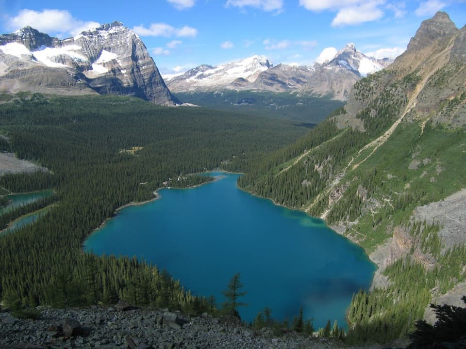 ChallengingYukness Ledges Loop8.6 km · 5 hr · At the trailheadAn 8.6 km alpine loop linking Lake Oesa, Yukness and Opabin.
 ModerateLake McArthur Circuit8 km · 3.5 hr · At the trailheadA proper alpine loop to a bright lake ringed by steep peaks.ChallengingLake O’Hara Alpine Circuit11.1 km · 6 hr · At the trailheadExposed ledges, high lakes, and a full circuit above Lake O’Hara.
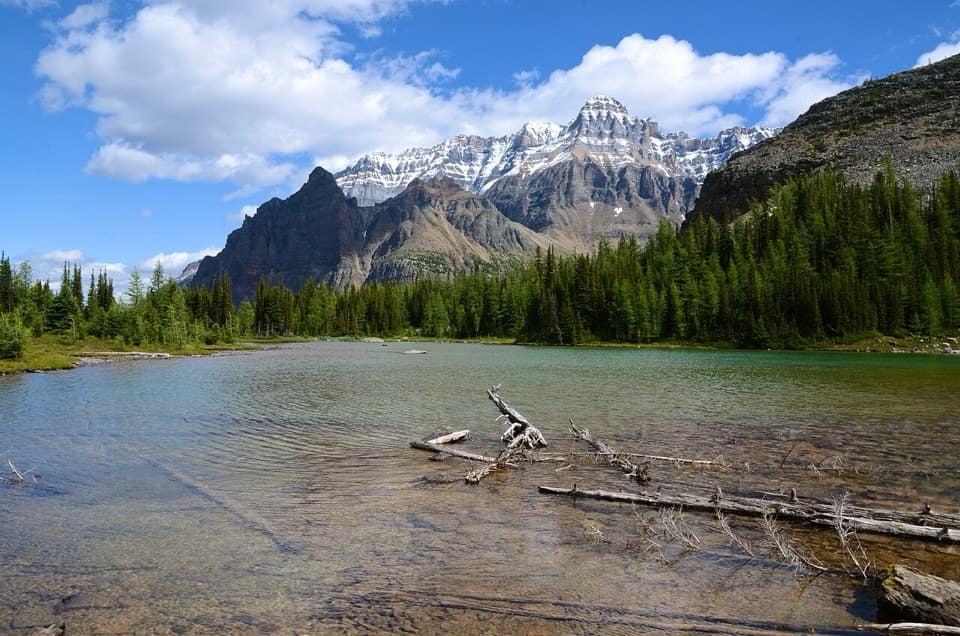 ModerateBig Larches and Schäffer Lake Loop3.2 km · 1.8 hr · At the trailheadA short alpine loop through larches to a clear mountain lake.
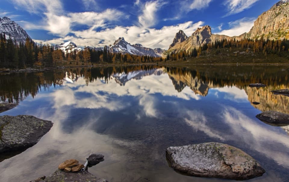 ModerateOpabin Plateau Circuit6.7 km · 2.8 hr · 0.3 km awayA steep climb opens onto alpine lakes beneath a glacier.
 Sight · At the trailheadLake O’HaraAlpine lake and hanging valleys, with a trail network to match.
 Food · At the trailheadLe Relais Day ShelterA warm trail stop for advice, hot drinks and carrot cake.
 Lodging · 0.2 km awayLake O’Hara LodgeA historic lakeshore base at the head of an alpine trail network.
 Lodging · 0.5 km awayElizabeth Parker HutA bookable hut base for Lake O’Hara’s alpine trails.
 Campground · 0.6 km awayLake O’Hara CampgroundA 30-site backcountry base for Lake O’Hara hikes.
 Sight · 1 km awaySeven Veils FallsA waterfall beneath pink quartzite earns a stop on the lakeshore loop.
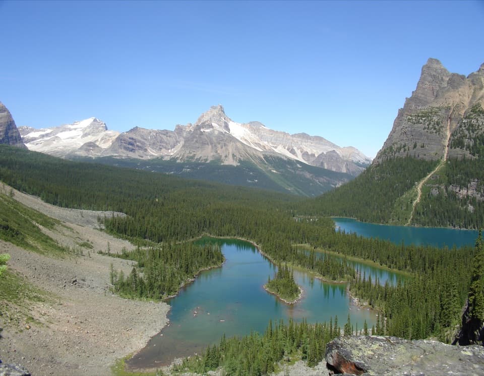 Sight · 1.1 km awayOpabin ProspectA short spur opens onto the cliffs above Lake O’Hara.
 Sight · 2.4 km awayLake OesaA high alpine lake beneath layered quartzite cliffs.
Parkwolf’s Yoho ranking

The audio tour guide for the drive, plus offline maps, trails, and wildlife heatmaps for when the signal drops.

