Parking
Park at the Lake O’Hara access-road parking lot. The seasonal shuttle requires an advance reservation. Walking to the start adds 11 km each way, separate from the circuit; cycling on the access road is prohibited.
#1 of 54 trails in Yoho
Yoho National Park, BC
Exposed ledges, high lakes, and a full circuit above Lake O’Hara.
Overview
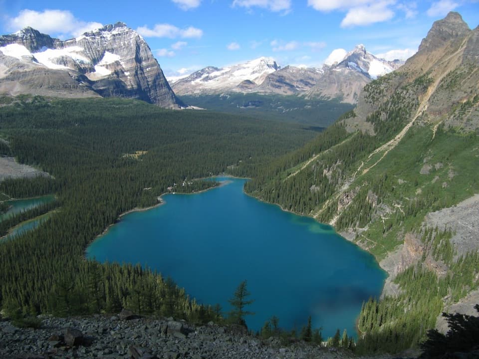
Lake O’Hara Alpine Circuit is a 6.9-mile loop around the high basin in Yoho National Park. It links Wiwaxy Gap and Huber Ledges, Lake Oesa, Yukness Ledges, Opabin Plateau, All Souls Prospect and Schäffer Lake before returning to Le Relais. Set aside about 5–7 hours, with extra time for stops. This is a full alpine day hike for experienced hikers: expect steep climbs, exposed ledges, loose rock and stretches where you must follow cairns and painted markers. The payoff is a changing view over Lake O’Hara, plus a chain of high lakes and open valleys. If heights or route-finding are a concern, take the lower Lake O’Hara Shoreline circuit instead.
Map & elevation
Plan your hike

The highest, rockiest slopes around here are a summer buffet for grizzly bears.
Yoho Tour Guide
Parkwolf is a GPS audio tour guide for Yoho National Park. As you drive, it chimes in with what’s ahead: hidden gems, upcoming stops, history, geology, and wildlife, right through your car’s speakers.
See the Yoho audio tourRecorded for this trailhead
Lake O’Hara: Arrange the Access First“You're nearing the Lake O'Hara access road, but the lake is eleven kilometres beyond the highway parking lot.”
Plays as you drive up to this trailhead in the Parkwolf Yoho Tour Guide.
More stories near here in the app
“Fantastic app with many points of information… It’s great to just turn on while you’re driving and it gives you an audio tour of the national Park. We love it!!!!”


Trail guide
The trail starts at Le Relais day-use shelter. Reach Lake O’Hara from the parking lot at the end of the access road; the seasonal shuttle needs an advance reservation. If you walk instead, the road adds 11 km each way before the circuit, for a 22 km road walk on top of the 6.9-mile loop. Bikes are not allowed on the road. Le Relais is a useful place to warm up, get trail information and buy a hot drink or snack when it is open; bring cash. Shuttle and shelter service are seasonal, so check the current access schedule before you plan the hike.
From Le Relais, the route follows the lakeshore to the Wiwaxy trail and climbs steep switchbacks to Wiwaxy Gap. The climb opens onto a high ridge with a wide view over the basin. From there, Huber Ledges crosses the exposed mountainside toward Lake Oesa. The ledge sections are narrow and uneven, with steep ground below; watch for cairns and blue-and-yellow route markers, and be ready to turn back if cloud or snow makes the line hard to follow.
The route drops to Lake Oesa, where the trail passes through avalanche-swept scree and talus, a patch of stunted forest, and steep rocky outcrops with stone steps built by Lawrence Grassi. The final approach crosses delicate meadows and a trough cut into bedrock before reaching the tilted slabs at the lake. Take care not to trample the small meadow plants around the water.
From Oesa, Yukness Ledges traverses the slope above the basin and connects with the Opabin trails. The Opabin Plateau is a hanging valley on a rocky cliff above Lake O’Hara. Its route winds past small lakes and open views toward Opabin Pass and the surrounding peaks. Stay on the marked trail; the glacier at the foot of Opabin Pass has dangerous crevasses and is not a walking route.
The high traverse gives several different views of the lake rather than one summit panorama. The clearest broad look back into the basin comes from the Yukness ledges, where the blue water sits below steep rock walls and forested slopes.
The circuit continues across the plateau and climbs toward Mount Schaffer before crossing All Souls Prospect, a lookout above Lake O’Hara. It then descends toward Schäffer Lake and follows forest and meadow paths back to Le Relais. Keep the full route in mind at every junction: the Odaray extension is a separate route and is not part of this circuit.
This route is substantially more demanding than the shoreline loop. The alpine routes here are for experienced hikers, with exposure, loose rock, scrambling and route-finding. Snow can linger on high routes into early summer, and steep snow slopes can be avalanche terrain. The best hiking window is generally July through late September, but check current conditions before setting out; mountain weather changes quickly.
Dogs are allowed on the trail if leashed and under control, but they cannot ride the shuttle or enter the campground. A dog means walking the access road, adding 22 km round trip before the circuit. The alpine route is a poor fit for anyone who is uncomfortable with exposure, loose footing or a long day away from the trailhead.
Lake O’Hara takes its name from Colonel Robert O’Hara, an Irish visitor from Galway who came in 1889 after surveyor J.J. McArthur told him about the valley. On the Lake Oesa approach, Lawrence Grassi’s stone steps are still part of the route. They sit among the rugged outcrops on a climb that changes from loose scree to meadows, bedrock and the lake’s slanted shoreline slabs.
Wildlife
 21 sightingsGrizzly BearMost seen around 6 AMSighting map
 55 sightingsMountain GoatMost seen around 8 AMSighting map
 61 sightingsBlack BearMost seen around 8 PMSighting map
 66 sightingsElkMost seen around 7 PMSighting map
 26 sightingsMooseMost seen around 6 AMSighting map
 10 sightingsBald EagleMost seen around 7 AMSighting map
Sighting maps show where each species has been reported across Yoho. Wildlife moves, so no sighting is guaranteed.
Keep exploring
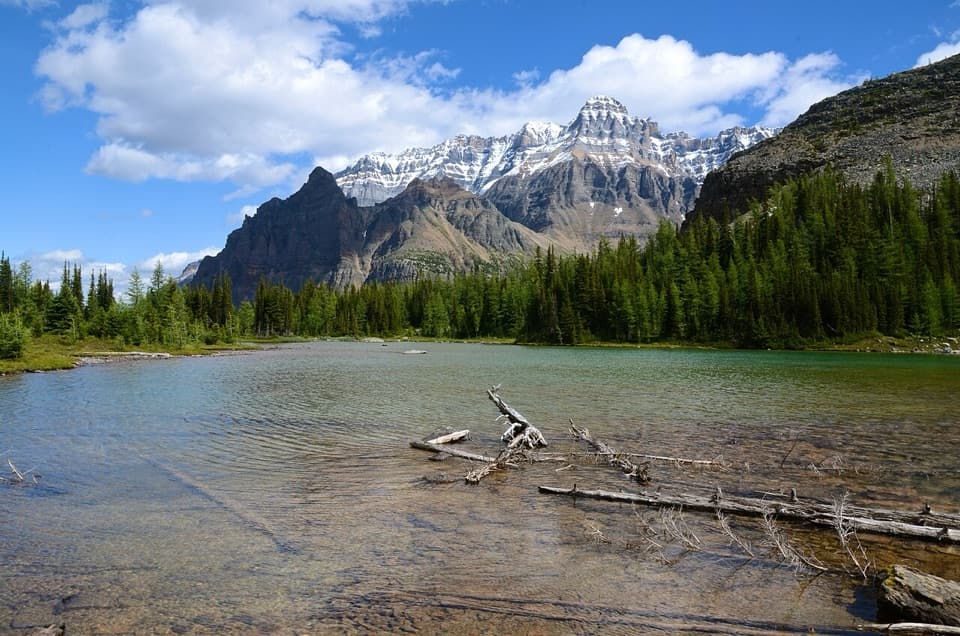 ModerateBig Larches and Schäffer Lake Loop3.2 km · 1.8 hr · At the trailheadA short alpine loop through larches to a clear mountain lake.
 ModerateLake McArthur Circuit8 km · 3.5 hr · At the trailheadA proper alpine loop to a bright lake ringed by steep peaks.
 ModerateLake Oesa Trail6.4 km · 2.5 hr · At the trailheadStone steps, copper cliffs and a turquoise lake in its rock basin.
 ChallengingWiwaxy Gap / Huber Ledges Loop to Lake Oesa7.2 km · 5 hr · At the trailheadA steep alpine loop over Wiwaxy Gap to Lake Oesa.ChallengingYukness Ledges Loop8.6 km · 5 hr · At the trailheadAn 8.6 km alpine loop linking Lake Oesa, Yukness and Opabin.
 EasyLake O’Hara Shoreline Trail2.8 km · 1 hr · At the trailheadA short lakeside loop to pink quartzite and Seven Veils Falls.
 ModerateCrystal Caves Trail3.4 km · 1.3 hr · At the trailheadA cave mouth frames Lake O’Hara on this short shore detour.
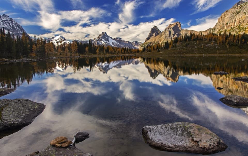 ModerateOpabin Plateau Circuit6.7 km · 2.8 hr · 0.2 km awayA steep climb opens onto alpine lakes beneath a glacier.
 Sight · At the trailheadLake O’HaraAlpine lake and hanging valleys, with a trail network to match.
 Food · At the trailheadLe Relais Day ShelterA warm trail stop for advice, hot drinks and carrot cake.
 Lodging · 0.2 km awayLake O’Hara LodgeA historic lakeshore base at the head of an alpine trail network.
 Lodging · 0.4 km awayElizabeth Parker HutA bookable hut base for Lake O’Hara’s alpine trails.
 Campground · 0.6 km awayLake O’Hara CampgroundA 30-site backcountry base for Lake O’Hara hikes.
 Sight · 1.1 km awaySeven Veils FallsA waterfall beneath pink quartzite earns a stop on the lakeshore loop.
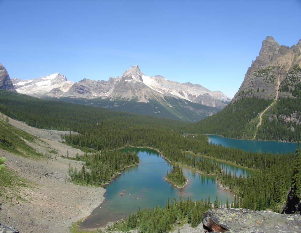 Sight · 1.1 km awayOpabin ProspectA short spur opens onto the cliffs above Lake O’Hara.
 Sight · 2.5 km awayLake OesaA high alpine lake beneath layered quartzite cliffs.
Parkwolf’s Yoho ranking

The audio tour guide for the drive, plus offline maps, trails, and wildlife heatmaps for when the signal drops.


