Opabin Plateau Circuit in Yoho National Park

#4 of 54 trails in Yoho

Yoho National Park, BC

Opabin Plateau Circuit

A steep climb opens onto alpine lakes beneath a glacier.

Photo: Wikimedia Commons
Length
6.7km
Time
2.8hr
Elev. change
279m
Difficulty
Moderate
  • Loop
  • Dogs allowed
  • High point 2,292 m

Hear the audio tour

Lake O’Hara: Arrange the Access First

Overview

About Opabin Plateau Circuit

Why go

  • A full traverse of alpine lakes, creek and larch-lined meadows.
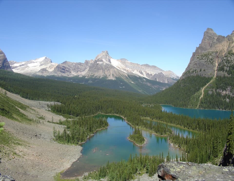
  • Opabin Prospect gives a wide view over Lake O’Hara and Mary Lake.

Heads up

  • The West arm’s open talus pitch and the East arm’s long switchbacks are tiring.
  • Without a shuttle reservation, the 11 km access road adds a 22 km walk.

Map & elevation

The route

Loading the Yoho map
Full map
Elevation2,013–2,292 m
TrailheadWest Opabin Trailhead, southwest shore of Lake O’Hara51.35585, -116.34097
Keep this map with you offline in the Parkwolf app

Plan your hike

Before you go

Parking

Begin at the signed West Opabin trailhead on Lake O’Hara’s southwest shore. Park at the Lake O’Hara lot beside Highway 1, 12 km west of Lake Louise or 13 km east of Field; the lake is 11 km up the access road. A reserved summer shuttle reaches the lake, or visitors can walk the road each way.

Safety

The West arm climbs a steep, loose talus slope for about 120 m. The East return descends 0.8 km of switchbacks. Higher routes can remain snowbound and avalanche-prone into late June; stay off the crevassed glacier beyond Opabin Lake. Treat surface water before drinking. Backcountry dogs must be leashed, and pets cannot ride the shuttle.

5 active Yoho alerts

  • ClosureYoho Valley Road closed for avalanche seasonYoho Valley Road is closed to vehicles from mid-October to mid-June because of avalanche risk. - Parks Canada’s current trail report lists no vehicle access to trails in the Yoho Valley.Official details
  • CautionWatercraft and angling prohibited in YohoWatercraft use and angling are prohibited on all waterbodies in Yoho National Park until March 31, 2027, to reduce the spread of aquatic invasive species, including whirling disease.Official details
See all 5 alerts
A park ranger sits on a dash-mounted phone, talking, as Parkwolf’s Tour Guide plays “Army Cutworm Moths: A Grizzly Bear Buffet” on Grand Loop Road below Dunraven Pass in Yellowstone
Parkwolf Tour GuideThe highest, rockiest slopes around here are a summer buffet for grizzly bears.

Yoho Tour Guide

Your drive to Opabin Plateau Circuit, narrated.

Parkwolf is a GPS audio tour guide for Yoho National Park. As you drive, it chimes in with what’s ahead: hidden gems, upcoming stops, history, geology, and wildlife, right through your car’s speakers.

See the Yoho audio tour

Recorded for this trailhead

Lake O’Hara: Arrange the Access First
0:00 / 0:36
“You're nearing the Lake O'Hara access road, but the lake is eleven kilometres beyond the highway parking lot.”

Plays as you drive up to this trailhead in the Parkwolf Yoho Tour Guide.

More stories near here in the app

  • A Predator With a Softer Menu
  • Lower Spiral Tunnel: Climbing Inside the Mountain
  • Sherbrooke Lake and Paget Lookout: Choose Your Climb
  • The Bird That Plants Pines
  • 35 audio storiesacross Yoho’s roads, triggered by GPS as you drive
  • Wildlife heatmapsfor Grizzly Bear, Mountain Goat, Black Bear, and 13 more
  • Works offlinemaps, 54 trails, 58 places, and audio download before you lose signal
  • CarPlay readysimple controls built for the drive
★★★★★
“Fantastic app with many points of information… It’s great to just turn on while you’re driving and it gives you an audio tour of the national Park. We love it!!!!”
JMJamesApp Store review
Download Parkwolf on the App StoreGet Parkwolf on Google Play

4.7 from 8,600+ ratings

Trail guide

Hiking Opabin Plateau Circuit

The full circuitThe Opabin Plateau Circuit is an alpine loop above Lake O’Hara, climbing the West Opabin arm,…

The Opabin Plateau Circuit is an alpine loop above Lake O’Hara, climbing the West Opabin arm, crossing the hanging valley to Opabin Lake, and returning by the East Opabin arm and lakeshore. The published circuit figure is 5.9 km, but tracing the closed walk from the West Opabin sign back along the shore measures about 6.7 km (4.2 miles); plan for the longer total. The route climbs about 250 m and usually takes 2½ to 3 hours, before longer stops. This is a moderate day hike with one steep, loose section that takes more care than the distance suggests.

Up the west armStart at the signed trail on Lake O’Hara’s southwest end.

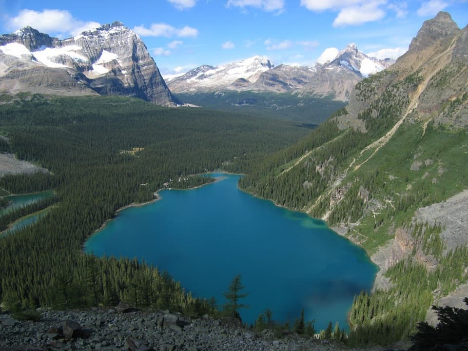
Start at the signed trail on Lake O’Hara’s southwest end. The path climbs quickly to Mary Lake, follows the shore, then tackles an open talus slope that gains about 120 m. The stones are loose and the slope is steep; take your time rather than trying to keep the pace of the smoother lower trail. A grassy cleft brings you onto the rolling plateau. That sudden change—from cliff-side climbing to broad alpine ground—is one of the best parts of the route.

Across the hanging valleyThe trail enters the small Opabin Creek valley, crosses the creek on a bridge, and passes…

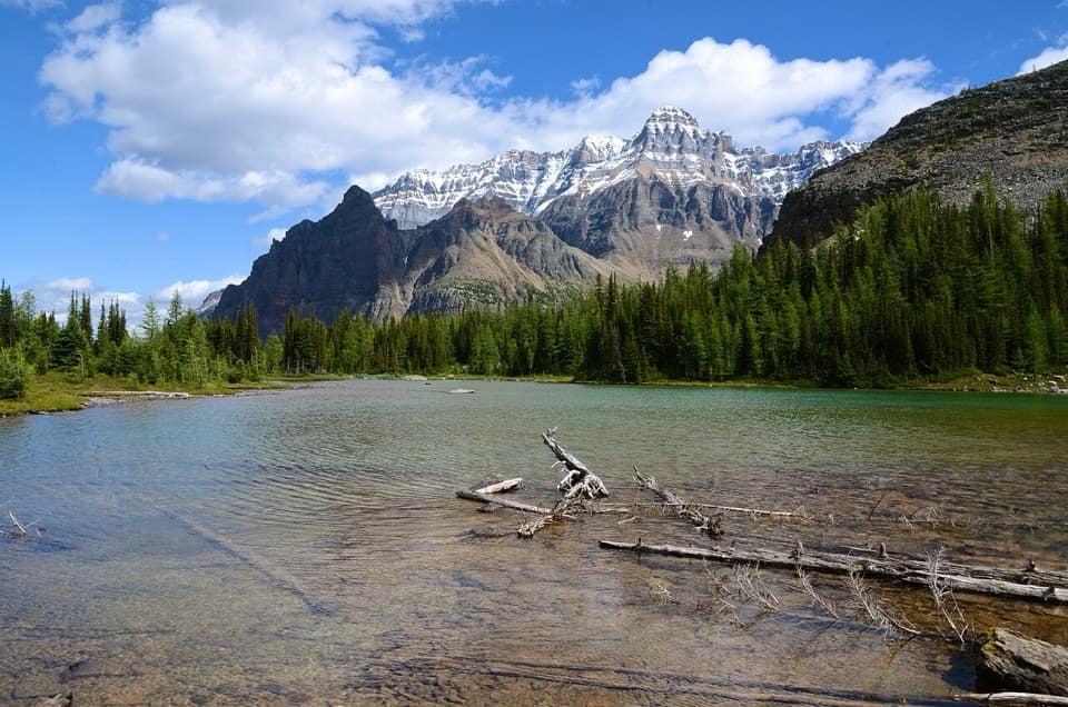
The trail enters the small Opabin Creek valley, crosses the creek on a bridge, and passes southwest of Hungabee Lake. It climbs another talus knoll before reaching Opabin Lake, tucked beneath the peaks at the end of the valley. A long glacier lies beyond the lake at Opabin Pass. Stay on the trail and off the glacier: crevasses make it dangerous even when the surface looks walkable. Filter or treat any surface water before drinking; the route’s streams are not a potable-water source.

Take the viewpoint spur if you have timeNear the top of the West Opabin climb, a small path branches east to Opabin Prospect.

Near the top of the West Opabin climb, a small path branches east to Opabin Prospect. The rocky edge opens a wide view across Lake O’Hara and Mary Lake below. It is an optional detour, not a required part of the circuit, but it gives you a useful look back at the cliff you just climbed. For a photo, use the rock lip in the foreground and include both lakes so the height reads in the frame. Late September can bring golden alpine larch, though the exact color peak shifts from year to year.

Down the east armThe return starts on Opabin Lake’s east shore and descends past Hungabee Lake along the foot of…

The return starts on Opabin Lake’s east shore and descends past Hungabee Lake along the foot of Yukness Mountain. The junction for the Yukness Ledges Alpine Route is a separate, more demanding outing; stay on the lower circuit. Grassy meadows lead to the valley brink, then a 0.8 km run of switchbacks drops back to Lake O’Hara. The descent is steady and can feel hard on tired legs, so save enough energy for the final switchbacks and shore walk back to the West Opabin sign.

Getting to the startThe trailhead is not at the highway lot.

The trailhead is not at the highway lot. Park at the Lake O’Hara parking lot beside Highway 1, then use a reserved summer day shuttle or walk the 11 km access road each way; that road approach is outside the trail distance and turns the day into a much longer outing. The road is not open to bicycles. Le Relais, near the shuttle stop, is a separate day-use shelter where hot drinks and snacks may be available during hiking season. The high trails can remain snowbound and avalanche-prone into late June, and mountain weather can change quickly. Carry bear spray and know how to use it. Dogs may hike in the backcountry on leash, but cannot ride the shuttle or stay at the campground; anyone bringing a dog needs to plan the road access accordingly. If you want less climbing, the Lake O’Hara Shore Loop is a shorter, gentler alternative.

Wildlife

Wildlife in Yoho

All Yoho wildlife maps

Sighting maps show where each species has been reported across Yoho. Wildlife moves, so no sighting is guaranteed.

Keep exploring

Near Opabin Plateau Circuit

See it all on the map

Trails that start nearby

Places near the trailhead

Parkwolf’s Yoho ranking

Top-rated trails in Yoho

All 54 trails
  1. 1Lake O’Hara Alpine CircuitChallenging · 11.1 km
  2. 2Iceline via Little YohoChallenging · 20.3 km
  3. 3Lake McArthur CircuitModerate · 8 km
  4. 5Emerald Lakeshore TrailEasy · 5.2 km
  5. 6Lake Oesa TrailModerate · 6.4 km
  6. 7Iceline via Celeste Lake LoopChallenging · 17.4 km

Take Parkwolf to Yoho.

The audio tour guide for the drive, plus offline maps, trails, and wildlife heatmaps for when the signal drops.

4.7 from 8,600+ ratings

Download Parkwolf on the App StoreGet Parkwolf on Google Play