Lake O’Hara Shoreline Trail in Yoho National Park

Yoho National Park, BC

Lake O’Hara Shoreline Trail

A short lakeside loop to pink quartzite and Seven Veils Falls.

Photo: Wikimedia Commons
Length
2.8km
Time
1hr
Elev. change
32m
Difficulty
Easy
  • Loop
  • High point 2,049 m
  • #11 of 54 in Yoho

Hear the audio tour

Lake O’Hara: Arrange the Access First

Overview

About Lake O’Hara Shoreline Trail

Why go

  • Seven Veils Falls and a pink quartzite outcrop sit on the short loop.
  • A close lake circuit without committing to the high alpine routes.

Heads up

  • The approach can add a 22 km road walk if you do not reserve the seasonal shuttle.
  • The north shore crosses several gullies on a steep hillside above the lake.

Map & elevation

The route

Loading the Yoho map
Full map
Elevation2,017–2,049 m
TrailheadO’Hara Warden Cabin51.35753, -116.33851
Keep this map with you offline in the Parkwolf app

Plan your hike

Before you go

Parking

The Lake O’Hara lot off Highway 1 is the shuttle departure, not the trailhead. Reserve the seasonal Parks Canada shuttle or arrange an eligible overnight stay to reach the Warden Cabin; otherwise, the 11 km road walk each way adds 22 km before the circuit.

Safety

The north shore follows a steep hillside above the lake and crosses several gullies. Pets cannot ride the shuttle or stay at the campground; confirm whether pets may use the shoreline trail if you plan to hike in with one.

5 active Yoho alerts

  • ClosureYoho Valley Road closed for avalanche seasonYoho Valley Road is closed to vehicles from mid-October to mid-June because of avalanche risk. - Parks Canada’s current trail report lists no vehicle access to trails in the Yoho Valley.Official details
  • CautionWatercraft and angling prohibited in YohoWatercraft use and angling are prohibited on all waterbodies in Yoho National Park until March 31, 2027, to reduce the spread of aquatic invasive species, including whirling disease.Official details
See all 5 alerts
A park ranger sits on a dash-mounted phone, talking, as Parkwolf’s Tour Guide plays “Army Cutworm Moths: A Grizzly Bear Buffet” on Grand Loop Road below Dunraven Pass in Yellowstone
Parkwolf Tour GuideThe highest, rockiest slopes around here are a summer buffet for grizzly bears.

Yoho Tour Guide

Your drive to Lake O’Hara Shoreline Trail, narrated.

Parkwolf is a GPS audio tour guide for Yoho National Park. As you drive, it chimes in with what’s ahead: hidden gems, upcoming stops, history, geology, and wildlife, right through your car’s speakers.

See the Yoho audio tour

Recorded for this trailhead

Lake O’Hara: Arrange the Access First
0:00 / 0:36
“You're nearing the Lake O'Hara access road, but the lake is eleven kilometres beyond the highway parking lot.”

Plays as you drive up to this trailhead in the Parkwolf Yoho Tour Guide.

More stories near here in the app

  • A Predator With a Softer Menu
  • Sherbrooke Lake and Paget Lookout: Choose Your Climb
  • Lower Spiral Tunnel: Climbing Inside the Mountain
  • The Bird That Plants Pines
  • 35 audio storiesacross Yoho’s roads, triggered by GPS as you drive
  • Wildlife heatmapsfor Grizzly Bear, Mountain Goat, Black Bear, and 13 more
  • Works offlinemaps, 54 trails, 58 places, and audio download before you lose signal
  • CarPlay readysimple controls built for the drive
★★★★★
“Fantastic app with many points of information… It’s great to just turn on while you’re driving and it gives you an audio tour of the national Park. We love it!!!!”
JMJamesApp Store review
Download Parkwolf on the App StoreGet Parkwolf on Google Play

4.7 from 8,600+ ratings

Trail guide

Hiking Lake O’Hara Shoreline Trail

A short loop with a long approachThe Lake O’Hara Shoreline Trail is a 2.8 km (1.

The Lake O’Hara Shoreline Trail is a 2.8 km (1.7 mi) loop from the O’Hara Warden Cabin, circling the lake and returning to the same access. Allow about 45 minutes to an hour for the walk and a few stops. Its small ups and downs make it an easy way to spend time beside Lake O’Hara, but don’t choose it expecting a flat lakeside promenade. The 2.8 km is the circuit only; it doesn’t include getting to the trailhead.

Reserve the trip in, not just the hikePrivate vehicles stop at the Lake O’Hara parking lot off Highway 1; a seasonal Parks Canada…

Private vehicles stop at the Lake O’Hara parking lot off Highway 1; a seasonal Parks Canada shuttle carries reserved day visitors to the lake. A booked overnight stay is another way to arrange access. Without a shuttle or an overnight booking, the road is an 11 km walk each way, adding 22 km before the loop. Check current access dates and reservation rules before planning a day around this short walk. Le Relais day-use shelter near the bus drop offers trail information, hot drinks and snacks in hiking season; treat it as a separate stop before or after the circuit, not a café on the shore.

Follow the shoreline signsStart at the O’Hara Warden Cabin, cross the bridge over Cataract Brook, and head east.

Start at the O’Hara Warden Cabin, cross the bridge over Cataract Brook, and head east. On the north shore, pass the left-hand start of the Wiwaxy Gap and Huber Ledges route, then continue across a steep hillside and several gullies above the lake. At the eastern end, the Lake Oesa junction and a huge pink quartzite outcrop mark a change in scenery; Seven Veils Falls drops just below the rock. Keep to the shoreline circuit at the alpine-route junctions if you want to stay on this short loop. Continue around the south shore to close the loop at the cabin; higher alpine trails branch away for a much bigger outing.

A hillside, not a flat waterfront pathThe loop has minor ups and downs overall, but the north side runs above the water on a steep…

The loop has minor ups and downs overall, but the north side runs above the water on a steep hillside and crosses several gullies. Cataract Brook is crossed by bridge. That makes this a short mountain hike rather than a level promenade, even though the elevation change is modest compared with the harder routes nearby. The shoreline route is a good fit for hikers who want the lake and its close-up landmarks without committing to a long climb; take the steeper branches only if you mean to turn the walk into a different hike.

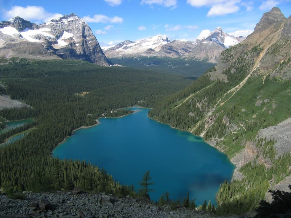
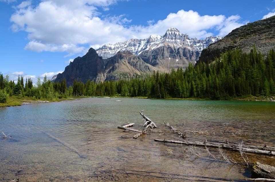
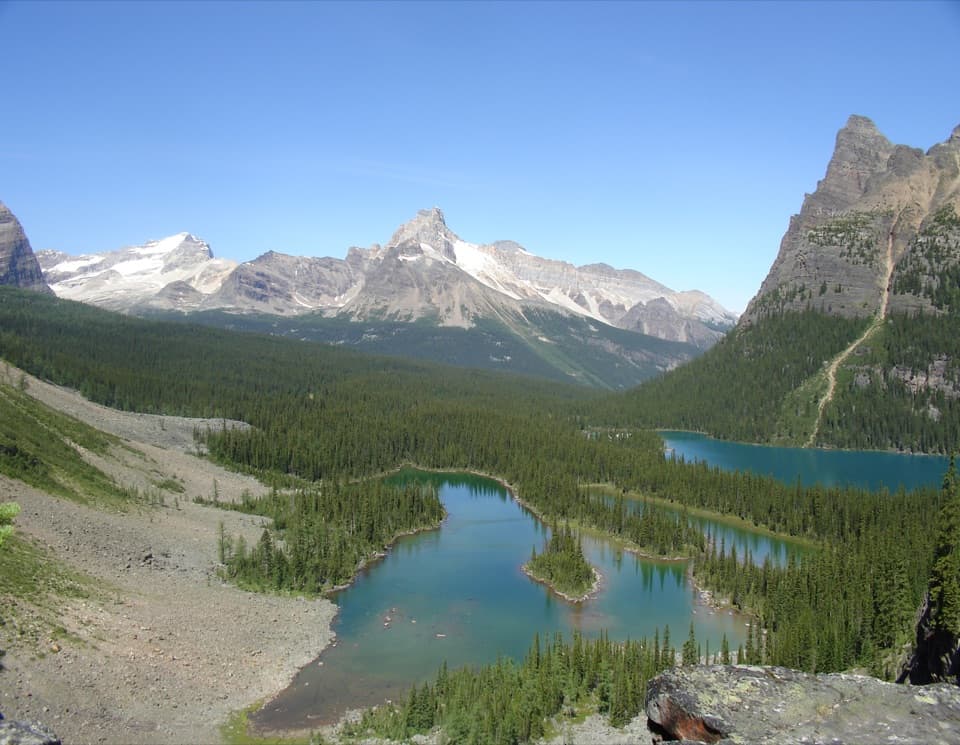
Two views in one lapThe payoff is close, not a summit: turquoise water, a ring of forest and high pale peaks.

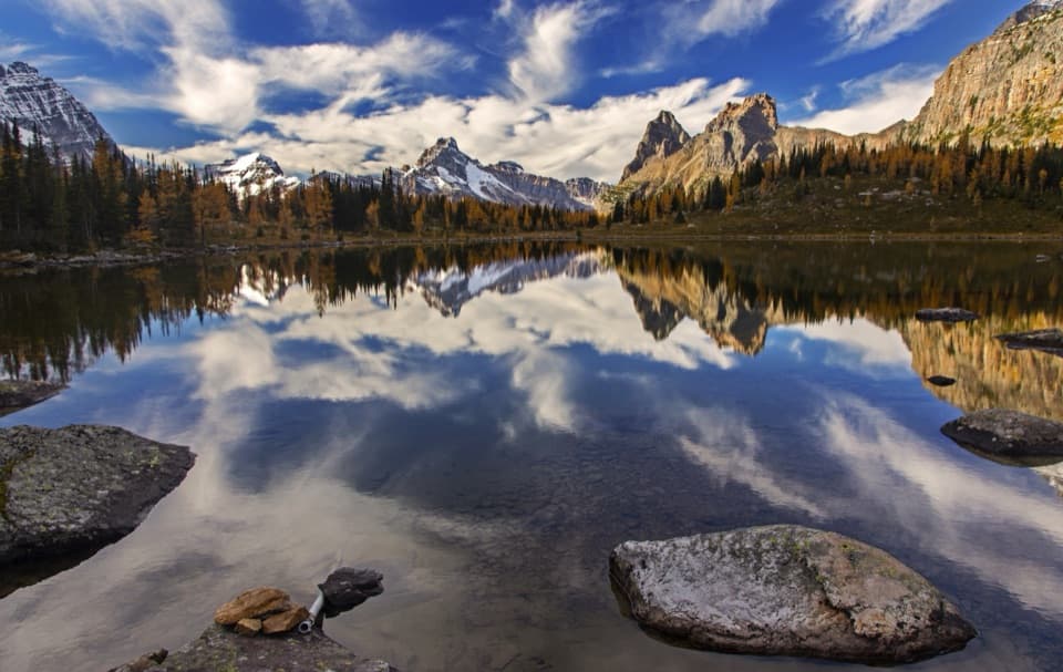
The payoff is close, not a summit: turquoise water, a ring of forest and high pale peaks. Low shoreline rocks make a useful foreground for a wide view across the lake. At the east end, the pink outcrop and Seven Veils Falls give you a more intimate subject than another panorama. The lower lake circuit also lets you see how the surrounding alpine routes rise away from the shore without taking those climbs yourself.

Names from the wider O’Hara storyThe lake is named for Lt.-Col. Robert O’Hara. In 1887, surveyor J.J.

The lake is named for Lt.-Col. Robert O’Hara. In 1887, surveyor J.J. McArthur is recorded as the first non-Indigenous person to see it. During the area’s first thorough exploration in 1894, Indigenous Canadian Pacific Railway worker Yule Carryer accompanied Samuel E.S. Allen, who used Îyethka (Stoney) words for several peaks and features. Îyârhe Nakoda Elders have also visited sites around O’Hara for ceremonies and to reconnect with stories carried by names such as Oesa, Yukness and Odaray. This shoreline walk is small, but it passes through a landscape with a much longer human history.

Wildlife

Wildlife in Yoho

All Yoho wildlife maps

Sighting maps show where each species has been reported across Yoho. Wildlife moves, so no sighting is guaranteed.

Keep exploring

Near Lake O’Hara Shoreline Trail

See it all on the map

Trails that start nearby

Places near the trailhead

Parkwolf’s Yoho ranking

Top-rated trails in Yoho

All 54 trails
  1. 1Lake O’Hara Alpine CircuitChallenging · 11.1 km
  2. 2Iceline via Little YohoChallenging · 20.3 km
  3. 3Lake McArthur CircuitModerate · 8 km
  4. 4Opabin Plateau CircuitModerate · 6.7 km
  5. 5Emerald Lakeshore TrailEasy · 5.2 km
  6. 6Lake Oesa TrailModerate · 6.4 km

Take Parkwolf to Yoho.

The audio tour guide for the drive, plus offline maps, trails, and wildlife heatmaps for when the signal drops.

4.7 from 8,600+ ratings

Download Parkwolf on the App StoreGet Parkwolf on Google Play