Lake O’Hara in Yoho National Park

#4 of 32 sights in Yoho

Sight · Yoho National Park

Lake O’Hara

Alpine lake and hanging valleys, with a trail network to match.

Photo: Wikimedia Commons
Type
Sight
Nearest trail
Right here
  • Trailhead
  • Scenic viewpoint
  • Food

Hear the audio tour

Lake O’Hara: Arrange the Access First

Overview

About Lake O’Hara

Why stop

  • Several alpine lakes and hanging valleys make this much more than a single-lake stop
  • The short shoreline circuit gives you a worthwhile lower-commitment option

Heads up

  • Day visits require advance shuttle access; walking the road adds 22 km round trip

Map

Where it is

Loading the Yoho map
Full map
SightLake O’Hara51.35719, -116.33925
Keep this map with you offline in the Parkwolf app

Plan your stop

Before you go

5 active Yoho alerts

  • ClosureOdaray trails closed or limited to protect wildlife corridorMentions this placeOdaray Prospect and Plateau are closed to hikers May 1–November 30 to protect seasonal wildlife habitat and limit disturbance in the McArthur Valley–Cataract Brook Wildlife Corridor.Official details
  • ClosureYoho Valley Road closed for avalanche seasonYoho Valley Road is closed to vehicles from mid-October to mid-June because of avalanche risk. - Parks Canada’s current trail report lists no vehicle access to trails in the Yoho Valley.Official details

See all 5 alerts
A park ranger sits on a dash-mounted phone, talking, as Parkwolf’s Tour Guide plays “Army Cutworm Moths: A Grizzly Bear Buffet” on Grand Loop Road below Dunraven Pass in Yellowstone
Parkwolf Tour GuideThe highest, rockiest slopes around here are a summer buffet for grizzly bears.

Yoho Tour Guide

Your drive to Lake O’Hara, narrated.

Parkwolf is a GPS audio tour guide for Yoho National Park. As you drive, it chimes in with what’s ahead: hidden gems, upcoming stops, history, geology, and wildlife, right through your car’s speakers.

See the Yoho audio tour

Recorded for this place

Lake O’Hara: Arrange the Access First
0:00 / 0:36
“You're nearing the Lake O'Hara access road, but the lake is eleven kilometres beyond the highway parking lot.”

Plays as you drive up to Lake O’Hara in the Parkwolf Yoho Tour Guide.

More stories near here in the app

  • A Predator With a Softer Menu
  • Lower Spiral Tunnel: Climbing Inside the Mountain
  • Sherbrooke Lake and Paget Lookout: Choose Your Climb
  • The Bird That Plants Pines
  • 35 audio storiesacross Yoho’s roads, triggered by GPS as you drive
  • Wildlife heatmapsfor Grizzly Bear, Mountain Goat, Black Bear, and 13 more
  • Works offlinemaps, 54 trails, 58 places, and audio download before you lose signal
  • CarPlay readysimple controls built for the drive
★★★★★
“Fantastic app with many points of information… It’s great to just turn on while you’re driving and it gives you an audio tour of the national Park. We love it!!!!”
JMJamesApp Store review
Download Parkwolf on the App StoreGet Parkwolf on Google Play

4.7 from 8,600+ ratings

Guide

More about Lake O’Hara

Why make the tripLake O’Hara is a high alpine lake in Yoho’s backcountry, ringed by peaks and linked to a…

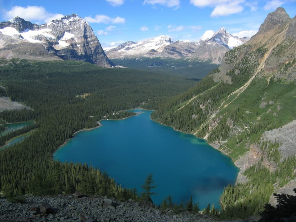
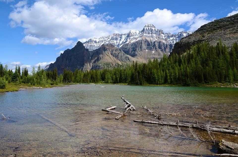
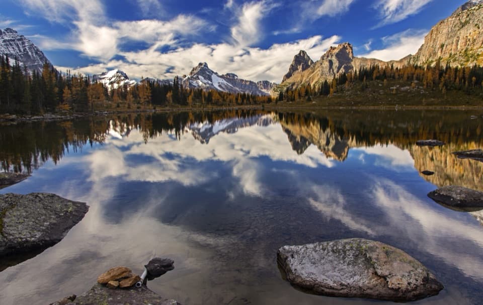
Lake O’Hara is a high alpine lake in Yoho’s backcountry, ringed by peaks and linked to a network of hanging valleys and smaller lakes. If you can line up access, make a day of it: the shoreline is lovely, but the trails above it are what make the area special. This is an outing to explore, not a quick roadside stop.

Getting inDay visitors arrive on a reserved Parks Canada shuttle from the Lake O’Hara parking lot.

Day visitors arrive on a reserved Parks Canada shuttle from the Lake O’Hara parking lot. It travels 11 km up to Le Relais, where the trails branch out; visitors can’t drive or cycle up the access road. Walking the road adds a 22 km round trip before you start any lake or alpine trails, so treat that as a serious hike. The campground also needs an advance reservation. July through late September is the main hiking season; higher routes can stay snowbound and avalanche-prone into late June.

Walk the shoreThe 2.8 km Lake O’Hara circuit is the easiest way to get a feel for the basin.

The 2.8 km Lake O’Hara circuit is the easiest way to get a feel for the basin. It follows the north shore above the water, with some ups and downs, then passes a pink quartzite outcrop and Seven Veils Falls near the eastern end. It’s a good shorter outing, though not a flat stroll right at the water’s edge.

Climb into OpabinOpabin is a hanging valley above the lake, with a 5.

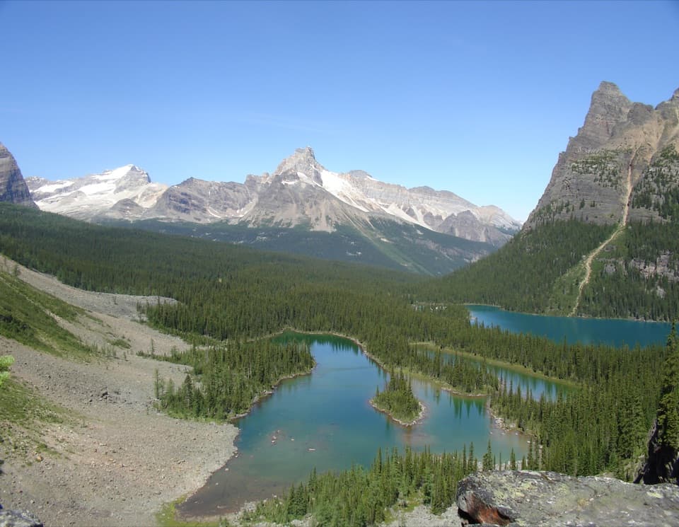
Opabin is a hanging valley above the lake, with a 5.9 km circuit linking Mary, Hungabee and Opabin lakes. The route climbs steeply from the shore on either side of the cliff. Opabin Prospect sits at the edge above Lake O’Hara; go up there when you want the broadest look back over the basin.

Make time for Lake OesaThe Lake Oesa trail climbs 240 m over 3.2 km one way.

The Lake Oesa trail climbs 240 m over 3.2 km one way. Switchbacks cross talus and scree before stone steps lead to meadows enclosed by copper-coloured quartzite cliffs. At the end, tilted slabs hold the lake. Lawrence Grassi built the stone steps, and the open, avalanche-swept slopes are part of what makes this feel like a high mountain route.

A mountaineering historyThe area’s Elizabeth Parker Hut recalls the early days of organized Canadian climbing.

The area’s Elizabeth Parker Hut recalls the early days of organized Canadian climbing. Journalist Elizabeth Parker helped persuade A.O. Wheeler to form the Alpine Club of Canada, founded in Winnipeg in 1906; Parker was one of its original honorary members. The present hut was built in 1919.

Le Relais and foodThe shuttle arrives at Le Relais, a seasonal day shelter where you can warm up and get trail…

The shuttle arrives at Le Relais, a seasonal day shelter where you can warm up and get trail information. When it’s operating, expect hot drinks and snacks rather than a full meal, so bring lunch for a hiking day. Lake O’Hara Lodge serves meals to its guests; it isn’t a public restaurant.

Wildlife

Wildlife in Yoho

All Yoho wildlife maps

Sighting maps show where each species has been reported across Yoho. Wildlife moves, so no sighting is guaranteed.

Keep exploring

Near Lake O’Hara

See it all on the map

Trails nearby

More stops nearby

Parkwolf’s Yoho ranking

Top sights in Yoho

All 58 places
  1. 1Emerald LakeSight
  2. 2Takakkaw FallsSight
  3. 3Natural BridgeSight
  4. 5Lower Spiral Tunnel ViewpointSight
  5. 6Wapta FallsSight
  6. 7Walcott QuarrySight

Take Parkwolf to Yoho.

The audio tour guide for the drive, plus offline maps, trails, and wildlife heatmaps for when the signal drops.

4.7 from 8,600+ ratings

Download Parkwolf on the App StoreGet Parkwolf on Google Play