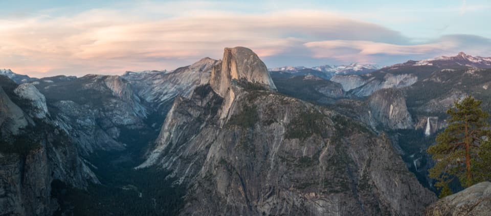
Vernal Fall in Yosemite National Park

#9 of 52 sights in Yosemite

Sight · Yosemite National Park

Vernal Fall

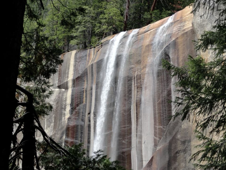
Spring spray can frame the 317-foot waterfall in rainbows.

Photo: Wikimedia Commons
Type
Sight
Nearest trail
0.9 mi
Audio stories
5 nearby
  • Trailhead
  • Restrooms
  • Scenic viewpoint

Hear the audio tour

Happy Isles and Vernal Fall Footbridge

Overview

About Vernal Fall

Why stop

  • The footbridge brings you close to the fall without the steep upper climb.

Heads up

  • The Mist Trail climbs more than 600 steep granite steps to the brink.

Map

Where it is

Loading the Yosemite map
Full map
SightVernal Fall37.72755, -119.54375
Keep this map with you offline in the Parkwolf app

Plan your stop

Before you go

4 active Yosemite alerts

  • CautionMist Trail access limited during October repairsMentions this placeThe Mist Trail between its John Muir Trail junction above the Vernal Fall footbridge and the top of Vernal Fall has limited access through October for repair work.Official details
  • ClosureDome Fire closes Glacier Point Road and trailsGlacier Point Road is temporarily closed because Dome Fire smoke reduces visibility and to allow firefighting operations; some trails south of the road are also closed.Official details
See all 4 alerts
The Parkwolf Tour Guide on a dash-mounted phone, driving into Yosemite Valley

“You're nearing the access for Happy Isles and the Vernal Fall hike. My pick for a shorter outing is the footbridge: one point six miles round trip from Happy Isles, with a steep climb taking one to one and a half hours.”

Yosemite Tour Guide

Yosemite, narrated.

Parkwolf is a GPS audio tour guide for Yosemite National Park. As you drive, it chimes in with what’s ahead: hidden gems, upcoming stops, history, geology, and wildlife, right through your car’s speakers.

See the Yosemite audio tour

Recorded for this place

Happy Isles and Vernal Fall Footbridge
0:00 / 0:25
“You're nearing the access for Happy Isles and the Vernal Fall hike. My pick for a shorter outing is the footbridge: one point six miles round trip from Happy Isles, with a steep climb taking one to one and a half hours.”

Plays as you drive up to Vernal Fall in the Parkwolf Yosemite Tour Guide.

More stories near here in the app

  • Mirror Lake
  • Glacier Point
  • Washburn Point
  • Curry Village and Stoneman Meadow
  • 125 audio storiesacross Yosemite’s roads, triggered by GPS as you drive
  • Wildlife heatmapsfor Black Bear, Peregrine Falcon, Mule Deer, and 13 more
  • Works offlinemaps, 141 trails, 99 places, and audio download before you lose signal
  • CarPlay readysimple controls built for the drive
★★★★★
“We just drove through Yosemite and it made our trip listening to this app as we drove through. Like having a tour guide in the car with you.”
Roddy 3210App Store review
Download Parkwolf on the App StoreGet Parkwolf on Google Play

4.7 from 8,600+ ratings

Guide

More about Vernal Fall

How much of the fall to doVernal Fall is a 317-foot waterfall on the Merced River in eastern Yosemite Valley, reached by…

Vernal Fall is a 317-foot waterfall on the Merced River in eastern Yosemite Valley, reached by trail from Happy Isles. For a close look without a strenuous climb, the 1.6-mile round trip to the Vernal Fall Footbridge is the sensible stop: the bridge is about 0.8 mile from the trailhead, with 400 feet of climbing, and takes about one to one and a half hours. If you have the time and legs, go on to the top. That trip is about 2.4 miles round trip, gains 1,000 feet and takes roughly three hours; the view straight down the full fall is the payoff. The footbridge walk is moderate; the climb to the top is strenuous.

From Happy Isles to the footbridgeStart at Happy Isles in eastern Yosemite Valley, shuttle stop 16.

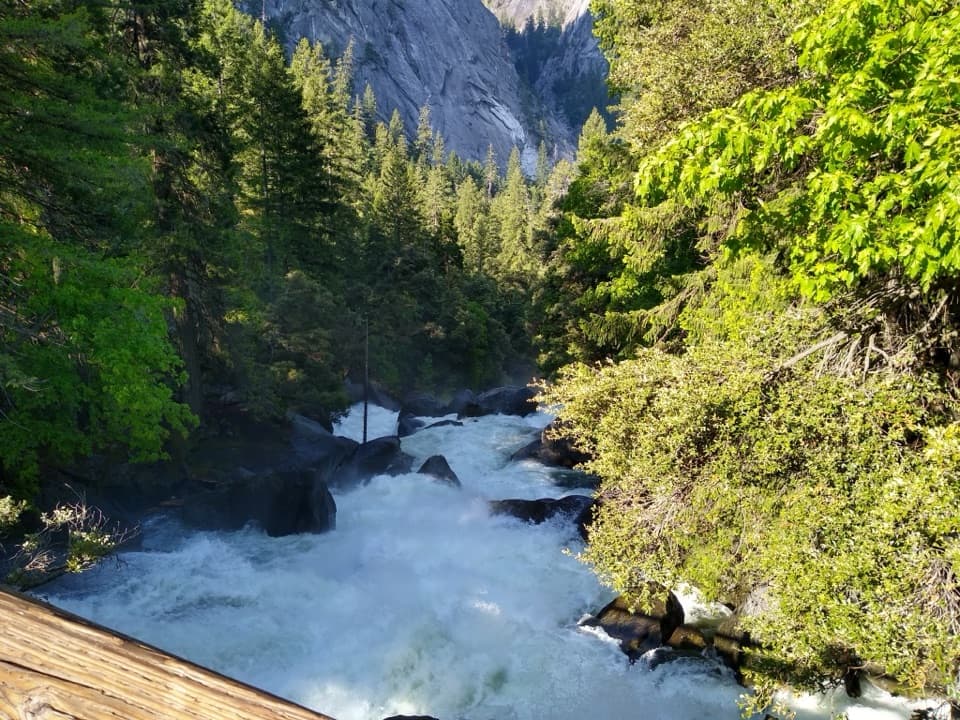
Start at Happy Isles in eastern Yosemite Valley, shuttle stop 16. The first paved mile is the busiest stretch, and the footbridge gives you an excellent view of the fall at about 0.8 mile. The first mile is usually busiest; start early if you want more space on the path.

Drinking water is available at the shuttle stop and, from May through October, at the footbridge; those are the only water sources along the trail. Restrooms are at the stop and footbridge, with the footbridge facilities seasonal. Vault toilets sit beyond the top of Vernal Fall along the Mist Trail.

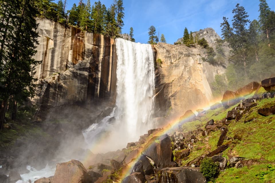
Climbing to the brinkAbout 0.2 mile beyond the footbridge, the Mist Trail and John Muir Trail split.

About 0.2 mile beyond the footbridge, the Mist Trail and John Muir Trail split. The Mist Trail reaches the top with a 0.3-mile climb up a steep granite stairway of more than 600 steps. It is a real uphill push, and the spray can make the steps slippery in spring and early summer. You get close views of the fall along the climb; at the brink, the view runs straight down its full 317-foot drop.

Flow, spray and rainbowsVernal Fall flows year-round, but it is fullest in late May or June.

Vernal Fall flows year-round, but it is fullest in late May or June. Later in summer the water often narrows into one, two or three channels, so the fall can look very different from its broad spring curtain. The heavy spring and early-summer spray is what gives the Mist Trail its name and can put a rainbow in the view. For a photograph, start with the footbridge's clear view, then look for a rainbow from the established Mist Trail stairs when sunlight catches the spray.

A trail with an old, uncertain beginningThe path to the top was already there when California took control of Yosemite in 1864, and its…

The path to the top was already there when California took control of Yosemite in 1864, and its origin was unknown even then. That makes the route part of Yosemite visits from the park's earliest years, though it is not known who first built it or when.

Water and winter conditionsThe lower Mist Trail beside Vernal Fall closes in winter because of falling ice and rock; open…

The lower Mist Trail beside Vernal Fall closes in winter because of falling ice and rock; open sections can still be icy or snowy. Check current trail conditions before choosing a route. Beyond the fall, the trail passes Emerald Pool and Silver Apron. Swimming there is illegal and dangerous because the current is extremely hazardous; stay behind railings and away from wet rock and flowing water.

Wildlife

Wildlife in Yosemite

All Yosemite wildlife maps

Sighting maps show where each species has been reported across Yosemite. Wildlife moves, so no sighting is guaranteed.

Keep exploring

Near Vernal Fall

See it all on the map

Trails nearby

More stops nearby

Parkwolf’s Yosemite ranking

Top sights in Yosemite

All 99 places
  1. 1Tunnel ViewSight
  2. 2Glacier PointSight
  3. 3Yosemite FallsSight
  4. 4Half DomeSight
  5. 5Bridalveil FallSight
  6. 6El Capitan MeadowSight

Take Parkwolf to Yosemite.

The audio tour guide for the drive, plus offline maps, trails, and wildlife heatmaps for when the signal drops.

4.7 from 8,600+ ratings

Download Parkwolf on the App StoreGet Parkwolf on Google Play