North Mountain Lookout Trail in Yosemite National Park

Yosemite National Park, CA

North Mountain Lookout Trail

A full-day climb from Hetch Hetchy to the North Mountain view

Length
26.7mi
Time
12.5hr
Elev. change
1,975ft
Difficulty
Challenging
  • No dogs
  • High point 5,682 ft

Hear the audio tour

Hetch Hetchy and O'Shaughnessy Dam

Overview

About North Mountain Lookout Trail

Why go

  • A high view back toward Miguel Meadows

Heads up

  • 26.7 miles with about 3,500 feet of climbing
  • The lookout structure and North Mountain continuation are not well documented
North Mountain Lookout Trail is a 26.7-mile out-and-back from the Hetch Hetchy Trailhead at O’Shaughnessy Dam, climbing about 3,503 feet to North Mountain. It’s a hard, full-day outing; allow about 11.5 to 12.5 hours, and remember that every mile you hike out has to be walked back.
Parkwolf’s verdictIs this the hike for you?

Map & elevation

The route

Loading the Yosemite map
Full map
Elevation3,707–5,682 ft
TrailheadHetch Hetchy Trailhead at O’Shaughnessy Dam37.94639, -119.78745
Keep this map with you offline in the Parkwolf app

Plan your hike

Before you go

Parking

Start at the Hetch Hetchy Trailhead by O’Shaughnessy Dam for the full-distance route. The reservoir parking area can cause entrance delays when it fills, especially around weekend mid-day. The 14.4-mile variant starts at Miguel Meadow and excludes the long approach; Hetch Hetchy Road access is daylight-only.

Best time to go

Hetch Hetchy has a long hiking season and is a good spring or fall choice, but summer can be uncomfortably hot at this low elevation. The access road is open only during daylight, so check the current gate window and make sure it gives you enough time for a 12-hour hike. Overnight trips require a wilderness permit. Pets aren’t allowed on the dam or hiking trails.

Safety

This is a 26.7-mile out-and-back with about 3,500 feet of climbing and an 11.5–12.5-hour expected duration. Hetch Hetchy Road is daylight-only; check the current gate window before starting. The North Mountain turn is underdocumented, and the lookout structure may not be present. No pets on the dam or hiking trails; overnight trips require a wilderness permit.

4 active Yosemite alerts

  • ClosureDome Fire closes Glacier Point Road and trailsGlacier Point Road is temporarily closed because Dome Fire smoke reduces visibility and to allow firefighting operations; some trails south of the road are also closed.Official details
  • CautionMist Trail access limited during October repairsThe Mist Trail between its John Muir Trail junction above the Vernal Fall footbridge and the top of Vernal Fall has limited access through October for repair work.Official details
See all 4 alerts
The Parkwolf Tour Guide on a dash-mounted phone, driving into Yosemite Valley

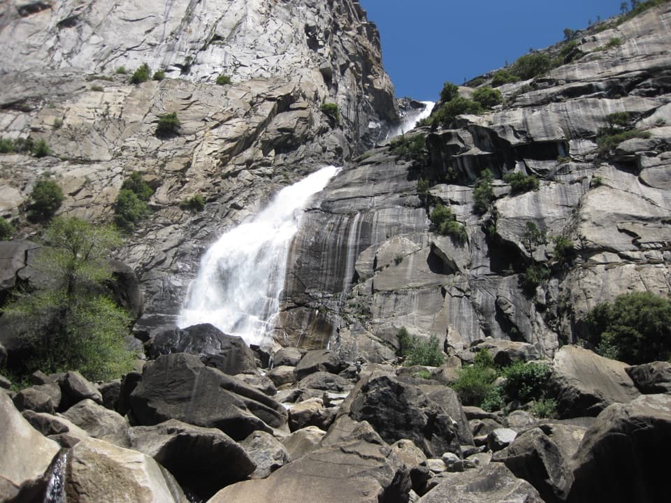
“Ahead is O'Shaughnessy Dam at Hetch Hetchy, with reservoir water between steep granite walls. For a short visit, the paved dam viewpoint gives you the broad scene and waterfall views without a hike.”

Yosemite Tour Guide

Yosemite, narrated.

Parkwolf is a GPS audio tour guide for Yosemite National Park. As you drive, it chimes in with what’s ahead: hidden gems, upcoming stops, history, geology, and wildlife, right through your car’s speakers.

See the Yosemite audio tour

Recorded for this trailhead

Hetch Hetchy and O'Shaughnessy Dam
0:00 / 0:37
“Ahead is O'Shaughnessy Dam at Hetch Hetchy, with reservoir water between steep granite walls. For a short visit, the paved dam viewpoint gives you the broad scene and waterfall views without a hike.”

Plays as you drive up to this trailhead in the Parkwolf Yosemite Tour Guide.

More stories near here in the app

  • A Treefrog on El Capitan
  • Smith Peak from Smith Meadows Trailhead
  • Poopenaut Valley Trailhead
  • Water That Works Twice
  • 125 audio storiesacross Yosemite’s roads, triggered by GPS as you drive
  • Wildlife heatmapsfor Black Bear, Peregrine Falcon, Mule Deer, and 13 more
  • Works offlinemaps, 141 trails, 99 places, and audio download before you lose signal
  • CarPlay readysimple controls built for the drive
★★★★★
“We just drove through Yosemite and it made our trip listening to this app as we drove through. Like having a tour guide in the car with you.”
Roddy 3210App Store review
Download Parkwolf on the App StoreGet Parkwolf on Google Play

4.7 from 8,600+ ratings

Trail guide

Hiking North Mountain Lookout Trail

The long approachFrom the reservoir access, the route follows the Miguel Meadow Fire Road through steep…

From the reservoir access, the route follows the Miguel Meadow Fire Road through steep switchbacks. About six miles in, it joins the named North Mountain trail; from there it’s roughly 7.2 miles one way to the high point. A 14.4-mile figure describes the out-and-back from Miguel Meadow and leaves out the approach from Hetch Hetchy. This guide follows the full route from the public reservoir access. A flush toilet is listed at Miguel Meadow; no water refill point was verified along the way, so carry what you need for the full day.

What you reachThe payoff is a high view back toward Miguel Meadows.

The payoff is a high view back toward Miguel Meadows. I couldn’t confirm whether a lookout structure is still standing or open, so plan around the mountain and its view rather than a guaranteed tower visit. This North Mountain continuation is lightly documented and doesn’t appear among the usual Hetch Hetchy hikes; carry a detailed map and confirm the turn off the fire road before committing to the long climb.

Wildlife

Wildlife in Yosemite

All Yosemite wildlife maps

Sighting maps show where each species has been reported across Yosemite. Wildlife moves, so no sighting is guaranteed.

Keep exploring

Near North Mountain Lookout Trail

See it all on the map

Trails that start nearby

Places near the trailhead

Parkwolf’s Yosemite ranking

Top-rated trails in Yosemite

All 141 trails
  1. 1Half Dome TrailChallenging · 14.3 mi
  2. 2Clouds Rest TrailChallenging · 14 mi
  3. 3Nevada Fall Loop via Mist and John Muir TrailsChallenging · 6.4 mi
  4. 4Yosemite Falls TrailChallenging · 7.2 mi
  5. 5Panorama TrailChallenging · 8.2 mi
  6. 6Four Mile TrailChallenging · 4.8 mi

Take Parkwolf to Yosemite.

The audio tour guide for the drive, plus offline maps, trails, and wildlife heatmaps for when the signal drops.

4.7 from 8,600+ ratings

Download Parkwolf on the App StoreGet Parkwolf on Google Play