Angels Landing in Zion National Park

#1 of 25 sights in Zion

Sight · Zion National Park

Angels Landing

A half-day summit hike, ending on a narrow ridge with chains.

Photo: Wikimedia Commons
Type
Sight
Nearest trail
0.5 mi
Audio stories
5 nearby
  • Scenic viewpoint
  • Restrooms

Hear the audio tour

The Grotto and Angels Landing

Overview

About Angels Landing

Why stop

  • A broad canyon panorama from the summit.

Heads up

  • The final ridge is narrow, exposed and permit-controlled.

Map

Where it is

Loading the Zion map
Full map
SightAngels Landing37.26931, -112.94799
Keep this map with you offline in the Parkwolf app

Plan your stop

Before you go

3 active Zion alerts

  • CautionToxic cyanobacteria in Zion waterwaysDo not drink Zion in-stream water, submerge your head, or touch or ingest algae mats; cyanobacteria can produce harmful toxins.Official details
  • ClosureWatchman Trail closed for repairsWatchman Trail is closed pending repairs; do not enter the trail and choose another hike. Check current park conditions before setting out.Official details
See all 3 alerts
A park ranger sits on a dash-mounted phone, talking, as Parkwolf’s Tour Guide plays “Army Cutworm Moths: A Grizzly Bear Buffet” on Grand Loop Road below Dunraven Pass in Yellowstone
Parkwolf Tour GuideThe highest, rockiest slopes around here are a summer buffet for grizzly bears.

Zion Tour Guide

Your drive to Angels Landing, narrated.

Parkwolf is a GPS audio tour guide for Zion National Park. As you drive, it chimes in with what’s ahead: hidden gems, upcoming stops, history, geology, and wildlife, right through your car’s speakers.

See the Zion audio tour

Recorded for this place

The Grotto and Angels Landing
0:00 / 0:38
“You're coming up on The Grotto, the starting point for Angels Landing and a cottonwood-shaded picnic stop beside the Virgin River. You can enjoy the river here without tackling the summit.”

Plays as you drive up to Angels Landing in the Parkwolf Zion Tour Guide.

More stories near here in the app

  • Big Bend
  • Weeping Rock
  • Temple of Sinawava and Riverside Walk
  • Zion Lodge and Emerald Pools
  • 45 audio storiesacross Zion’s roads, triggered by GPS as you drive
  • Wildlife heatmapsfor California Condor, Bighorn Sheep, Mountain Lion, and 13 more
  • Works offlinemaps, 54 trails, 36 places, and audio download before you lose signal
  • CarPlay readysimple controls built for the drive
★★★★★
“Fantastic app with many points of information… It’s great to just turn on while you’re driving and it gives you an audio tour of the national Park. We love it!!!!”
JMJamesApp Store review
Download Parkwolf on the App StoreGet Parkwolf on Google Play

4.7 from 8,600+ ratings

Guide

More about Angels Landing

A summit with a serious approachAngels Landing is a narrow sandstone summit above Zion Canyon, known for the chain-assisted…

Angels Landing is a narrow sandstone summit above Zion Canyon, known for the chain-assisted ridge at the top and a sweeping canyon view. Plan at least half a day for the hike. The last half-mile is steep, exposed and permit-controlled; the climb before it is already demanding.

The route from The GrottoTake the park shuttle to stop 6 at The Grotto, cross the road and bridge, then follow the West…

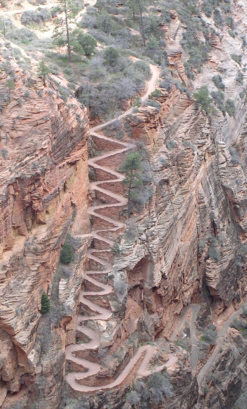
Take the park shuttle to stop 6 at The Grotto, cross the road and bridge, then follow the West Rim Trail to Scout Lookout. On the climb to Scout Lookout, you gain about 1,000 feet over 2.25 miles; the chain section comes after that. The full outing takes at least half a day. Water is available at The Grotto, but there is no drinking water along the trail. Restrooms are at The Grotto and Scout Lookout.

An Angels Landing permit is required beyond Scout Lookout; you can reach the lookout without one. Keep the confirmation downloaded or printed because cell service can be unreliable at ranger checks.

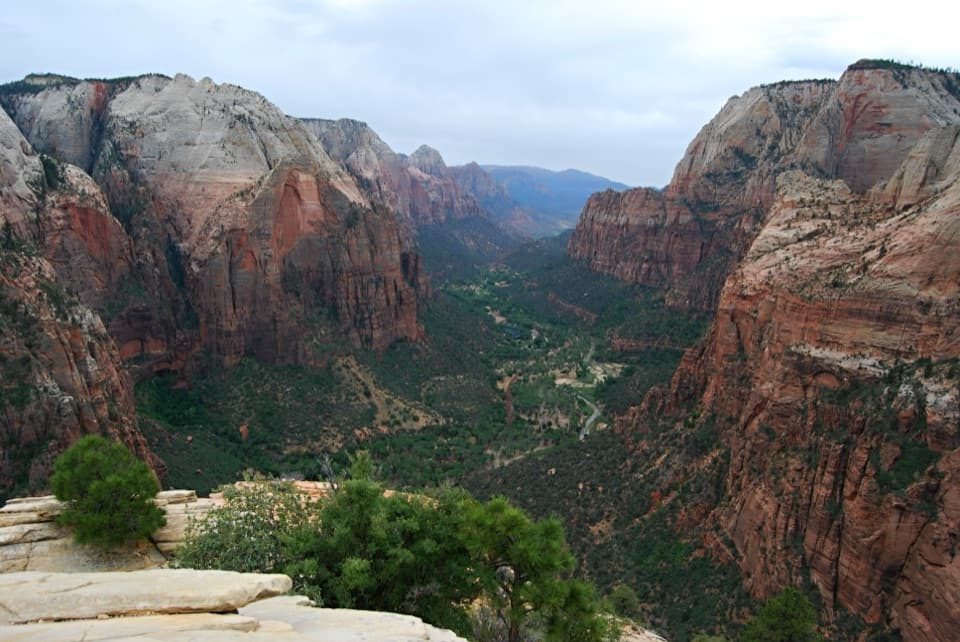
Make your call at Scout LookoutScout Lookout is a sensible turnaround if you don't want narrow ledges or big drops.

Scout Lookout is a sensible turnaround if you don't want narrow ledges or big drops. You still get a canyon view after the demanding climb, and the chain ridge starts ahead of you. There is no shame in stopping here; the final stretch is a real commitment.

Take the chain ridge slowlyThe last half-mile follows steep sandstone steps and narrow ledges.

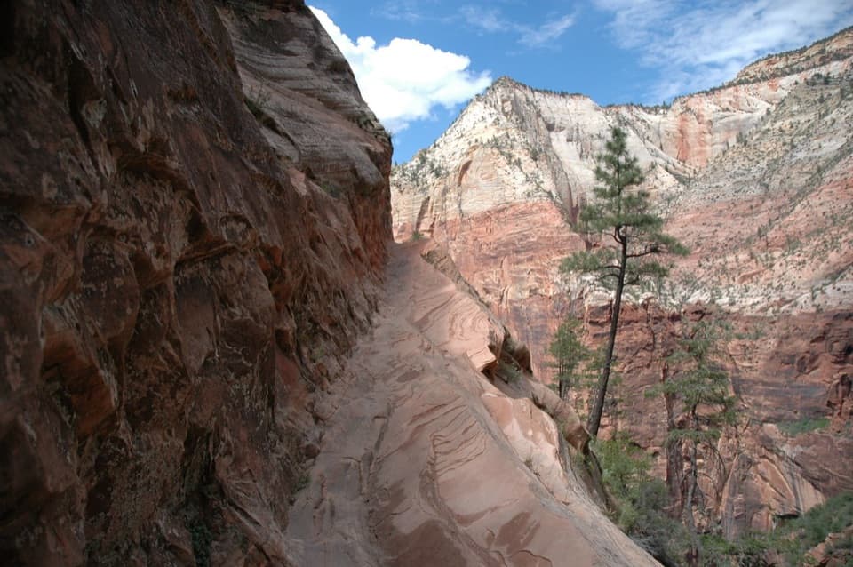
The last half-mile follows steep sandstone steps and narrow ledges. Chains provide handholds in places, and hikers share the ridge in both directions, so passing can slow you down on a busy day. Drop-offs reach about 1,000 feet in places; the summit itself widens into small areas to rest and take in the view. Skip the ridge during storms or when the rock is wet or icy, when the sandstone gets slick.

The view from the topAt the summit, the canyon opens into a long panorama of layered red and cream cliffs, green…

At the summit, the canyon opens into a long panorama of layered red and cream cliffs, green slopes and the river below. For a photo, include the pale ledge or scrub in the foreground to show how high the viewpoint sits. A shot along the chain line captures the route's narrow ridge as well as the drop.

Built into the sandstoneThe Angels Landing Trail was built in 1926, after the West Rim Trail, under the supervision of…

The Angels Landing Trail was built in 1926, after the West Rim Trail, under the supervision of acting superintendent Walter Ruesch. Crews cut footholds into steep sandstone, work described at the time as hazardous and daring. The chains came to define the last exposed stretch.

A name from 1916Methodist minister Frederick Vining Fisher visited Zion in 1916, and his remark about angels…

Methodist minister Frederick Vining Fisher visited Zion in 1916, and his remark about angels landing on the summit is credited with giving the place its name. The story fits the shape of the peak: it rises as a steep, isolated fin above the canyon.

Old dunes and a young canyonZion's sandstone began as desert sand, later bound into rock by mineral cements.

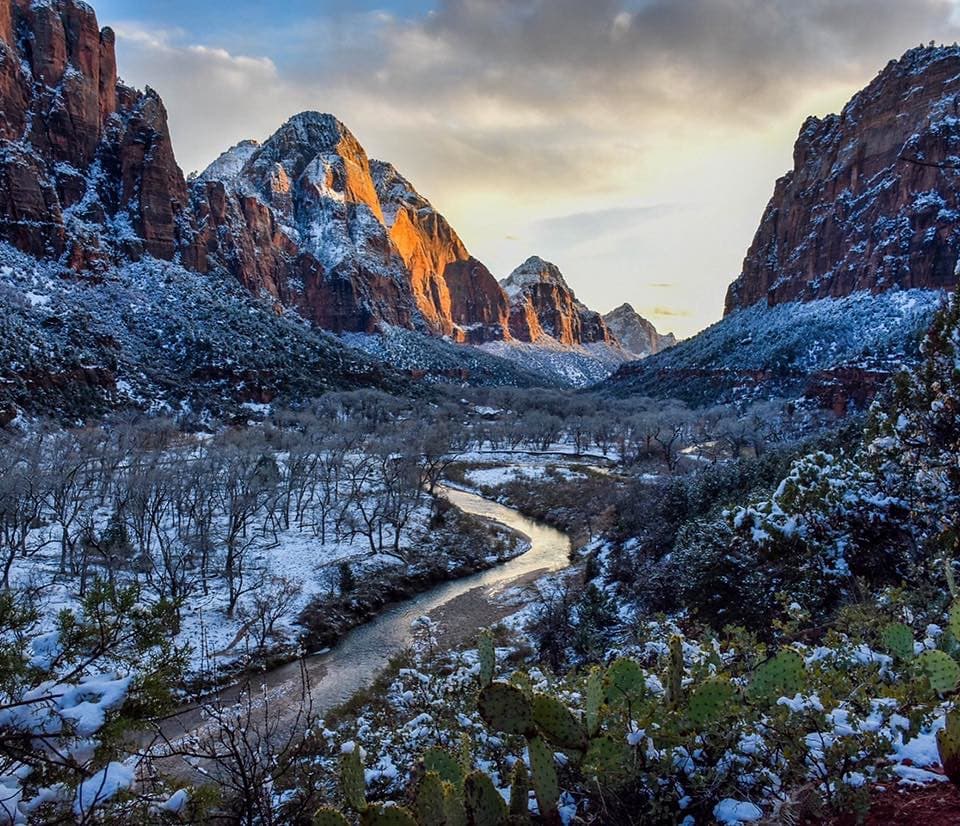
Zion's sandstone began as desert sand, later bound into rock by mineral cements. Regional uplift raised those layers, and the North Fork of the Virgin River cut down through them, carrying away thousands of feet of overlying rock and leaving the deep canyon exposed.

Watch the cliffsCalifornia condors may be seen near Angels Landing; ravens, squirrels and chipmunks are also…

California condors may be seen near Angels Landing; ravens, squirrels and chipmunks are also found along the route. Look overhead from Scout Lookout or the summit, but sightings are never guaranteed.

Wildlife

Wildlife in Zion

All Zion wildlife maps

Sighting maps show where each species has been reported across Zion. Wildlife moves, so no sighting is guaranteed.

Keep exploring

Near Angels Landing

See it all on the map

Trails nearby

More stops nearby

Parkwolf’s Zion ranking

Top sights in Zion

All 36 places
  1. 2Temple of SinawavaSight
  2. 3Canyon OverlookSight
  3. 4Checkerboard MesaSight
  4. 5Court of the PatriarchsSight
  5. 6Emerald PoolsSight
  6. 7Observation PointSight

Take Parkwolf to Zion.

The audio tour guide for the drive, plus offline maps, trails, and wildlife heatmaps for when the signal drops.

4.7 from 8,600+ ratings

Download Parkwolf on the App StoreGet Parkwolf on Google Play