West Rim to Scout Lookout in Zion National Park

#9 of 54 trails in Zion

Zion National Park, UT

West Rim to Scout Lookout

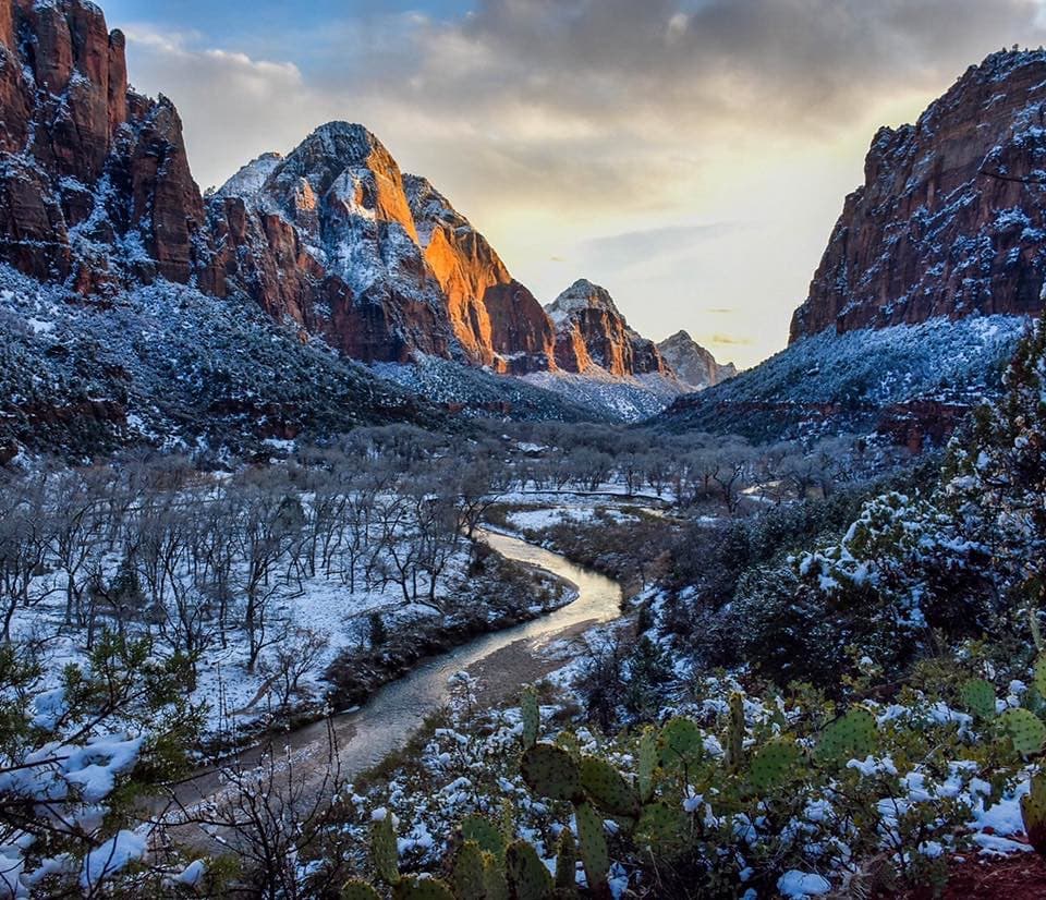
A steep climb to a canyon lookout, before the permit boundary.

Photo: Public Domain
Length
3.8mi
Time
3.5hr
Elev. change
1,014ft
Difficulty
Challenging
  • No dogs
  • High point 5,299 ft

Hear the audio tour

The Grotto and Angels Landing

Overview

About West Rim to Scout Lookout

Why go

  • Zion Canyon views without hiking the Angels Landing chain section
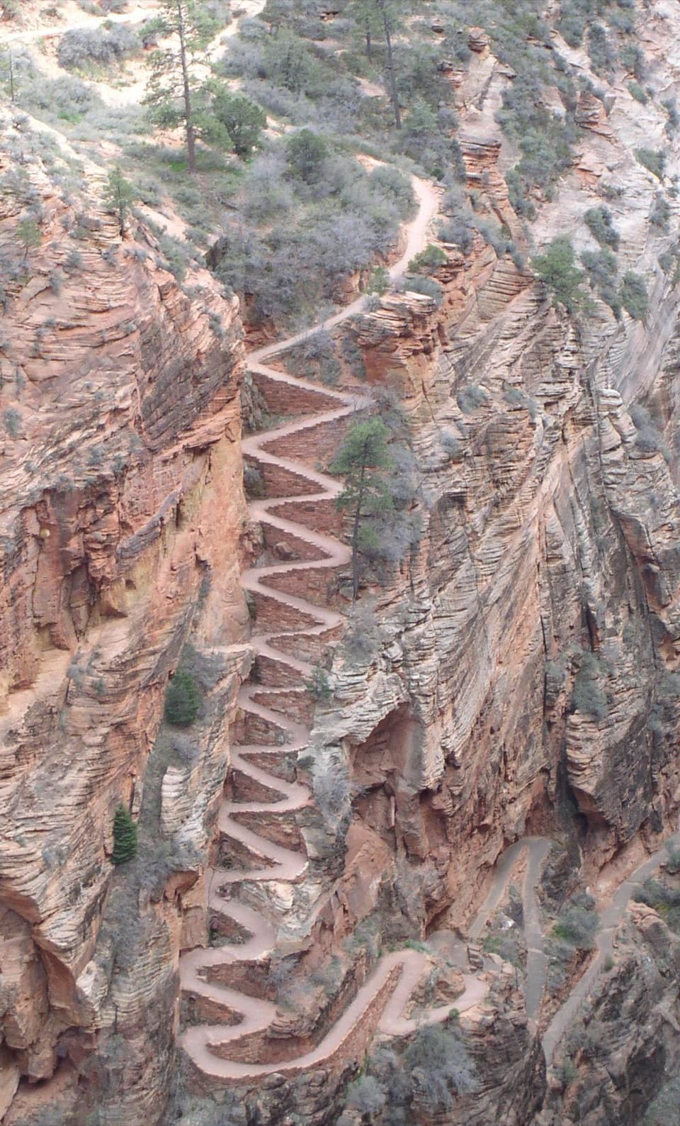
  • Walter’s Wiggles makes the climb a memorable route

Heads up

  • A sustained, steep uphill climb
  • No drinking water beyond The Grotto
West Rim to Scout Lookout is a strenuous out-and-back from The Grotto, through Refrigerator Canyon and up Walter’s Wiggles to the sandy lookout above Zion Canyon. The published distance is 1.9 miles one way; the mapped route to the junction is about 1.79 miles, and another measured version comes out to 3.6 miles round trip. Plan for roughly 3.6 to 3.8 miles total and allow three to four hours. The climb gains about 1,200 feet. It’s a strong choice if you want the big Angels Landing approach and canyon views but don’t plan to tackle the narrow chain section.
Parkwolf’s verdictIs this the hike for you?

Map & elevation

The route

Loading the Zion map
Full map
Elevation4,285–5,299 ft
TrailheadThe Grotto (Shuttle Stop #6)37.25897, -112.95093
Keep this map with you offline in the Parkwolf app

Plan your hike

Before you go

Parking

In the main shuttle season, ride the Zion Canyon shuttle to stop 6, The Grotto, then cross the road and bridge to the West Rim Trail. During the short winter and spring periods when the shuttle is not running, drive to the Grotto and park on pavement. If the lot is full, park farther away and walk back.

Safety

The climb is steep and the lower section can be hot. Carry water from The Grotto; there is no drinking water on the route or at Scout Lookout. Pets are not allowed. A permit is required to continue past Scout Lookout onto the Angels Landing chains.

3 active Zion alerts

  • CautionToxic cyanobacteria in Zion waterwaysDo not drink Zion in-stream water, submerge your head, or touch or ingest algae mats; cyanobacteria can produce harmful toxins.Official details
  • ClosureWatchman Trail closed for repairsWatchman Trail is closed pending repairs; do not enter the trail and choose another hike. Check current park conditions before setting out.Official details
See all 3 alerts
A park ranger sits on a dash-mounted phone, talking, as Parkwolf’s Tour Guide plays “Army Cutworm Moths: A Grizzly Bear Buffet” on Grand Loop Road below Dunraven Pass in Yellowstone
Parkwolf Tour GuideThe highest, rockiest slopes around here are a summer buffet for grizzly bears.

Zion Tour Guide

Your drive to West Rim to Scout Lookout, narrated.

Parkwolf is a GPS audio tour guide for Zion National Park. As you drive, it chimes in with what’s ahead: hidden gems, upcoming stops, history, geology, and wildlife, right through your car’s speakers.

See the Zion audio tour

Recorded for this trailhead

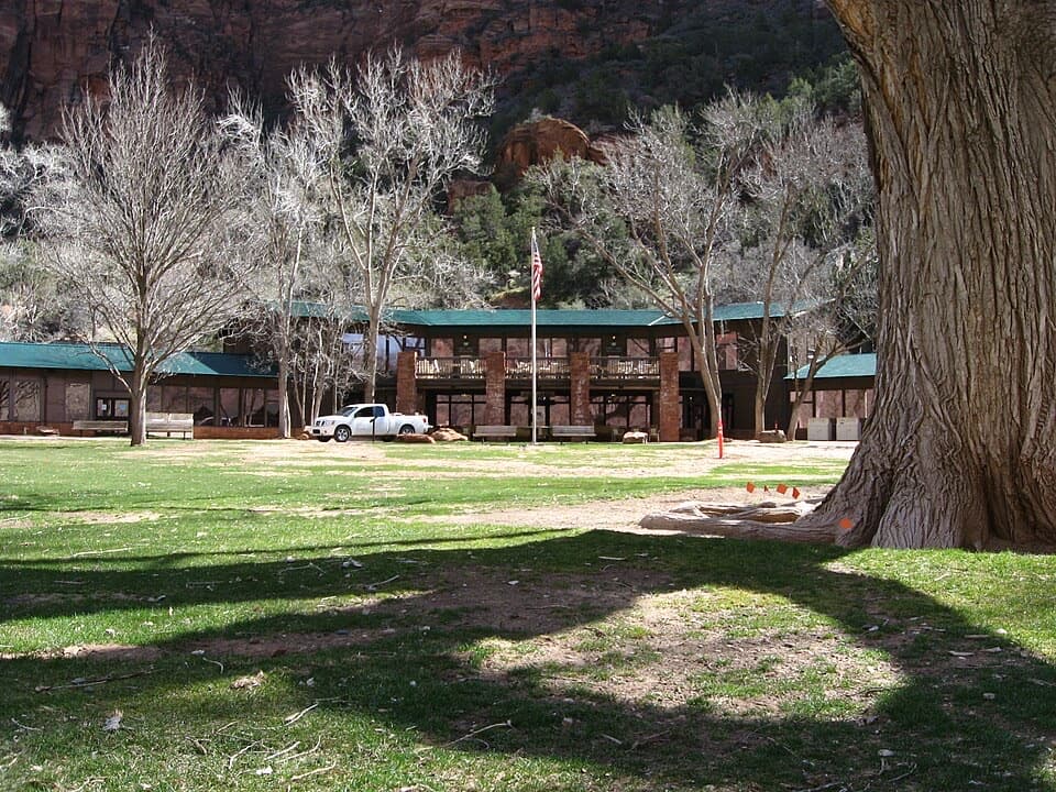
The Grotto and Angels Landing
0:00 / 0:38
“You're coming up on The Grotto, the starting point for Angels Landing and a cottonwood-shaded picnic stop beside the Virgin River. You can enjoy the river here without tackling the summit.”

Plays as you drive up to this trailhead in the Parkwolf Zion Tour Guide.

More stories near here in the app

  • Zion Lodge and Emerald Pools
  • Big Bend
  • Weeping Rock
  • Court of the Patriarchs
  • 45 audio storiesacross Zion’s roads, triggered by GPS as you drive
  • Wildlife heatmapsfor California Condor, Bighorn Sheep, Mountain Lion, and 13 more
  • Works offlinemaps, 54 trails, 36 places, and audio download before you lose signal
  • CarPlay readysimple controls built for the drive
★★★★★
“Fantastic app with many points of information… It’s great to just turn on while you’re driving and it gives you an audio tour of the national Park. We love it!!!!”
JMJamesApp Store review
Download Parkwolf on the App StoreGet Parkwolf on Google Play

4.7 from 8,600+ ratings

Trail guide

Hiking West Rim to Scout Lookout

Follow the route in orderStart at The Grotto shuttle stop, cross the road and bridge, then cross the Virgin River as you…

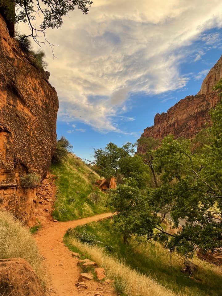
Start at The Grotto shuttle stop, cross the road and bridge, then cross the Virgin River as you join the West Rim Trail. The first climb is steep, with switchbacks rising along the canyon wall. Most of the tread is hard concrete; some stretches are concrete covered by firm soil, and there’s a little soft sand near the top. This is a steady uphill hike, not a quick walk to an overlook, and the exposed lower climb can feel hot.

The trail levels out as it enters Refrigerator Canyon. That flatter, cooler stretch is a welcome break from the first climb, but it doesn’t last long. Soon the trail turns uphill again for Walter’s Wiggles, a set of 21 switchbacks that carries you to Scout Lookout. Take your time here: the turns are close together and the grade is steep, but the trail itself is the main event of the hike.

Where to turn aroundScout Lookout is a relatively flat, sandy clearing with some shade at the junction of the West…

Scout Lookout is a relatively flat, sandy clearing with some shade at the junction of the West Rim Trail and Angels Landing route. This is the natural end of this hike. You do not need a permit to reach the lookout; continuing onto the narrow chain section toward Angels Landing requires one. If you don’t have that permit, turn around here rather than joining the chain route.

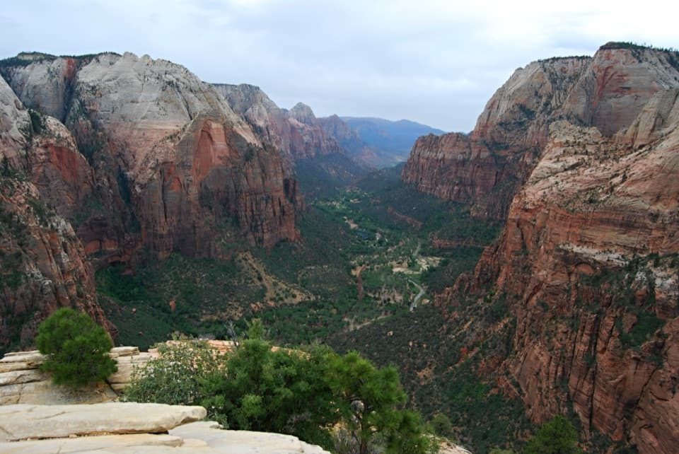
The lookout opens onto Zion Canyon and the Angels Landing ridge. It’s a good place to pause and scan the cliffs for California condors, an endangered bird that lives in the area. For a photo, frame the ridge against the canyon from the sandy clearing; it gives the rock fin room to read as part of the larger landscape. There’s a restroom at Scout Lookout, but no drinking water.

A piece of early trail buildingWalter’s Wiggles takes its name from Walter Ruesch, a foreman who worked on the Angels…

Walter’s Wiggles takes its name from Walter Ruesch, a foreman who worked on the Angels Landing–West Rim route; park engineer A. E. Cowell is also named in the historic account. The historic account marks 1925 and 1926 as significant years, when crews cut switchbacks into difficult canyon terrain. You can still feel that engineering in the last climbing section: 21 turns bring you onto the relatively flat, sandy shoulder at Scout Lookout.

Getting to the startMost of the year, take the Zion Canyon shuttle to stop 6, The Grotto, then cross the road and…

Most of the year, take the Zion Canyon shuttle to stop 6, The Grotto, then cross the road and bridge to the trail. During the short winter and spring periods when the shuttle isn’t operating, you can drive to the Grotto. Park on pavement; if the lot is full, park farther away and walk back. There’s water and a restroom at The Grotto, so fill bottles before you climb. No drinking water is available on the route or at Scout Lookout, and pets aren’t allowed. Park entrance fees apply.

Wildlife

Wildlife in Zion

All Zion wildlife maps

Sighting maps show where each species has been reported across Zion. Wildlife moves, so no sighting is guaranteed.

Keep exploring

Near West Rim to Scout Lookout

See it all on the map

Trails that start nearby

Places near the trailhead

Parkwolf’s Zion ranking

Top-rated trails in Zion

All 54 trails
  1. 1Angels Landing TrailChallenging · 4.2 mi
  2. 2The Narrows from the Bottom UpChallenging · 9.4 mi
  3. 3Canyon Overlook TrailModerate · 1 mi
  4. 4East Mesa Trail to Observation PointModerate · 6.8 mi
  5. 5Left Fork (Subway) Bottom-UpChallenging · 9 mi
  6. 6West Rim Trail (Top-Down)Challenging · 14.6 mi

Take Parkwolf to Zion.

The audio tour guide for the drive, plus offline maps, trails, and wildlife heatmaps for when the signal drops.

4.7 from 8,600+ ratings

Download Parkwolf on the App StoreGet Parkwolf on Google Play