West Rim and Telephone Canyon Loop in Zion National Park

Zion National Park, UT

West Rim and Telephone Canyon Loop

A long climb opens into a quieter plateau circuit above the canyons.

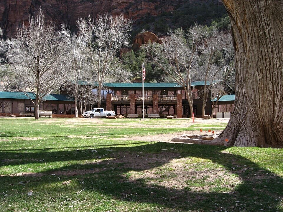
Photo: Wikimedia Commons
Length
15.3mi
Time
9hr
Elev. change
3,015ft
Difficulty
Challenging
  • Loop
  • No dogs
  • High point 7,352 ft
  • #20 of 54 in Zion

Hear the audio tour

The Grotto and Angels Landing

Overview

About West Rim and Telephone Canyon Loop

Why go

  • The upper plateau circuit turns the West Rim approach into more than an out-and-back.
  • Wide views over Phantom Valley, North Creek and Zion Canyon.

Heads up

  • The steep lower approach is repeated on the descent.
  • Telephone Canyon is quieter and gentler, but less dramatic than the rim.

Map & elevation

The route

Loading the Zion map
Full map
Elevation4,337–7,352 ft
TrailheadThe Grotto West Rim Trailhead37.25997, -112.95153
Keep this map with you offline in the Parkwolf app

Plan your hike

Before you go

Parking

Start at The Grotto Picnic Area and West Rim Trailhead. Take the Zion Canyon shuttle when it is operating; the Scenic Drive is closed to private vehicles during shuttle season. The Grotto lot capacity was not established, so check current access if driving outside that season.

Best time to go

Do not plan around springs: Cabin Spring usually has only a small flow, and Potato Hollow Spring may dry by mid-summer. Treat any natural water before drinking and carry what you need for the day. Snow can linger on the high West Rim into late spring. Overnight camping requires a wilderness permit and designated site. Dogs are prohibited on Zion trails other than Pa’rus. During shuttle season the Zion Canyon Scenic Drive is closed to private cars, so take the shuttle to The Grotto; check the current service schedule before leaving.

Safety

A strenuous all-day route with high open ridges and a steep 2,500-foot descent. Springs are unreliable; treat natural water. Snow can linger on the high rim into late spring. Dogs are prohibited on Zion trails other than Pa’rus. Angels Landing is a separate spur and requires its own permit.

3 active Zion alerts

  • CautionToxic cyanobacteria in Zion waterwaysDo not drink Zion in-stream water, submerge your head, or touch or ingest algae mats; cyanobacteria can produce harmful toxins.Official details
  • ClosureWatchman Trail closed for repairsWatchman Trail is closed pending repairs; do not enter the trail and choose another hike. Check current park conditions before setting out.Official details
See all 3 alerts
A park ranger sits on a dash-mounted phone, talking, as Parkwolf’s Tour Guide plays “Army Cutworm Moths: A Grizzly Bear Buffet” on Grand Loop Road below Dunraven Pass in Yellowstone
Parkwolf Tour GuideThe highest, rockiest slopes around here are a summer buffet for grizzly bears.

Zion Tour Guide

Your drive to West Rim and Telephone Canyon Loop, narrated.

Parkwolf is a GPS audio tour guide for Zion National Park. As you drive, it chimes in with what’s ahead: hidden gems, upcoming stops, history, geology, and wildlife, right through your car’s speakers.

See the Zion audio tour

Recorded for this trailhead

The Grotto and Angels Landing
0:00 / 0:38
“You're coming up on The Grotto, the starting point for Angels Landing and a cottonwood-shaded picnic stop beside the Virgin River. You can enjoy the river here without tackling the summit.”

Plays as you drive up to this trailhead in the Parkwolf Zion Tour Guide.

More stories near here in the app

  • Zion Lodge and Emerald Pools
  • Big Bend
  • Weeping Rock
  • Court of the Patriarchs
  • 45 audio storiesacross Zion’s roads, triggered by GPS as you drive
  • Wildlife heatmapsfor California Condor, Bighorn Sheep, Mountain Lion, and 13 more
  • Works offlinemaps, 54 trails, 36 places, and audio download before you lose signal
  • CarPlay readysimple controls built for the drive
★★★★★
“Fantastic app with many points of information… It’s great to just turn on while you’re driving and it gives you an audio tour of the national Park. We love it!!!!”
JMJamesApp Store review
Download Parkwolf on the App StoreGet Parkwolf on Google Play

4.7 from 8,600+ ratings

Trail guide

Hiking West Rim and Telephone Canyon Loop

What the day involvesThe 15.3-mile West Rim and Telephone Canyon route is a full-day hike from The Grotto.

The 15.3-mile West Rim and Telephone Canyon route is a full-day hike from The Grotto. It climbs the West Rim to Cabin Spring, circles the high plateau by way of Telephone Canyon and the scenic rim, then retraces the lower trail. Allow about nine hours and expect roughly 4,200 feet of climbing. The reward is variety: a steep canyon approach, a cool ravine, a quieter plateau, and long views over North Creek and Zion Canyon. It suits fit hikers ready for an all-day outing, high open ridges, and a steep descent. The upper circuit is gentler than the climb, but it adds several miles after you are already high; if that commitment is too much, Scout Lookout is a natural shorter turnaround.

From the river to the plateauAt The Grotto, cross the road and river bridge and start climbing.

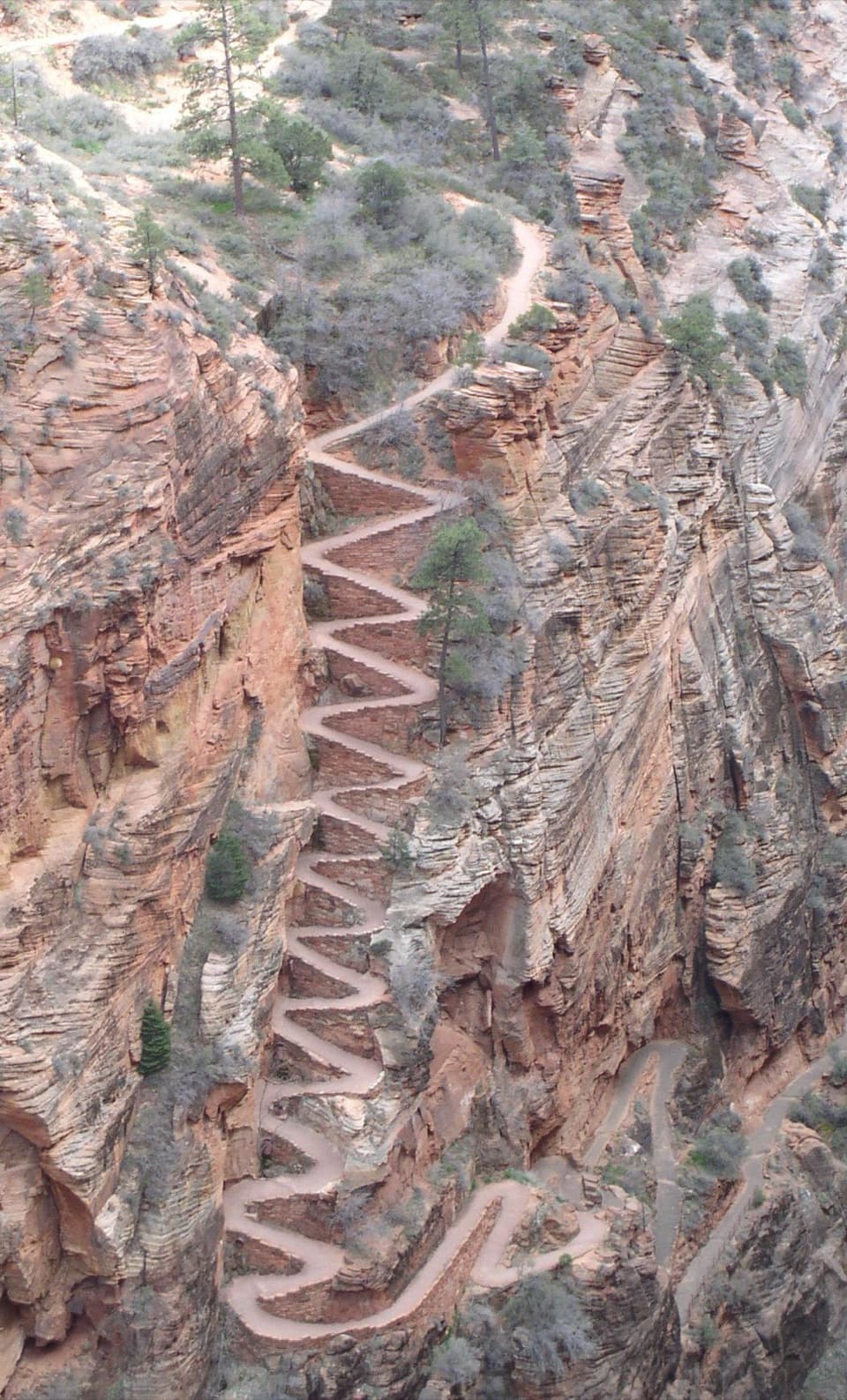
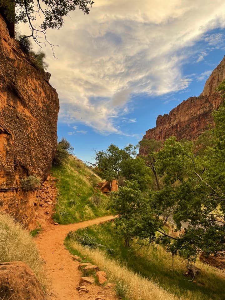
At The Grotto, cross the road and river bridge and start climbing. Switchbacks steepen toward Refrigerator Canyon, where the grade eases briefly before Walter’s Wiggles climb to Scout Lookout. Take the West Rim branch; Angels Landing turns off to the right and is a separate hike. Past Scout Lookout, the path follows a narrow ridge between Refrigerator Canyon and Zion Canyon; signs mark a short slickrock section. Around 2.7 miles in, it drops about 250 feet to a hidden valley, crosses a ravine on a bridge, and climbs Mount Majestic’s north slope. That shaded hillside is cooler and moister, with Douglas fir, ponderosa pine and deciduous shrubs. A saddle above Behunin Canyon leads to long switchbacks up the south face of Horse Pasture Plateau and Cabin Spring.

The Telephone Canyon circuitAt Cabin Spring, follow Telephone Canyon north to Potato Hollow, then take the West Rim south…

At Cabin Spring, follow Telephone Canyon north to Potato Hollow, then take the West Rim south to close the upper circuit. The canyon is a broad, gently sloping drainage with ponderosa pines, open grassland and oak scrub. Its thin woodland is recovering from a 2007 wildfire, so expect a quieter, more open stretch after the steep climb rather than another run of sheer canyon walls. Potato Hollow is the turn toward the rim, not a destination in itself.

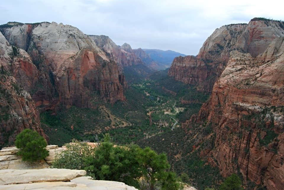
Views from the rimThe West Rim leg swings south along high points above North Creek, Right Fork North Creek and…

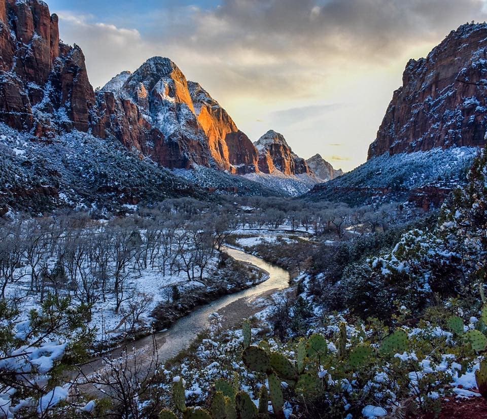
The West Rim leg swings south along high points above North Creek, Right Fork North Creek and Phantom Valley. Look for sandstone pinnacles and buttes above the deep creek cuts; farther south, the West and East Temples, Towers of the Virgin and Mount Majestic appear from a different angle. Pine groves and designated campsites break up the open rim. Near Cathedral Mountain, diagonal cross-bedding in the Navajo Sandstone preserves the pattern of ancient moving dunes. Watch for trail signs where the path crosses slickrock.

The long way backThe upper circuit reconnects at Cabin Spring, but the hike is not finished: the lower approach…

The upper circuit reconnects at Cabin Spring, but the hike is not finished: the lower approach is the return route too. From Cabin Spring it is about 4.7 miles and 2,500 feet down to The Grotto. Save energy for the descent; trekking poles can help on the steep, switchbacked trail. If all you want is the famous ridge and a view, stop at Scout Lookout instead of continuing to the remote plateau. This route excludes Angels Landing; adding that exposed spur changes the hike and requires its own permit.

Wildlife

Wildlife in Zion

All Zion wildlife maps

Sighting maps show where each species has been reported across Zion. Wildlife moves, so no sighting is guaranteed.

Keep exploring

Near West Rim and Telephone Canyon Loop

See it all on the map

Trails that start nearby

Places near the trailhead

Parkwolf’s Zion ranking

Top-rated trails in Zion

All 54 trails
  1. 1Angels Landing TrailChallenging · 4.2 mi
  2. 2The Narrows from the Bottom UpChallenging · 9.4 mi
  3. 3Canyon Overlook TrailModerate · 1 mi
  4. 4East Mesa Trail to Observation PointModerate · 6.8 mi
  5. 5Left Fork (Subway) Bottom-UpChallenging · 9 mi
  6. 6West Rim Trail (Top-Down)Challenging · 14.6 mi

Take Parkwolf to Zion.

The audio tour guide for the drive, plus offline maps, trails, and wildlife heatmaps for when the signal drops.

4.7 from 8,600+ ratings

Download Parkwolf on the App StoreGet Parkwolf on Google Play