Hidden Canyon Trail in Zion National Park

Zion National Park, UT

Hidden Canyon Trail

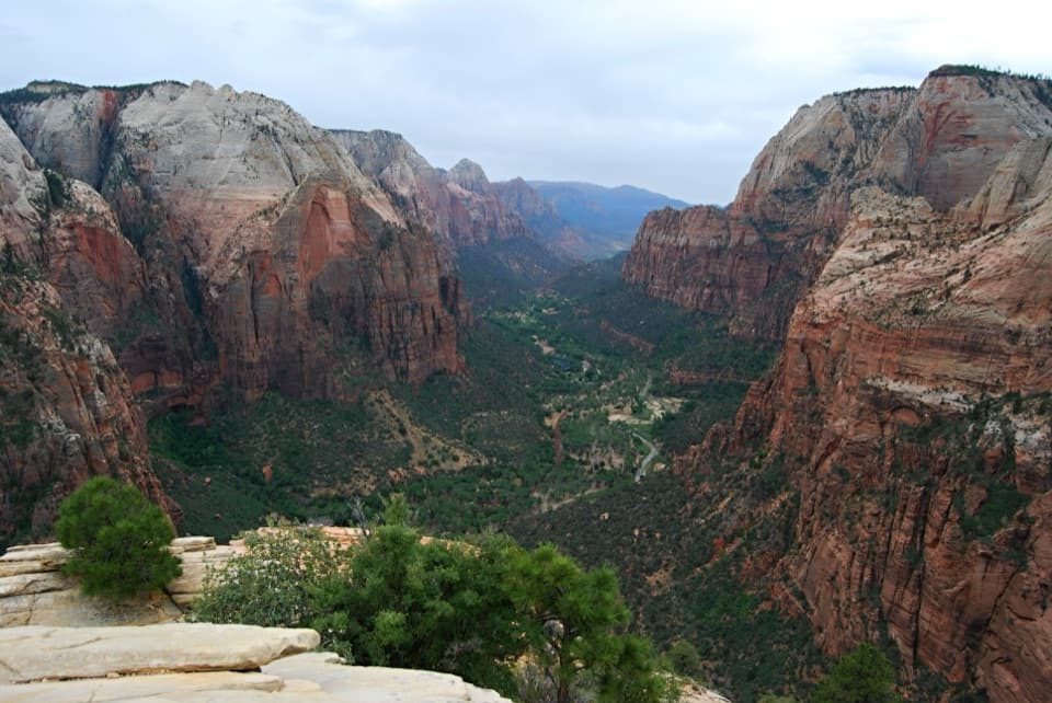
Exposed chain ledges lead to a shaded hanging canyon.

Photo: CC BY 2.0
Length
3.2mi
Time
4hr
Elev. change
975ft
Difficulty
Challenging
  • No dogs
  • High point 5,337 ft
  • #22 of 54 in Zion

Hear the audio tour

Weeping Rock

Overview

About Hidden Canyon Trail

Why go

  • A memorable chain-assisted traverse across carved sandstone ledges.
  • The narrow canyon beyond opens into a cool, fern-lined pocket.

Heads up

  • Steep drop-offs and chain ledges make this a poor fit for anyone uneasy with heights.
  • The optional arch requires a rough scramble beyond the maintained route.

Map & elevation

The route

Loading the Zion map
Full map
Elevation4,362–5,337 ft
TrailheadWeeping Rock Trailhead37.27082, -112.93849
Keep this map with you offline in the Parkwolf app

Plan your hike

Before you go

Parking

The trailhead is at Weeping Rock on Zion Canyon Scenic Drive, served by the Zion Canyon shuttle at stop 7. Ride the shuttle when it is running; private-vehicle access to the drive varies by season, so check park transportation before planning to drive.

Safety

The climb crosses exposed ledges above steep drops; chains and cut steps do not remove the fall risk. The maintained trail ends at the canyon mouth. Reaching the optional arch requires boulder scrambling beyond the mapped route.

3 active Zion alerts

  • CautionToxic cyanobacteria in Zion waterwaysDo not drink Zion in-stream water, submerge your head, or touch or ingest algae mats; cyanobacteria can produce harmful toxins.Official details
  • ClosureWatchman Trail closed for repairsWatchman Trail is closed pending repairs; do not enter the trail and choose another hike. Check current park conditions before setting out.Official details
See all 3 alerts
A park ranger sits on a dash-mounted phone, talking, as Parkwolf’s Tour Guide plays “Army Cutworm Moths: A Grizzly Bear Buffet” on Grand Loop Road below Dunraven Pass in Yellowstone
Parkwolf Tour GuideThe highest, rockiest slopes around here are a summer buffet for grizzly bears.

Zion Tour Guide

Your drive to Hidden Canyon Trail, narrated.

Parkwolf is a GPS audio tour guide for Zion National Park. As you drive, it chimes in with what’s ahead: hidden gems, upcoming stops, history, geology, and wildlife, right through your car’s speakers.

See the Zion audio tour

Recorded for this trailhead

Weeping Rock
0:00 / 0:28
“You're coming up on Weeping Rock, where a short climb takes you beneath a dripping sandstone alcove. I'd choose this for a quick close look at the wet rock and greenery, with a canyon view framed by the overhang.”

Plays as you drive up to this trailhead in the Parkwolf Zion Tour Guide.

More stories near here in the app

  • Big Bend
  • The Grotto and Angels Landing
  • Temple of Sinawava and Riverside Walk
  • Zion Lodge and Emerald Pools
  • 45 audio storiesacross Zion’s roads, triggered by GPS as you drive
  • Wildlife heatmapsfor California Condor, Bighorn Sheep, Mountain Lion, and 13 more
  • Works offlinemaps, 54 trails, 36 places, and audio download before you lose signal
  • CarPlay readysimple controls built for the drive
★★★★★
“Fantastic app with many points of information… It’s great to just turn on while you’re driving and it gives you an audio tour of the national Park. We love it!!!!”
JMJamesApp Store review
Download Parkwolf on the App StoreGet Parkwolf on Google Play

4.7 from 8,600+ ratings

Trail guide

Hiking Hidden Canyon Trail

A steep out-and-backHidden Canyon Trail is a strenuous 3.

Hidden Canyon Trail is a strenuous 3.2-mile out-and-back from Weeping Rock to the mouth of Hidden Canyon and back. The first roughly 0.6 mile follows the shared East Rim approach; at the junction, the Hidden Canyon spur climbs another mile to the maintained trail end. The walk trades ordinary canyon path for steep steps and narrow cliff ledges. Go for the exposed approach and the tucked-away canyon, not for an easy viewpoint stroll.

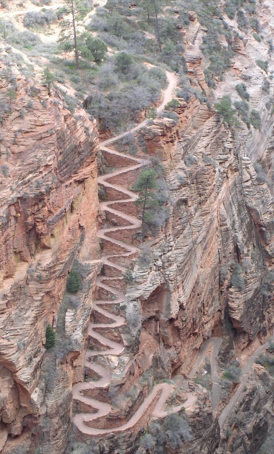
Climb above Weeping RockThe route climbs the curving wall in switchbacks, then leaves the shared approach at the Hidden…

The route climbs the curving wall in switchbacks, then leaves the shared approach at the Hidden Canyon fork. Loose sand, uneven rock and cut sandstone steps make the climb feel steeper than the mileage suggests. Keep an eye out for the junction before you commit to the East Rim route.

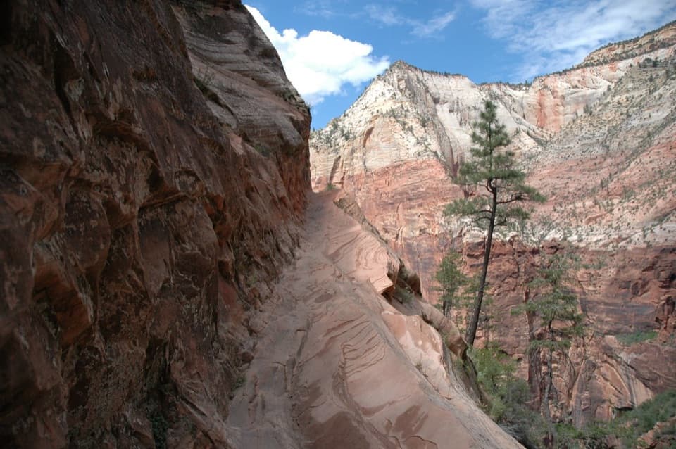
Cross the ledgesThe memorable stretch crosses narrow sandstone ledges above steep drops.

The memorable stretch crosses narrow sandstone ledges above steep drops. Fixed chains help on the most exposed sections, but they don't make the fall risk go away. If you tense up on cliffside tread or need a handrail-free route, this is a poor fit.

At the canyon mouthThe trail reaches a small pool and the shaded mouth of a narrow hanging canyon.

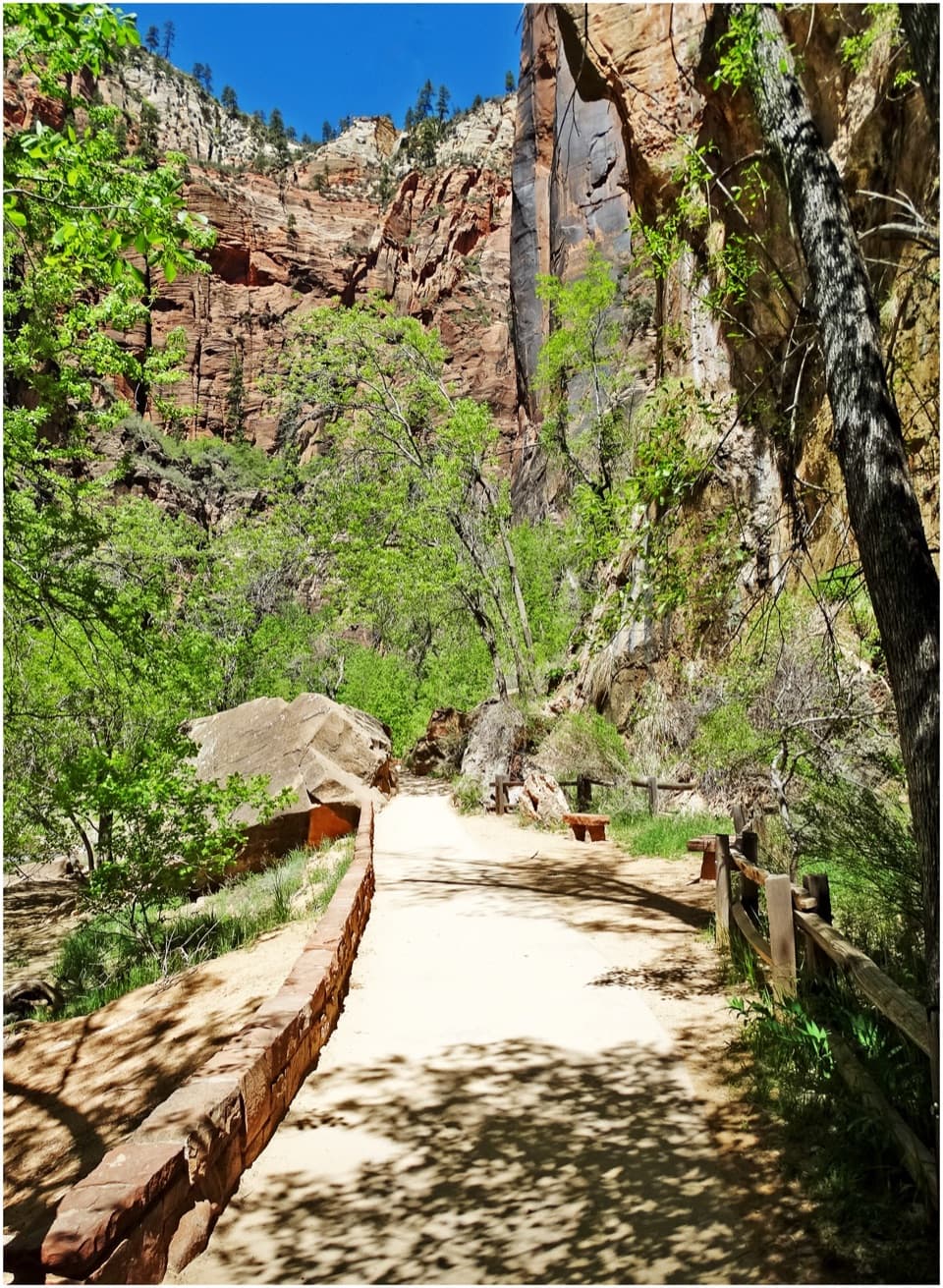
The trail reaches a small pool and the shaded mouth of a narrow hanging canyon. Cross-bedded Navajo Sandstone, moss and ferns in the cracks make the interior feel much greener than the open climb. The maintained route ends here. A small arch lies about a quarter mile farther in, but getting to it means scrambling over boulders beyond the trail; that detour isn't part of the 3.2-mile route.

Getting there and decidingAllow about four hours for the steep climb and stops.

Allow about four hours for the steep climb and stops. The trailhead is at Weeping Rock on Zion Canyon Scenic Drive, served by the Zion Canyon shuttle at stop 7. Ride the shuttle when it is running; private-vehicle access to the drive varies by season, so check park transportation before planning to drive. Zion permits pets only on Pa'rus Trail, so leave dogs out of this hike.

Wildlife

Wildlife in Zion

All Zion wildlife maps

Sighting maps show where each species has been reported across Zion. Wildlife moves, so no sighting is guaranteed.

Keep exploring

Near Hidden Canyon Trail

See it all on the map

Trails that start nearby

Places near the trailhead

Parkwolf’s Zion ranking

Top-rated trails in Zion

All 54 trails
  1. 1Angels Landing TrailChallenging · 4.2 mi
  2. 2The Narrows from the Bottom UpChallenging · 9.4 mi
  3. 3Canyon Overlook TrailModerate · 1 mi
  4. 4East Mesa Trail to Observation PointModerate · 6.8 mi
  5. 5Left Fork (Subway) Bottom-UpChallenging · 9 mi
  6. 6West Rim Trail (Top-Down)Challenging · 14.6 mi

Take Parkwolf to Zion.

The audio tour guide for the drive, plus offline maps, trails, and wildlife heatmaps for when the signal drops.

4.7 from 8,600+ ratings

Download Parkwolf on the App StoreGet Parkwolf on Google Play