Lambs Knoll Climbing Site in Zion National Park

Sight · Zion National Park

Lambs Knoll Climbing Site

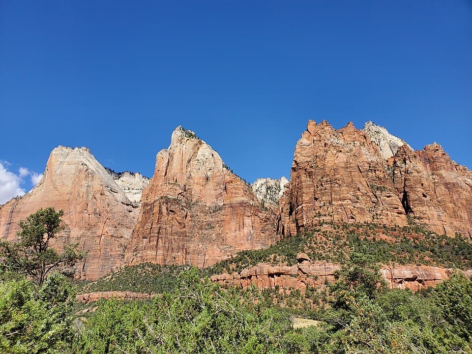
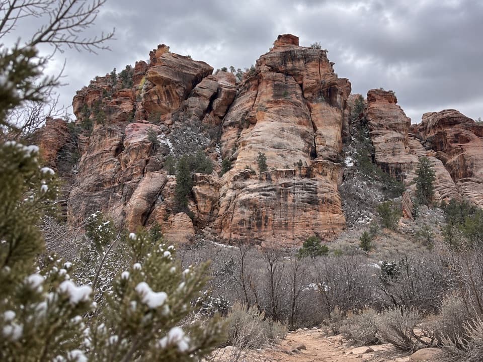
A sandstone crag with a short, exposed scramble to its high point.

Type
Sight
Nearest trail
1.9 mi
Audio stories
5 nearby
  • Trailhead
  • Parking
  • Restrooms
  • Picnic tables

Hear the audio tour

Lambs Knoll

Overview

About Lambs Knoll Climbing Site

Why stop

  • More than 25 established routes across several named climbing areas
  • Covered picnic shelters below the sandstone

Heads up

  • The summit route is exposed, and no accessible facilities are listed

Map

Where it is

Loading the Zion map
Full map
SightLambs Knoll Climbing Site37.31090, -113.10886
Keep this map with you offline in the Parkwolf app

Plan your stop

Before you go

Getting there and making it work

From State Route 9 just east of Virgin, head north on Kolob Terrace Road for 10.6 miles, turn left onto the Lambs Knoll access road, then continue 0.2 mile to the trailhead. BLM improved the trailhead, access road, day-use picnic area and restroom in 2018. There's a restroom mapped as a pit toilet, but no accessible facilities are listed. No food service or potable water was found, so plan to bring what you need. The nearby eight-site walk-in campground is a separate dispersed-camping area, not part of the day-use lot. Kolob Terrace Road is usually open year-round, but snow and winter weather can make the drive hazardous.

3 active Zion alerts

  • CautionToxic cyanobacteria in Zion waterwaysDo not drink Zion in-stream water, submerge your head, or touch or ingest algae mats; cyanobacteria can produce harmful toxins.Official details
  • ClosureWatchman Trail closed for repairsWatchman Trail is closed pending repairs; do not enter the trail and choose another hike. Check current park conditions before setting out.Official details
See all 3 alerts
A park ranger sits on a dash-mounted phone, talking, as Parkwolf’s Tour Guide plays “Army Cutworm Moths: A Grizzly Bear Buffet” on Grand Loop Road below Dunraven Pass in Yellowstone
Parkwolf Tour GuideThe highest, rockiest slopes around here are a summer buffet for grizzly bears.

Zion Tour Guide

Your drive to Lambs Knoll Climbing Site, narrated.

Parkwolf is a GPS audio tour guide for Zion National Park. As you drive, it chimes in with what’s ahead: hidden gems, upcoming stops, history, geology, and wildlife, right through your car’s speakers.

See the Zion audio tour

Recorded for this place

Lambs Knoll
0:00 / 0:29
“You're approaching the access road for Lambs Knoll, a sandstone climbing and picnic area just outside the park on BLM land. I'd stop for a picnic beneath the crag, even if you aren't a climber.”

Plays as you drive up to Lambs Knoll Climbing Site in the Parkwolf Zion Tour Guide.

More stories near here in the app

  • The Jay That Plants Pines
  • Food Through the Seasons
  • Left Fork Trailhead and the Subway
  • Hop Valley Trailhead
  • 45 audio storiesacross Zion’s roads, triggered by GPS as you drive
  • Wildlife heatmapsfor California Condor, Bighorn Sheep, Mountain Lion, and 13 more
  • Works offlinemaps, 54 trails, 36 places, and audio download before you lose signal
  • CarPlay readysimple controls built for the drive
★★★★★
“Fantastic app with many points of information… It’s great to just turn on while you’re driving and it gives you an audio tour of the national Park. We love it!!!!”
JMJamesApp Store review
Download Parkwolf on the App StoreGet Parkwolf on Google Play

4.7 from 8,600+ ratings

Guide

More about Lambs Knoll Climbing Site

A crag on the Kolob Terrace approachLambs Knoll Climbing Site is a sandstone crag and day-use picnic area on BLM land, about 10.

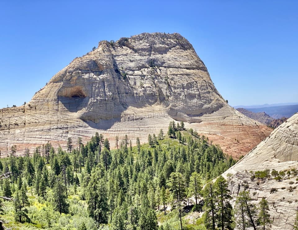
Lambs Knoll Climbing Site is a sandstone crag and day-use picnic area on BLM land, about 10.6 miles up Kolob Terrace Road from State Route 9 near Virgin. It's just outside Zion National Park. Keep it in the plan if you're climbing or want a picnic beneath the sandstone; more than 25 established routes and a developed trailhead make this a real stop, while the shelters at the base are easy to enjoy without getting on the rock.

Routes are close; the high point is a different askA short informal approach brings you from the parking area to the rock.

A short informal approach brings you from the parking area to the rock. The climbing is split among named areas including Ewe Wall, Mutton Block, Ram Wall and The Basement. For a quick summit outing, a guide estimates about an hour round trip; allow longer if you want to wander the shelves and several high points. The true summit route includes a short, exposed Class 3 scramble, so don't mistake the easy picnic access for an easy summit walk.

Look back across the terraceYou don't need to climb to get the broad view: from the trailhead area, look toward Tabernacle…

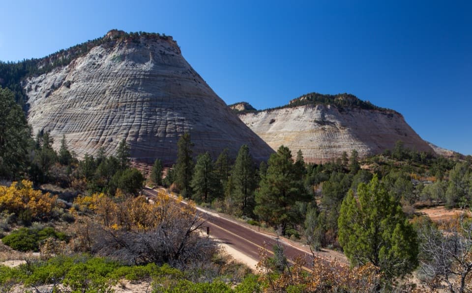
You don't need to climb to get the broad view: from the trailhead area, look toward Tabernacle Dome, West Temple and the Guardian Angels. For a photo, include one of the picnic shelters below the crag to give the sandstone towers a sense of scale. The higher viewpoints bring you closer to the rock, but require that exposed scramble.

Wildlife

Wildlife in Zion

All Zion wildlife maps

Sighting maps show where each species has been reported across Zion. Wildlife moves, so no sighting is guaranteed.

Parkwolf’s Zion ranking

Top sights in Zion

All 36 places
  1. 1Angels LandingSight
  2. 2Temple of SinawavaSight
  3. 3Canyon OverlookSight
  4. 4Checkerboard MesaSight
  5. 5Court of the PatriarchsSight
  6. 6Emerald PoolsSight

Take Parkwolf to Zion.

The audio tour guide for the drive, plus offline maps, trails, and wildlife heatmaps for when the signal drops.

4.7 from 8,600+ ratings

Download Parkwolf on the App StoreGet Parkwolf on Google Play