Tunnel Mountain Summit Trail in Banff National Park

Banff National Park, AB

Tunnel Mountain Summit Trail

A short, steady climb to a wide view over Banff.

Photo: Wikimedia Commons
Length
4.6km
Time
2hr
Elev. change
266m
Difficulty
Moderate
  • Dogs allowed
  • High point 1,685 m
  • #22 of 162 in Banff

Hear the audio tour

Tunnel Mountain: A Summit Above Town

Overview

About Tunnel Mountain Summit Trail

Why go

  • Wide views over Banff and the Bow Valley from a short summit climb
  • Easy to reach on foot from downtown

Heads up

  • Steady uphill grade with few level stretches
  • Limited paid parking at the lower trailhead

Map & elevation

The route

Loading the Banff map
Full map
Elevation1,419–1,685 m
TrailheadTunnel Mountain Trailhead (Lower Parking Area), St. Julien Road51.17535, -115.56187
Keep this map with you offline in the Parkwolf app

Plan your hike

Before you go

Parking

Start at the lower parking area on St. Julien Road at the Banff Centre campus. It has limited gravel spaces and paid parking. There is also a small upper lot on Tunnel Mountain Drive; starting there changes the distance. Roadside parking is illegal and unsafe. A valid Banff National Park pass is required.

Best time to go

The trail is open year-round, with the busiest period from June through October. Both parking areas are limited, so arriving early or walking from downtown avoids relying on roadside space. Snow and shade can leave the steeper pitches icy in winter; carry microspikes or crampons when the trail is snow-covered. Dogs may come, but Banff law requires them to stay leashed and under physical control at all times. No washrooms or water refill point are listed at the trailheads, so use facilities in town and bring what you need.

Safety

The climb is sustained, with a typical 12% grade and pitches up to 31%; rock, roots and winter ice can make footing difficult. Keep dogs leashed and under physical control, as required in Banff National Park.

8 active Banff alerts

  • ClosureJohnston Canyon Trail and Day Use Area closedJohnston Canyon Trail and Day Use Area are closed to all traffic and travel through December 11, 2026, because construction work requires protecting public and workers’ safety.Official details
  • ClosureBaker Lake and Hidden Lake campgrounds closed to campingCamping is prohibited at Baker Lake and Hidden Lake campgrounds through December 1, 2026, because a grizzly bear entered campsites and investigated tents and gear; the closures reduce risk to…Official details
See all 8 alerts
A park ranger sits on a dash-mounted phone, talking, as Parkwolf’s Tour Guide plays “Army Cutworm Moths: A Grizzly Bear Buffet” on Grand Loop Road below Dunraven Pass in Yellowstone
Parkwolf Tour GuideThe highest, rockiest slopes around here are a summer buffet for grizzly bears.

Banff Tour Guide

Your drive to Tunnel Mountain Summit Trail, narrated.

Parkwolf is a GPS audio tour guide for Banff National Park. As you drive, it chimes in with what’s ahead: hidden gems, upcoming stops, history, geology, and wildlife, right through your car’s speakers.

See the Banff audio tour

Recorded for this trailhead

Tunnel Mountain: A Summit Above Town
0:00 / 0:24
“Up ahead is the lower trailhead for Tunnel Mountain, a steady climb to views over Banff and Mount Rundle.”

Plays as you drive up to this trailhead in the Parkwolf Banff Tour Guide.

More stories near here in the app

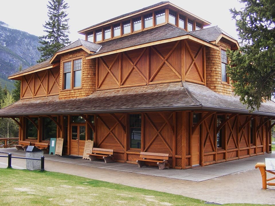
  • Banff Park Museum and the Gardens
  • Banff Visitor Centre and Grizzly House
  • Surprise Corner: The Hotel View
  • Bow Falls: A Wide River Cascade
  • 185 audio storiesacross Banff’s roads, triggered by GPS as you drive
  • Wildlife heatmapsfor Grizzly Bear, Brown Bear, Gray Wolf, and 13 more
  • Works offlinemaps, 162 trails, 90 places, and audio download before you lose signal
  • CarPlay readysimple controls built for the drive
★★★★★
“…Loved the commentary as you drove thru. I’m sure the app can do more than I know but the tips were very helpful. I’m gonna use it when we go to Banff next month.”
tesja22App Store review
Download Parkwolf on the App StoreGet Parkwolf on Google Play

4.7 from 8,600+ ratings

Trail guide

Hiking Tunnel Mountain Summit Trail

A short summit with a real climbTunnel Mountain Summit Trail is the out-and-back from Banff’s lower St.

Tunnel Mountain Summit Trail is the out-and-back from Banff’s lower St. Julien Road access to the mountain’s low summit. The route is 2.3 km each way: count on 4.6 km round trip, 275 m of climbing and about two hours. It is a good half-day choice if you want a steady uphill walk and a close look at Banff without committing to a long alpine hike. The reward is a broad view across the town, the Bow Valley and Mount Rundle.

Start at the lower trailheadThe lower parking area is on St.

The lower parking area is on St. Julien Road at the Banff Centre campus, about 1 km or a 15-minute walk east of downtown. If you walk from town, budget roughly 2 km extra for the return. The lower lot has limited gravel parking and is paid; There is also a small paved lot on Tunnel Mountain Drive. Use the distance that matches your starting point. Roadside parking is illegal and unsafe. A valid national park pass is required to visit Banff National Park.

What the climb feels likeThe route climbs by switchbacks, mostly on soft soil with patches of rock and exposed roots and…

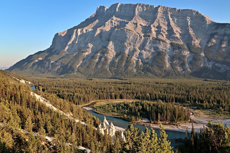
The route climbs by switchbacks, mostly on soft soil with patches of rock and exposed roots and a few concrete steps at the lower and upper access points. The path averages about 2.1 m wide but narrows to roughly 0.8 m in places. The typical grade is about 12%, with short pitches up to 31%, so expect sustained uphill work even though the mileage is modest. The first part rises through trees; as you gain height, openings begin to show the town and Bow River below. The higher bends bring Mount Rundle and more of the valley into view. The route is popular and well-trodden, but stay on the marked path where stepping off can damage the slope.

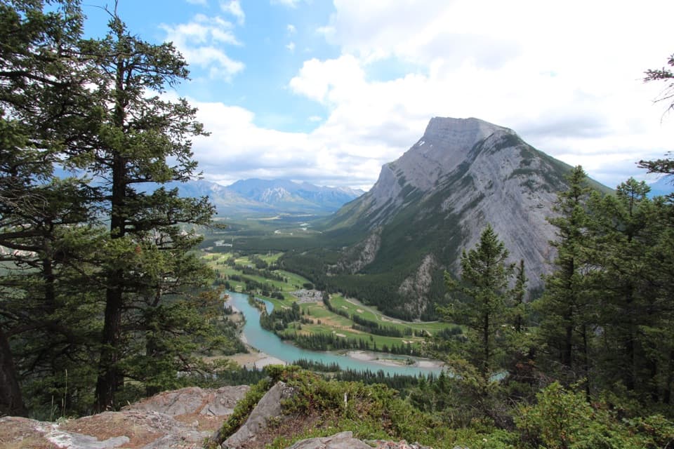
Give the summit a few minutesThe top is a low, partly forested summit with red chairs and panoramic views of Banff, the Bow…

The top is a low, partly forested summit with red chairs and panoramic views of Banff, the Bow Valley, Mount Rundle and the Banff Springs golf course. Interpretive signs along the route add context about the area, so save a few minutes for them after the climb. For a photo, frame the Bow River and green fairways below with Mount Rundle beyond; the river bend gives the valley a sense of scale that a tight peak shot loses.

Wildlife

Wildlife in Banff

All Banff wildlife maps

Sighting maps show where each species has been reported across Banff. Wildlife moves, so no sighting is guaranteed.

Keep exploring

Near Tunnel Mountain Summit Trail

See it all on the map

Trails that start nearby

Places near the trailhead

Parkwolf’s Banff ranking

Top-rated trails in Banff

All 162 trails
  1. 1Sentinel Pass via Larch Valley TrailChallenging · 11.2 km
  2. 2Plain of Six Glaciers TrailModerate · 11.6 km
  3. 3Lake Agnes TrailModerate · 7.8 km
  4. 4Johnston Canyon Trail to Upper FallsEasy · 4.8 km
  5. 5Larch Valley / Minnestimma Lakes TrailModerate · 9 km
  6. 6Parker Ridge TrailModerate · 5.6 km

Take Parkwolf to Banff.

The audio tour guide for the drive, plus offline maps, trails, and wildlife heatmaps for when the signal drops.

4.7 from 8,600+ ratings

Download Parkwolf on the App StoreGet Parkwolf on Google Play