Shafer Trail Viewpoint in Canyonlands National Park

Sight · Canyonlands National Park

Shafer Trail Viewpoint

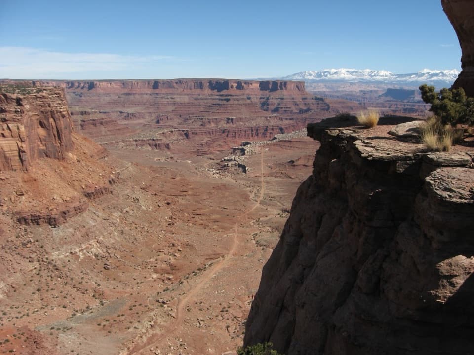
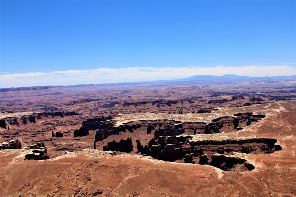
Watch the Shafer Trail drop through 1,500 feet of sandstone.

Photo: National Park Service
Type
Sight
Nearest trail
0.3 mi
Audio stories
4 nearby
  • Scenic viewpoint
  • Pullout
  • #16 of 45 sights

Hear the audio tour

Shafer Canyon Overlooks

Overview

About Shafer Trail Viewpoint

Why stop

  • You can see the famous switchbacks from above without driving the backcountry road.

Map

Where it is

Loading the Canyonlands map
Full map
SightShafer Trail Viewpoint38.44807, -109.82155
Keep this map with you offline in the Parkwolf app

Plan your stop

Before you go

2 active Canyonlands alerts

  • ClosureRain-damaged Needles backcountry roads impassableRecent rains have made several Needles backcountry roads impassable; do not drive these routes.Official details
  • CautionMaze access roads require high-clearance 4WDOnly use high-clearance 4WD to reach Hans Flat or Horseshoe Canyon in The Maze; low-clearance vehicles are not recommended on these damaged, rutted, muddy routes.Official details

Canyonlands alerts
A park ranger sits on a dash-mounted phone, talking, as Parkwolf’s Tour Guide plays “Army Cutworm Moths: A Grizzly Bear Buffet” on Grand Loop Road below Dunraven Pass in Yellowstone
Parkwolf Tour GuideThe highest, rockiest slopes around here are a summer buffet for grizzly bears.

Canyonlands Tour Guide

Your drive to Shafer Trail Viewpoint, narrated.

Parkwolf is a GPS audio tour guide for Canyonlands National Park. As you drive, it chimes in with what’s ahead: hidden gems, upcoming stops, history, geology, and wildlife, right through your car’s speakers.

See the Canyonlands audio tour

Recorded for this place

Shafer Canyon Overlooks
0:00 / 0:34
“Up ahead are the Shafer Canyon overlooks, where you can see the switchbacks without driving the backcountry road yourself.”

Plays as you drive up to Shafer Trail Viewpoint in the Parkwolf Canyonlands Tour Guide.

More stories near here in the app

  • Island in the Sky Visitor Center
  • Lathrop Trailhead
  • Four Wooden Boats into Canyon Country
  • A Thin Coat on the Cliffs
  • 43 audio storiesacross Canyonlands’s roads, triggered by GPS as you drive
  • Wildlife heatmapsfor Bighorn Sheep, Mule Deer, Coyote, and 13 more
  • Works offlinemaps, 63 trails, 65 places, and audio download before you lose signal
  • CarPlay readysimple controls built for the drive
★★★★★
“Fantastic app with many points of information… It’s great to just turn on while you’re driving and it gives you an audio tour of the national Park. We love it!!!!”
JMJamesApp Store review
Download Parkwolf on the App StoreGet Parkwolf on Google Play

4.7 from 8,600+ ratings

Guide

More about Shafer Trail Viewpoint

See the Shafer Trail from aboveShafer Trail Viewpoint is a roadside overlook in Island in the Sky, above the famous road as it…

Shafer Trail Viewpoint is a roadside overlook in Island in the Sky, above the famous road as it drops 1,500 feet through colorful sandstone. It is a quick, high-payoff stop if you want to understand the route without driving it yourself. The switchbacks cut across the canyon wall, and a vehicle negotiating them gives the view a vivid sense of scale.

Walk from the pulloutDrive 0.9 mile beyond the Island in the Sky Visitor Center.

Drive 0.9 mile beyond the Island in the Sky Visitor Center. The paved pullout fits only a handful of cars, then a short, uneven unpaved path leads to a fenced viewing area. The path is rough underfoot, so this is not a flat paved lookout.

You do not need to drive the Shafer Trail to reach the viewpoint. The road below is a separate backcountry route; the park recommends high-clearance four-wheel drive with low range for anyone driving it.

Keep the switchbacks in frameThe road's bends are the reason to stop.

The road's bends are the reason to stop. Frame several switchbacks with the sandstone wall and canyon basin so the descent reads as a route, not just a strip of dirt. You may see four-wheel-drive vehicles below, but the road itself is the main event.

A cattle route turned haul roadThe Shafer name comes from a Mormon pioneer family.

The Shafer name comes from a Mormon pioneer family. John “Sog” Shafer began using the trail in 1916 to move cattle between mesa-top summer pasture and winter range, and he improved the route. Decades later, the Atomic Energy Commission widened and extended it so trucks could haul uranium-bearing rock to Moab for processing. After Canyonlands was established in 1964, ranchers received a ten-year extension to continue ranching in the park.

Wildlife

Wildlife in Canyonlands

All Canyonlands wildlife maps

Sighting maps show where each species has been reported across Canyonlands. Wildlife moves, so no sighting is guaranteed.

Keep exploring

Near Shafer Trail Viewpoint

See it all on the map

Trails nearby

More stops nearby

Parkwolf’s Canyonlands ranking

Top sights in Canyonlands

All 65 places
  1. 1Mesa ArchSight
  2. 2Grand View PointSight
  3. 3Green River OverlookSight
  4. 4Great GallerySight
  5. 5Upheaval DomeSight
  6. 6Druid ArchSight

Take Parkwolf to Canyonlands.

The audio tour guide for the drive, plus offline maps, trails, and wildlife heatmaps for when the signal drops.

4.7 from 8,600+ ratings

Download Parkwolf on the App StoreGet Parkwolf on Google Play