Mesa Arch Trail in Canyonlands National Park

#1 of 63 trails in Canyonlands

Canyonlands National Park, UT

Mesa Arch Trail

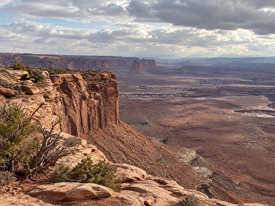
Short loop, cliff-edge arch, canyon views framed by the La Sal Mountains.

Photo: Public Domain
Length
0.6mi
Time
36min
Elev. change
66ft
Difficulty
Easy
  • Loop
  • No dogs
  • High point 6,191 ft

Hear the audio tour

Mesa Arch

Overview

About Mesa Arch Trail

Why go

  • A short loop ends at a 27-foot arch framing the canyon and La Sals.
  • Easy route with just 56 feet of official elevation change.

Heads up

  • Sunrise crowds can block the arch’s famous view.
  • Uneven rock and stone steps rule out wheelchair access.

Map & elevation

The route

Loading the Canyonlands map
Full map
Elevation6,125–6,191 ft
TrailheadMesa Arch Trailhead parking area38.38922, -109.86814
Keep this map with you offline in the Parkwolf app

Plan your hike

Before you go

Parking

Start at the Mesa Arch Trailhead parking area off the Island in the Sky road. The lot is the marked auto access for the loop; parking pressure is reported around sunrise, and popular trailhead lots can fill during the March–November busy season. Capacity is not posted.

Safety

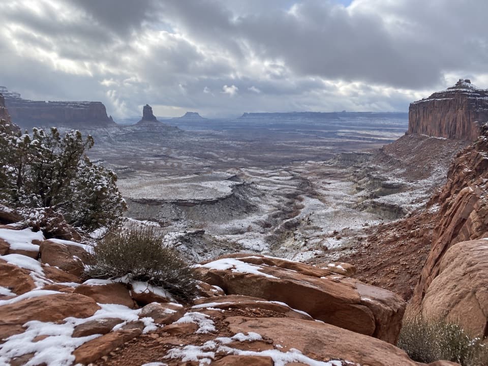
Rough, uneven rock and dirt, a rocky rise, and stone steps; the arch sits at the mesa edge. Snow or ice can make the trail slippery in winter. Dogs are prohibited.

2 active Canyonlands alerts

  • ClosureRain-damaged Needles backcountry roads impassableRecent rains have made several Needles backcountry roads impassable; do not drive these routes.Official details
  • CautionMaze access roads require high-clearance 4WDOnly use high-clearance 4WD to reach Hans Flat or Horseshoe Canyon in The Maze; low-clearance vehicles are not recommended on these damaged, rutted, muddy routes.Official details
Canyonlands alerts
A park ranger sits on a dash-mounted phone, talking, as Parkwolf’s Tour Guide plays “Army Cutworm Moths: A Grizzly Bear Buffet” on Grand Loop Road below Dunraven Pass in Yellowstone
Parkwolf Tour GuideThe highest, rockiest slopes around here are a summer buffet for grizzly bears.

Canyonlands Tour Guide

Your drive to Mesa Arch Trail, narrated.

Parkwolf is a GPS audio tour guide for Canyonlands National Park. As you drive, it chimes in with what’s ahead: hidden gems, upcoming stops, history, geology, and wildlife, right through your car’s speakers.

See the Canyonlands audio tour

Recorded for this trailhead

Mesa Arch
0:00 / 0:30
“You're coming up on Mesa Arch, where a low sandstone opening frames the canyon and the distant La Sal Mountains. Keep this stop even if you missed sunrise.”

Plays as you drive up to this trailhead in the Parkwolf Canyonlands Tour Guide.

More stories near here in the app

  • Aztec Butte Granaries
  • The Sheep That Rebuilt Other Herds
  • Candlestick Tower Overlook
  • Willow Flat Campground
  • 43 audio storiesacross Canyonlands’s roads, triggered by GPS as you drive
  • Wildlife heatmapsfor Bighorn Sheep, Mule Deer, Coyote, and 13 more
  • Works offlinemaps, 63 trails, 65 places, and audio download before you lose signal
  • CarPlay readysimple controls built for the drive
★★★★★
“Fantastic app with many points of information… It’s great to just turn on while you’re driving and it gives you an audio tour of the national Park. We love it!!!!”
JMJamesApp Store review
Download Parkwolf on the App StoreGet Parkwolf on Google Play

4.7 from 8,600+ ratings

Trail guide

Hiking Mesa Arch Trail

The short loopMesa Arch Trail is an easy 0.

Mesa Arch Trail is an easy 0.6-mile loop from the parking area to the cliff-edge arch and back, across slickrock and desert dirt. The official estimate is 30 minutes; allow 30–45 minutes if you want time at the overlook. For one short walk in Island in the Sky, this is a good use of a half hour: the route is brief, but it ends at a 27-foot arch framing the canyon and the La Sal Mountains.

Pick your directionThe full trail is a loop.

The full trail is a loop. The counter-clockwise direction puts a little more elevation change near the start. If you want fewer stone steps, walk clockwise to the arch and retrace your steps; that’s the easier out-and-back option, not the complete circuit. A few visitors have found the left fork confusing, so pause at the junction and stay with the marked tread instead of following informal prints across the dirt.

Rock, dirt, and stepsExpect a rocky rise and dips, uneven ground, and stone steps cut into the slickrock.

Expect a rocky rise and dips, uneven ground, and stone steps cut into the slickrock. The path is usually easy to spot, with signs at intersections and cairns marking trails across the mesa. It’s a short hike, but it isn’t a smooth paved stroll and is not wheelchair accessible. Snow or ice can make the rock slippery in winter.

The view at the endThe arch sits right on the mesa edge.

The arch sits right on the mesa edge. Through its opening, the canyon drops away toward the Colorado River country, with the La Sal Mountains in the distance. The low sandstone span is 27 feet long. The opening faces east, and sunrise can light the underside of the arch; the view is there at other times too, so you don’t need to make dawn your only chance to see it.

Sunrise has a tradeoffThis is one of the area’s most photographed spots, and people gather close to the arch for the…

This is one of the area’s most photographed spots, and people gather close to the arch for the classic sunrise view. The photo position can be crowded before dawn, and a crowd may block a clean frame. If that glow is the reason you came, build in time for the parking area and for other people already at the arch. Lots at popular park trailheads often fill during the busy March–November season; parking capacity here isn’t posted.

A living desert floorThe high desert around the trail supports biological soil crust: dark, bumpy groundcover made…

The high desert around the trail supports biological soil crust: dark, bumpy groundcover made up of organisms including cyanobacteria, lichens, and mosses. It helps hold soil and water in place and supports plant life. A footstep can damage the crust; mature patches may take decades to recover, so keep to the established path even where the dirt beside it looks bare.

Before you set outThere’s no drinking water along Canyonlands hiking trails; seasonal drinking water is available…

There’s no drinking water along Canyonlands hiking trails; seasonal drinking water is available at the Island in the Sky Visitor Center. An entrance pass is required to enter the park. Dogs aren’t allowed on this trail, though service animals are. Start from the Mesa Arch Trailhead parking area off the Island in the Sky road.

Wildlife

Wildlife in Canyonlands

All Canyonlands wildlife maps

Sighting maps show where each species has been reported across Canyonlands. Wildlife moves, so no sighting is guaranteed.

Keep exploring

Near Mesa Arch Trail

See it all on the map

Trails that start nearby

Places near the trailhead

Parkwolf’s Canyonlands ranking

Top-rated trails in Canyonlands

All 63 trails
  1. 2Chesler Park Loop and Joint TrailChallenging · 10.7 mi
  2. 3Druid Arch TrailChallenging · 10.8 mi
  3. 4Grand View Point TrailEasy · 1.8 mi
  4. 5Horseshoe Canyon Trail to the Great GalleryChallenging · 7 mi
  5. 6White Rim Overlook TrailEasy · 1.8 mi
  6. 7Chesler Park Viewpoint TrailChallenging · 5.8 mi

Take Parkwolf to Canyonlands.

The audio tour guide for the drive, plus offline maps, trails, and wildlife heatmaps for when the signal drops.

4.7 from 8,600+ ratings

Download Parkwolf on the App StoreGet Parkwolf on Google Play