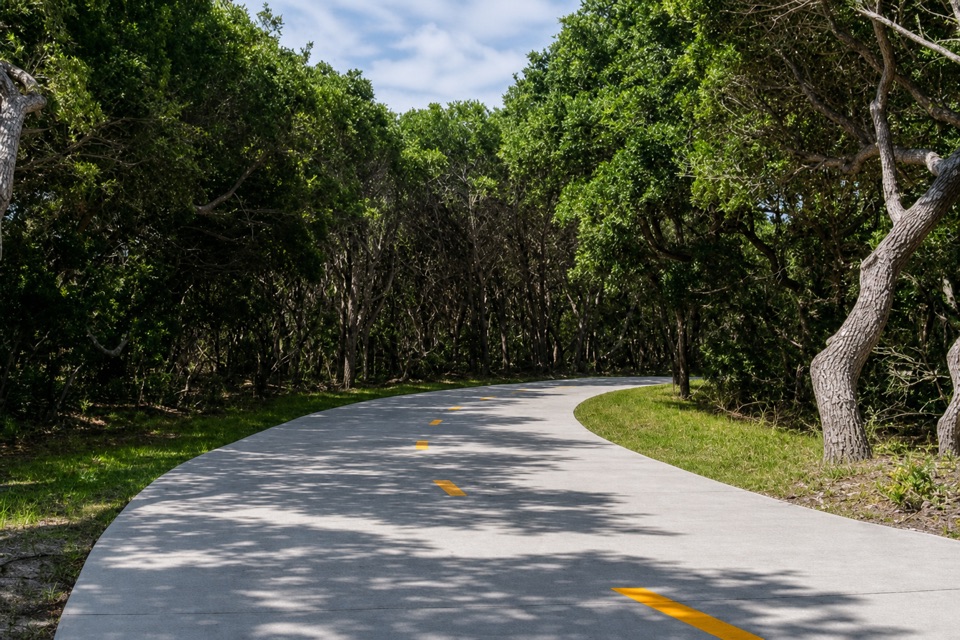
The Lighthouse Pathway in Cape Hatteras National Seashore

#9 of 11 trails in Cape Hatteras

Cape Hatteras National Seashore, NC

The Lighthouse Pathway

A broad paved link from Buxton to the lighthouse and beach.

Length
1.5mi
Time
36min
Elevation
Flat
Difficulty
Easy
  • Dogs allowed
  • High point 23 ft

Hear the audio tour

Orange Blossom Bakery and the Apple Ugly

Overview

About The Lighthouse Pathway

Why go

  • A smooth 10–12-foot path links the village, Light Station and beach access.
  • Interpretive panels cover the lighthouse’s 1999 move and local ecology.

Heads up

  • Point-to-point; walking back makes it about three miles.
  • Lighthouse Road traffic stays nearby for most of the route.

Map & elevation

The route

Loading the Cape Hatteras map
Full map
Elevation3–23 ft
TrailheadN.C. 12 and Lighthouse Road35.26507, -75.52501
Keep this map with you offline in the Parkwolf app

Plan your hike

Before you go

Parking

The trail begins at the N.C. 12/Lighthouse Road intersection in Buxton and ends by the Light Station and beach access. Use the Cape Hatteras Light Station parking lot at the far end; this is a point-to-point route, so return on the path or arrange a ride.


Safety

Pedestrians and cyclists share the wide path; traffic remains nearby on Lighthouse Road.

6 active Cape Hatteras alerts

  • ClosurePartial beach closures in front of Buxton VillageSections of beachfront in front of Buxton Village are temporarily closed. - The closure is due to threatened oceanfront structures and Dare County’s beach nourishment project.Official details
  • ClosurePartial beach closure in northern RodantheThe beach from the northern boundary of Rodanthe to the Rodanthe pier is closed to all access. - The closure is required because multiple threatened oceanfront structures pose risks to public safety.Official details
See all 6 alerts
A park ranger sits on a dash-mounted phone, talking, as Parkwolf’s Tour Guide plays “Army Cutworm Moths: A Grizzly Bear Buffet” on Grand Loop Road below Dunraven Pass in Yellowstone
Parkwolf Tour GuideThe highest, rockiest slopes around here are a summer buffet for grizzly bears.

Cape Hatteras Tour Guide

Your drive to The Lighthouse Pathway, narrated.

Parkwolf is a GPS audio tour guide for Cape Hatteras National Seashore. As you drive, it chimes in with what’s ahead: hidden gems, upcoming stops, history, geology, and wildlife, right through your car’s speakers.

Recorded for this area

Orange Blossom Bakery and the Apple Ugly
0:00 / 0:25
“You're coming up on Orange Blossom Bakery in Buxton. I'd stop for the Apple Ugly, a big, twisted apple-and-cinnamon fritter with glaze tucked into its folds.”

Plays on the road 0.2 mi from the trailhead in the Parkwolf Cape Hatteras Tour Guide.

More stories near here in the app

  • Cape Hatteras Lighthouse Grounds
  • Old Lighthouse Beach and the Former Tower Site
  • The Lighthouse That Floated
  • Buxton British Cemetery and Open Ponds Trail
  • 67 audio storiesacross Cape Hatteras’s roads, triggered by GPS as you drive
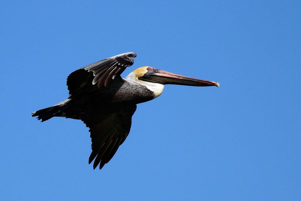
  • Wildlife heatmapsfor Brown Pelican, Tamanend's Bottlenose Dolphin, Bald Eagle, and 13 more
  • Works offlinemaps, 11 trails, 35 places, and audio download before you lose signal
  • CarPlay readysimple controls built for the drive
★★★★★
“Fantastic app with many points of information… It’s great to just turn on while you’re driving and it gives you an audio tour of the national Park. We love it!!!!”
JMJamesApp Store review
Download Parkwolf on the App StoreGet Parkwolf on Google Play

4.7 from 8,600+ ratings

Trail guide

Hiking The Lighthouse Pathway

A useful way to reach the lighthouseThe Lighthouse Pathway is a 1.5-mile point-to-point multi-use route, one way, from the N.C.

The Lighthouse Pathway is a 1.5-mile point-to-point multi-use route, one way, from the N.C. 12 and Lighthouse Road intersection in Buxton to the Cape Hatteras Light Station and Old Lighthouse Beach. Its value is practical: this wide paved link lets you reach the seashore’s best-known stop on foot or by bike without using Lighthouse Road’s travel lane. It works well as a low-effort way to stretch your legs or link town and coast. Walking back makes the outing about three miles.

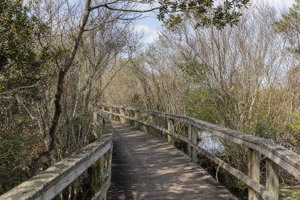
Smooth footing, traffic nearbyThe route is a broad, 10-to-12-foot concrete path.

The route is a broad, 10-to-12-foot concrete path. It follows Lighthouse Road, so the setting feels more like a parkway walk than a secluded woodland hike, and traffic stays nearby. The mapped profile is nearly level; distance and stops matter more than climbing. Allow 30 to 45 minutes one way at an easy walking pace, longer if you pause at the signs or visit the light station.

What to look for at the endInterpretive panels along the pathway explain the lighthouse’s move to its current site in…

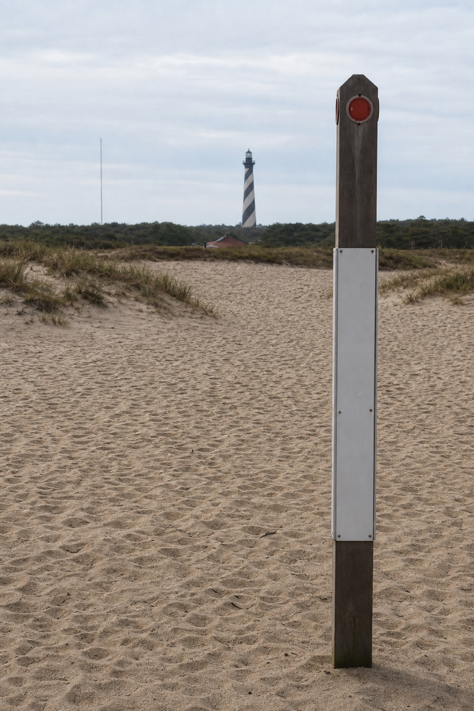
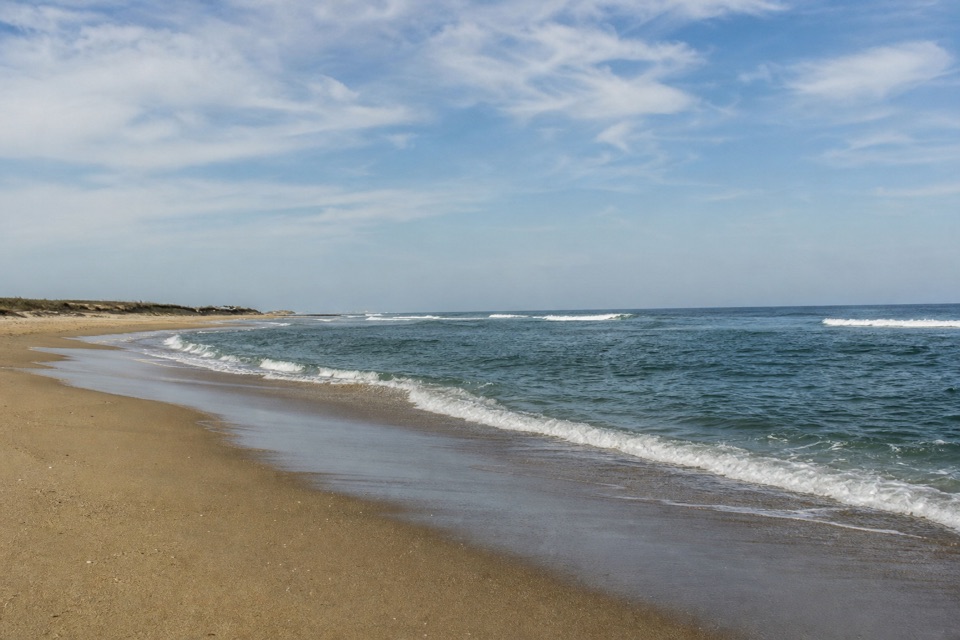
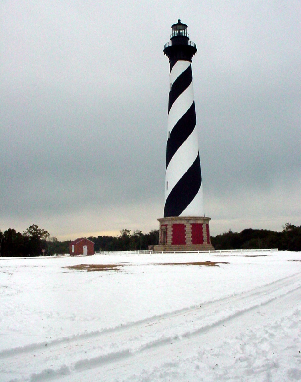
Interpretive panels along the pathway explain the lighthouse’s move to its current site in 1999, local ecology, and the area’s watersports. At the far end, Old Lighthouse Beach occupies the lighthouse’s former site, so a stop on the sand gives the walk a bit of history as well as a view of the tower. This is a useful connector to those destinations; the payoff is at the end, not a string of separate viewpoints along the way.

Getting on the routeThe Buxton end is at N.C. 12 and Lighthouse Road.

The Buxton end is at N.C. 12 and Lighthouse Road. The Cape Hatteras Light Station parking lot is the practical access at the other end; walk toward the village and back if you don’t have a ride. Pedestrians and cyclists share the wide path. Dogs are allowed on a leash no longer than six feet.

Wildlife

Wildlife in Cape Hatteras

All Cape Hatteras wildlife maps

Sighting maps show where each species has been reported across Cape Hatteras. Wildlife moves, so no sighting is guaranteed.

Keep exploring

Near The Lighthouse Pathway

See it all on the map

Trails that start nearby

Places near the trailhead

Parkwolf’s Cape Hatteras ranking

Top-rated trails in Cape Hatteras

All 11 trails
  1. 1Open Ponds TrailModerate · 4.5 mi
  2. 2Buxton Woods TrailEasy · 0.8 mi
  3. 3Bodie Island Boardwalk TrailEasy · 0.4 mi
  4. 4Hammock Hills TrailEasy · 0.8 mi
  5. 5Mountains-to-Sea Trail: Cape Hatteras SectionChallenging · 72.3 mi
  6. 6Off-Island TrailEasy · 0.6 mi

Take Parkwolf to Cape Hatteras.

The audio tour guide for the drive, plus offline maps, trails, and wildlife heatmaps for when the signal drops.

4.7 from 8,600+ ratings

Download Parkwolf on the App StoreGet Parkwolf on Google Play