Dartmeet in Dartmoor National Park

Sight · Dartmoor National Park

Dartmeet

Two crossings beside where the East and West Dart meet.

Photo: Wikimedia Commons
Type
Sight
Nearest trail
1.4 km
Audio stories
8 nearby
  • #15 of 46 sights

Hear the audio tour

Dartmeet's Two Crossings

Overview

About Dartmeet

Why stop

  • The 1792 road bridge and clapper stones tell different stories.

Map

Where it is

Loading the Dartmoor map
Full map
SightDartmeet50.54328, -3.87567
Keep this map with you offline in the Parkwolf app

Plan your stop

Before you go

2 active Dartmoor alerts

  • CautionDartmoor military firing restricts accessDo not cross the Okehampton, Willsworthy or Merrivale training-range boundaries when warning signals are displayed.Official details
  • CautionAccess restriction at Huccaby FarmAccess to CROW Access Land at Huccaby Farm in the West Dart River Valley is subject to a current restriction notice.Official details
Dartmoor alerts
A park ranger sits on a dash-mounted phone, talking, as Parkwolf’s Tour Guide plays “Army Cutworm Moths: A Grizzly Bear Buffet” on Grand Loop Road below Dunraven Pass in Yellowstone
Parkwolf Tour GuideThe highest, rockiest slopes around here are a summer buffet for grizzly bears.

Dartmoor Tour Guide

Your drive to Dartmeet, narrated.

Parkwolf is a GPS audio tour guide for Dartmoor National Park. As you drive, it chimes in with what’s ahead: hidden gems, upcoming stops, history, geology, and wildlife, right through your car’s speakers.

Recorded for this place

Dartmeet's Two Crossings
0:00 / 0:32
“You're coming up on Dartmeet, where the East and West Dart join below the road to become the River Dart.”

Plays as you drive up to Dartmeet in the Parkwolf Dartmoor Tour Guide.

More stories near here in the app

  • The School Desks in St Raphael's
  • Combestone Tor to Aune Head Mire
  • The Flood That Broke the Crossing
  • Hexworthy Walk to Week Ford and Combestone Tor
  • 298 audio storiesacross Dartmoor’s roads, triggered by GPS as you drive
  • Wildlife heatmapsfor Western Roe Deer, Red Fox, European Rabbit, and 13 more
  • Works offlinemaps, 54 trails, 59 places, and audio download before you lose signal
  • CarPlay readysimple controls built for the drive
★★★★★
“Fantastic app with many points of information… It’s great to just turn on while you’re driving and it gives you an audio tour of the national Park. We love it!!!!”
JMJamesApp Store review
Download Parkwolf on the App StoreGet Parkwolf on Google Play

4.7 from 8,600+ ratings

Guide

More about Dartmeet

Where the Darts meetDartmeet is a compact riverside stop where the East Dart and West Dart meet to form the Dart.

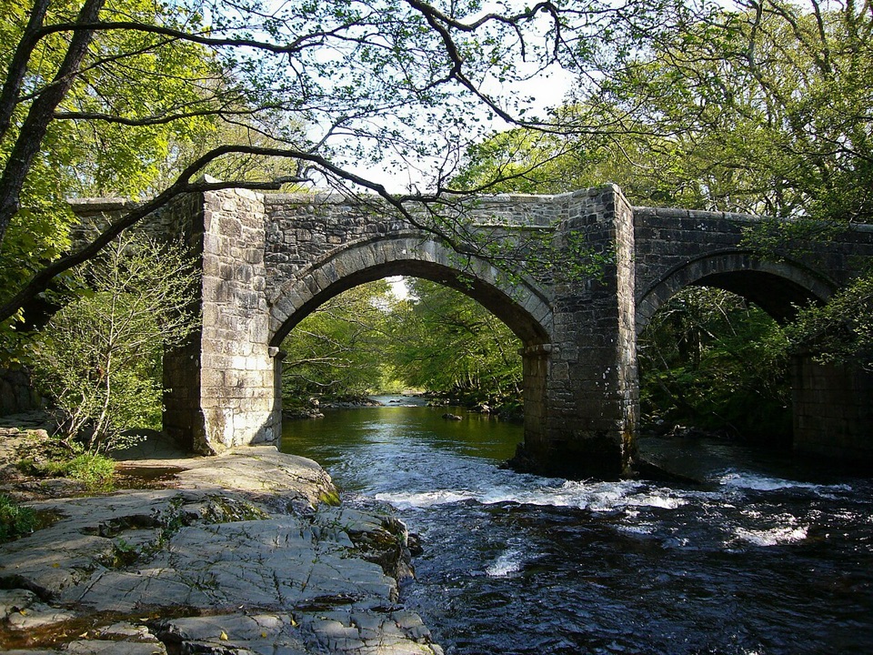
Dartmeet is a compact riverside stop where the East Dart and West Dart meet to form the Dart. In one short stretch, the B3357 crosses the East Dart on a road bridge dated to 1792, while the broken granite slabs of a clapper bridge lie close by. The confluence sits just below the road crossing, so the name describes both the geography and the reason people pause here.

Two crossings, different storiesThe clapper bridge is the visual draw: broad stone slabs sit low over the river, with some…

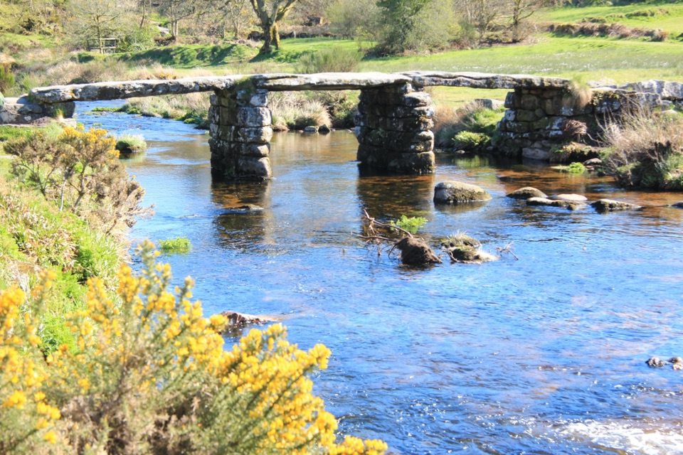
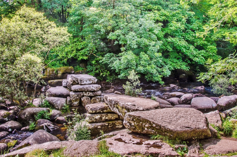
The clapper bridge is the visual draw: broad stone slabs sit low over the river, with some still spanning the water and others left as fragments. Its precise age is uncertain, so enjoy it as a surviving crossing rather than relying on a neat construction date. The road bridge still carries the B3357; seeing it beside the broken stone crossing makes the layers of travel here easy to read. Bridge scenes have appeared in Dartmoor postcards since the late nineteenth century.

For a photo, include the water around the low granite slabs. It makes the broken shape of the old crossing clear and gives the stones a sense of scale.

Make a walk of itDartmeet also works as the start of a longer walk.

Dartmeet also works as the start of a longer walk. The circular route from the car park is about 5.5 km (3.5 miles), takes roughly three hours and passes Pixies Holt. That turns this small riverside stop into a good starting point for a half-day walk rather than another roadside photo. For a brief visit, the bridge remains and river meeting are the draw; the loop is a reason to stay longer if you want more time on the moor.

What to plan forThe B3357 runs directly through Dartmeet, and the car park is beside the bridge.

The B3357 runs directly through Dartmeet, and the car park is beside the bridge. Current parking arrangements and on-site facilities are unclear, so check before relying on a toilet, café or a particular charge. The crossings and confluence are close together, making this easy to understand on foot, but the circular route takes longer than a quick photo stop.

Wildlife

Wildlife in Dartmoor

All Dartmoor wildlife maps

Sighting maps show where each species has been reported across Dartmoor. Wildlife moves, so no sighting is guaranteed.

Keep exploring

Near Dartmeet

See it all on the map

Trails nearby

More stops nearby

Parkwolf’s Dartmoor ranking

Top sights in Dartmoor

All 59 places
  1. 1Haytor RocksSight
  2. 2Postbridge Clapper BridgeSight
  3. 3Hound TorSight
  4. 4GrimspoundSight
  5. 5Wistman’s WoodSight
  6. 6Castle DrogoSight

Take Parkwolf to Dartmoor.

The audio tour guide for the drive, plus offline maps, trails, and wildlife heatmaps for when the signal drops.

4.7 from 8,600+ ratings

Download Parkwolf on the App StoreGet Parkwolf on Google Play