Desolation Canyon in Death Valley National Park

Death Valley National Park, CA · NV

Desolation Canyon

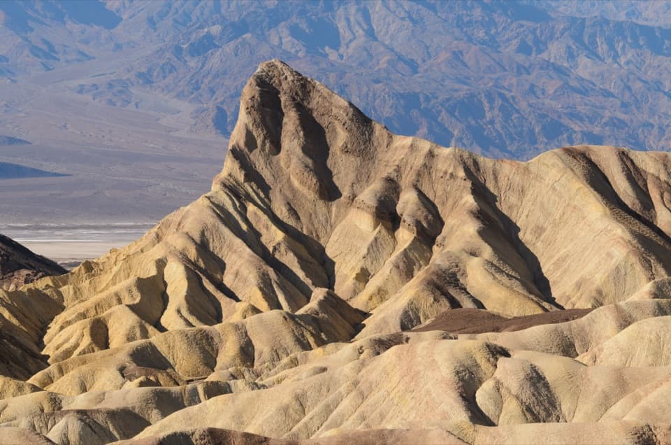
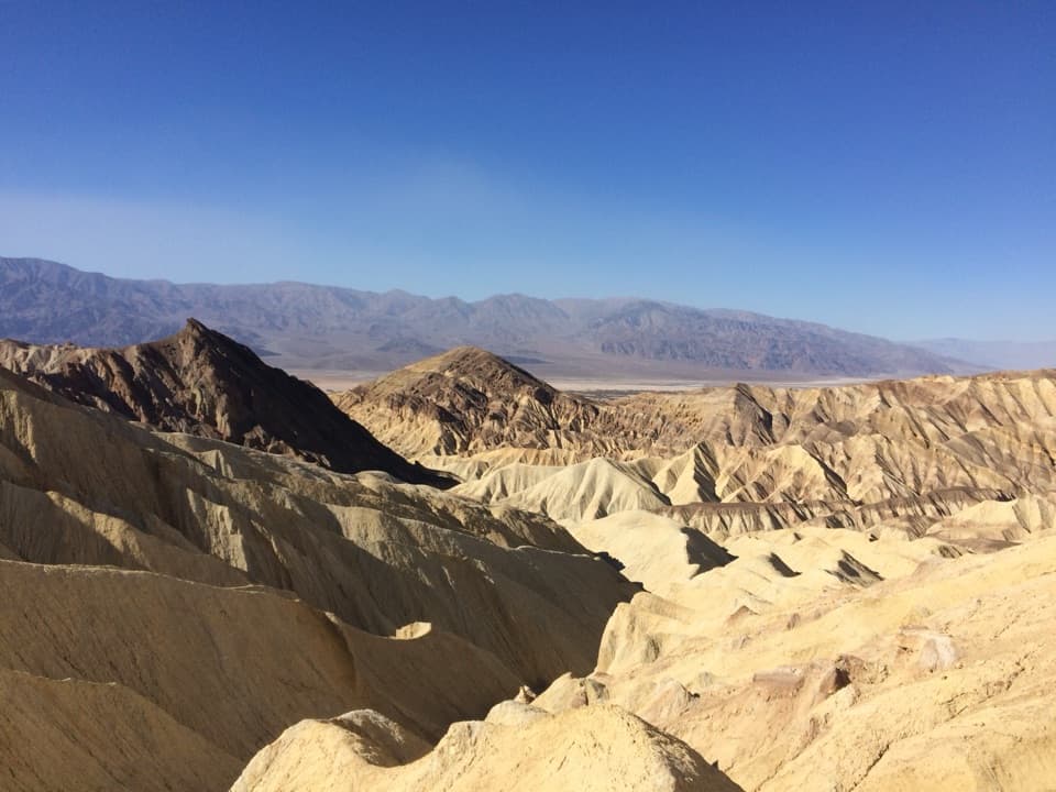
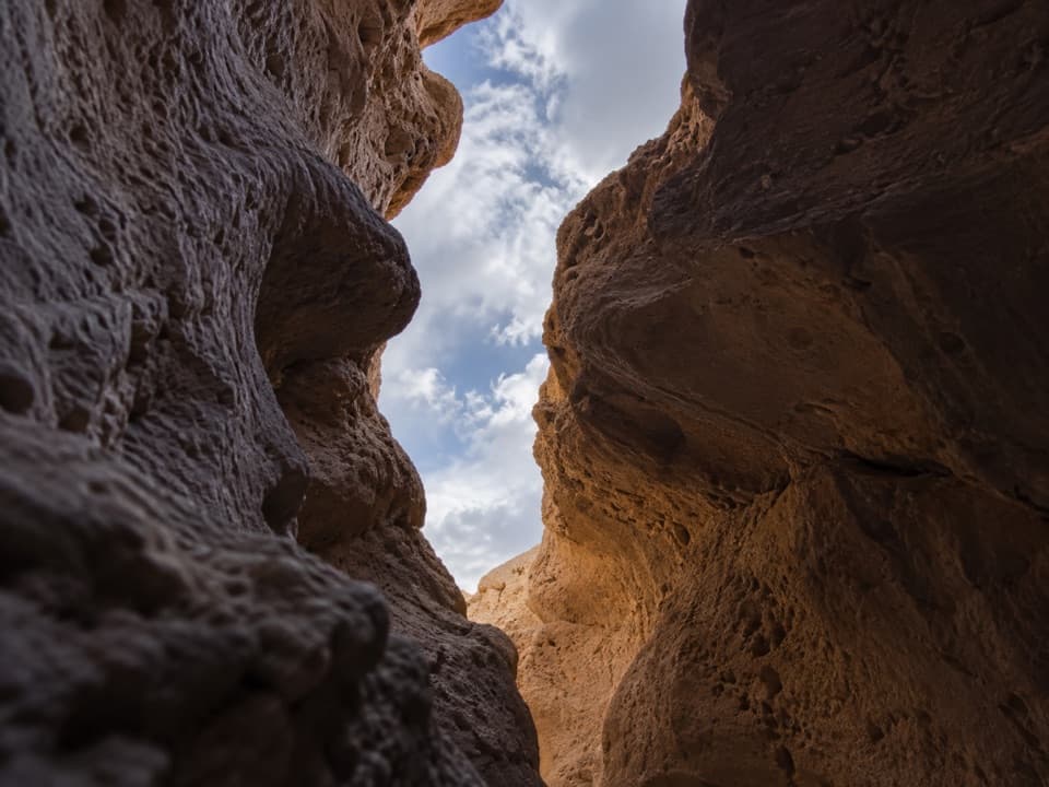
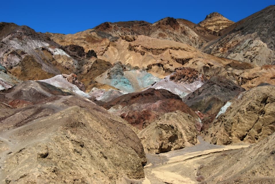
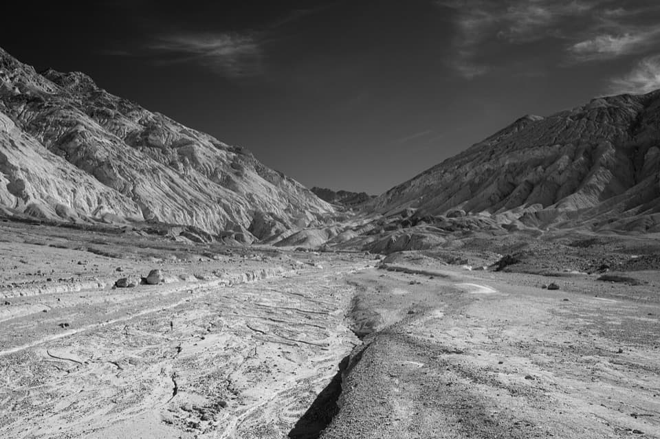
Canyon narrows lead to a high view over Artist Drive.

Photo: Clyde Charles Brown, CC BY-SA 4.0, via Wikimedia Commons

Length
3.6mi
Time
2.5hr
Elev. change
774ft
Difficulty
Challenging
  • No dogs
  • High point 692 ft
  • #16 of 57 in Death Valley

Hear the audio tour

Desolation Canyon: Narrows and Dryfall Scrambles

Overview

About Desolation Canyon

Why go

  • Colorful narrows and sculpted canyon walls
  • Ridgeline view over Death Valley and Artist Drive

Heads up

  • Unmarked route with confusing canyon branches
  • Two dryfalls require scrambling

Map & elevation

The route

Loading the Death Valley map
Full map
Elevation-82–692 ft
TrailheadDesolation Canyon Road parking area36.39585, -116.83886
Keep this map with you offline in the Parkwolf app

Plan your hike

Before you go

Parking

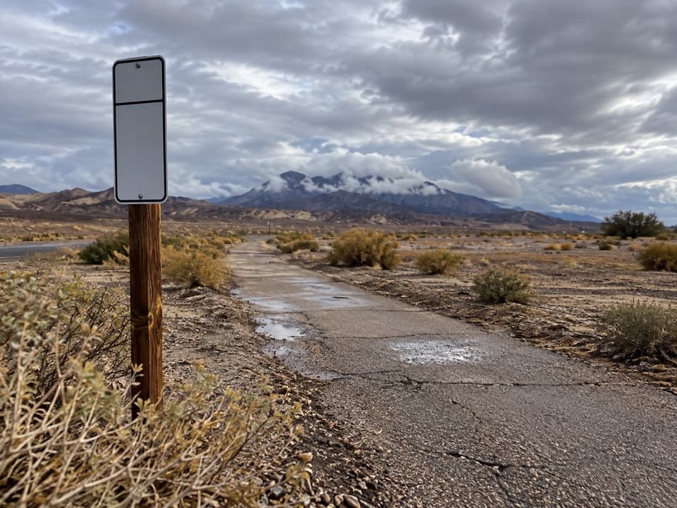
Desolation Canyon Road gravel parking area, reached by the short unpaved spur 3.7 miles south of CA-190 on Badwater Road. The road is typically sedan-passable; the lot accommodates buses and RVs. Nearest vault toilet is at Golden Canyon parking, 1.7 miles north.

Best time to go

The parking area is reached by a short unpaved road 3.7 miles south of CA-190 on Badwater Road. The road is typically passable to sedans, and the gravel lot can take buses and RVs. There is no restroom at the trailhead; the nearest vault toilet is at Golden Canyon parking, 1.7 miles north. Carry all the water you need; the park recommends at least 2 liters even for a short winter day hike and more in warm weather. November through March is the best hiking season at these low elevations; summer heat can be dangerous, and spring and fall can still be very hot. Pets are not allowed on trails or in designated wilderness.

Safety

Unmarked route in designated wilderness; bring a map and compass. The 8-foot and 6-foot dryfalls require scrambling and can be harder to descend. Avoid the canyon wash when storms threaten because flash flooding is possible. Low-elevation heat can be dangerous; carry ample water. Pets are prohibited on trails and in wilderness.

4 active Death Valley alerts

  • ClosureRoad closures and hazardous conditionsSeveral park roads are closed or hazardous; follow closures and vehicle restrictions.Official details
  • ClosureSaline Valley Lower Springs closed after wildfireLower Springs pools at Saline Valley Warm Springs remain closed because the September 15 wildfire left safety hazards, including potential hazardous chemicals; do not enter the closed area.Official details
See all 4 alerts
A park ranger sits on a dash-mounted phone, talking, as Parkwolf’s Tour Guide plays “Army Cutworm Moths: A Grizzly Bear Buffet” on Grand Loop Road below Dunraven Pass in Yellowstone
Parkwolf Tour GuideThe highest, rockiest slopes around here are a summer buffet for grizzly bears.

Death Valley Tour Guide

Your drive to Desolation Canyon, narrated.

Parkwolf is a GPS audio tour guide for Death Valley National Park. As you drive, it chimes in with what’s ahead: hidden gems, upcoming stops, history, geology, and wildlife, right through your car’s speakers.

See the Death Valley audio tour

Recorded for this trailhead

Desolation Canyon: Narrows and Dryfall Scrambles
0:00 / 0:25
“Desolation Canyon's trailhead is coming up, for an unmarked hike through colorful narrows to a ridge above Artists Drive.”

Plays as you drive up to this trailhead in the Parkwolf Death Valley Tour Guide.

More stories near here in the app

  • Water from a Seed
  • The Homeland on the Sign
  • The Cactus's Night Shift
  • Golden Canyon: Walk to Red Cathedral
  • 228 audio storiesacross Death Valley’s roads, triggered by GPS as you drive
  • Wildlife heatmapsfor Bighorn Sheep, Desert Tortoise, Coyote, and 13 more
  • Works offlinemaps, 57 trails, 81 places, and audio download before you lose signal
  • CarPlay readysimple controls built for the drive
★★★★★
“Fantastic app with many points of information… It’s great to just turn on while you’re driving and it gives you an audio tour of the national Park. We love it!!!!”
JMJamesApp Store review
Download Parkwolf on the App StoreGet Parkwolf on Google Play

4.7 from 8,600+ ratings

Trail guide

Hiking Desolation Canyon

What this hike asks of youDesolation Canyon is an unmarked, 3.

Desolation Canyon is an unmarked, 3.6-mile out-and-back from the gravel parking area on Desolation Canyon Road to a ridgeline lookout above Death Valley, then back the same way. Allow about 2.5 hours. The route starts in an open wash, narrows between colorful canyon walls, and finishes with a climb to a broad view over Artist Drive. It is moderate to difficult, with route-finding and scrambling rather than a maintained path. The published gain is 600 feet, while independent terrain checks put the endpoint roughly 780 feet above the parking area; expect a sustained climb. Bring a map and compass because the GPS line is supplemental.

Find the main canyonFrom the parking area, two drainages are obvious.

From the parking area, two drainages are obvious. Avoid the smaller one to the south and head east toward the Black Mountains, then turn south along the wash with the mountain wall on your left. The canyon tightens as its walls rise, and short side canyons branch away. About a mile into the main canyon, keep right at the next two intersections; the gradual sandy climb beyond them leads to the ridge. Return by the same route.

The dryfalls are the cruxAn 8-foot dryfall is followed soon after by one about 6 feet high. Both require scrambling.

An 8-foot dryfall is followed soon after by one about 6 feet high. Both require scrambling. They may feel easier to climb up than to climb back down, so decide before committing whether you can manage the return. If either drop is beyond your comfort, turn around before climbing it.

Look at the wallsThe colors shift from red and orange to yellow, green, blue, and purple.

The colors shift from red and orange to yellow, green, blue, and purple. Those shades come from minerals in the rock: hematite, limonite, chlorite, and nontronite. Desert holly and rock nettle are among the plants noted in the canyon. At the ridge, frame Artist Drive below the canyon edge to show how the narrow route opens onto the broad valley.

Wildlife

Wildlife in Death Valley

All Death Valley wildlife maps

Sighting maps show where each species has been reported across Death Valley. Wildlife moves, so no sighting is guaranteed.

Keep exploring

Near Desolation Canyon

See it all on the map

Trails that start nearby

Places near the trailhead

Parkwolf’s Death Valley ranking

Top-rated trails in Death Valley

All 57 trails
  1. 1Badwater Salt FlatEasy · 1.9 mi
  2. 2Mosaic CanyonModerate · 4 mi
  3. 3Golden Canyon to Red CathedralModerate · 3 mi
  4. 4Telescope Peak TrailChallenging · 12.2 mi
  5. 5Golden Canyon Complete CircuitChallenging · 7.8 mi
  6. 6Gower Gulch LoopModerate · 4.3 mi

Take Parkwolf to Death Valley.

The audio tour guide for the drive, plus offline maps, trails, and wildlife heatmaps for when the signal drops.

4.7 from 8,600+ ratings

Download Parkwolf on the App StoreGet Parkwolf on Google Play