Ubehebe Crater Loop in Death Valley National Park

#8 of 57 trails in Death Valley

Death Valley National Park, CA · NV

Ubehebe Crater Loop

Circle a 600-foot-deep crater on an exposed volcanic rim.

Photo: Samartur, CC BY-SA 3.0, via Wikimedia Commons

Length
1.5mi
Time
1.3hr
Elev. change
331ft
Difficulty
Moderate
  • Loop
  • No dogs
  • High point 2,860 ft

Hear the audio tour

Ubehebe Crater: A Steam-Blasted Bowl

Overview

About Ubehebe Crater Loop

Why go

  • The crater walls change with every bend of the rim.
  • Little Hebe adds a second volcanic crater to the walk.

Heads up

  • Loose cinder and exposed drops make the short mileage feel harder.

Map & elevation

The route

Loading the Death Valley map
Full map
Elevation2,529–2,860 ft
TrailheadUbehebe Crater Parking Lot37.01075, -117.45492
Keep this map with you offline in the Parkwolf app

Plan your hike

Before you go

Parking

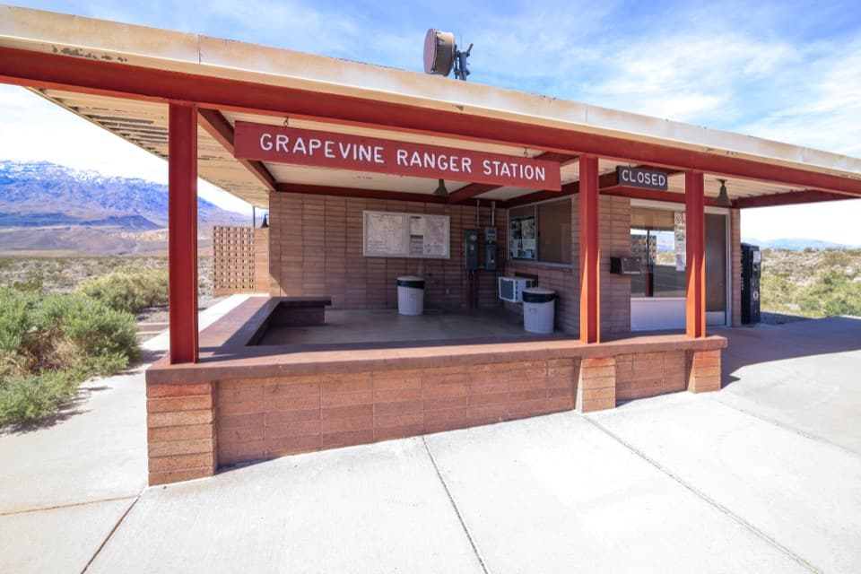
Use the paved Ubehebe Crater parking lot at the end of Ubehebe Crater Road, eight miles west of Scotty’s Castle. The overlook lot fits buses and large RVs. There is no restroom; the nearest is at Grapevine Ranger Station about five miles east.

Safety

The rim has exposed edges and loose, unstable cinder; stay on the established path and give the drop-offs room. Low-elevation heat can become dangerous, especially from spring through fall. Pets are not allowed on trails.

4 active Death Valley alerts

  • ClosureRoad closures and hazardous conditionsSeveral park roads are closed or hazardous; follow closures and vehicle restrictions.Official details
  • ClosureSaline Valley Lower Springs closed after wildfireLower Springs pools at Saline Valley Warm Springs remain closed because the September 15 wildfire left safety hazards, including potential hazardous chemicals; do not enter the closed area.Official details
See all 4 alerts
A park ranger sits on a dash-mounted phone, talking, as Parkwolf’s Tour Guide plays “Army Cutworm Moths: A Grizzly Bear Buffet” on Grand Loop Road below Dunraven Pass in Yellowstone
Parkwolf Tour GuideThe highest, rockiest slopes around here are a summer buffet for grizzly bears.

Death Valley Tour Guide

Your drive to Ubehebe Crater Loop, narrated.

Parkwolf is a GPS audio tour guide for Death Valley National Park. As you drive, it chimes in with what’s ahead: hidden gems, upcoming stops, history, geology, and wildlife, right through your car’s speakers.

See the Death Valley audio tour

Recorded for this trailhead

Ubehebe Crater: A Steam-Blasted Bowl
0:00 / 0:34
“Ubehebe Crater is coming up, and the paved parking area gives you a view straight into this half-mile-wide bowl. You don't need to hike to appreciate it.”

Plays as you drive up to this trailhead in the Parkwolf Death Valley Tour Guide.

More stories near here in the app

  • Racetrack Playa: Before the Backcountry Drive
  • The Tarantula’s Autumn Search
  • The Bat That Listens for Footsteps
  • The Moth Inside the Joshua Tree Story
  • 228 audio storiesacross Death Valley’s roads, triggered by GPS as you drive
  • Wildlife heatmapsfor Bighorn Sheep, Desert Tortoise, Coyote, and 13 more
  • Works offlinemaps, 57 trails, 81 places, and audio download before you lose signal
  • CarPlay readysimple controls built for the drive
★★★★★
“Fantastic app with many points of information… It’s great to just turn on while you’re driving and it gives you an audio tour of the national Park. We love it!!!!”
JMJamesApp Store review
Download Parkwolf on the App StoreGet Parkwolf on Google Play

4.7 from 8,600+ ratings

Trail guide

Hiking Ubehebe Crater Loop

The short rim loopUbehebe Crater Loop is a 1.

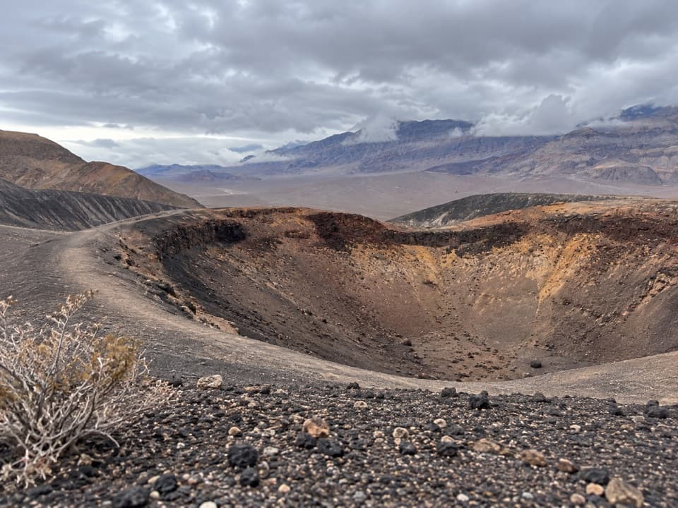
Ubehebe Crater Loop is a 1.5-mile circuit around a volcanic crater in Death Valley National Park. It is a moderate hike that takes about an hour and climbs roughly 500 feet. The paved overlook gives you the crater right away; the loop earns close views by taking you up onto its exposed rim. Most hikers go counterclockwise, getting the uphill section out of the way first. Give yourself more time if you want to stop at the smaller craters and look across the bowl.

Loose footing and open edgesThis is a short walk with demanding footing.

This is a short walk with demanding footing. The tread crosses loose cinder and gravel, and parts of the rim sit above steep drops. The first climb is the main effort; the unstable material also makes it easy to slide off the tread. Keep to the established path and give the edge room. Visitors report that wind can make the exposed rim uncomfortable. The route is at low elevation, where heat can become dangerous; winter is the best season, and spring or fall can still be too hot for many people.

Little Hebe is the halfway decisionWithin about half a mile, Little Hebe Crater comes into view.

Within about half a mile, Little Hebe Crater comes into view. It is smaller than Ubehebe and appears younger. Some hikers turn back here for a shorter walk; retracing the same route makes that a roughly one-mile outing. The full circuit continues around Ubehebe, with the view changing as you pass the smaller cones and gullies.

A crater made by steamUbehebe is about half a mile across and 600 feet deep.

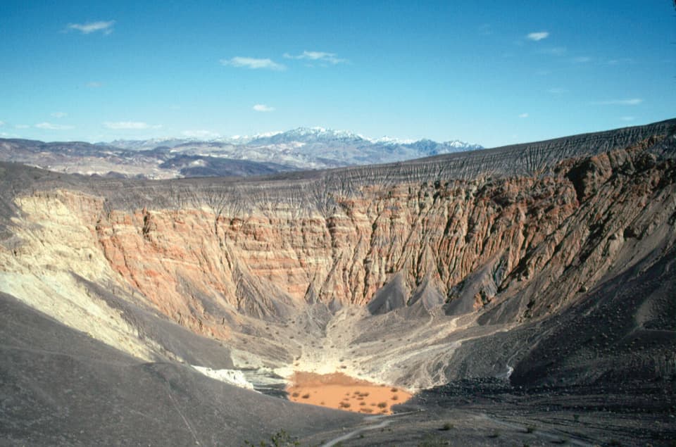
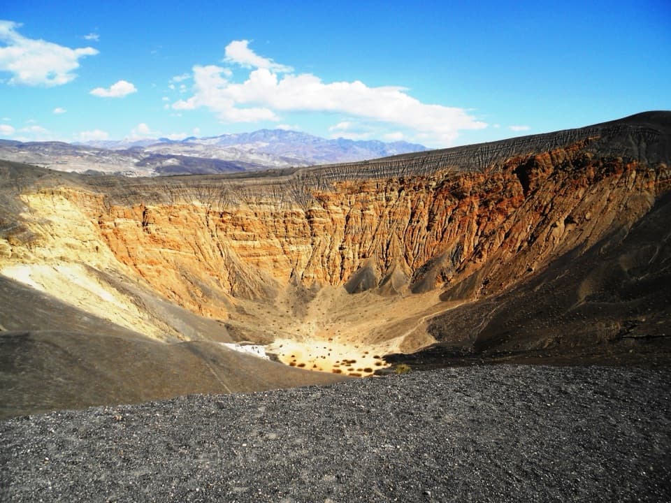
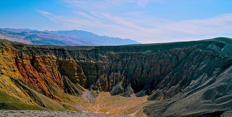
Ubehebe is about half a mile across and 600 feet deep. It is a maar, formed when rising magma met groundwater and explosions of steam and gas opened a crater. That process explains the bowl shape and steep walls. The dark cinder rim makes a strong frame for the orange and gray slopes inside. From the trail, include the far rim above the gullied walls to show the crater's depth without stepping closer to the edge.

Gullies and a shifting floorWater has cut deep gullies into the eastern side of the crater.

Water has cut deep gullies into the eastern side of the crater. The pink and brown mud flat below has held short-lived lakes, but don't expect water there on a given visit. The steep walls and loose material are still changing, so staying on the path protects both the rim and your footing.

A name with a false translation“Big basket” is a familiar translation of Ubehebe, but it is incorrect.

“Big basket” is a familiar translation of Ubehebe, but it is incorrect. The name was first used for Ubehebe Peak, southwest of the crater; how it became attached to this crater is unknown. The Timbisha Shoshone name for the place is Tem-pin-tta-Wo’sah.

Parking and accessThe trail starts at the paved Ubehebe Crater parking lot, eight miles west of Scotty’s Castle.

The trail starts at the paved Ubehebe Crater parking lot, eight miles west of Scotty’s Castle. The lot overlooks the crater and can fit buses and large RVs. There is no restroom at the trailhead; the nearest is at Grapevine Ranger Station, about five miles east. Pets may be in developed areas and on roads, but are not allowed on trails.

Wildlife

Wildlife in Death Valley

All Death Valley wildlife maps

Sighting maps show where each species has been reported across Death Valley. Wildlife moves, so no sighting is guaranteed.

Parkwolf’s Death Valley ranking

Top-rated trails in Death Valley

All 57 trails
  1. 1Badwater Salt FlatEasy · 1.9 mi
  2. 2Mosaic CanyonModerate · 4 mi
  3. 3Golden Canyon to Red CathedralModerate · 3 mi
  4. 4Telescope Peak TrailChallenging · 12.2 mi
  5. 5Golden Canyon Complete CircuitChallenging · 7.8 mi
  6. 6Gower Gulch LoopModerate · 4.3 mi

Take Parkwolf to Death Valley.

The audio tour guide for the drive, plus offline maps, trails, and wildlife heatmaps for when the signal drops.

4.7 from 8,600+ ratings

Download Parkwolf on the App StoreGet Parkwolf on Google Play