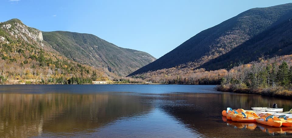
Profile Lake in Franconia Notch State Park

Sight · Franconia Notch State Park

Profile Lake

A fly-fishing lake beneath the vanished Old Man profile.

Photo: Pexels License
Type
Sight
Nearest trail
0.5 mi
Audio stories
17 nearby
  • Parking
  • Scenic viewpoint
  • Trailhead
  • #13 of 26 sights

Hear the audio tour

Profile Lake and the Eagle Cliff View

Overview

About Profile Lake

Why stop

  • Reflective water below Eagle Cliff
  • Fly fishing with an adaptive platform

Map

Where it is

Loading the Franconia Notch map
Full map
SightProfile Lake44.16093, -71.67695
Keep this map with you offline in the Parkwolf app

Plan your stop

Before you go

A particular kind of fishing access

The lake is managed for fly fishing, and a New Hampshire fishing license is required. A state park improvement project describes a 1,578-foot access trail and an adaptive fishing platform, giving anglers a more accessible place to fish without making the whole shoreline accessible. Check current brook-trout rules before you cast. General permission for swimming or paddling isn't clear, and there is no boat ramp, so plan around the shore and fishing rather than a water-sports outing.

2 active Franconia Notch alerts

  • ClosureFlume Gorge Short Trail closed; seasonal closure Oct 26The Flume Gorge Short Trail/Rim Path is closed; before the seasonal closure, visitors must use the full 2-mile loop.Official details
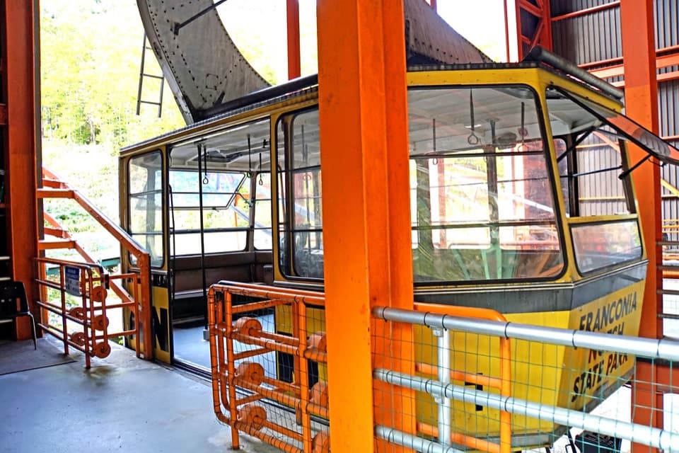
  • ClosureCannon Mountain Aerial Tramway closed and retiredThe Cannon Mountain Aerial Tramway (Tram II) is closed and retired; do not plan on a tram ride.Official details
Franconia Notch alerts
A park ranger sits on a dash-mounted phone, talking, as Parkwolf’s Tour Guide plays “Army Cutworm Moths: A Grizzly Bear Buffet” on Grand Loop Road below Dunraven Pass in Yellowstone
Parkwolf Tour GuideThe highest, rockiest slopes around here are a summer buffet for grizzly bears.

Franconia Notch Tour Guide

Your drive to Profile Lake, narrated.

Parkwolf is a GPS audio tour guide for Franconia Notch State Park. As you drive, it chimes in with what’s ahead: hidden gems, upcoming stops, history, geology, and wildlife, right through your car’s speakers.

See the Franconia Notch audio tour

Recorded for this place

Profile Lake and the Eagle Cliff View
0:00 / 0:16
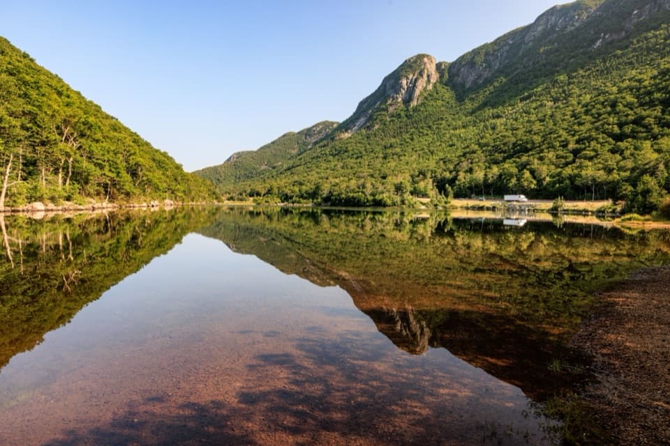
“You're approaching Profile Lake's southern viewing area, a quick stop for Eagle Cliff across the water. If the lake is calm, the cliff and forest can reflect in it; I'd give this ten minutes rather than plan a long walk.”

Plays as you drive up to Profile Lake in the Parkwolf Franconia Notch Tour Guide.

More stories near here in the app

  • Old Man of the Mountain Profile Plaza
  • Boise Rock and Its Winter Legend
  • Cannon Mountain via Kinsman Ridge
  • Greenleaf Trail and Eagle Pass
  • 32 audio storiesacross Franconia Notch’s roads, triggered by GPS as you drive
  • Wildlife heatmapsfor Black Bear, Moose, Wild Turkey, and 13 more
  • Works offlinemaps, 29 trails, 33 places, and audio download before you lose signal
  • CarPlay readysimple controls built for the drive
★★★★★
“Fantastic app with many points of information… It’s great to just turn on while you’re driving and it gives you an audio tour of the national Park. We love it!!!!”
JMJamesApp Store review
Download Parkwolf on the App StoreGet Parkwolf on Google Play

4.7 from 8,600+ ratings

Guide

More about Profile Lake

A quiet lake below Cannon CliffProfile Lake is a small, clear mountain lake below the former Old Man of the Mountain site on…

Profile Lake is a small, clear mountain lake below the former Old Man of the Mountain site on Cannon Mountain, at the headwaters of the Pemigewasset River. It suits a quiet shoreline stop, a reflective view, or fly fishing. The lake and the Old Man of the Mountain memorial are related but separate visits: the lake access is at the south end, while the Profiler Plaza is on the north shore.

The lake beneath the Old ManProfile Lake has also been called Old Man's Washbowl and Ferrin's Pond.

Profile Lake has also been called Old Man's Washbowl and Ferrin's Pond. The Old Man was a face-shaped formation of five granite blocks, about 40 feet high and 25 feet wide, on Cannon Mountain roughly 1,200 feet above the lake. It collapsed overnight on May 2–3, 2003. The north-shore Profiler Plaza now marks the view with seven metal frames aligned to recreate the profile and 1,000 engraved pavers; it's a separate stop from the south-shore lake access.

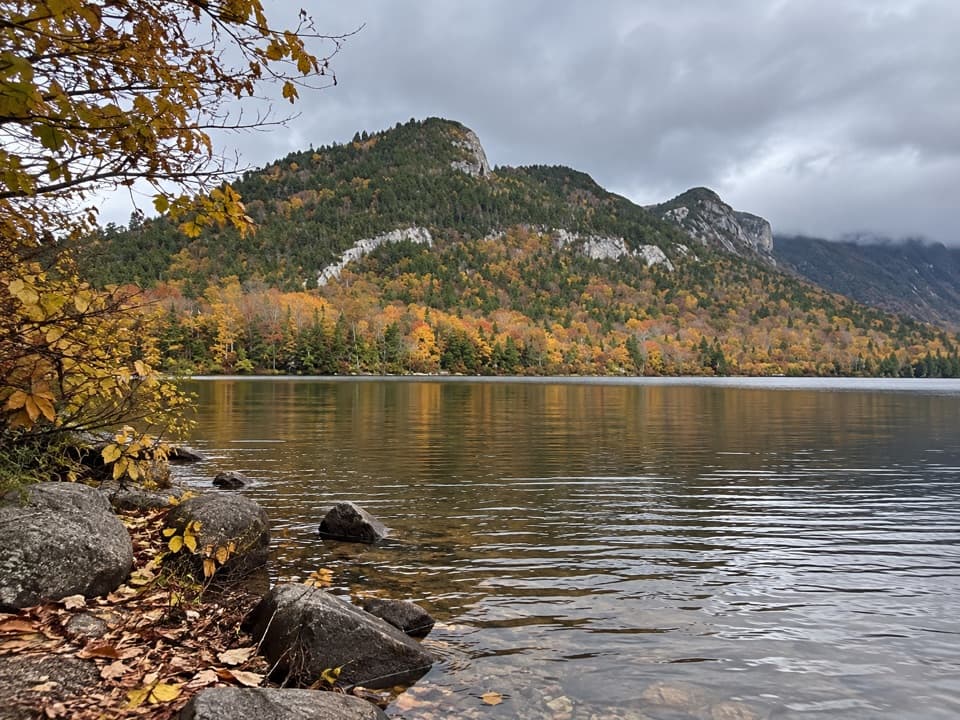
Where to look for the reflectionOn a calm day, the lake mirrors the forested slopes and the steep rock of Eagle Cliff.

On a calm day, the lake mirrors the forested slopes and the steep rock of Eagle Cliff. The broad view across the water gives the cliff a strong reflection, while a closer shoreline angle adds boulders and trees in the foreground. The southern parking area is the pin for reaching the lake; use the north-shore parking and walk into the plaza separately if you want the recreated profile view.

Wildlife

Wildlife in Franconia Notch

All Franconia Notch wildlife maps

Sighting maps show where each species has been reported across Franconia Notch. Wildlife moves, so no sighting is guaranteed.

Keep exploring

Near Profile Lake

See it all on the map

Trails nearby

More stops nearby

Parkwolf’s Franconia Notch ranking

Top sights in Franconia Notch

All 33 places
  1. 1Flume GorgeSight
  2. 2The BasinSight
  3. 3Old Man of the Mountain Profile PlazaSight
  4. 4Artists BluffSight
  5. 5Echo Lake BeachBeach
  6. 6Mount LafayetteSight

Take Parkwolf to Franconia Notch.

The audio tour guide for the drive, plus offline maps, trails, and wildlife heatmaps for when the signal drops.

4.7 from 8,600+ ratings

Download Parkwolf on the App StoreGet Parkwolf on Google Play