Flume Gorge in Franconia Notch State Park

#1 of 26 sights in Franconia Notch

Sight · Franconia Notch State Park

Flume Gorge

Follow a brook through an 800-foot granite gorge and two bridges.

Type
Sight
Nearest trail
0.6 mi
Audio stories
12 nearby
  • Trailhead
  • Parking
  • Restrooms
  • Visitor center

Hear the audio tour

Flume Gorge and the Full Loop

Overview

About Flume Gorge

Why stop

  • Close views of granite walls, waterfalls, and covered bridges.

Heads up

  • Ticketed, uphill circuit with stairs; not wheelchair accessible.

Map

Where it is

Loading the Franconia Notch map
Full map
SightFlume Gorge44.10013, -71.66965
Keep this map with you offline in the Parkwolf app

Plan your stop

Before you go

Best time to go

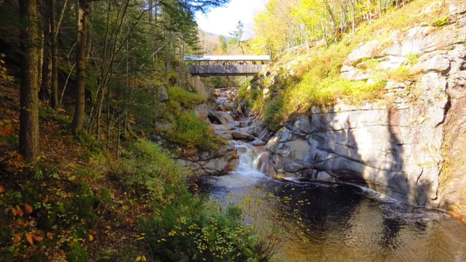
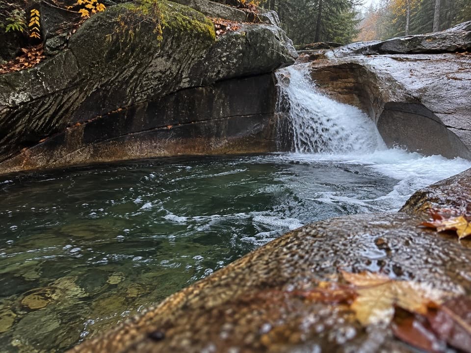
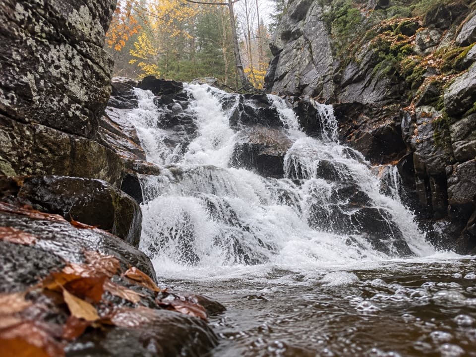
The managed gorge circuit is a warm-season outing, generally open from spring into fall; it is not a regular winter walking route. Pets are not allowed on the gorge trail. For a photo, frame the brook low between the close granite wall and the boulders across it: the water gives the cleft scale, while the rock shows how tightly the walkway passes through.

2 active Franconia Notch alerts

  • ClosureFlume Gorge Short Trail closed; seasonal closure Oct 26Mentions this placeThe Flume Gorge Short Trail/Rim Path is closed; before the seasonal closure, visitors must use the full 2-mile loop.Official details
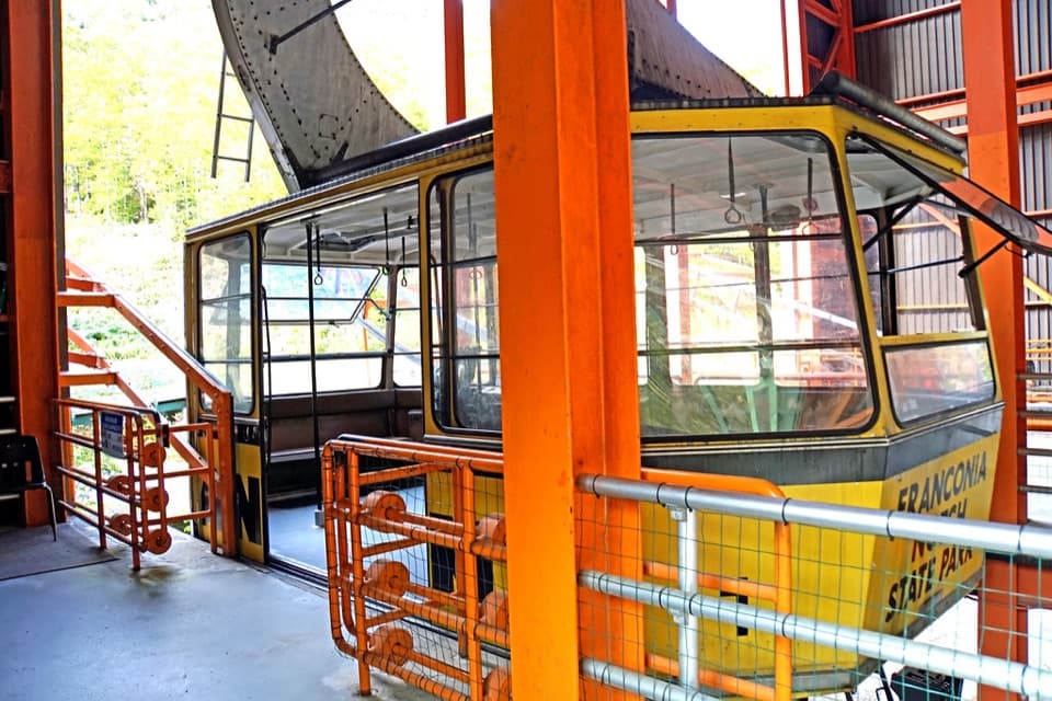
  • ClosureCannon Mountain Aerial Tramway closed and retiredThe Cannon Mountain Aerial Tramway (Tram II) is closed and retired; do not plan on a tram ride.Official details
Franconia Notch alerts
A park ranger sits on a dash-mounted phone, talking, as Parkwolf’s Tour Guide plays “Army Cutworm Moths: A Grizzly Bear Buffet” on Grand Loop Road below Dunraven Pass in Yellowstone
Parkwolf Tour GuideThe highest, rockiest slopes around here are a summer buffet for grizzly bears.

Franconia Notch Tour Guide

Your drive to Flume Gorge, narrated.

Parkwolf is a GPS audio tour guide for Franconia Notch State Park. As you drive, it chimes in with what’s ahead: hidden gems, upcoming stops, history, geology, and wildlife, right through your car’s speakers.

See the Franconia Notch audio tour

Recorded for this place

Flume Gorge and the Full Loop
0:00 / 0:33
“You're coming up on the entrance to Flume Gorge, where boardwalks take you between high granite walls beside rushing water. I'd stop if you have about an hour and a half to two hours for the full two-mile circuit.”

Plays as you drive up to Flume Gorge in the Parkwolf Franconia Notch Tour Guide.

More stories near here in the app

  • Mount Liberty via Liberty Spring Trail
  • Mount Pemigewasset and the Indian Head Profile
  • The Storm That Changed the Flume
  • The Rock Missing from the Flume
  • 32 audio storiesacross Franconia Notch’s roads, triggered by GPS as you drive
  • Wildlife heatmapsfor Black Bear, Moose, Wild Turkey, and 13 more
  • Works offlinemaps, 29 trails, 33 places, and audio download before you lose signal
  • CarPlay readysimple controls built for the drive
★★★★★
“Fantastic app with many points of information… It’s great to just turn on while you’re driving and it gives you an audio tour of the national Park. We love it!!!!”
JMJamesApp Store review
Download Parkwolf on the App StoreGet Parkwolf on Google Play

4.7 from 8,600+ ratings

Guide

More about Flume Gorge

The full circuit is the attractionFlume Gorge is a natural granite chasm at the base of Mount Liberty, where Flume Brook runs…

Flume Gorge is a natural granite chasm at the base of Mount Liberty, where Flume Brook runs between walls that rise as high as 90 feet. The marked, one-way circuit is about two miles and 1.5 hours, with moderate uphill walking and stairs. This is a ticketed, seasonal walk rather than a quick roadside stop: come for close views of the rock, waterfalls, and covered bridges. The route is not wheelchair accessible.

Start at Gilman Visitor CenterThe gorge is reached from Gilman Visitor Center on Daniel Webster Highway.

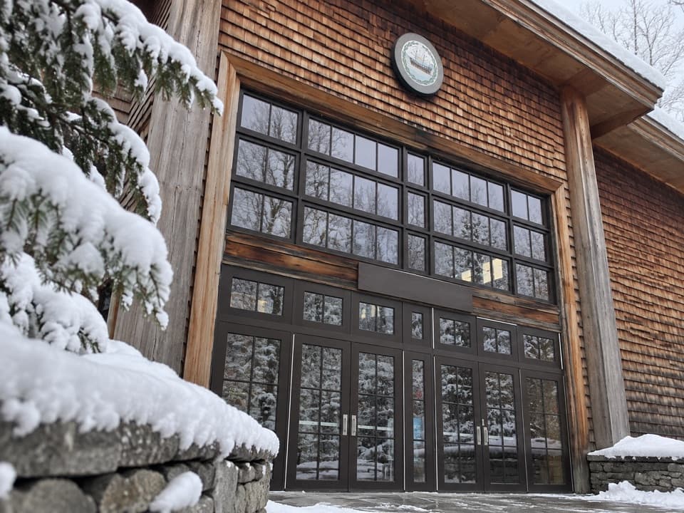
The gorge is reached from Gilman Visitor Center on Daniel Webster Highway. Check in outside the building, then walk around it to the trail entrance. The public center has restrooms, a food court, and a gift shop, handy before or after the loop. Check the current ticket and entry arrangements before you drive over; walk-in access depends on availability.

Inside the granite wallsThe narrow passage is the main event.

The narrow passage is the main event. Boardwalk sections bring you close to mossy, lichen-speckled rock and the brook, while stairs climb through the tightest parts. The gorge itself extends about 800 feet; at its highest, the granite walls reach roughly 90 feet. Avalanche Falls drops about 45 feet, and its flow changes with water and weather conditions. On busy days the narrow walkway can bunch people together, so expect a managed, single-file visit rather than solitude.

More than one gorgeThe loop continues past Liberty Gorge, Table Rock, the Pool, glacial boulders, and several…

The loop continues past Liberty Gorge, Table Rock, the Pool, glacial boulders, and several cascades. The optional Wolf Den passage is a narrow one-way squeeze that involves crouching and crawling; skip that section if it is uncomfortable. The rest of the circuit still gives you a full walk through the gorge landscape.

Two bridges, two storiesThe red Flume Covered Bridge crosses the Pemigewasset River near the visitor area.

The red Flume Covered Bridge crosses the Pemigewasset River near the visitor area. Farther along, Sentinel Pine Bridge stands beside the Pool, where a huge pine was thrown across the cliffs by the 1938 hurricane. Its trunk became part of the landmark setting for the bridge and the pool below.

How the cleft formedThe gorge cuts through Conway granite, formed as molten rock cooled roughly 200 million years…

The gorge cuts through Conway granite, formed as molten rock cooled roughly 200 million years ago. Basalt later filled cracks in the granite; as the softer dikes wore away, they helped open fractures that water and frost continued to widen. The polished walls and broken boulders show both sides of that process: slow cracking and fast-moving water.

The discovery storyThe traditional account dates the gorge's discovery to 1808, when 93-year-old Jess Guernsey,…

The traditional account dates the gorge's discovery to 1808, when 93-year-old Jess Guernsey, known as Aunt Jess, came across it while fishing near her family's homestead. Her family initially doubted what she had found; the story became part of the Flume's identity as visitors began making the trip to see it.

Wildlife

Wildlife in Franconia Notch

All Franconia Notch wildlife maps

Sighting maps show where each species has been reported across Franconia Notch. Wildlife moves, so no sighting is guaranteed.

Keep exploring

Near Flume Gorge

See it all on the map

Trails nearby

More stops nearby

Parkwolf’s Franconia Notch ranking

Top sights in Franconia Notch

All 33 places
  1. 2The BasinSight
  2. 3Old Man of the Mountain Profile PlazaSight
  3. 4Artists BluffSight
  4. 5Echo Lake BeachBeach
  5. 6Mount LafayetteSight
  6. 7Cannon Mountain Aerial TramwaySight

Take Parkwolf to Franconia Notch.

The audio tour guide for the drive, plus offline maps, trails, and wildlife heatmaps for when the signal drops.

4.7 from 8,600+ ratings

Download Parkwolf on the App StoreGet Parkwolf on Google Play