The Basin in Franconia Notch State Park

#2 of 26 sights in Franconia Notch

Sight · Franconia Notch State Park

The Basin

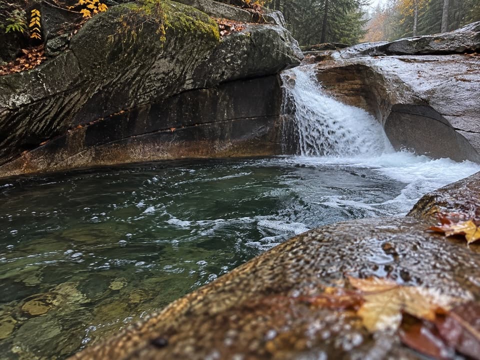
A river-carved granite bowl and waterfall, reached by a short paved walk.

Type
Sight
Nearest trail
Right here
Audio stories
13 nearby
  • Parking
  • Picnic tables
  • Restrooms
  • Scenic viewpoint

Hear the audio tour

The Basin’s Water-Carved Bowl

Overview

About The Basin

Why stop

  • A sculpted granite bowl and waterfall make the short stop memorable.

Map

Where it is

Loading the Franconia Notch map
Full map
SightThe Basin44.12107, -71.68295
Keep this map with you offline in the Parkwolf app

Plan your stop

Before you go

2 active Franconia Notch alerts

  • ClosureFlume Gorge Short Trail closed; seasonal closure Oct 26The Flume Gorge Short Trail/Rim Path is closed; before the seasonal closure, visitors must use the full 2-mile loop.Official details
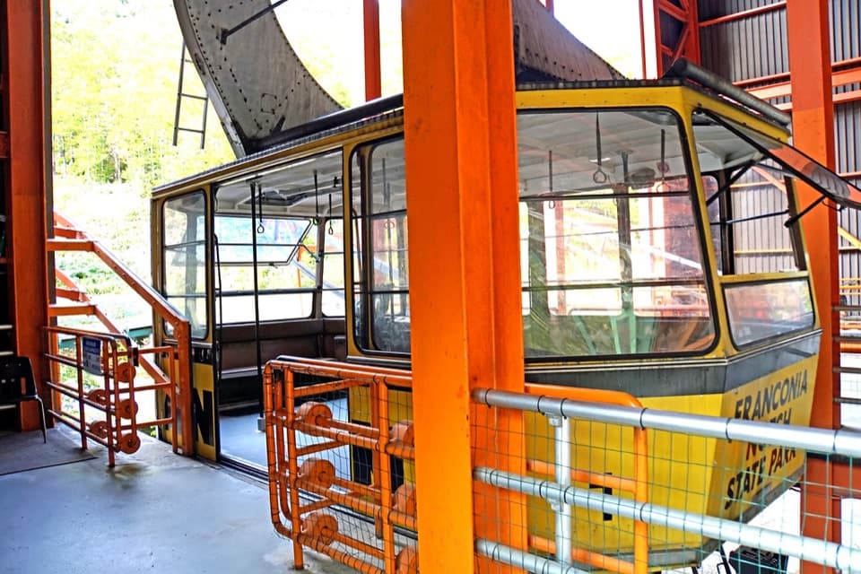
  • ClosureCannon Mountain Aerial Tramway closed and retiredThe Cannon Mountain Aerial Tramway (Tram II) is closed and retired; do not plan on a tram ride.Official details

Franconia Notch alerts
A park ranger sits on a dash-mounted phone, talking, as Parkwolf’s Tour Guide plays “Army Cutworm Moths: A Grizzly Bear Buffet” on Grand Loop Road below Dunraven Pass in Yellowstone
Parkwolf Tour GuideThe highest, rockiest slopes around here are a summer buffet for grizzly bears.

Franconia Notch Tour Guide

Your drive to The Basin, narrated.

Parkwolf is a GPS audio tour guide for Franconia Notch State Park. As you drive, it chimes in with what’s ahead: hidden gems, upcoming stops, history, geology, and wildlife, right through your car’s speakers.

See the Franconia Notch audio tour

Recorded for this place

The Basin’s Water-Carved Bowl
0:00 / 0:34
“The Basin is coming up, and it's a good choice for a short stop without a mountain hike. A paved path leads to a waterfall pouring into a smooth granite bowl in the Pemigewasset River.”

Plays as you drive up to The Basin in the Parkwolf Franconia Notch Tour Guide.

More stories near here in the app

  • A Chickadee’s Hidden Food
  • Where Autumn’s Colors Come From
  • A Squirrel’s Cone Pile
  • The Rock Missing from the Flume
  • 32 audio storiesacross Franconia Notch’s roads, triggered by GPS as you drive
  • Wildlife heatmapsfor Black Bear, Moose, Wild Turkey, and 13 more
  • Works offlinemaps, 29 trails, 33 places, and audio download before you lose signal
  • CarPlay readysimple controls built for the drive
★★★★★
“Fantastic app with many points of information… It’s great to just turn on while you’re driving and it gives you an audio tour of the national Park. We love it!!!!”
JMJamesApp Store review
Download Parkwolf on the App StoreGet Parkwolf on Google Play

4.7 from 8,600+ ratings

Guide

More about The Basin

A quick stop for a water-carved bowlThe Basin is a granite pothole in the Pemigewasset River, where a waterfall feeds a smooth,…

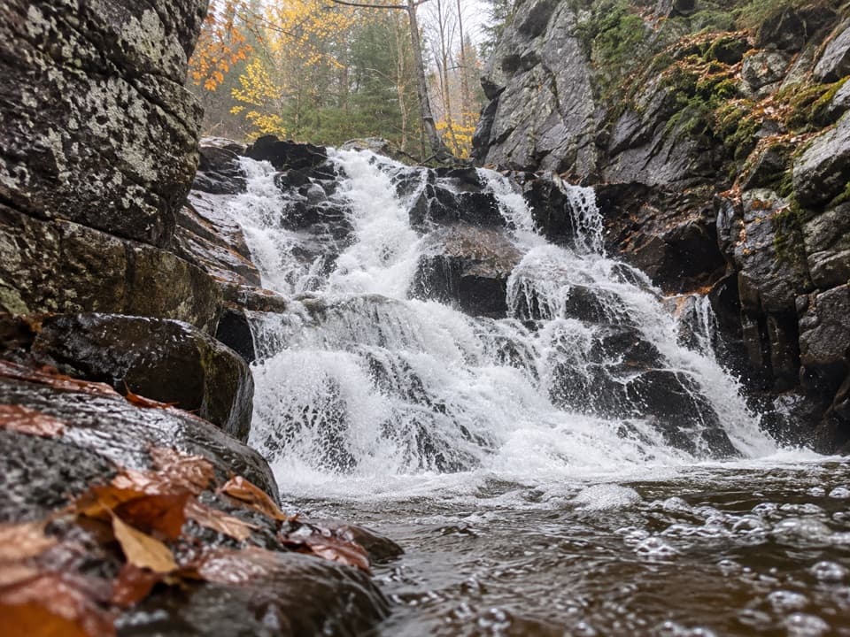
The Basin is a granite pothole in the Pemigewasset River, where a waterfall feeds a smooth, bowl-shaped pool. It’s reached from the designated lot by a short paved path and a tunnel beneath I-93, so you can see the main feature without committing to a hike. This is one of Franconia Notch’s most rewarding short stops.

How the river shaped itSmall stones and sand carried in the current whirl around the granite, grinding it into the…

Small stones and sand carried in the current whirl around the granite, grinding it into the rounded bowl; the river is still smoothing the rock. Another water-worn feature just below the main boulder is called Old Man’s Foot.

Keep going for more fallsThe main Basin is the easy part.

The main Basin is the easy part. Basin Cascade Trail continues from the area toward Kinsman Falls and Rocky Glen Falls, with steeper, rootier footing that can get slick or muddy when wet. Make that a longer walk; you don’t need to tackle it to enjoy the pothole.

A long-known landmarkHenry David Thoreau visited The Basin in 1839 and later wrote about the pothole in his journal.

Henry David Thoreau visited The Basin in 1839 and later wrote about the pothole in his journal. An 1858 guide to the White Mountains also singled it out, making this a well-known stop for generations.

Make the stop workThe main approach is paved with mild grades, and picnic tables are nearby.

The main approach is paved with mild grades, and picnic tables are nearby. Visitors report restrooms by the lot, though their type isn’t clear. A cool spring is also nearby, but its drinking-water status isn’t specified, so bring your own water. From the viewing platforms, frame the waterfall with the curved granite rim to show both the cascade and the shape of the bowl.

Wildlife

Wildlife in Franconia Notch

All Franconia Notch wildlife maps

Sighting maps show where each species has been reported across Franconia Notch. Wildlife moves, so no sighting is guaranteed.

Keep exploring

Near The Basin

See it all on the map

Trails nearby

More stops nearby

Parkwolf’s Franconia Notch ranking

Top sights in Franconia Notch

All 33 places
  1. 1Flume GorgeSight
  2. 3Old Man of the Mountain Profile PlazaSight
  3. 4Artists BluffSight
  4. 5Echo Lake BeachBeach
  5. 6Mount LafayetteSight
  6. 7Cannon Mountain Aerial TramwaySight

Take Parkwolf to Franconia Notch.

The audio tour guide for the drive, plus offline maps, trails, and wildlife heatmaps for when the signal drops.

4.7 from 8,600+ ratings

Download Parkwolf on the App StoreGet Parkwolf on Google Play