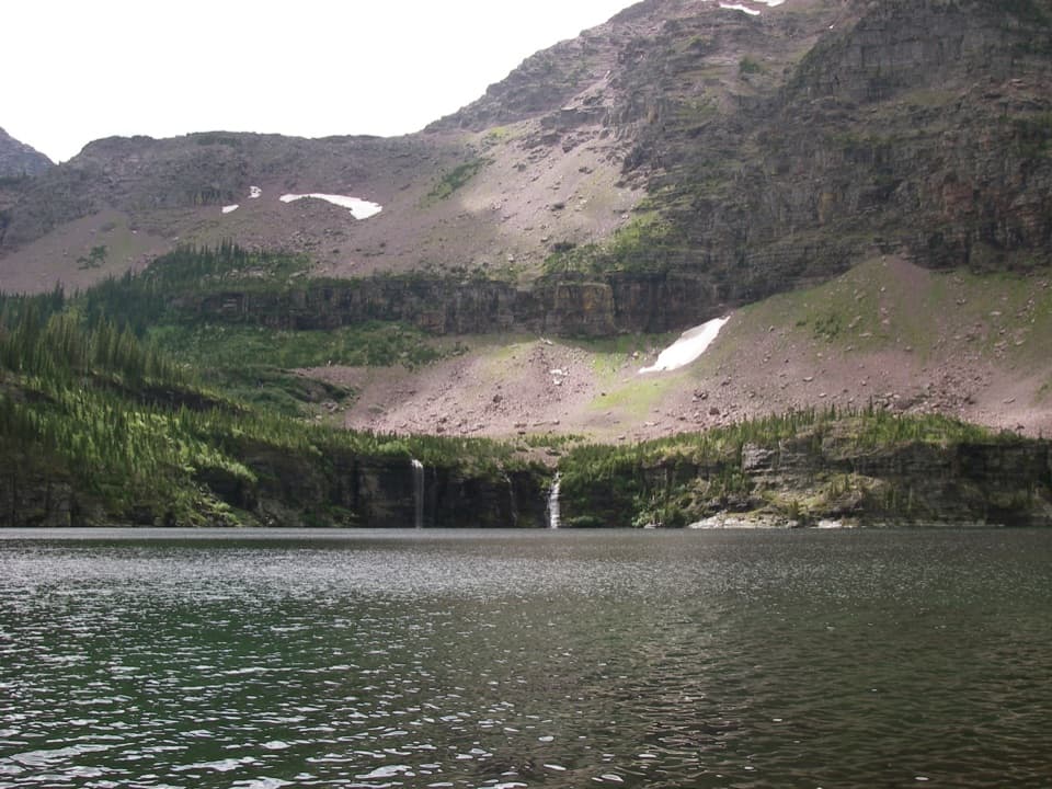
Coal–Fielding Trail in Glacier National Park

Glacier National Park, MT

Coal–Fielding Trail

A remote traverse with long climbs and a serious river ford.

Length
21.4mi
Time
14hr
Elev. change
2,211ft
Difficulty
Challenging
  • No dogs
  • High point 5,705 ft

Hear the audio tour

When the Valley Is Colder

Overview

About Coal–Fielding Trail

Why go

  • Links five remote drainages in one point-to-point hike
  • Open burned slopes give way to wooded creek valleys

Heads up

  • A major river ford plus several smaller creek crossings
  • Long one-way route requires separate end-to-end transport

Map & elevation

The route

Loading the Glacier map
Full map
Elevation3,494–5,705 ft
TrailheadCoal Creek Trailhead48.41168, -113.71806
Keep this map with you offline in the Parkwolf app

Plan your hike

Before you go

Parking

Coal Creek access is about 16 miles east of West Glacier along US 2; park guidance places the trail start north of the highway, just east of the stock parking area south of the road. The Fielding exit uses a separate access road opposite milepost 192. Arrange a pickup and confirm current access directions.

Safety

The Middle Fork ford can be extremely dangerous in spring; snowpack affects water levels. Do not cross if water is unsafe. Several smaller creek crossings and poorly maintained sections add difficulty. The Fielding approach crosses private property and railroad tracks; use current marked access directions.

1 active Glacier alert

  • ClosureTwo Medicine Campground closed for 2026 constructionTwo Medicine Campground is closed throughout 2026 because of construction in the Two Medicine developed area.Official details
Glacier alerts
A park ranger sits on a dash-mounted phone, talking, as Parkwolf’s Tour Guide plays “Army Cutworm Moths: A Grizzly Bear Buffet” on Grand Loop Road below Dunraven Pass in Yellowstone
Parkwolf Tour GuideThe highest, rockiest slopes around here are a summer buffet for grizzly bears.

Glacier Tour Guide

Your drive to Coal–Fielding Trail, narrated.

Parkwolf is a GPS audio tour guide for Glacier National Park. As you drive, it chimes in with what’s ahead: hidden gems, upcoming stops, history, geology, and wildlife, right through your car’s speakers.

See the Glacier audio tour

Recorded for this area

When the Valley Is Colder
0:00 / 0:34
“A valley can be colder than the slopes above it, especially after a clear, calm night. The ground loses heat, cooling the air touching it.”

Plays on the road 0.5 mi from the trailhead in the Parkwolf Glacier Tour Guide.

More stories near here in the app

  • How a River Drills a Pothole
  • When a Lake Mixes from Top to Bottom
  • A Nest Behind the Waterfall
  • The Insect That Dents the Water
  • 204 audio storiesacross Glacier’s roads, triggered by GPS as you drive
  • Wildlife heatmapsfor Grizzly Bear, Wolverine, Mountain Goat, and 13 more
  • Works offlinemaps, 157 trails, 91 places, and audio download before you lose signal
  • CarPlay readysimple controls built for the drive
★★★★★
“Our first time to glacier and we used the audio portion for Going to the Sun Road. Wonderful information with perfect advice of what to see and do along the road.”
PaisleyParkFanApp Store review
Download Parkwolf on the App StoreGet Parkwolf on Google Play

4.7 from 8,600+ ratings

Trail guide

Hiking Coal–Fielding Trail

Before committingCoal–Fielding is a one-way point-to-point backcountry traverse from Coal Creek to the park…

Coal–Fielding is a one-way point-to-point backcountry traverse from Coal Creek to the park boundary at Fielding. The mapped route is 21.4 miles; it connects five drainages and gains more than 5,000 feet. There is no loop, so arrange transport at both ends and budget roughly 12–14 or more hours for a very long day. Published distance estimates range from about 17 miles to over 23; the line here follows the full connected Coal–Fielding corridor.

Access at both endsCoal Creek access is along US 2 east of West Glacier.

Coal Creek access is along US 2 east of West Glacier. The approach reaches the Middle Fork before the trail continues on the park side. Finish at Fielding and arrange a separate pickup. The marked Fielding approach is described across private property and railroad tracks; follow current park access directions and do not improvise a shortcut.

Crossings and treadThe Middle Fork ford can be extremely dangerous in spring, and safe timing varies with snowpack.

The Middle Fork ford can be extremely dangerous in spring, and safe timing varies with snowpack. At least four more creek crossings are reported along the traverse, and some sections are poorly maintained. Do not cross if water is unsafe. Check current park status and water conditions before setting out.

Across five drainagesThe trail links the Bear, Ole, Park, Muir and Coal drainages, climbing over saddles between…

The trail links the Bear, Ole, Park, Muir and Coal drainages, climbing over saddles between creek valleys. Open, burned slopes around Coal contrast with wooded sections near Muir and lodgepole forest with intermittent views toward Fielding.

Wildlife

Wildlife in Glacier

All Glacier wildlife maps

Sighting maps show where each species has been reported across Glacier. Wildlife moves, so no sighting is guaranteed.

Parkwolf’s Glacier ranking

Top-rated trails in Glacier

All 157 trails
  1. 1Highline TrailChallenging · 11.8 mi
  2. 2Grinnell Glacier TrailChallenging · 10 mi
  3. 3Iceberg Lake TrailModerate · 9.6 mi
  4. 4Hidden Lake Overlook TrailModerate · 2.6 mi
  5. 5Avalanche Lake TrailModerate · 5 mi
  6. 6Trail of the CedarsEasy · 0.9 mi

Take Parkwolf to Glacier.

The audio tour guide for the drive, plus offline maps, trails, and wildlife heatmaps for when the signal drops.

4.7 from 8,600+ ratings

Download Parkwolf on the App StoreGet Parkwolf on Google Play