Parking
Nyack Crossing is off US 2 near mile markers 164–165. A small pull-off beside the railroad access road is reported; keep the road clear and confirm legal access and parking before setting out.

Glacier National Park, MT
A rough 42-mile loop over Surprise Pass with repeated river fords.
Overview
The Nyack Creek–Coal Creek Loop is a 42.4-mile wilderness circuit through Glacier’s remote southern backcountry. It starts at Nyack Crossing, follows Nyack Creek to Surprise Pass, drops through Martha’s Basin and Coal Creek, then returns on South Boundary Trail. Plan four days. A three-day push has been reported with pack horses carrying the overnight gear; the route is rough, brushy and repeatedly forded, so that pace isn’t a useful benchmark. Choose this only if you’re comfortable with remote navigation, uneven tread and cold-water crossings.
 Parkwolf’s verdictIs this the trip for you?
Map & elevation
Plan your hike

The highest, rockiest slopes around here are a summer buffet for grizzly bears.
Glacier Tour Guide
Parkwolf is a GPS audio tour guide for Glacier National Park. As you drive, it chimes in with what’s ahead: hidden gems, upcoming stops, history, geology, and wildlife, right through your car’s speakers.
See the Glacier audio tourRecorded for this area
The Insect That Dents the Water“If you spot an insect skating across a quiet pool, it may be a water strider. Its long legs spread its weight, while tiny grooved hairs trap air and help repel water.”
Plays on the road 0.7 mi from the trailhead in the Parkwolf Glacier Tour Guide.
More stories near here in the app
“Our first time to glacier and we used the audio portion for Going to the Sun Road. Wonderful information with perfect advice of what to see and do along the road.”


Trail guide
The route begins and ends with a ford of the Middle Fork Flathead River at Nyack Crossing. The usable ford shifts with water flow, and the crossing is cold, unbridged water rather than a fixed bridge or marked crossing. On the Nyack side, the trail climbs a steep bank after crossing Nyack Creek, then spends a long stretch in brushy forest above the creek canyon. Openings bring views toward Mount Stimson and Threesuns Mountain. Near the old Nyack Ranger Station, the cabin and barn remain. Mount Stimson rises to 10,142 feet, more than 6,000 feet above the Nyack valley floor, and dominates much of this side of the loop. Near the Cut Bank Pass junction, the tread gets swampy and muddy before climbing through avalanche openings and forest toward Surprise Pass.
Surprise Pass is the high point and the hinge between the two drainages, with views toward Mount Pinchot and Mount Phillips. The descent reaches Martha’s Basin, a cirque below Mount Pinchot and Peril Peak. Side trails from the basin lead to Beaver Woman and Buffalo Woman lakes; they are not part of the mapped loop, so don’t add their mileage unless you choose to extend the trip. This is the route’s clearest open mountain view: the basin and enclosing peaks make a stronger frame than another close-up of forest tread.
Coal Creek is brushy and asks for repeated substantial fords; five major crossings are reported before Coal Creek Campground. Near the campground, the trail crosses talus with a view of Mount Saint Nicholas. Lower in the drainage, a burn opened the forest and left a sunnier, less shaded stretch. The South Boundary return can thin out in brush, so keep checking the mapped corridor and trail markers instead of expecting an obvious tread the whole way.
This is a backcountry backpacking trip, not a long day hike. An overnight wilderness permit is required. The Nyack/Coal Creek camping area includes both designated sites and an area where undesignated camping is allowed with a permit; check current NPS instructions before planning camps. Pets aren’t allowed on Glacier trails or in the backcountry.
Wildlife
 404 sightingsGrizzly BearMost seen around 6 AMSighting map
 11 sightingsWolverineMost seen around 8 PMSighting map
 1,173 sightingsMountain GoatMost seen around 6 AMSighting map
 1,000 sightingsBighorn SheepMost seen around 6 AMSighting map
 395 sightingsMooseMost seen around 6 AMSighting map
 506 sightingsBlack BearMost seen around 8 PMSighting map
Sighting maps show where each species has been reported across Glacier. Wildlife moves, so no sighting is guaranteed.
Keep exploring
 ChallengingLoneman Lookout Trail14.8 mi · 9 hr · At the trailheadTwo fords, a burn shelf, and a rarely seen lookout above Nyack.ChallengingNyack Creek Trail18.3 mi · 14 hr · 1.1 mi awayAn 18-mile backcountry corridor with serious river crossings.
 ChallengingCoal–Fielding Trail21.4 mi · 14 hr · 4 mi awayA remote traverse with long climbs and a serious river ford.
 ChallengingCoal Creek Trail15 mi · 12 hr · 4.1 mi awayA remote, ford-heavy route through Coal Creek's backcountry.
 ModerateHarrison Lake Trail9.8 mi · 6.5 hr · 4.7 mi awayA remote lake walk reached by an unbridged river ford.
 ModerateLincoln Creek Trail6.7 mi · 4.5 hr · 5.7 mi awayA remote creek connector with three fords and open burn views.
 ChallengingSouth Boundary Trail11.5 mi · 5.3 hr · 9 mi awayFollow the Middle Fork through an old ranger route to Lincoln Creek.
 EasyBelton Bridge Trail1 mi · 30 min · 9.5 mi awayA level riverside walk to the old entrance bridge.
 Lodging · 9.2 mi awayBelton ChaletA 1910 railway chalet still serving dinner beneath its timber gables.
 Sight · 9.3 mi awayHistoric Belton DepotA 1910 rail depot turned bookstore, with park passport stamps.
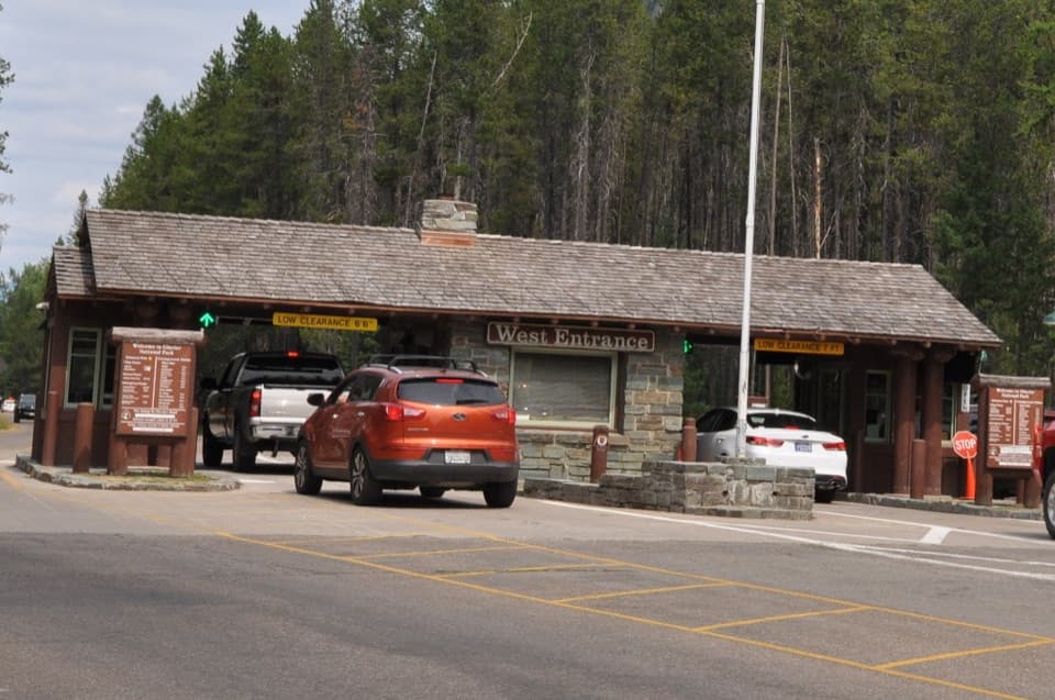 Entrance station · 10 mi awayWest Entrance StationA CCC-built 1941 checkpoint with a distinctive rustic tollbooth design.
Parkwolf’s Glacier ranking
The audio tour guide for the drive, plus offline maps, trails, and wildlife heatmaps for when the signal drops.





