Billimina Shelter in Grampians National Park

Sight · Grampians National Park

Billimina Shelter

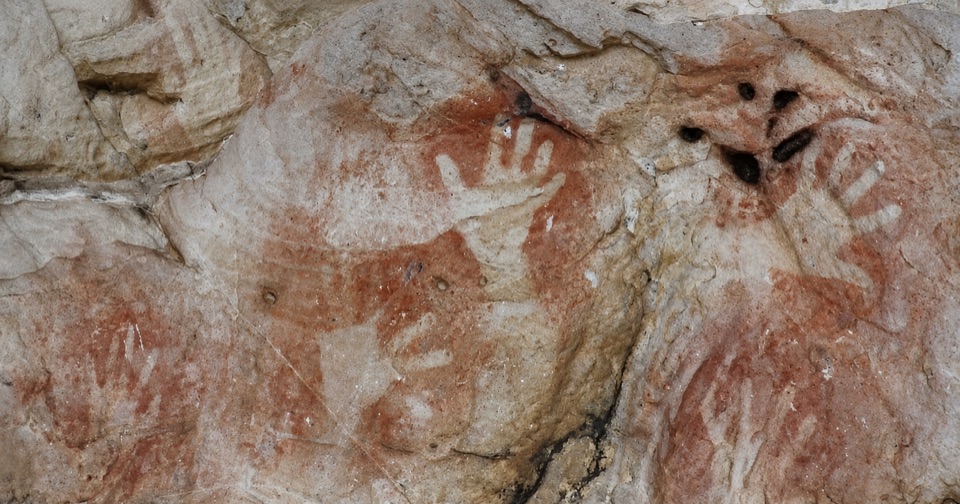
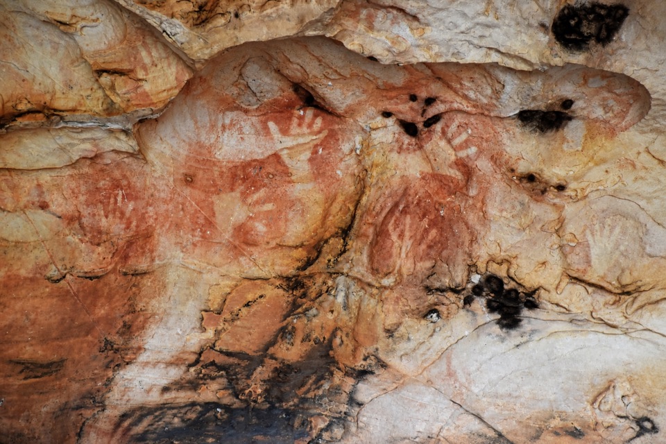
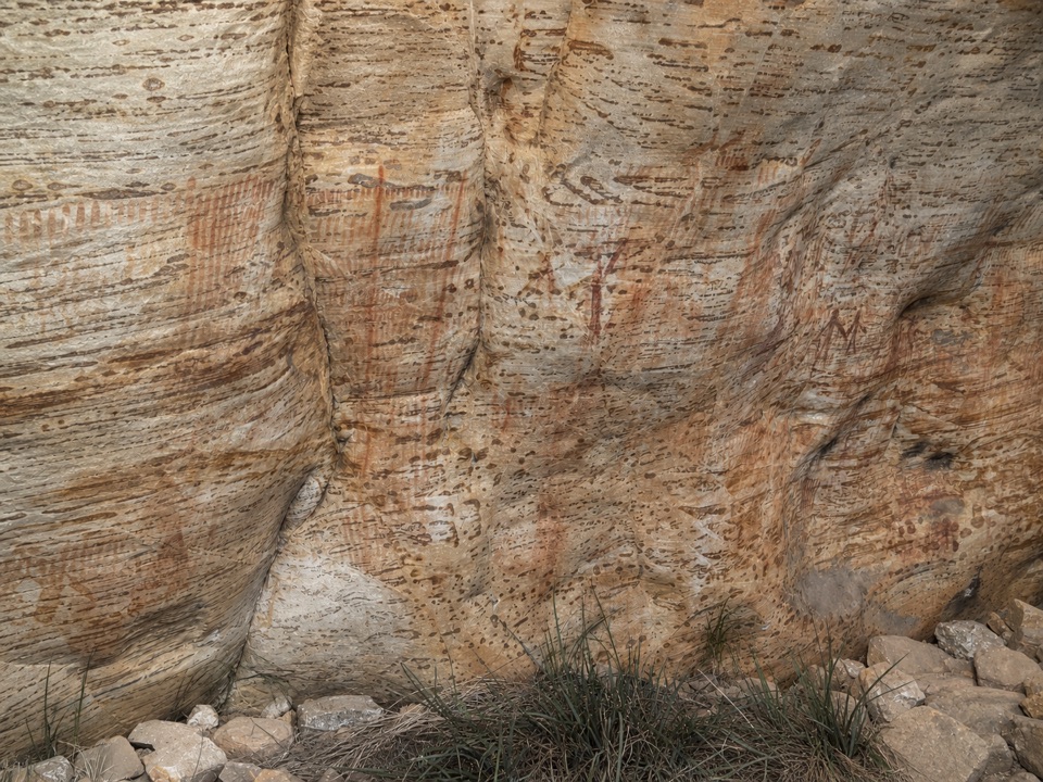
A massive sandstone overhang covered in red-ochre bar strokes

Type
Sight
Nearest trail
0.4 km
Audio stories
1 nearby
  • Parking
  • Picnic tables
  • Restrooms

Hear the audio tour

Buandik and Billimina: Look for the Ochre

Overview

About Billimina Shelter

Why stop

  • More than 2,500 motifs make the shelter a memorable cultural site
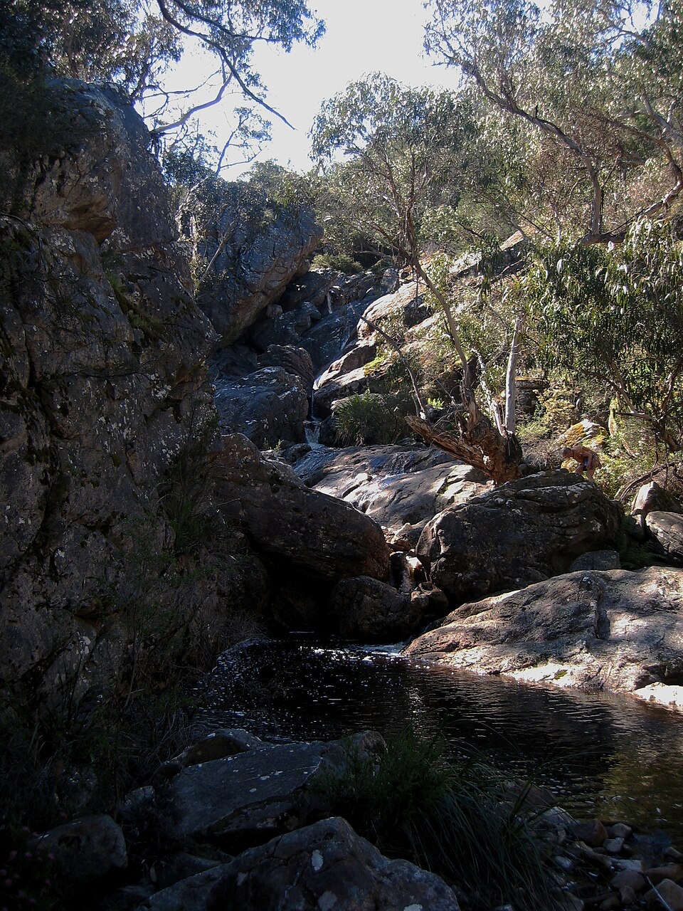
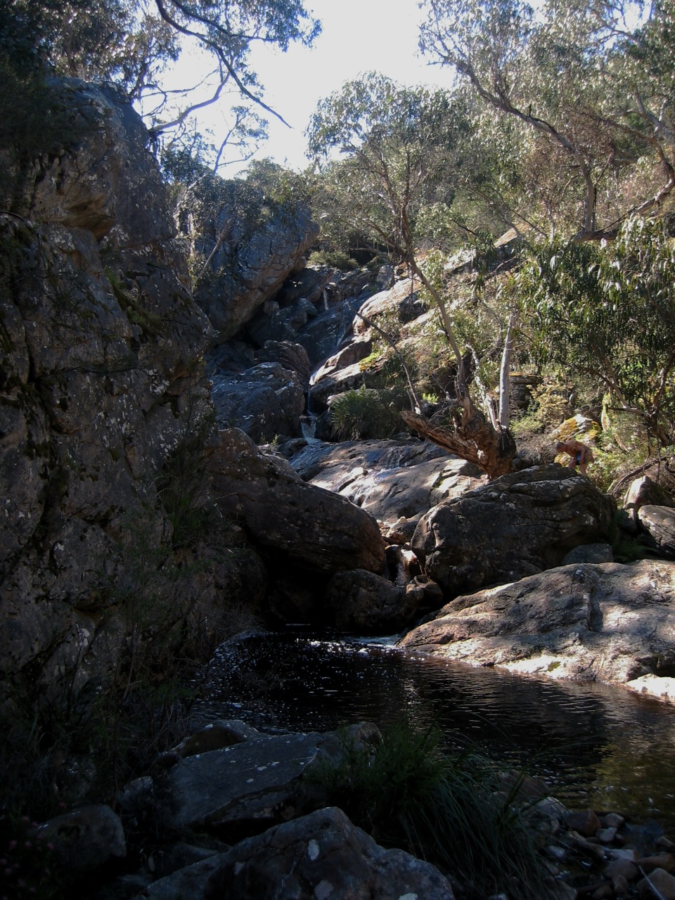
  • Buandik Falls adds a worthwhile second payoff to the walk

Heads up

  • Rough unsealed roads make the remote approach time-consuming
  • The rocky uphill finish is harder than the distance suggests
Billimina Shelter is one of the Grampians' most important Aboriginal rock-art sites: a huge sandstone overhang carrying more than 2,500 red-ochre motifs, including the fine bar strokes that make this shelter so distinctive. The art is the reason to come, but the scale of the overhang and the quiet bush setting make the approach feel worthwhile too.
Parkwolf’s verdictWhy stop

Map

Where it is

Loading the Grampians map
Full map
SightBillimina Shelter-37.24819, 142.27570
Keep this map with you offline in the Parkwolf app

Plan your stop

Before you go

Best time to go

Cooler months and early morning are the most comfortable choices, especially before the rocky climb heats up. Morning light is also gentler under the overhang and gives the ochre marks more definition. In warmer weather, carry enough water and avoid rushing the exposed sections of the approach.

Keep behind the protective enclosure, leave the rock untouched, and give the site the quiet attention it deserves. Billimina is a rewarding stop for visitors interested in Gariwerd's living cultural history, but the rough drive and short uphill finish make it a poor choice for anyone seeking an effortless roadside attraction.


Arrival and facilities

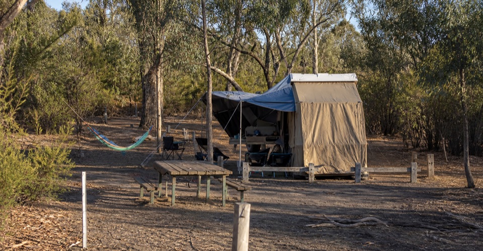
This is a remote western-Grampians stop, so the road in is part of the outing. Approach via the Buandik area and follow the shelter signs from the picnic ground. The unsealed access roads can be rough, and a map pin for the shelter is less useful than navigating to the picnic area first.

At the start, expect parking, picnic tables, and a drop toilet rather than visitor-centre facilities. Bring drinking water, food, sun protection, and sturdy footwear. Dogs are not allowed in the national park, and fires are not permitted at this site.

5 active Grampians alerts

  • ClosureBushfire-damaged walks and picnic area remain closedThe Fortress, Red Gum, Billimina, Chimney Pots and Brownings Loop walks, plus Mafeking Picnic Area, remain closed because of track or site damage from the 2024/25 summer bushfires.Official details
  • ClosureMackenzie Falls precinct closed during constructionThe Mackenzie Falls (Migunang wirab) Precinct has no vehicle or visitor access during major construction works expected to finish by the end of 2026.Official details
See all 5 alerts
A park ranger sits on a dash-mounted phone, talking, as Parkwolf’s Tour Guide plays “Army Cutworm Moths: A Grizzly Bear Buffet” on Grand Loop Road below Dunraven Pass in Yellowstone
Parkwolf Tour GuideThe highest, rockiest slopes around here are a summer buffet for grizzly bears.

Grampians Tour Guide

Your drive to Billimina Shelter, narrated.

Parkwolf is a GPS audio tour guide for Grampians National Park. As you drive, it chimes in with what’s ahead: hidden gems, upcoming stops, history, geology, and wildlife, right through your car’s speakers.

Recorded for this place

Buandik and Billimina: Look for the Ochre
0:00 / 0:50
“Buandik Picnic Area is coming up, the starting point for Billimina Shelter, where a close look at the rock art is the reason I'd stop.”

Plays as you drive up to Billimina Shelter in the Parkwolf Grampians Tour Guide.

More stories near here in the app

  • Manja Shelter: Hand Stencils in Sandstone
  • Why the Ark Crosses Park Borders
  • Pinpricks in a Gum Leaf
  • The Other Black Cockatoo
  • 233 audio storiesacross Grampians’s roads, triggered by GPS as you drive
  • Wildlife heatmapsfor Short-beaked Echidna, Powerful Owl, Wedge-tailed Eagle, and 13 more
  • Works offlinemaps, 81 trails, 62 places, and audio download before you lose signal
  • CarPlay readysimple controls built for the drive
★★★★★
“Fantastic app with many points of information… It’s great to just turn on while you’re driving and it gives you an audio tour of the national Park. We love it!!!!”
JMJamesApp Store review
Download Parkwolf on the App StoreGet Parkwolf on Google Play

4.7 from 8,600+ ratings

Guide

More about Billimina Shelter

The walk inStart at Buandik Picnic Area and follow Billimina Creek toward Buandik Falls before climbing to…

Start at Buandik Picnic Area and follow Billimina Creek toward Buandik Falls before climbing to the shelter. The walk is roughly 2 kilometres return and usually takes about an hour, but it is more of a short bush hike than a flat stroll. The final section is rocky and uphill, with uneven footing and some thicker vegetation.

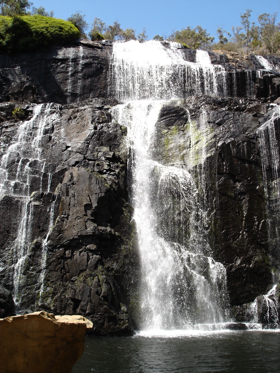
Buandik Falls is a useful detour on the way and adds a second reason to make the drive. Water flow is most dependable after wetter weather, while in dry periods the art shelter remains the main event. Wear shoes with grip and allow extra time if the track is damp.

Why stopThe shelter was a place where Jardwadjali people gathered and camped.

The shelter was a place where Jardwadjali people gathered and camped. Look closely rather than expecting a single dramatic painted figure. The markings spread across the weathered rock surface in dense layers, and the protected viewing area lets you study them without touching the sandstone.

Wildlife

Wildlife in Grampians

All Grampians wildlife maps

Sighting maps show where each species has been reported across Grampians. Wildlife moves, so no sighting is guaranteed.

Parkwolf’s Grampians ranking

Top sights in Grampians

All 62 places
  1. 1MacKenzie Falls (Migunang wirab)Sight
  2. 2Pinnacle LookoutSight
  3. 3Boroka LookoutSight
  4. 4Reeds LookoutSight
  5. 5The BalconiesSight
  6. 6Mount William (Duwul)Sight

Take Parkwolf to Grampians.

The audio tour guide for the drive, plus offline maps, trails, and wildlife heatmaps for when the signal drops.

4.7 from 8,600+ ratings

Download Parkwolf on the App StoreGet Parkwolf on Google Play