Grandview Point in Grand Canyon National Park

#9 of 58 sights in Grand Canyon

Sight · Grand Canyon National Park

Grandview Point

A broad river view above a steep trail into canyon history.

Type
Sight
Nearest trail
Right here
Audio stories
3 nearby
  • Parking
  • Restrooms
  • Picnic tables
  • Scenic viewpoint

Hear the audio tour

Grandview Point and the Miners’ Trail

Overview

About Grandview Point

Why stop

  • Wide view reaches the Colorado River and layered inner canyon.

Heads up

  • Peak-time crowds can make parking feel limited.

Map

Where it is

Loading the Grand Canyon map
Full map
SightGrandview Point35.99848, -111.98776
Keep this map with you offline in the Parkwolf app

Plan your stop

Before you go

4 active Grand Canyon alerts

  • ClosureInner Canyon and North Rim trail closuresDo not enter the closed trails, bridges, campgrounds, and inner-canyon areas.Official details
  • ClosureNorth Rim scenic roads closed for repairsCape Royal Road and Point Imperial Road are closed from sunset October 15 through sunrise November 3, 2026. - The roads are closed to accommodate critical road repair and rehabilitation work.Official details
See all 4 alerts
A park ranger sits on a dash-mounted phone, talking, as Parkwolf’s Tour Guide plays “Army Cutworm Moths: A Grizzly Bear Buffet” on Grand Loop Road below Dunraven Pass in Yellowstone
Parkwolf Tour GuideThe highest, rockiest slopes around here are a summer buffet for grizzly bears.

Grand Canyon Tour Guide

Your drive to Grandview Point, narrated.

Parkwolf is a GPS audio tour guide for Grand Canyon National Park. As you drive, it chimes in with what’s ahead: hidden gems, upcoming stops, history, geology, and wildlife, right through your car’s speakers.

See the Grand Canyon audio tour

Recorded for this place

Grandview Point and the Miners’ Trail
0:00 / 0:31
“Grandview Point is ahead, with a broad panorama of layered cliffs and the Colorado River. I'd stop for the view and treat the trailhead beside it as a separate outing.”

Plays as you drive up to Grandview Point in the Parkwolf Grand Canyon Tour Guide.

More stories near here in the app

  • Footsteps Before Dinosaurs
  • A Minnow with a Thirty-Year Life
  • Thor’s Overlook’s Roadside Pause
  • Buggeln Picnic Area’s Ranching Past
  • 79 audio storiesacross Grand Canyon’s roads, triggered by GPS as you drive
  • Wildlife heatmapsfor California Condor, Bighorn Sheep, American Bison, and 13 more
  • Works offlinemaps, 73 trails, 96 places, and audio download before you lose signal
  • CarPlay readysimple controls built for the drive
★★★★★
“Fantastic app with many points of information… It’s great to just turn on while you’re driving and it gives you an audio tour of the national Park. We love it!!!!”
JMJamesApp Store review
Download Parkwolf on the App StoreGet Parkwolf on Google Play

4.7 from 8,600+ ratings

Guide

More about Grandview Point

A rim stop with its own pathGrandview Point is a South Rim overlook on Desert View Drive, about 7,400 feet above sea level.

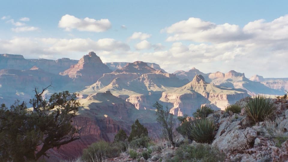
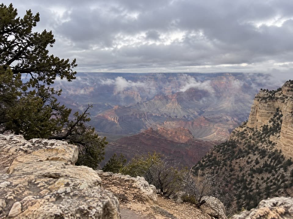
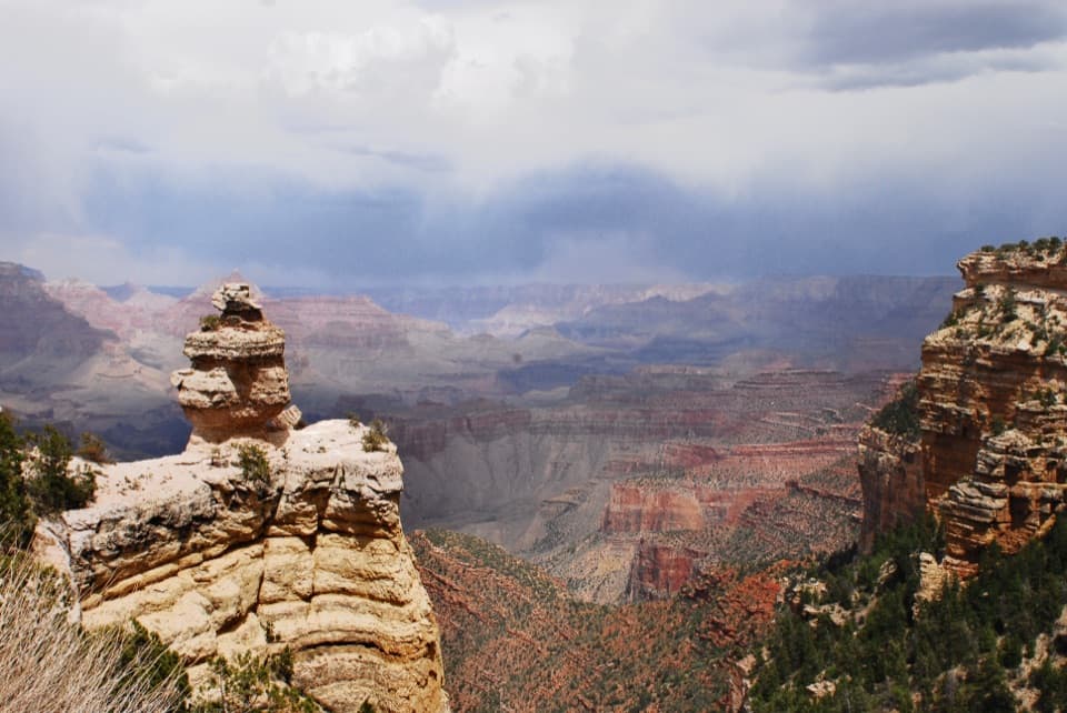
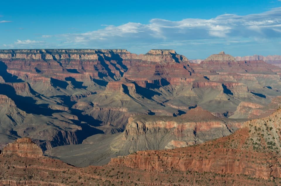
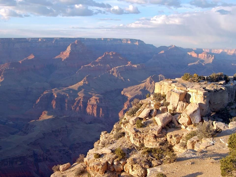
Grandview Point is a South Rim overlook on Desert View Drive, about 7,400 feet above sea level. Its broad view reaches the Colorado River and the canyon’s colorful, stacked rock layers. It sits 10.2 miles from Grand Canyon Village and 13.8 miles from Desert View, making it a natural pause on an east-rim drive. Stop for the panorama; treat the trailhead as a separate, much tougher outing.

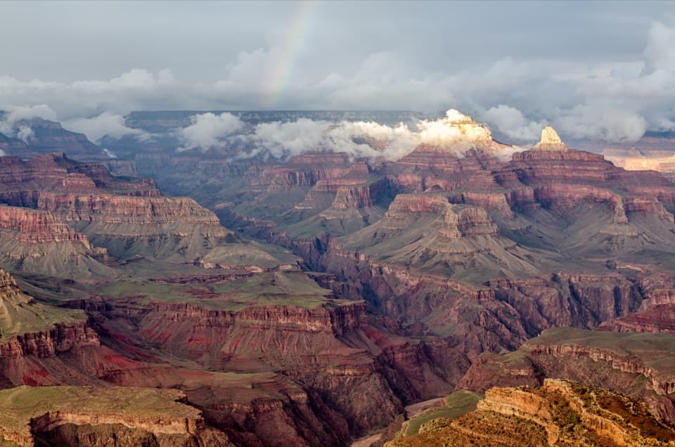
Best in changing lightEarly and late light bring out the canyon’s color and depth.

Early and late light bring out the canyon’s color and depth. Grandview is a popular stop, and parking can feel tight at busy times. For a photo, keep a near rim ledge in the foreground and let the bands of rock recede toward the river; a frame filled only with the far wall loses the scale.

Bring the basicsParking for cars and larger vehicles, picnic tables, and vault or composting toilets serve the…

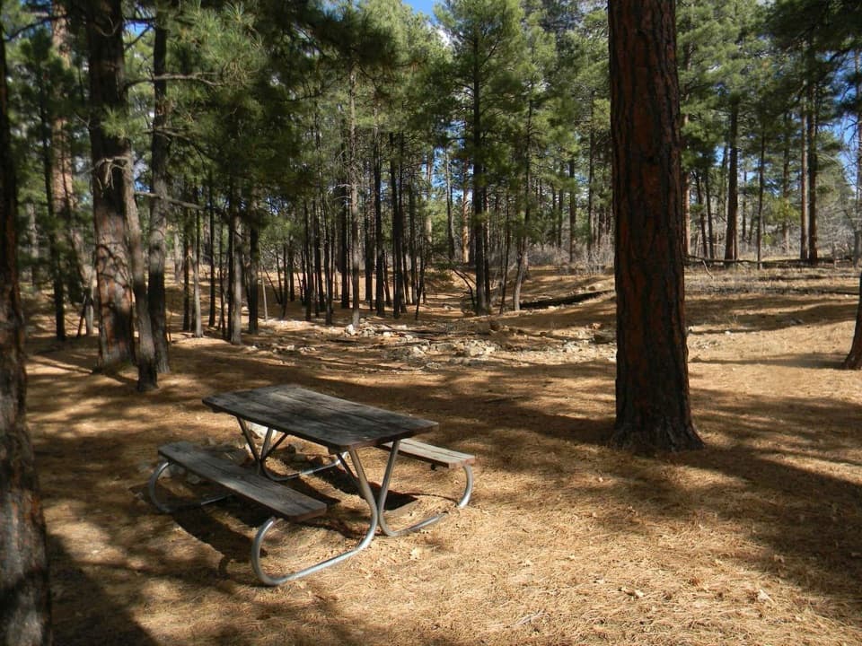
Parking for cars and larger vehicles, picnic tables, and vault or composting toilets serve the overlook. There is no drinking water, and no food service is listed here, so bring water and a snack. The overlook is marked wheelchair accessible, though the step-free route and viewing surfaces are not described; check ahead if those details matter.

The descent is a serious hikeGrandview Trail starts at the overlook and drops toward Horseshoe Mesa.

Grandview Trail starts at the overlook and drops toward Horseshoe Mesa. It is steep, rocky, exposed and strenuous: a route for experienced desert hikers, not a casual extension of the viewpoint or a recommended first hike below the rim. There is no maintained water on the trail, and springs are seasonal and unreliable. Summer heat and monsoon lightning, plus winter and early-spring ice, make preparation important. Below-rim camping requires a backcountry permit, with designated sites on Horseshoe Mesa.

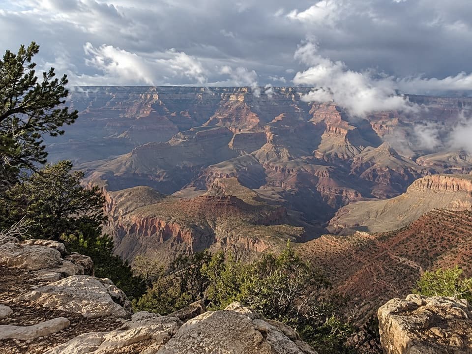
A route to copper minesNative American people first used this route to gather mineral pigments on Horseshoe Mesa.
Native American people first used this route to gather mineral pigments on Horseshoe Mesa. Copper miners later developed it to reach mines there, and intact upper sections still show how they built the trail. The mining sites are closed to visitors, but the route itself preserves part of that story.

Read the rock and the trailAt Coconino Saddle, the route crosses from Coconino Sandstone into Hermit Shale, then descends…

At Coconino Saddle, the route crosses from Coconino Sandstone into Hermit Shale, then descends toward the Supai Formation; the saddle looks over the upper Hance Creek valley. In the Coconino section, sandstone slabs set on edge make a rough cobbled surface. Farther down, log cribs chained or pinned to cliff faces form steep steps. Winter 2005 landslides destroyed several cribs, and trail crews repaired the route.

Leave the remnants where they areCans, nails, tools and structures from the mining era are protected archaeological resources.

Cans, nails, tools and structures from the mining era are protected archaeological resources. The historic mines are closed, as is the Cave of the Domes, to protect bats and other sensitive resources. Look without moving or taking anything.

Wildlife

Wildlife in Grand Canyon

All Grand Canyon wildlife maps

Sighting maps show where each species has been reported across Grand Canyon. Wildlife moves, so no sighting is guaranteed.

Parkwolf’s Grand Canyon ranking

Top sights in Grand Canyon

All 96 places
  1. 1Mather PointSight
  2. 2Desert View WatchtowerSight
  3. 3Yavapai Geology MuseumSight
  4. 4Hopi PointSight
  5. 5Toroweap OverlookSight
  6. 6Point ImperialSight

Take Parkwolf to Grand Canyon.

The audio tour guide for the drive, plus offline maps, trails, and wildlife heatmaps for when the signal drops.

4.7 from 8,600+ ratings

Download Parkwolf on the App StoreGet Parkwolf on Google Play