Delta Lake Trail in Grand Teton National Park

#6 of 70 trails in Grand Teton

Grand Teton National Park, WY

Delta Lake Trail

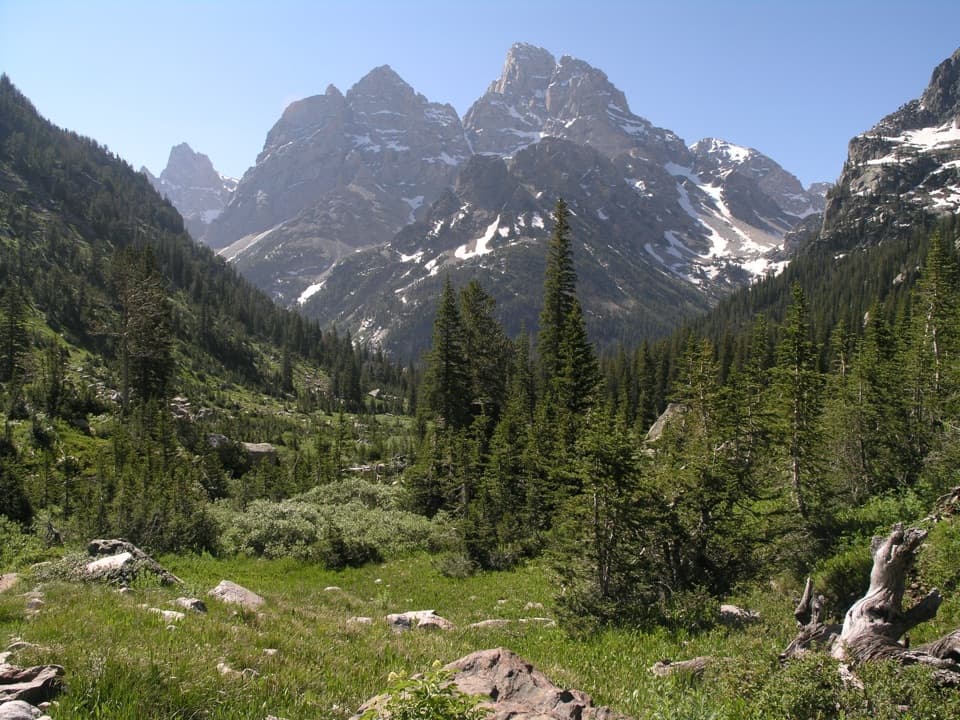
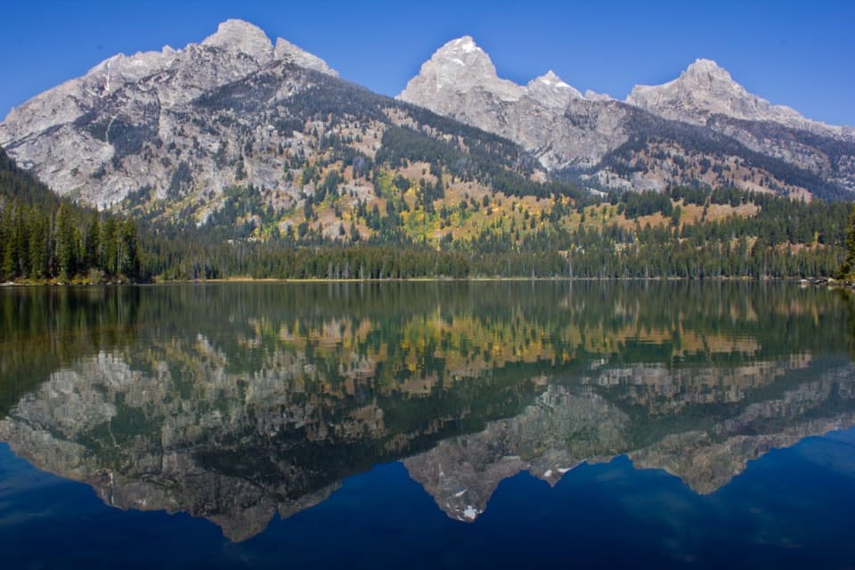
A steep boulder climb to turquoise water below the Tetons.

Photo: Wikimedia Commons
Length
7.6mi
Time
6hr
Elev. change
2,320ft
Difficulty
Challenging
  • No dogs
  • High point 9,058 ft

Hear the audio tour

Lupine Meadows: The Climb to Amphitheater Lake

Overview

About Delta Lake Trail

Why go

  • Turquoise lake beneath Grand Teton and Teton Glacier
  • A dramatic alpine payoff for a hard climb

Heads up

  • Steep, loose talus and boulder footing
  • The upper branch is informal and can be easy to miss
Delta Lake Trail is a 7.6-mile out-and-back from Lupine Meadows, climbing about 2,275 feet to a turquoise alpine lake beneath Grand Teton and Teton Glacier. Allow around six hours. The maintained trail gets you to the upper basin; the final stretch leaves it for a rough, steep route over talus and boulders. This is a high-payoff day for hikers who are steady on loose rock. Skip it if you want a maintained path or an easier lake stroll. The return repeats the same route, and the loose downhill can be harder on knees than the climb.
Parkwolf’s verdictIs this the hike for you?

Map & elevation

The route

Loading the Grand Teton map
Full map
Elevation6,739–9,058 ft
TrailheadLupine Meadows Trailhead43.73458, -110.74153
Keep this map with you offline in the Parkwolf app

Plan your hike

Before you go

Parking

Start at Lupine Meadows Trailhead at the end of Lupine Meadows Road. From Teton Park Road, turn west about one mile south of South Jenny Lake Junction and follow the gravel road for roughly 1.5 miles. The shared lot serves several hikes and climbs and can fill very early in summer. A vault toilet and bear-food storage boxes are at the trailhead.

Safety

The route leaves the maintained approach for a steep, informal path over loose talus and boulders; the upper branch can be hard to find and the descent is demanding. Snow or ice may linger on the upper climb into May and June. Check current signs at the junction and keep to the established tread. Pets are prohibited on park trails.

2 active Grand Teton alerts

  • ClosureConstruction closures and delaysConstruction is causing current road and area closures and delays across Grand Teton; use the signed Taggart Trail detour. - Moose-Wilson Road is closed between Moose and Laurance S.Official details
  • ClosureJackson Lake boat ramps closed; Signal launch riskColter Bay and Leeks boat ramps are closed; Signal Mountain Boat Ramp is open, but water is below the ramp edge and loose cobbles make launching risky.Official details
Grand Teton alerts
A park ranger sits on a dash-mounted phone, talking, as Parkwolf’s Tour Guide plays “Army Cutworm Moths: A Grizzly Bear Buffet” on Grand Loop Road below Dunraven Pass in Yellowstone
Parkwolf Tour GuideThe highest, rockiest slopes around here are a summer buffet for grizzly bears.

Grand Teton Tour Guide

Your drive to Delta Lake Trail, narrated.

Parkwolf is a GPS audio tour guide for Grand Teton National Park. As you drive, it chimes in with what’s ahead: hidden gems, upcoming stops, history, geology, and wildlife, right through your car’s speakers.

See the Grand Teton audio tour

Recorded for this trailhead

Lupine Meadows: The Climb to Amphitheater Lake
0:00 / 0:27
“You're approaching Lupine Meadows, the starting point for the climb to Amphitheater Lake below Disappointment Peak.”

Plays as you drive up to this trailhead in the Parkwolf Grand Teton Tour Guide.

More stories near here in the app

  • A Darkroom in the Mountains
  • From Bathhouse to Climbing Base
  • Lucas-Fabian Homestead: Geraldine’s Grand Teton Climb
  • South Jenny Lake: Shore or Shuttle
  • 118 audio storiesacross Grand Teton’s roads, triggered by GPS as you drive
  • Wildlife heatmapsfor Grizzly Bear, Brown Bear, Gray Wolf, and 13 more
  • Works offlinemaps, 70 trails, 121 places, and audio download before you lose signal
  • CarPlay readysimple controls built for the drive
★★★★★
“…We have been driving around with the audio tour and it has been informational and spot on. The whole family has been impressed. We used it for Yellowstone and Grand Teton.”
KWaz1122App Store review
Download Parkwolf on the App StoreGet Parkwolf on Google Play

4.7 from 8,600+ ratings

Trail guide

Hiking Delta Lake Trail

The climb to the turnThe first 0.4 mile is fairly flat. Then it climbs almost the whole way.

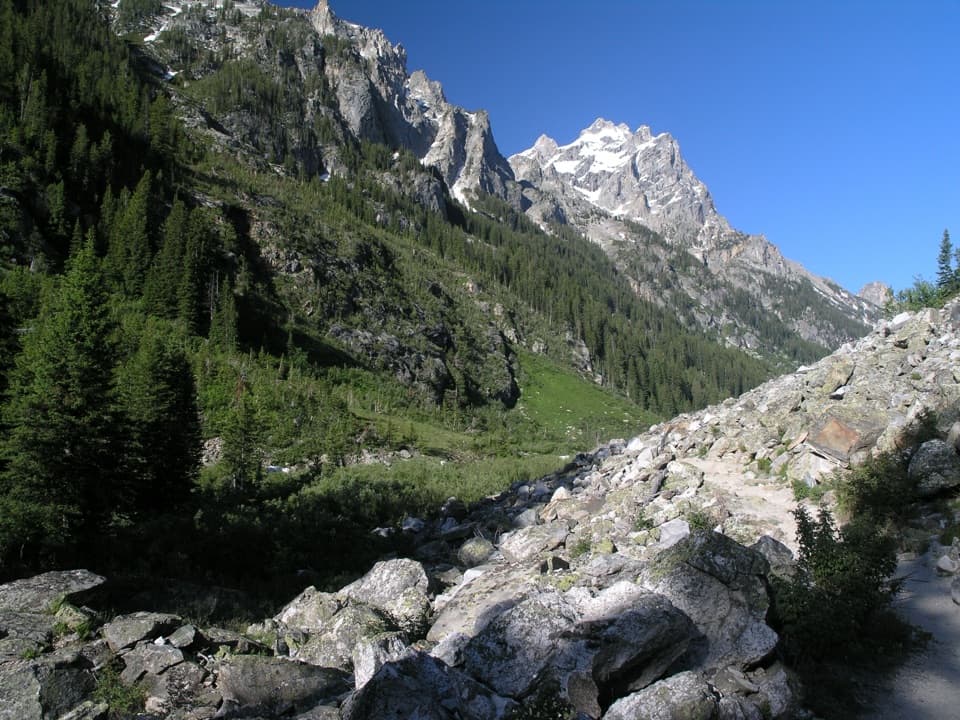
The first 0.4 mile is fairly flat. Then it climbs almost the whole way. Stay on the maintained approach toward Surprise and Amphitheater Lakes. Around 1.8 miles, keep going straight at the Valley Trail junction; after this point the shade thins and the Grand Teton starts to appear through the trees. Count the switchbacks. Pass the Garnet Canyon junction around mile 3.2, then look for the Delta Lake branch at the sixth switchback, around mile 3.4. That turn is easy to miss if you do not know to expect it. A 2026 restoration targeted wayfinding and the boulder-field line, but its finished layout is unclear; check current markers at the turn and stay on the main tread.

The rough upper routeBeyond the branch, the path drops below the maintained trail and traverses toward Glacier Gulch…

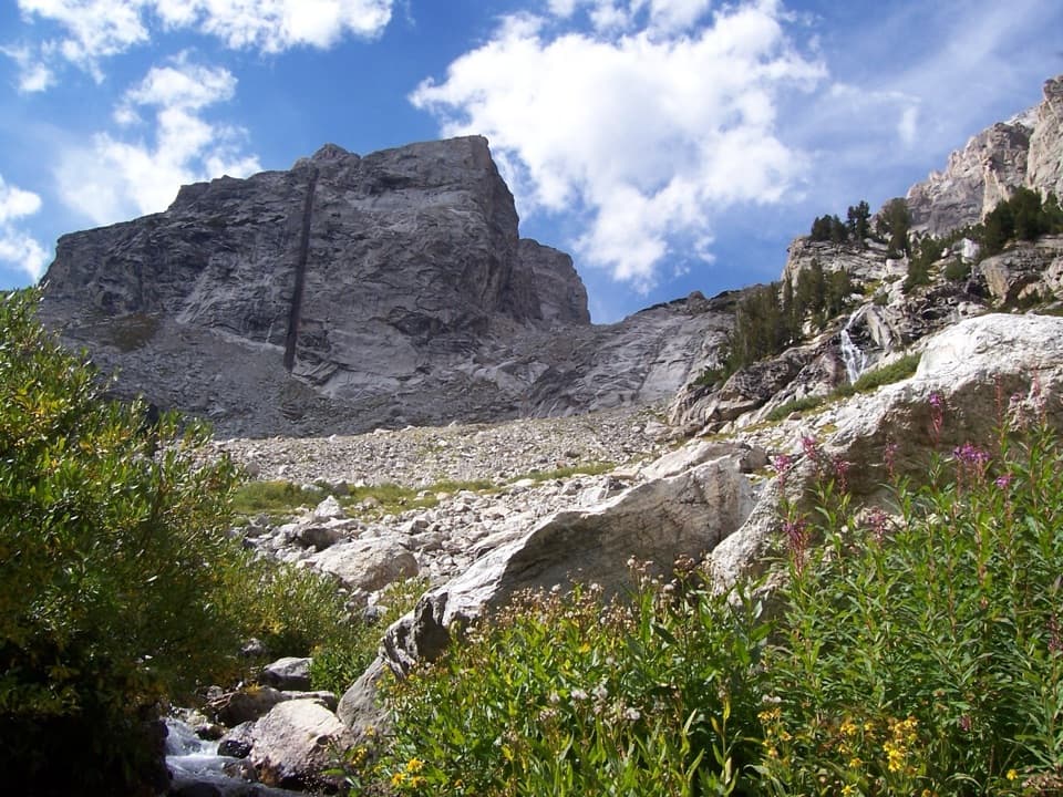
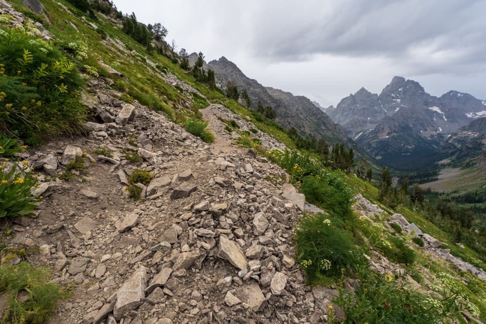
Beyond the branch, the path drops below the maintained trail and traverses toward Glacier Gulch Creek, with short descents and rises instead of a clean climb. It crosses the creek, then climbs the steep talus slope toward the lake. The final ascent is nearly constant, with loose stones and big boulders underfoot, before the trail levels just short of the shore. Expect the descent to take care and concentration too: one visitor reported that the downhill was harder on their knees than the uphill. Poles can help on the uneven return, but they do not make the boulder field easy. Snow and ice can linger into May and June, so early-season footing can be more serious than the mileage suggests.

The lake payoffThe lake sits in a steep rocky basin below Grand Teton and Teton Glacier.

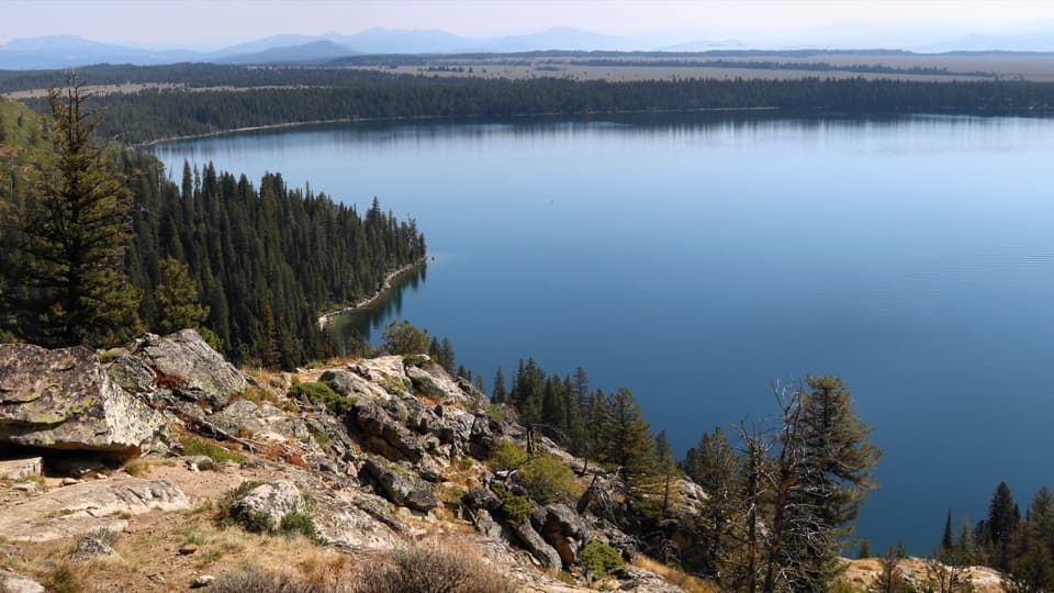
The lake sits in a steep rocky basin below Grand Teton and Teton Glacier. The turquoise water and close-up peak setting are the point of the long climb. Walk toward the south side for the classic view with Grand Teton behind the lake; the creek-side shore gives a more centered look across the water and boulder slope. This is a worthwhile place to stop and take in the basin before turning around. Keep to established shore paths in this sensitive alpine setting.

Trailhead and accessStart at Lupine Meadows Trailhead at the end of Lupine Meadows Road.

Start at Lupine Meadows Trailhead at the end of Lupine Meadows Road. From Teton Park Road, turn west about one mile south of South Jenny Lake Junction and follow the gravel road for about 1.5 miles. The shared lot serves several hikes and climbs and can fill very early in summer. There is a vault toilet and bear-food storage at the trailhead; bring all the water you need for the climb and return. Dogs are prohibited on park trails.

Wildlife

Wildlife in Grand Teton

All Grand Teton wildlife maps

Sighting maps show where each species has been reported across Grand Teton. Wildlife moves, so no sighting is guaranteed.

Keep exploring

Near Delta Lake Trail

See it all on the map

Trails that start nearby

Places near the trailhead

Parkwolf’s Grand Teton ranking

Top-rated trails in Grand Teton

All 70 trails
  1. 1Teton Crest TrailChallenging · 39 mi
  2. 2Paintbrush Canyon - Cascade Canyon LoopChallenging · 19.9 mi
  3. 3Lake Solitude TrailChallenging · 15.1 mi
  4. 4Inspiration Point TrailModerate · 1.8 mi
  5. 5Taggart Lake TrailEasy · 3 mi
  6. 7Forks of Cascade CanyonModerate · 9.4 mi

Take Parkwolf to Grand Teton.

The audio tour guide for the drive, plus offline maps, trails, and wildlife heatmaps for when the signal drops.

4.7 from 8,600+ ratings

Download Parkwolf on the App StoreGet Parkwolf on Google Play