Forks of Cascade Canyon in Grand Teton National Park

#7 of 70 trails in Grand Teton

Grand Teton National Park, WY

Forks of Cascade Canyon

A high canyon walk whose hardest steps come before the big views.

Photo: Public Domain
Length
9.4mi
Time
7hr
Elev. change
1,129ft
Difficulty
Moderate
  • No dogs
  • High point 7,917 ft

Hear the audio tour

South Jenny Lake: Shore or Shuttle

Overview

About Forks of Cascade Canyon

Why go

  • Cathedral Group peaks stay overhead through the canyon
  • Boat access shortens the Jenny Lake approach

Heads up

  • Exposed, unrailed steps at Inspiration Point
  • Long, high-altitude day with early parking pressure

Map & elevation

The route

Loading the Grand Teton map
Full map
Elevation6,788–7,917 ft
TrailheadWest Shore Boat Dock43.76728, -110.74405
Keep this map with you offline in the Parkwolf app

Plan your hike

Before you go

Parking

Park at South Jenny Lake, where the shuttle boat leaves for the West Shore Boat Dock. The lot fills in mid-summer; arrive before 9 a.m. for the best chance of a space. Walking the South Jenny Lake Loop Trail instead of taking the boat makes the out-and-back 13.3 miles.

Safety

The exposed final steps to Inspiration Point have no rail or handholds. Snow can linger into early or mid-summer; check conditions and do not cross steep snow without prior experience and proper equipment. Bears use the canyon: make noise, carry bear spray, hike in groups of three or more when possible, and stay at least 100 yards away.

2 active Grand Teton alerts

  • ClosureConstruction closures and delaysConstruction is causing current road and area closures and delays across Grand Teton; use the signed Taggart Trail detour. - Moose-Wilson Road is closed between Moose and Laurance S.Official details
  • ClosureJackson Lake boat ramps closed; Signal launch riskColter Bay and Leeks boat ramps are closed; Signal Mountain Boat Ramp is open, but water is below the ramp edge and loose cobbles make launching risky.Official details
Grand Teton alerts
A park ranger sits on a dash-mounted phone, talking, as Parkwolf’s Tour Guide plays “Army Cutworm Moths: A Grizzly Bear Buffet” on Grand Loop Road below Dunraven Pass in Yellowstone
Parkwolf Tour GuideThe highest, rockiest slopes around here are a summer buffet for grizzly bears.

Grand Teton Tour Guide

Your drive to Forks of Cascade Canyon, narrated.

Parkwolf is a GPS audio tour guide for Grand Teton National Park. As you drive, it chimes in with what’s ahead: hidden gems, upcoming stops, history, geology, and wildlife, right through your car’s speakers.

See the Grand Teton audio tour

Recorded for this trailhead

South Jenny Lake: Shore or Shuttle
0:00 / 0:38
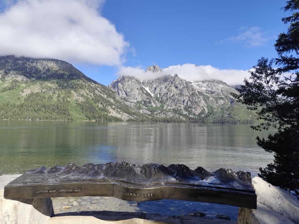
“You're nearing South Jenny Lake, where you can enjoy the mountain view from a paved lakeshore path or take the seasonal shuttle across the water.”

Plays as you drive up to this trailhead in the Parkwolf Grand Teton Tour Guide.

More stories near here in the app

  • Jenny Lake Overlook and Its Namesake
  • Jenny Lake Lodge: A Meal Among the Cabins
  • From Bathhouse to Climbing Base
  • String and Leigh Lakes: Picnic, Paddle or Walk
  • 118 audio storiesacross Grand Teton’s roads, triggered by GPS as you drive
  • Wildlife heatmapsfor Grizzly Bear, Brown Bear, Gray Wolf, and 13 more
  • Works offlinemaps, 70 trails, 121 places, and audio download before you lose signal
  • CarPlay readysimple controls built for the drive
★★★★★
“…We have been driving around with the audio tour and it has been informational and spot on. The whole family has been impressed. We used it for Yellowstone and Grand Teton.”
KWaz1122App Store review
Download Parkwolf on the App StoreGet Parkwolf on Google Play

4.7 from 8,600+ ratings

Trail guide

Hiking Forks of Cascade Canyon

The boat-access routeForks of Cascade Canyon is a long out-and-back from the West Shore Boat Dock at Jenny Lake,…

Forks of Cascade Canyon is a long out-and-back from the West Shore Boat Dock at Jenny Lake, following Cascade Creek to the junction of the North and South forks. The shuttle-boat version is 9.4 miles round trip with about 1,480 feet of elevation gain; allow five to nine hours for the hike, with seven hours a sensible day plan. The canyon walk is the payoff: you get deep into the Tetons without climbing onto a high pass. The boat shortens the walk around Jenny Lake, but it also makes your return dependent on the shuttle. If you walk the South Jenny Lake Loop Trail to the same route instead, the full out-and-back is 13.3 miles with more climbing. You can also turn around earlier; the canyon is worthwhile well before the forks.

The steep steps come earlyFrom the dock, the path crosses a bridge and follows the creek toward the canyon mouth.

From the dock, the path crosses a bridge and follows the creek toward the canyon mouth. A short side trail reaches Hidden Falls if you want to add that stop. The main route then climbs stone steps and crosses bridges toward Inspiration Point. The last set of steps is exposed and has no rail or handholds; the footing is rocky, and that section can be a real obstacle if heights make you uneasy. It is fine to stop at the falls or point instead of committing to the full canyon walk.

Past Inspiration PointAfter the point, the grade eases, but the trail keeps gaining height as it works deeper into…

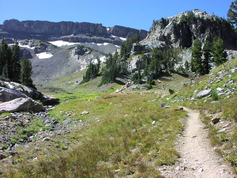
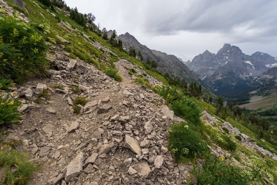
After the point, the grade eases, but the trail keeps gaining height as it works deeper into the canyon. Expect crushed rock and dirt, small stream crossings, rock-slide traverses, and plenty of short ups and downs. It is easier walking than the stairway, not flat walking: the long distance and high elevation make this a substantial day. Start with enough time and energy left for the return to the dock.

The canyon and its peaksCascade Canyon is a glacially carved U-shaped valley between Teewinot and Mount Saint John.

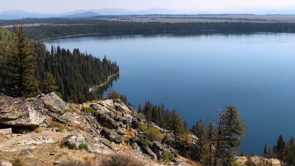
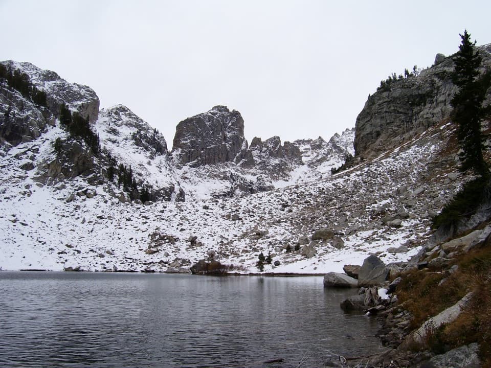
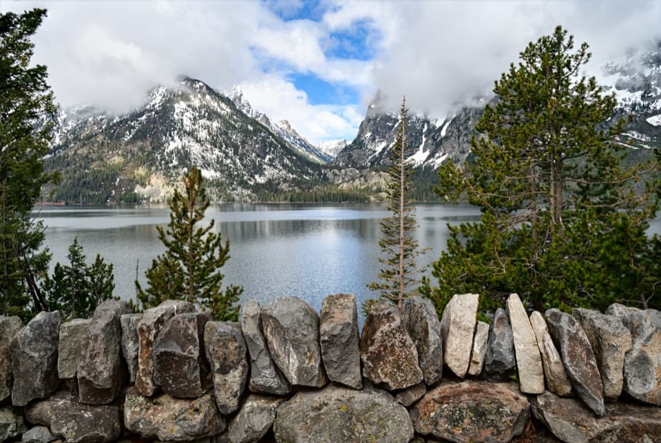
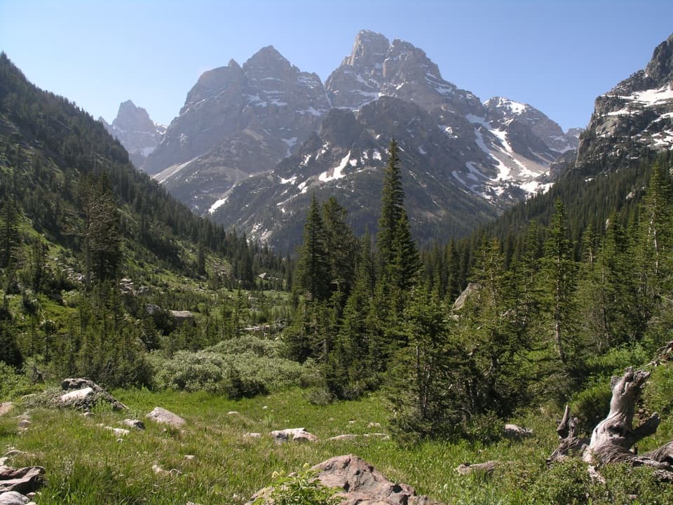
Cascade Canyon is a glacially carved U-shaped valley between Teewinot and Mount Saint John. Cascade Creek stays close to the trail, and the Cathedral Group—Teewinot, Grand Teton, and Mount Owen—rises above the canyon. Boulders and small ponds break up the forested stretches, while rock slides open broad views across the valley. At Inspiration Point, look east over Jenny Lake and Jackson Hole; farther in, turn back toward the peaks. For a useful photo, include a stretch of rocky path beneath the mountains so the foreground shows how the trail fits into the scale of the canyon.

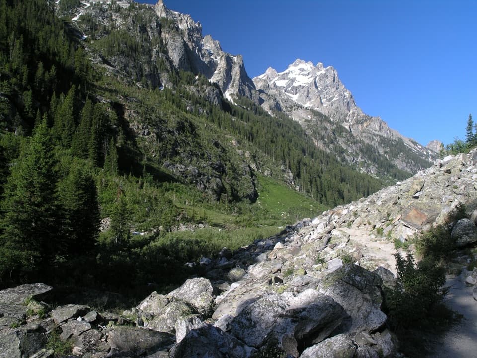
The forks are the turnaroundThe North and South forks meet in a forested junction beside rushing water.

The North and South forks meet in a forested junction beside rushing water. This is the endpoint for this hike. Beyond it, the North Fork continues toward Lake Solitude and the South Fork leads toward Hurricane Pass and Alaska Basin; either choice turns the day into a different, longer outing. For this hike, turn around at the junction rather than taking either branch. The out-and-back shape makes an earlier turnaround straightforward if time, weather, or energy says so.

Wildlife and accessMoose may be near the willows along the creek, and pikas or marmots may be visible around…

Moose may be near the willows along the creek, and pikas or marmots may be visible around boulder fields; sightings are never guaranteed. Bears also use this canyon. Stay alert, make noise, carry bear spray, hike in a group of three or more when possible, and give bears at least 100 yards. Dogs are not allowed on park trails. Snow can linger into early or mid-summer, so check trail conditions before setting out and do not cross steep snow without the experience and equipment for it. South Jenny Lake is the parking and boat departure point; its lot fills in mid-summer, so arriving before 9 a.m. improves your chance of finding a space. The boat landing on the west shore is the mapped start of the 9.4-mile version.

Wildlife

Wildlife in Grand Teton

All Grand Teton wildlife maps

Sighting maps show where each species has been reported across Grand Teton. Wildlife moves, so no sighting is guaranteed.

Keep exploring

Near Forks of Cascade Canyon

See it all on the map

Trails that start nearby

Places near the trailhead

Parkwolf’s Grand Teton ranking

Top-rated trails in Grand Teton

All 70 trails
  1. 1Teton Crest TrailChallenging · 39 mi
  2. 2Paintbrush Canyon - Cascade Canyon LoopChallenging · 19.9 mi
  3. 3Lake Solitude TrailChallenging · 15.1 mi
  4. 4Inspiration Point TrailModerate · 1.8 mi
  5. 5Taggart Lake TrailEasy · 3 mi
  6. 6Delta Lake TrailChallenging · 7.6 mi

Take Parkwolf to Grand Teton.

The audio tour guide for the drive, plus offline maps, trails, and wildlife heatmaps for when the signal drops.

4.7 from 8,600+ ratings

Download Parkwolf on the App StoreGet Parkwolf on Google Play