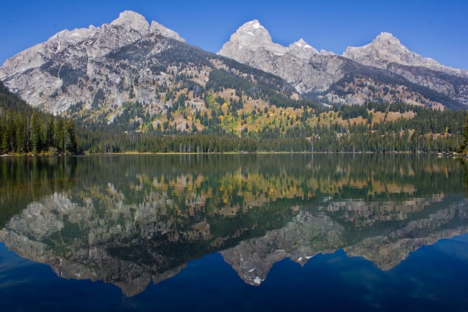
Lake Solitude Trail in Grand Teton National Park

#3 of 70 trails in Grand Teton

Grand Teton National Park, WY

Lake Solitude Trail

A full-day climb through Cascade Canyon to a high alpine lake.

Photo: Public Domain
Length
15.1mi
Time
11hr
Elev. change
2,208ft
Difficulty
Challenging
  • No dogs
  • High point 9,055 ft

Hear the audio tour

South Jenny Lake: Shore or Shuttle

Overview

About Lake Solitude Trail

Why go

  • Big canyon scenery from the start through the lake basin
  • A gradual canyon approach followed by a sustained high-country climb
  • Ferry access shortens the walk around Jenny Lake

Heads up

  • About 15 miles round trip and a full day on foot
  • The exposed, rocky North Fork climb is strenuous
  • The shorter access depends on seasonal boat service

Map & elevation

The route

Loading the Grand Teton map
Full map
Elevation6,847–9,055 ft
TrailheadWest Shore Boat Dock43.76720, -110.74421
Keep this map with you offline in the Parkwolf app

Plan your hike

Before you go

Parking

Use South Jenny Lake parking off Teton Park Road, then take the shuttle boat to West Shore Boat Dock for this saved route. The lot fills on busy summer days. Boat fares and service times change; check the current timetable and return departure. Walking around Jenny Lake is a longer alternative of about 18.3 miles round trip.

Safety

Strenuous, high-elevation route with a rocky final climb and exposed upper terrain. Snow can linger after lower trails clear; storms and temperatures can change quickly. Leave enough daylight to return to the dock and confirm the last boat before setting out. Bears and moose live in the area; give wildlife room. Pets are prohibited on park trails.

2 active Grand Teton alerts

  • ClosureConstruction closures and delaysConstruction is causing current road and area closures and delays across Grand Teton; use the signed Taggart Trail detour. - Moose-Wilson Road is closed between Moose and Laurance S.Official details
  • ClosureJackson Lake boat ramps closed; Signal launch riskColter Bay and Leeks boat ramps are closed; Signal Mountain Boat Ramp is open, but water is below the ramp edge and loose cobbles make launching risky.Official details
Grand Teton alerts
A park ranger sits on a dash-mounted phone, talking, as Parkwolf’s Tour Guide plays “Army Cutworm Moths: A Grizzly Bear Buffet” on Grand Loop Road below Dunraven Pass in Yellowstone
Parkwolf Tour GuideThe highest, rockiest slopes around here are a summer buffet for grizzly bears.

Grand Teton Tour Guide

Your drive to Lake Solitude Trail, narrated.

Parkwolf is a GPS audio tour guide for Grand Teton National Park. As you drive, it chimes in with what’s ahead: hidden gems, upcoming stops, history, geology, and wildlife, right through your car’s speakers.

See the Grand Teton audio tour

Recorded for this trailhead

South Jenny Lake: Shore or Shuttle
0:00 / 0:38
“You're nearing South Jenny Lake, where you can enjoy the mountain view from a paved lakeshore path or take the seasonal shuttle across the water.”

Plays as you drive up to this trailhead in the Parkwolf Grand Teton Tour Guide.

More stories near here in the app

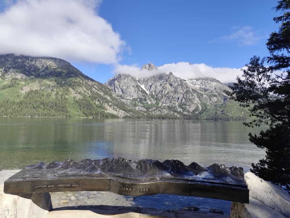
  • Jenny Lake Overlook and Its Namesake
  • Jenny Lake Lodge: A Meal Among the Cabins
  • From Bathhouse to Climbing Base
  • String and Leigh Lakes: Picnic, Paddle or Walk
  • 118 audio storiesacross Grand Teton’s roads, triggered by GPS as you drive
  • Wildlife heatmapsfor Grizzly Bear, Brown Bear, Gray Wolf, and 13 more
  • Works offlinemaps, 70 trails, 121 places, and audio download before you lose signal
  • CarPlay readysimple controls built for the drive
★★★★★
“…We have been driving around with the audio tour and it has been informational and spot on. The whole family has been impressed. We used it for Yellowstone and Grand Teton.”
KWaz1122App Store review
Download Parkwolf on the App StoreGet Parkwolf on Google Play

4.7 from 8,600+ ratings

Trail guide

Hiking Lake Solitude Trail

The full commitmentLake Solitude is a long out-and-back to a high alpine lake at the head of North Fork Cascade…

Lake Solitude is a long out-and-back to a high alpine lake at the head of North Fork Cascade Canyon. This saved route follows the boat-access version from West Shore Boat Dock, passes Inspiration Point and turns right at the Forks of Cascade Canyon. It measures about 15.1 miles round trip, with roughly 2,670 feet of climbing; allow 9 to 13 hours. Published mileage figures range from 14.4 to 15.3 miles, so use the longer end when planning. The route returns the way you came. Walking around the south end of Jenny Lake before joining it makes the trip about 18.3 miles round trip. The payoff is the whole canyon, a sustained final climb and a lake beneath a high rocky headwall.

Cross Jenny Lake firstPark at South Jenny Lake and take the shuttle boat to West Shore Boat Dock for this shorter…

Park at South Jenny Lake and take the shuttle boat to West Shore Boat Dock for this shorter version. The saved route starts at the west dock, so a walk around the lake does not follow the line shown here. Boat service has its own seasonal timetable and fare; check current service and the return departure before starting a full-day hike. The South Jenny Lake lot fills on busy summer days. The boat saves several miles of walking, while the walk-around route is a useful backup if the shuttle is not running, with a longer day as a result.

From the dock to Cascade CanyonThe trail climbs through forest, then joins the busy route toward Hidden Falls and Inspiration…

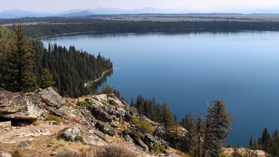
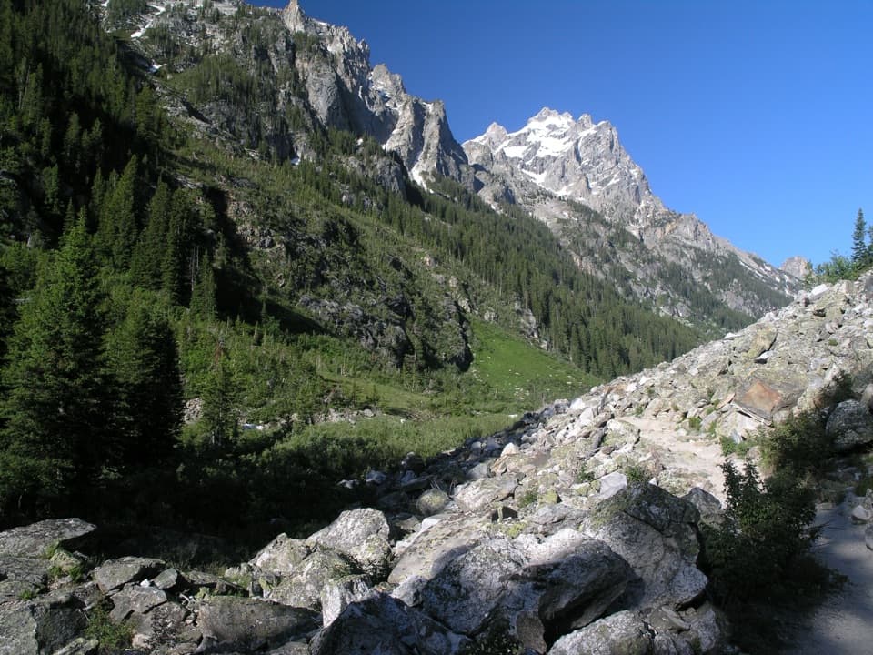
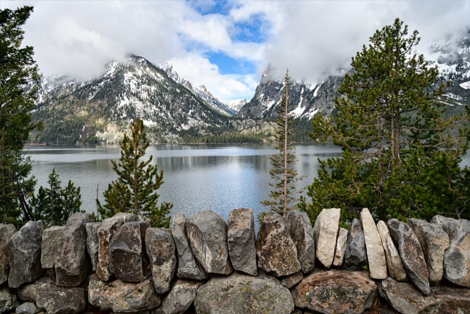
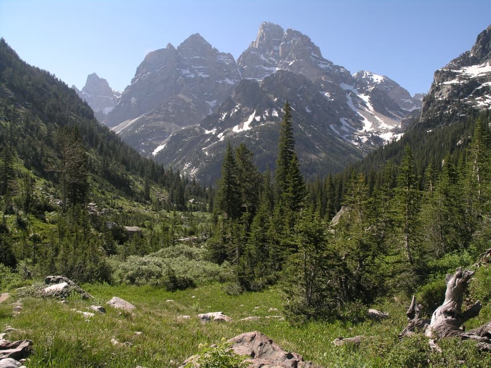
The trail climbs through forest, then joins the busy route toward Hidden Falls and Inspiration Point. Expect a rougher, rocky approach as you gain the ledge at Inspiration Point. Jenny Lake opens below, with the Cathedral Group rising across the canyon. Past the viewpoint, the crowds thin as the trail heads into Cascade Canyon. It follows Cascade Creek through shaded stretches and open meadows; the valley gradually narrows, and boulder slopes begin to crowd the creek. The long approach is comparatively gentle, which makes the distance feel deceptively manageable before the final branch.

Choose the North ForkAt the Forks of Cascade Canyon, take the signed right branch toward Lake Solitude.

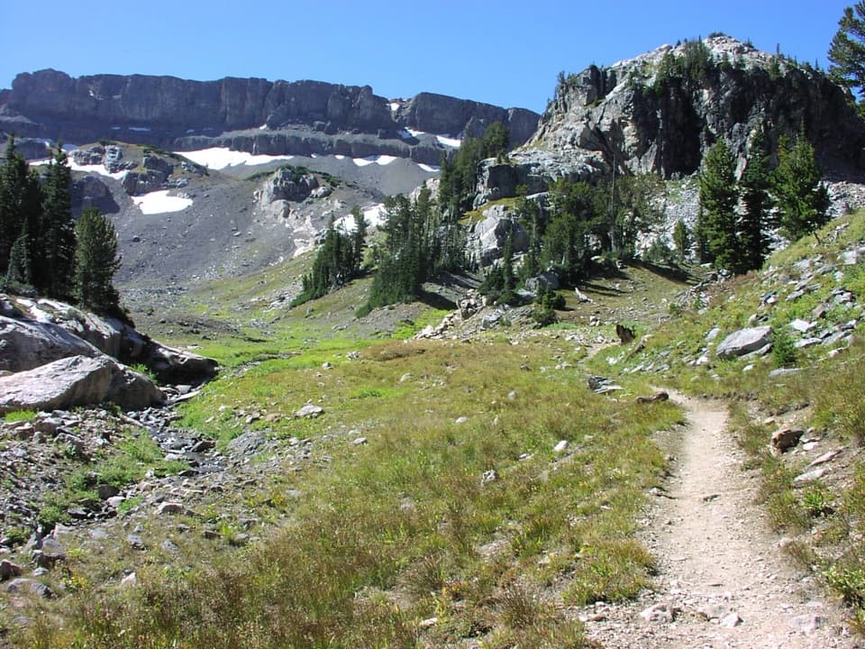
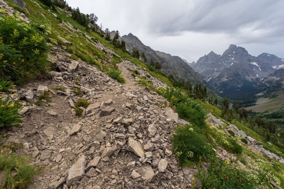
At the Forks of Cascade Canyon, take the signed right branch toward Lake Solitude. The left branch leads toward Hurricane Pass and Alaska Basin; continuing beyond the lake over Paintbrush Divide turns this outing into the much longer Paintbrush-Cascade loop. From the junction, the trail gains elevation steadily for about 2.5 miles. Near the turn, look for the old Cascade Canyon Patrol Cabin, built in 1935 and later adapted for ranger use. The upper trail leaves much of the shade behind and grows steeper and rockier. Footing becomes uneven around boulders and creek crossings, so the climb takes longer than the mileage alone suggests.

The lake and its settingLake Solitude sits in a high glacial basin beneath a broad headwall.

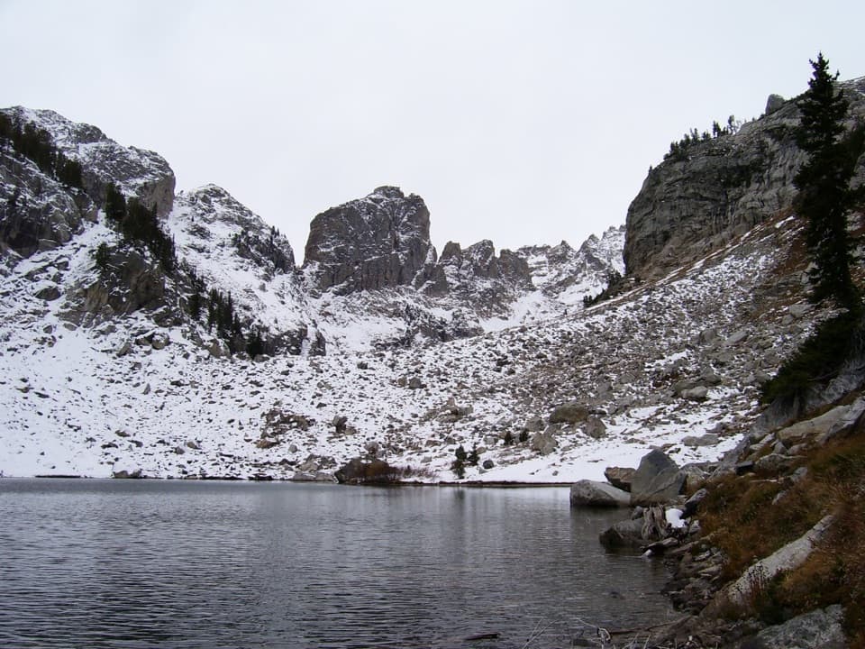
Lake Solitude sits in a high glacial basin beneath a broad headwall. The last stretch climbs over a rocky moraine before a short side path drops to the lakeshore. From there, the view takes in the lake, the enclosing cliffs and the Teton peaks to the south. The shore is a natural place to stop for food and rest before retracing the climb and canyon. If the water is still, include the near shore in a photo to show the lake's scale against the rock walls.

Ice, water and wildlifeJenny Lake at the start of the hike fills a depression carved by glaciers; the same ice-shaped…

Jenny Lake at the start of the hike fills a depression carved by glaciers; the same ice-shaped canyon landscape continues west into Cascade Canyon. The valley's creek, forest edges and willow patches are places visitors report seeing moose, while bears also live in the Jenny Lake area. Wildlife is never guaranteed. Give animals plenty of room and follow park guidance for traveling in bear country.

Make the day workThis is a strenuous, high-elevation hike.

This is a strenuous, high-elevation hike. The open upper North Fork has little shade, and snow can linger after lower trails have cleared. Afternoon storms, wind and fast temperature changes matter more once you are above the tree line; choose a day with a stable forecast and leave enough daylight for the return to the boat dock. Pets are prohibited on park trails. Overnight stays require a backcountry permit. Carry enough food and water for a long day, since there is no reliable resupply on the route.

Wildlife

Wildlife in Grand Teton

All Grand Teton wildlife maps

Sighting maps show where each species has been reported across Grand Teton. Wildlife moves, so no sighting is guaranteed.

Keep exploring

Near Lake Solitude Trail

See it all on the map

Trails that start nearby

Places near the trailhead

Parkwolf’s Grand Teton ranking

Top-rated trails in Grand Teton

All 70 trails
  1. 1Teton Crest TrailChallenging · 39 mi
  2. 2Paintbrush Canyon - Cascade Canyon LoopChallenging · 19.9 mi
  3. 4Inspiration Point TrailModerate · 1.8 mi
  4. 5Taggart Lake TrailEasy · 3 mi
  5. 6Delta Lake TrailChallenging · 7.6 mi
  6. 7Forks of Cascade CanyonModerate · 9.4 mi

Take Parkwolf to Grand Teton.

The audio tour guide for the drive, plus offline maps, trails, and wildlife heatmaps for when the signal drops.

4.7 from 8,600+ ratings

Download Parkwolf on the App StoreGet Parkwolf on Google Play