Stella Lake via Alpine Lakes Loop Trail in Great Basin National Park

Great Basin National Park, NV

Stella Lake via Alpine Lakes Loop Trail

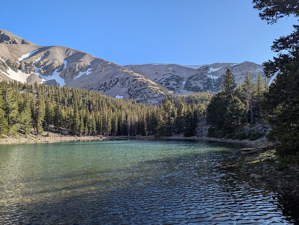
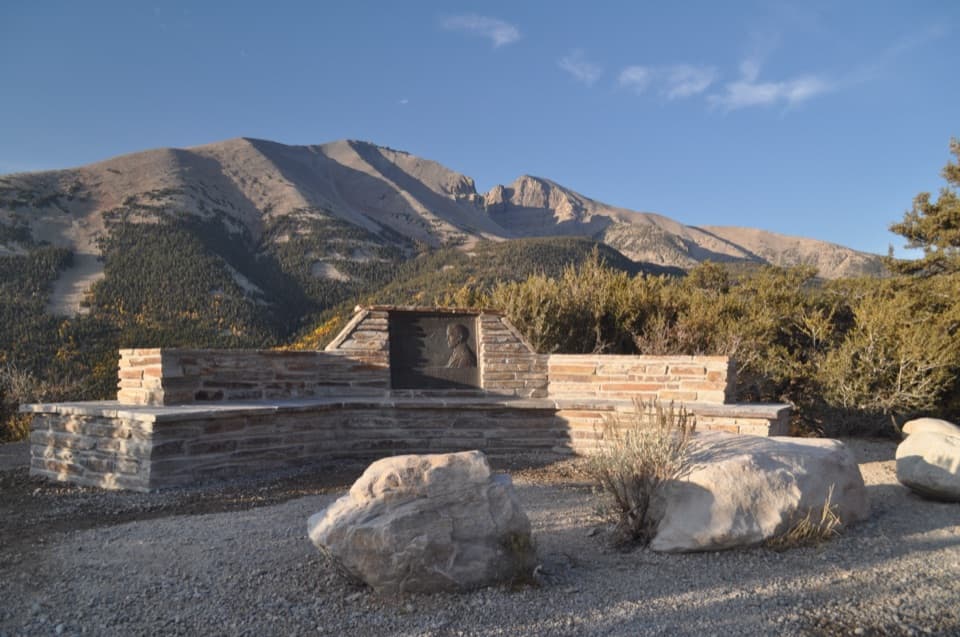
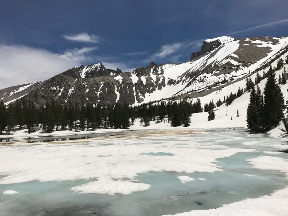
A high lake beneath Wheeler Peak, a little over a mile in.

Photo: National Park Service
Length
2.1mi
Time
1.5hr
Elev. change
479ft
Difficulty
Moderate
  • No dogs
  • High point 10,466 ft

Hear the audio tour

Bristlecone Trailhead: The Grove Walk

Overview

About Stella Lake via Alpine Lakes Loop Trail

Why go

  • A mountain lake with Wheeler Peak as its backdrop.
  • The full circuit adds Teresa Lake without much extra distance.

Heads up

  • Near 10,000 feet, the climb can feel harder than the mileage.
  • Scenic-drive closures can make access substantially longer.

Map & elevation

The route

Loading the Great Basin map
Full map
Elevation9,987–10,466 ft
TrailheadBristlecone, Alpine Lake and Sky Island Forest Trailhead39.00998, -114.30715
Keep this map with you offline in the Parkwolf app

Plan your hike

Before you go

Parking

Start at the Bristlecone, Alpine Lake and Sky Island Forest Trailhead at the end of Wheeler Peak Scenic Drive. Use marked spaces only; roadside parking is prohibited. Pit toilets are available at the trailhead, but there is no potable water along the drive. The paved road has an 8% grade, and vehicles longer than 24 feet are restricted beyond Upper Lehman Creek Campground. The road usually closes in winter and after snowfall; the NPS winter approach uses the Lehman Creek Trail.


Safety

The route starts near 10,000 feet, where altitude can intensify the effort; afternoon thunderstorms are possible in summer. Bring water because none is available along Wheeler Peak Scenic Drive. No pets are allowed on park trails; trained service animals are permitted.

4 active Great Basin alerts

  • CautionStage II fire restrictions prohibit outdoor fires and smokingStage II fire restrictions are active throughout Great Basin National Park because of extreme fire danger. - Do not use campfires, charcoal grills, or smoke outdoors anywhere in the park.Official details
  • CautionPotable water is unavailable at park campgroundsPotable water is currently unavailable in every Great Basin National Park campground; bring sufficient water or fill containers before settling in.Official details
See all 4 alerts
A park ranger sits on a dash-mounted phone, talking, as Parkwolf’s Tour Guide plays “Army Cutworm Moths: A Grizzly Bear Buffet” on Grand Loop Road below Dunraven Pass in Yellowstone
Parkwolf Tour GuideThe highest, rockiest slopes around here are a summer buffet for grizzly bears.

Great Basin Tour Guide

Your drive to Stella Lake via Alpine Lakes Loop Trail, narrated.

Parkwolf is a GPS audio tour guide for Great Basin National Park. As you drive, it chimes in with what’s ahead: hidden gems, upcoming stops, history, geology, and wildlife, right through your car’s speakers.

Recorded for this trailhead

Bristlecone Trailhead: The Grove Walk
0:00 / 0:27
“Up ahead is Bristlecone Trailhead, where I'd choose the hike to Wheeler Peak's bristlecone grove.”

Plays as you drive up to this trailhead in the Parkwolf Great Basin Tour Guide.

More stories near here in the app

  • Wheeler Peak Summit Trailhead: A Full Hiking Day
  • Wheeler Peak Overlook: Find the Rock Glacier
  • Mather Overlook: Match the Map to the Mountain
  • Mountains Pulled Apart
  • 36 audio storiesacross Great Basin’s roads, triggered by GPS as you drive
  • Wildlife heatmapsfor Elk, Mule Deer, Wild Turkey, and 13 more
  • Works offlinemaps, 29 trails, 29 places, and audio download before you lose signal
  • CarPlay readysimple controls built for the drive
★★★★★
“Fantastic app with many points of information… It’s great to just turn on while you’re driving and it gives you an audio tour of the national Park. We love it!!!!”
JMJamesApp Store review
Download Parkwolf on the App StoreGet Parkwolf on Google Play

4.7 from 8,600+ ratings

Trail guide

Hiking Stella Lake via Alpine Lakes Loop Trail

Is this the walk you want?Stella Lake via Alpine Lakes Loop Trail is a 2.

Stella Lake via Alpine Lakes Loop Trail is a 2.1-mile out-and-back from the Bristlecone, Alpine Lake and Sky Island Forest Trailhead to Stella Lake and back along the west side of the Alpine Lakes route. The mapped leg is about 1.1 miles each way, with roughly 460 feet of total climbing. Allow about 1 to 1.5 hours. Wheeler Peak rises over the lake, but the trail starts near 10,000 feet, so the thin air can make this short hike feel harder than its mileage suggests.

If you would rather see two lakes and avoid retracing the same leg, continue around the full 2.7-mile Alpine Lakes Loop past Teresa Lake. That circuit is only about half a mile longer than the Stella out-and-back.

Follow the Stella branchFrom the shared trailhead, take the short link to the Alpine Lakes path and follow the west,…

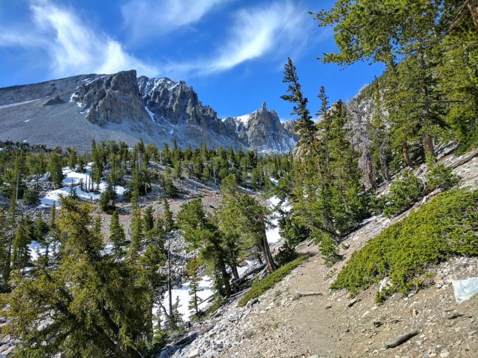
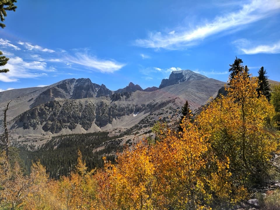
From the shared trailhead, take the short link to the Alpine Lakes path and follow the west, counterclockwise branch toward Stella. The climb is gradual through conifers; as the route opens into alpine meadows, Wheeler Peak and Doso Doyabi come into view. Two Wheeler Peak Summit Trail junctions occur before the lake. Stay on the Alpine Lakes route at both, rather than taking a summit spur.

Stella is the turn-around for this outing. The full loop carries on toward Teresa Lake and returns by a different side of the circuit. The full loop is an easy 2.7-mile walk through forest and meadows, but it is a separate, longer experience from this Stella-only out-and-back.

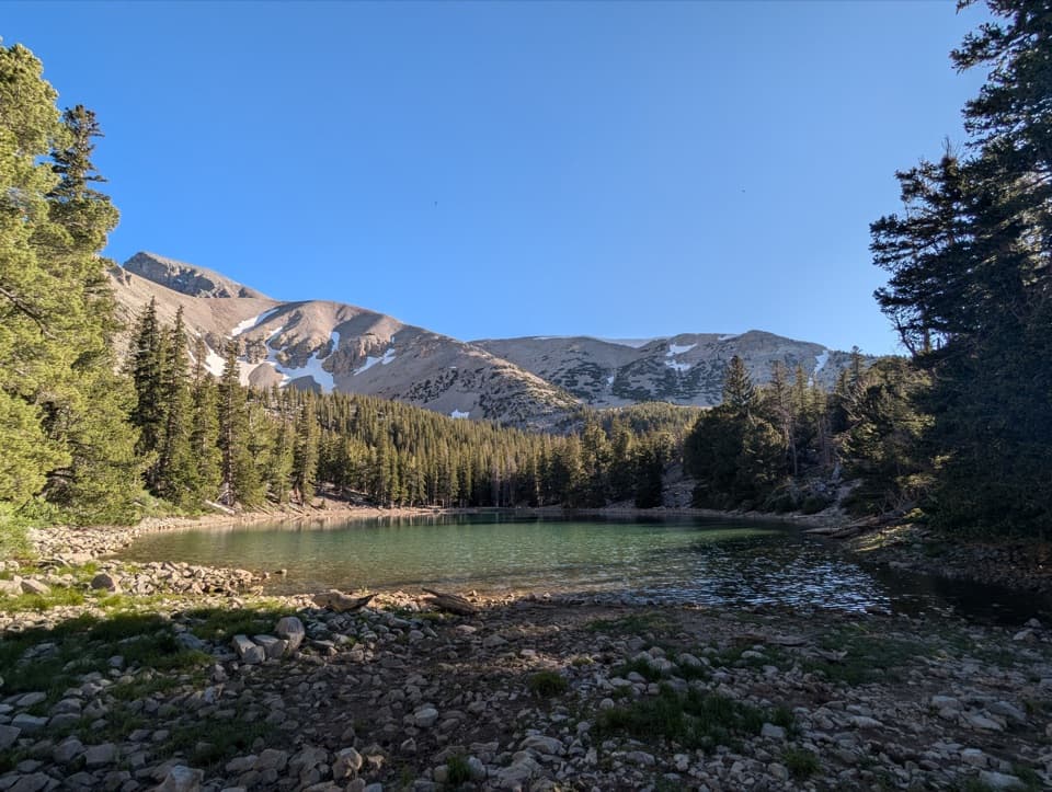
At the lakeStella Lake is a high mountain lake beneath Wheeler Peak, with views toward Doso Doyabi as well.

Stella Lake is a high mountain lake beneath Wheeler Peak, with views toward Doso Doyabi as well. Snowmelt feeds the lakes in this basin, so Stella can shrink in late summer and early fall. Wildflowers and wildlife are regular summer sights along the high route, though no particular animal is guaranteed.

At the shore, frame the lake with Wheeler Peak behind it; a strip of rocky foreground helps show the water and the scale of the peaks. Water levels and the amount of exposed shore change through the season.

Access and effortThe trailhead is at the end of Wheeler Peak Scenic Drive.

The trailhead is at the end of Wheeler Peak Scenic Drive. There are pit toilets at the parking area, but no potable water along the drive, so bring what you need. The trail is near 10,000 feet, and afternoon thunderstorms can build in summer. Take the altitude seriously, and turn back if you feel unwell or storms are approaching. Pets are not allowed on park trails; trained service animals are permitted.

Use marked parking spaces only; roadside parking is prohibited. The paved drive has an 8% grade, and vehicles longer than 24 feet cannot continue beyond Upper Lehman Creek Campground. The scenic drive typically closes in winter and after snowfall; when it is closed, reaching this high trailhead requires the longer Lehman Creek Trail connection. Check the current road status before setting out.

Wildlife

Wildlife in Great Basin

All Great Basin wildlife maps

Sighting maps show where each species has been reported across Great Basin. Wildlife moves, so no sighting is guaranteed.

Keep exploring

Near Stella Lake via Alpine Lakes Loop Trail

See it all on the map

Trails that start nearby

Places near the trailhead

Parkwolf’s Great Basin ranking

Top-rated trails in Great Basin

All 29 trails
  1. 1Bristlecone TrailModerate · 2.8 mi
  2. 2Wheeler Peak Summit TrailChallenging · 8.6 mi
  3. 3Alpine Lakes LoopEasy · 2.7 mi
  4. 4Glacier TrailModerate · 4.8 mi
  5. 5Alpine Lakes, Bristlecone, and Glacier LoopChallenging · 6 mi
  6. 6Baker & Johnson Lakes LoopChallenging · 11.7 mi

Take Parkwolf to Great Basin.

The audio tour guide for the drive, plus offline maps, trails, and wildlife heatmaps for when the signal drops.

4.7 from 8,600+ ratings

Download Parkwolf on the App StoreGet Parkwolf on Google Play