Addiscot Beach in Great Otway National Park

Beach · Great Otway National Park

Addiscot Beach

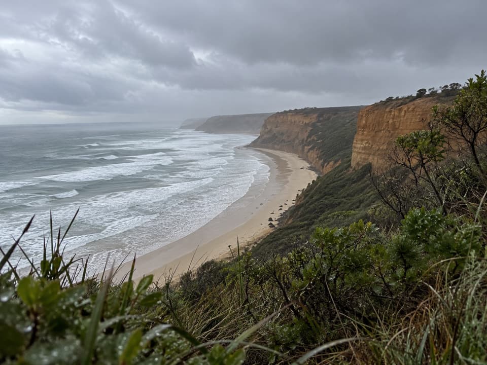
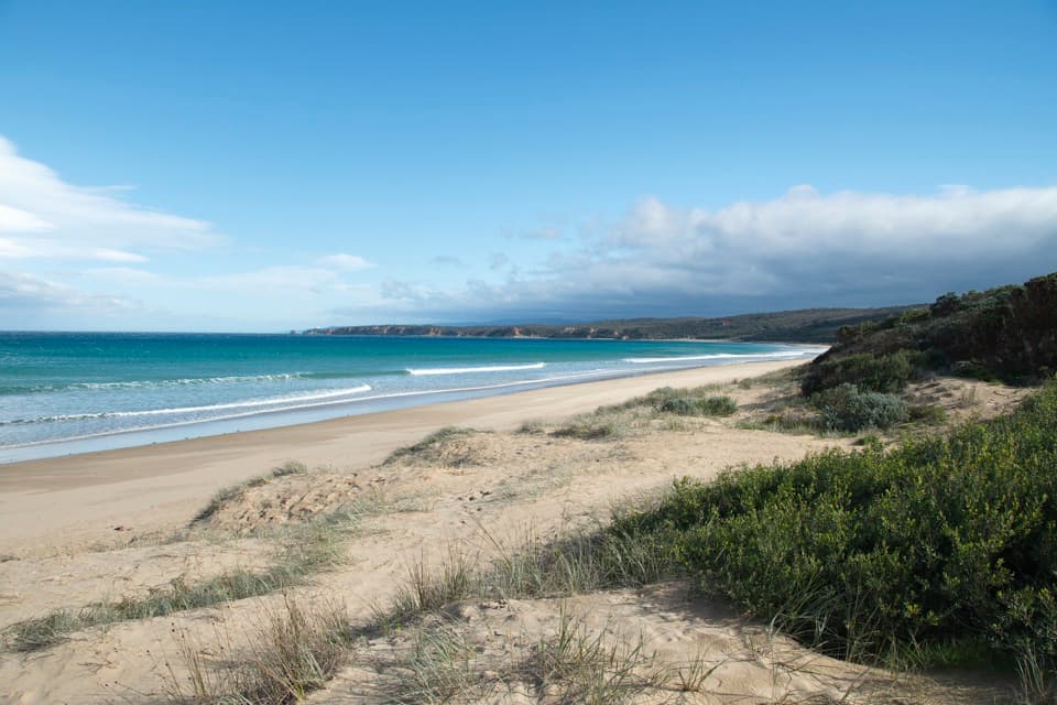
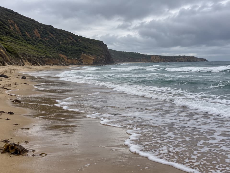
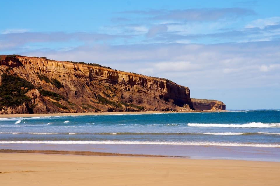
A long curve of sand beneath red cliffs and low-tide rockpools.

Photo: Flickr
Type
Beach
Nearest trail
2.3 km
Audio stories
4 nearby
  • Parking
  • Restrooms

Hear the audio tour

Point Addis: Coast from the Boardwalk

Overview

About Addiscot Beach

Why stop

  • A 1.8 km shore beneath striking cliffs up to about 80 m.

Heads up

  • The shore connection beneath Jarosite depends on low tide.

Map

Where it is

Loading the Great Otway map
Full map
BeachAddiscot Beach-38.37868, 144.26921
Keep this map with you offline in the Parkwolf app

Plan your stop

Before you go

3 active Great Otway alerts

  • ClosureWye Road closed after storm and flood damageWye Road is closed until further notice because recent storm and flood damage requires road maintenance and repair works; plan around the closure.Official details
  • ClosureLorne-area walking trails closed after flood damageSome walking trails near Lorne are closed for public safety after the January 2026 flash floods washed away or severely damaged bridges and walkways.Official details

See all 3 alerts
A park ranger sits on a dash-mounted phone, talking, as Parkwolf’s Tour Guide plays “Army Cutworm Moths: A Grizzly Bear Buffet” on Grand Loop Road below Dunraven Pass in Yellowstone
Parkwolf Tour GuideThe highest, rockiest slopes around here are a summer buffet for grizzly bears.

Great Otway Tour Guide

Your drive to Addiscot Beach, narrated.

Parkwolf is a GPS audio tour guide for Great Otway National Park. As you drive, it chimes in with what’s ahead: hidden gems, upcoming stops, history, geology, and wildlife, right through your car’s speakers.

See the Great Otway audio tour

Recorded for this place

Point Addis: Coast from the Boardwalk
0:00 / 0:30
“Point Addis is coming up, with a boardwalk linking several lookouts above the surf and sandy cove.”

Plays as you drive up to Addiscot Beach in the Parkwolf Great Otway Tour Guide.

More stories near here in the app

  • Southside Beach: Below the Cliffs
  • Ironbark Basin: A Woodland Picnic
  • An Orchid with a Hinged Trap
  • Before Bass Strait Was Sea
  • 252 audio storiesacross Great Otway’s roads, triggered by GPS as you drive
  • Wildlife heatmapsfor Koala, Grey Kangaroo, Echidna, and 13 more
  • Works offlinemaps, 83 trails, 79 places, and audio download before you lose signal
  • CarPlay readysimple controls built for the drive
★★★★★
“Fantastic app with many points of information… It’s great to just turn on while you’re driving and it gives you an audio tour of the national Park. We love it!!!!”
JMJamesApp Store review
Download Parkwolf on the App StoreGet Parkwolf on Google Play

4.7 from 8,600+ ratings

Guide

More about Addiscot Beach

A long beach on the Surf CoastAddiscot Beach is a 1.

Addiscot Beach is a 1.8 km, southeast-facing curve of sand east of Point Addis, backed by red, slumping cliffs that reach about 80 m near Jarosite Headland. Go for a beach walk, look for rockpools at low tide, or watch the smaller wave breaks that make it a local surf-school spot. Time the shore route beneath Jarosite for low tide; high water can make that connecting stretch impassable.

Stay clear of the cliff lineThe steep cliffs are made of soft sand and clay and continue to erode.

The steep cliffs are made of soft sand and clay and continue to erode. Keep well away from their edges and bases, and obey any signs or closures. This is open coast with strong currents and undertows, and no Surf Life Saving Australia service is listed for the beach. For a photo, include the sweep of shoreline and cliff wall together; a tight crop of the cliffs hides their scale.

Before you goPoint Addis Road reaches the access car park, with public toilets at Point Addis rather than on…

Point Addis Road reaches the access car park, with public toilets at Point Addis rather than on the sand. There is no food service listed at the beach, so bring water and a snack. Dogs are allowed on lead. The eastern end is officially optional-clothing; that applies to that end, not the whole beach.

The name and CountryThe beach's name is tied to nearby Addiscot Homestead, which local history traces to a cottage…

The beach's name is tied to nearby Addiscot Homestead, which local history traces to a cottage belonging to Edward Brown Addis, Commissioner of Crown Lands. This is Wadawurrung Sea Country; Wadawurrung Traditional Owners maintain a continuing connection to and role in caring for this coast.

Wildlife

Wildlife in Great Otway

All Great Otway wildlife maps

Sighting maps show where each species has been reported across Great Otway. Wildlife moves, so no sighting is guaranteed.

Parkwolf’s Great Otway ranking

Top sights in Great Otway

All 79 places
  1. 1Cape Otway LightstationSight
  2. 2Erskine FallsSight
  3. 3Hopetoun FallsSight
  4. 4Triplet FallsSight
  5. 5Aire Valley RedwoodsSight
  6. 6Lake ElizabethSight

Take Parkwolf to Great Otway.

The audio tour guide for the drive, plus offline maps, trails, and wildlife heatmaps for when the signal drops.

4.7 from 8,600+ ratings

Download Parkwolf on the App StoreGet Parkwolf on Google Play