Finley Cane, Bote Mountain and Lead Cove Loop in Great Smoky Mountains National Park

Great Smoky Mountains National Park, TN · NC

Finley Cane, Bote Mountain and Lead Cove Loop

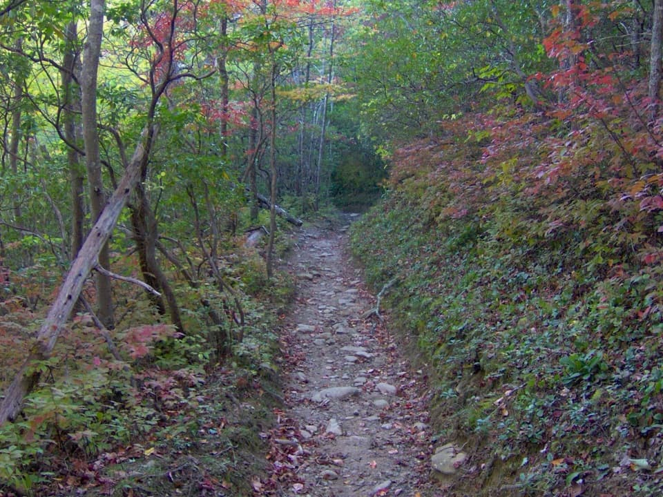
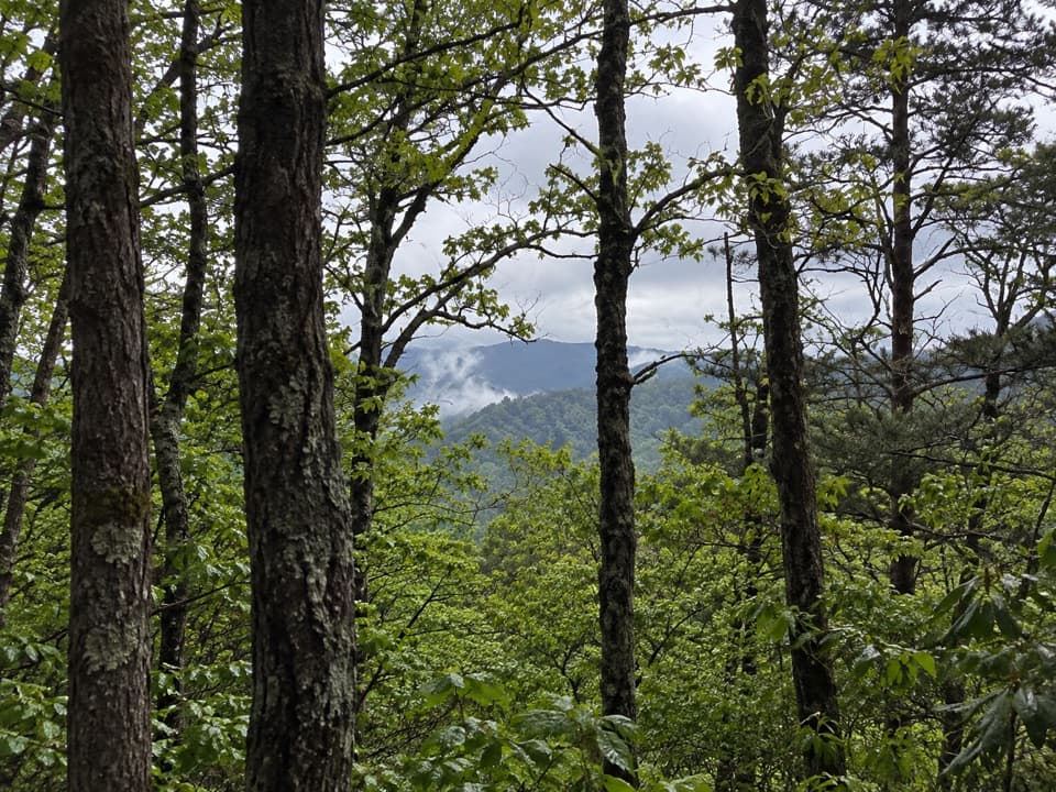
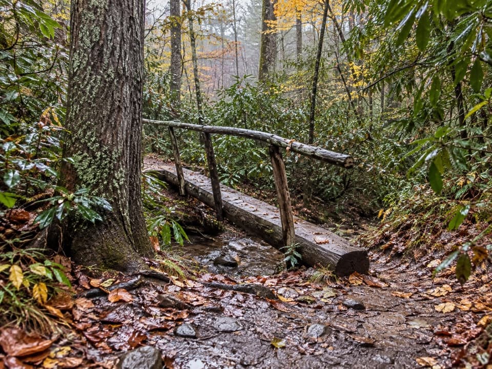
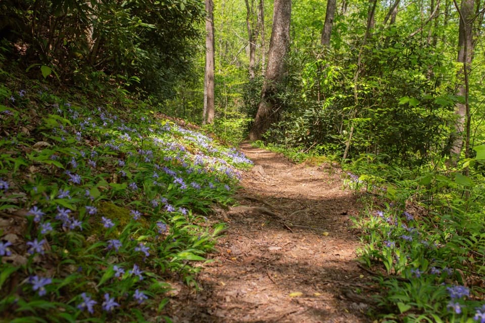
A rhododendron tunnel leads to a rocky ridge with valley views.

Photo: National Park Service
Length
6.9mi
Time
4hr
Elev. change
1,188ft
Difficulty
Moderate
  • Loop
  • No dogs
  • High point 3,005 ft
  • #96 of 197 in Great Smoky Mountains

Hear the audio tour

Lead Cove and Finley Cane Trailheads

Overview

About Finley Cane, Bote Mountain and Lead Cove Loop

Why go

  • A half-mile rhododendron tunnel followed by a drier ridge walk.
  • Leaf-off season opens views both east and west from Bote Mountain.

Heads up

  • Steep grades, roots, loose gravel and creek crossings slow the walk.
  • Roadside pull-offs are shared with nearby trailheads.

Map & elevation

The route

Loading the Great Smoky Mountains map
Full map
Elevation1,818–3,005 ft
TrailheadFinley Cane Trailhead, Laurel Creek Road pull-offs35.60684, -83.74488
Keep this map with you offline in the Parkwolf app

Plan your hike

Before you go

Parking

Driving west on Laurel Creek Road toward Cades Cove, use either of the two paved pull-offs on the left (south) side near Finley Cane Trailhead. They also serve Lead Cove and Turkeypen Ridge; parking on the opposite side requires crossing a road that can carry heavy traffic.

Safety

Steep grades, protruding roots, rocky sections, loose gravel and stream crossings make footing uneven. Pets are not allowed on this trail. A parking tag is required if you leave your car longer than 15 minutes.

7 active Great Smoky Mountains alerts

  • ClosureHurricane Helene backcountry trail closures and hazardsHurricane Helene damage has closed backcountry trails and left hazardous crossings; avoid closed routes and heed trail-specific restrictions.Official details
  • CautionBear-related trail, road, shelter, and campsite restrictionsBear activity has closed trails, a shelter, and campsites and restricted pedestrian access on Cherokee Orchard Road; follow the vehicle restrictions and avoid closed areas.Official details
See all 7 alerts
A park ranger sits on a dash-mounted phone, talking, as Parkwolf’s Tour Guide plays “Army Cutworm Moths: A Grizzly Bear Buffet” on Grand Loop Road below Dunraven Pass in Yellowstone
Parkwolf Tour GuideThe highest, rockiest slopes around here are a summer buffet for grizzly bears.

Great Smoky Mountains Tour Guide

Your drive to Finley Cane, Bote Mountain and Lead Cove Loop, narrated.

Parkwolf is a GPS audio tour guide for Great Smoky Mountains National Park. As you drive, it chimes in with what’s ahead: hidden gems, upcoming stops, history, geology, and wildlife, right through your car’s speakers.

See the Great Smoky Mountains audio tour

Recorded for this trailhead

Lead Cove and Finley Cane Trailheads
0:00 / 0:29
“You're approaching the Lead Cove and Finley Cane trailheads on Laurel Creek Road. For a half-day forest hike, I'd choose the six point nine-mile loop through Finley Cane's rhododendron tunnel and across Bote Mountain.”

Plays as you drive up to this trailhead in the Parkwolf Great Smoky Mountains Tour Guide.

More stories near here in the app

  • A Mayfly's Longer Life
  • Cades Cove Picnic Area
  • Schoolhouse Gap Trailhead
  • Cades Cove Campground Store and Riding Stables
  • 188 audio storiesacross Great Smoky Mountains’s roads, triggered by GPS as you drive
  • Wildlife heatmapsfor Black Bear, Elk, Bald Eagle, and 13 more
  • Works offlinemaps, 197 trails, 100 places, and audio download before you lose signal
  • CarPlay readysimple controls built for the drive
★★★★★
“Fantastic app with many points of information… It’s great to just turn on while you’re driving and it gives you an audio tour of the national Park. We love it!!!!”
JMJamesApp Store review
Download Parkwolf on the App StoreGet Parkwolf on Google Play

4.7 from 8,600+ ratings

Trail guide

Hiking Finley Cane, Bote Mountain and Lead Cove Loop

A half-day loopFinley Cane, Bote Mountain and Lead Cove make a 6.

Finley Cane, Bote Mountain and Lead Cove make a 6.9-mile loop from the Laurel Creek Road trailhead. The short Finley Cane access segment joins the loop; then follow Finley Cane uphill to Bote Mountain, cross the ridge to Lead Cove, and descend to the same trailhead. With 1,215 feet of climbing, roots, loose gravel, rocks and creek crossings, plan on about four hours. The reward is a changing walk: shaded forest gives way to drier ridge tread and valley openings, then hardwood shade on the return.

Through the Finley Cane thicketFrom the road, Finley Cane turns into rhododendron, magnolia and hemlock, with small creek…

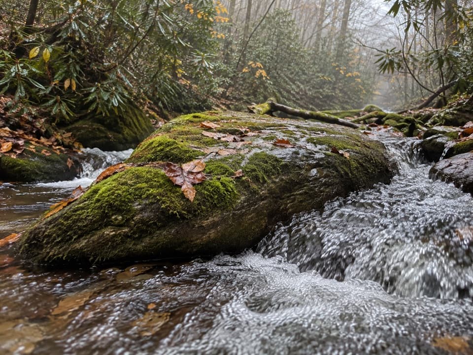
From the road, Finley Cane turns into rhododendron, magnolia and hemlock, with small creek crossings. A half-mile rhododendron tunnel is the standout stretch; its tight green corridor then opens into hardwoods. The last mile climbs more steadily toward Bote Mountain. The small crossings are usually rock hops, but roots and uneven stones keep this section from feeling like a smooth walk.

Across Bote MountainBote Mountain is the drier, rougher part of the circuit: the tread turns rockier and sandier,…

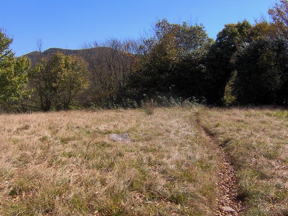
Bote Mountain is the drier, rougher part of the circuit: the tread turns rockier and sandier, with a sustained uphill start and a gentler middle along the ridge. Openings look across the valley toward Defeat Ridge. In winter, leaf-off conditions open views east and west; spring brings wildflowers, summer more shade, and fall leaf-lined vistas. Views are intermittent rather than a continuous panorama, so pause at the openings before starting the descent.

Down Lead CoveLead Cove drops through mixed hardwoods and tulip poplars.

Lead Cove drops through mixed hardwoods and tulip poplars. Stream crossings and a steep grade make the final leg more demanding than its shade suggests; expect to keep choosing your footing among rocks and roots until the path returns to Laurel Creek Road.

Parking and rulesDriving west on Laurel Creek Road toward Cades Cove, use one of the two paved pull-offs on the…

Driving west on Laurel Creek Road toward Cades Cove, use one of the two paved pull-offs on the left (south) side near Finley Cane Trailhead. They also serve Lead Cove and Turkeypen Ridge; crossing from parking on the opposite side means crossing a road that can carry heavy traffic. No restroom is listed on the route; the nearest listed restroom is at Cades Cove Picnic Area, a separate stop. Pets are not allowed, and a parking tag is required for parking longer than 15 minutes.

Wildlife

Wildlife in Great Smoky Mountains

All Great Smoky Mountains wildlife maps

Sighting maps show where each species has been reported across Great Smoky Mountains. Wildlife moves, so no sighting is guaranteed.

Keep exploring

Near Finley Cane, Bote Mountain and Lead Cove Loop

See it all on the map

Trails that start nearby

Places near the trailhead

Parkwolf’s Great Smoky Mountains ranking

Top-rated trails in Great Smoky Mountains

All 197 trails
  1. 1Mount Le Conte via Alum Cave TrailChallenging · 10 mi
  2. 2Charlies Bunion via Appalachian TrailModerate · 8 mi
  3. 3Alum Cave Trail to Alum Cave BluffsModerate · 4.6 mi
  4. 4Ramsey Cascades TrailChallenging · 8 mi
  5. 5Mount Cammerer TrailChallenging · 11.1 mi
  6. 6Gregory Ridge TrailChallenging · 11.4 mi

Take Parkwolf to Great Smoky Mountains.

The audio tour guide for the drive, plus offline maps, trails, and wildlife heatmaps for when the signal drops.

4.7 from 8,600+ ratings

Download Parkwolf on the App StoreGet Parkwolf on Google Play