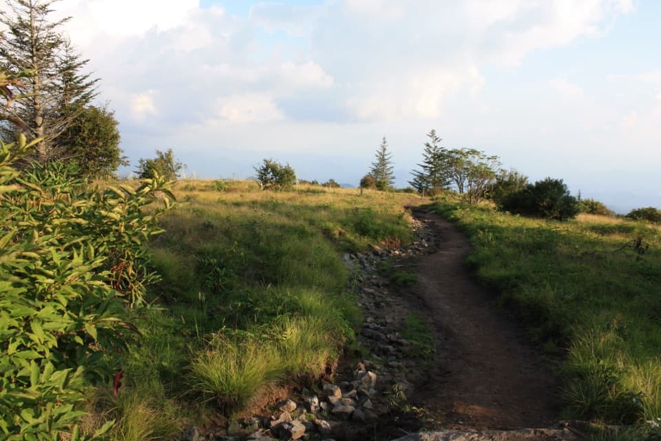
Charlies Bunion via Appalachian Trail in Great Smoky Mountains National Park

#2 of 197 trails in Great Smoky Mountains

Great Smoky Mountains National Park, TN · NC

Charlies Bunion via Appalachian Trail

An 8-mile Appalachian Trail out-and-back to an exposed Smokies outcrop

Photo: Public Domain
Length
8mi
Time
5hr
Elev. change
1,052ft
Difficulty
Moderate
  • No dogs
  • High point 6,096 ft

Hear the audio tour

Newfound Gap and the Rockefeller Memorial

Overview

About Charlies Bunion via Appalachian Trail

Why go

  • A distinctive rock outcrop and wide mountain views reward the long walk.
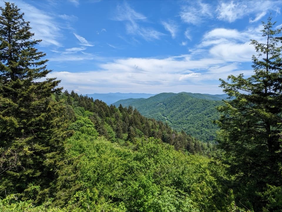
  • Hardwood forest gives way to high-elevation spruce-fir along the ridge.

Heads up

  • Eight miles with repeated climbs makes this a half-day commitment.
  • Rocky, rooty footing and exposed cliffs need care.

Map & elevation

The route

Loading the Great Smoky Mountains map
Full map
Elevation5,045–6,096 ft
TrailheadAppalachian Trailhead, Newfound Gap Overlook35.61129, -83.42532
Keep this map with you offline in the Parkwolf app

Plan your hike

Before you go

Parking

Newfound Gap Overlook on US 441/Newfound Gap Road. The Appalachian Trail starts at the far end of the parking area, to the left of the overlook. The lot often fills; the park recommends considering a shuttle. A parking tag is required when parked longer than 15 minutes.

Safety

Steep, exposed cliffs at Charlies Bunion; keep well back from edges. Rocky and rooty footing can be muddy after rain. Ice is possible in cold weather; microspikes are recommended in winter. Pets are not allowed. A parking tag is required for stays longer than 15 minutes.

7 active Great Smoky Mountains alerts

  • ClosureHurricane Helene backcountry trail closures and hazardsHurricane Helene damage has closed backcountry trails and left hazardous crossings; avoid closed routes and heed trail-specific restrictions.Official details
  • CautionBear-related trail, road, shelter, and campsite restrictionsBear activity has closed trails, a shelter, and campsites and restricted pedestrian access on Cherokee Orchard Road; follow the vehicle restrictions and avoid closed areas.Official details
See all 7 alerts
A park ranger sits on a dash-mounted phone, talking, as Parkwolf’s Tour Guide plays “Army Cutworm Moths: A Grizzly Bear Buffet” on Grand Loop Road below Dunraven Pass in Yellowstone
Parkwolf Tour GuideThe highest, rockiest slopes around here are a summer buffet for grizzly bears.

Great Smoky Mountains Tour Guide

Your drive to Charlies Bunion via Appalachian Trail, narrated.

Parkwolf is a GPS audio tour guide for Great Smoky Mountains National Park. As you drive, it chimes in with what’s ahead: hidden gems, upcoming stops, history, geology, and wildlife, right through your car’s speakers.

See the Great Smoky Mountains audio tour

Recorded for this trailhead

Newfound Gap and the Rockefeller Memorial
0:00 / 0:33
“Newfound Gap is coming up, where the road crosses the Tennessee and North Carolina state line. This is a good stop for mountain views without a hike.”

Plays as you drive up to this trailhead in the Parkwolf Great Smoky Mountains Tour Guide.

More stories near here in the app

  • Ben Morton Overlook
  • Tulips Above Your Head
  • A Waterfall as a Refuge
  • Deep Creek Valley Overlook
  • 188 audio storiesacross Great Smoky Mountains’s roads, triggered by GPS as you drive
  • Wildlife heatmapsfor Black Bear, Elk, Bald Eagle, and 13 more
  • Works offlinemaps, 197 trails, 100 places, and audio download before you lose signal
  • CarPlay readysimple controls built for the drive
★★★★★
“Fantastic app with many points of information… It’s great to just turn on while you’re driving and it gives you an audio tour of the national Park. We love it!!!!”
JMJamesApp Store review
Download Parkwolf on the App StoreGet Parkwolf on Google Play

4.7 from 8,600+ ratings

Trail guide

Hiking Charlies Bunion via Appalachian Trail

Is this the half-day hike you want?Charlies Bunion via the Appalachian Trail is an 8-mile out-and-back from Newfound Gap Overlook…

Charlies Bunion via the Appalachian Trail is an 8-mile out-and-back from Newfound Gap Overlook to a distinctive rocky outcrop high above the Smokies. The 8 miles is the full walk there and back; the map follows the trail corridor once to the destination. Allow about four to six hours with stops. It is a strong choice if you want a real ridge hike and a memorable rocky endpoint, but it takes most of a day rather than fitting between quick overlooks.

Start with the climbThe Appalachian Trail begins at the far end of the Newfound Gap Overlook parking area, to the…

The Appalachian Trail begins at the far end of the Newfound Gap Overlook parking area, to the left of the overlook. The tread starts broad and firm, then narrows as it climbs toward Mount Ambler. The early uphill is a good reason to settle into an easy pace; there is still a long way to walk after the first climb. On the return, every descent you enjoyed on the way out becomes another uphill.

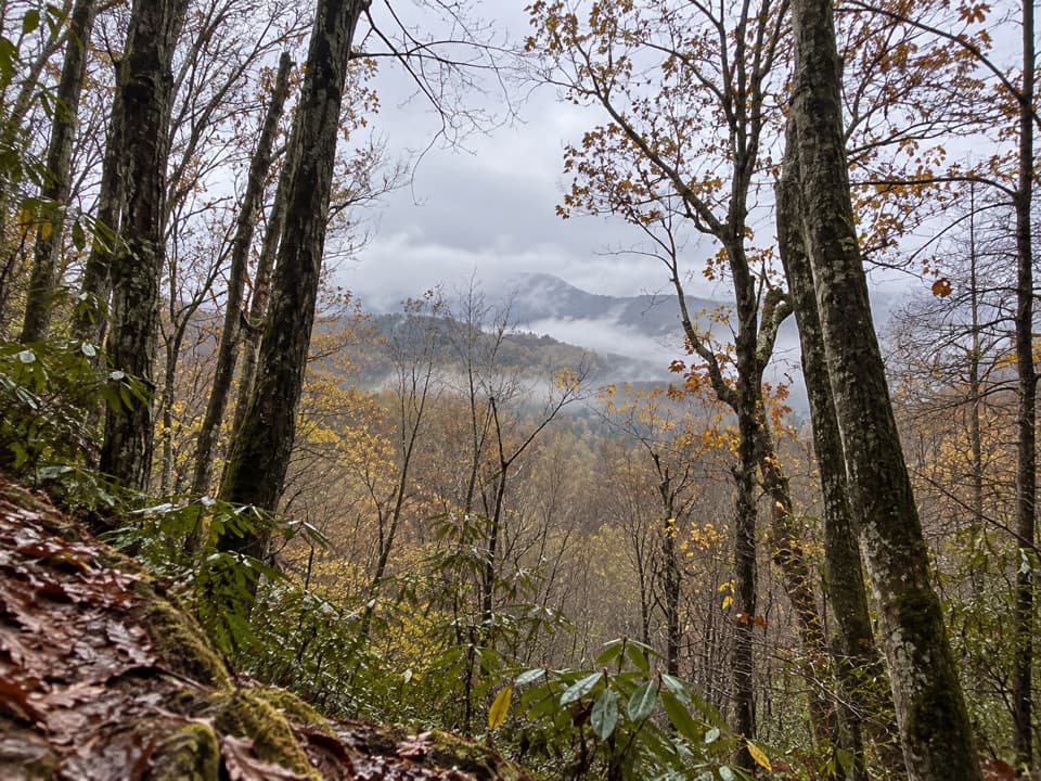
Watch the forest changeThe route moves from hardwood forest into high-elevation spruce-fir forest.

The route moves from hardwood forest into high-elevation spruce-fir forest. Shaded woods and stretches of open ridge trade places along the way, with mountain views appearing between the trees rather than all at once. That changing feel is part of the walk: it builds from a forest trail into a high-country ridge journey before the Bunion comes into view.

Expect a rolling route, not one climbAfter the climb toward Mount Ambler, the trail drops toward Masa Knob and continues toward…

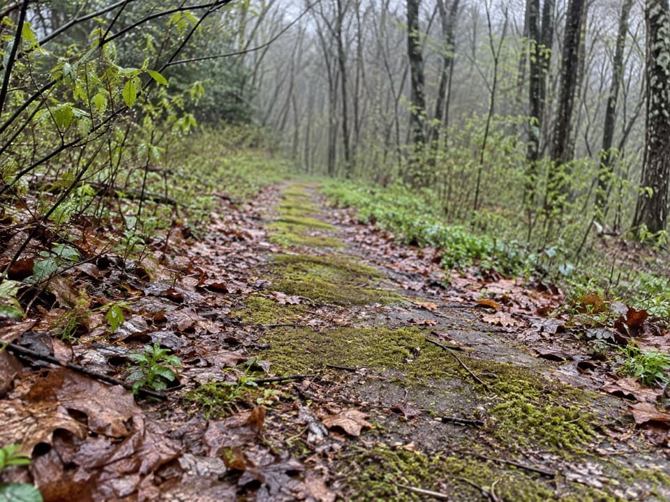
After the climb toward Mount Ambler, the trail drops toward Masa Knob and continues toward Charlies Bunion. There are more rises and descents along this section, so the mileage can feel longer than the map suggests. Hikers repeatedly describe rocky, rooty footing, with logs and steps underfoot; wet weather can leave some stretches muddy. Leave time for the ground as well as the distance, especially if you prefer a careful pace.

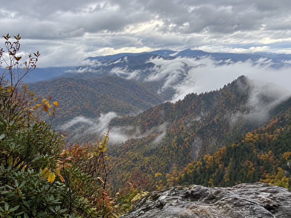
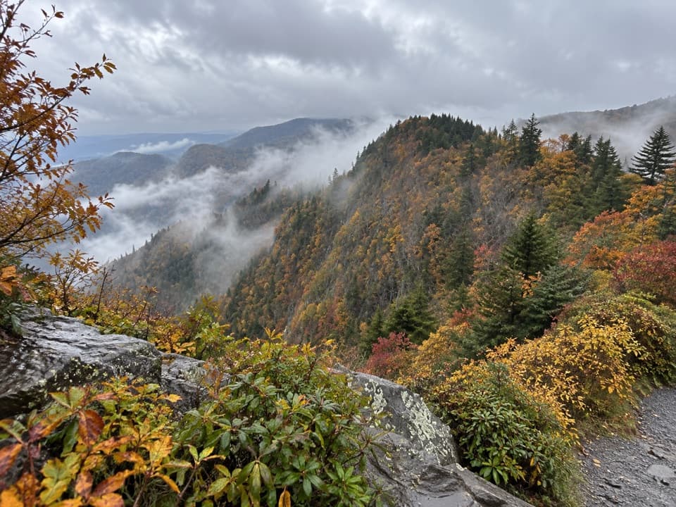
The rocky finishCharlies Bunion is a striking outcrop with broad views across the surrounding mountains.

Charlies Bunion is a striking outcrop with broad views across the surrounding mountains. The last few minutes bring you from the forest to exposed rock, and steep cliffs sit close to parts of the destination. Keep back from edges and choose a stable place to stop. The rock makes a distinctive foreground against the ridges, so there is plenty to frame without edging closer. A separate side trip to The Jump Off can lengthen the day, but it is not part of this route or the 8-mile total.

Access, rules, and cold weatherPark at Newfound Gap Overlook on US 441/Newfound Gap Road.

Park at Newfound Gap Overlook on US 441/Newfound Gap Road. The Appalachian Trail starts at the far end of the lot, left of the overlook. The lot often fills; the park recommends considering a shuttle. A parking tag is required for stays longer than 15 minutes. Pets are not allowed on this trail. In cold weather, expect the possibility of ice; microspikes are recommended in winter.

Wildlife

Wildlife in Great Smoky Mountains

All Great Smoky Mountains wildlife maps

Sighting maps show where each species has been reported across Great Smoky Mountains. Wildlife moves, so no sighting is guaranteed.

Keep exploring

Near Charlies Bunion via Appalachian Trail

See it all on the map

Trails that start nearby

Places near the trailhead

Parkwolf’s Great Smoky Mountains ranking

Top-rated trails in Great Smoky Mountains

All 197 trails
  1. 1Mount Le Conte via Alum Cave TrailChallenging · 10 mi
  2. 3Alum Cave Trail to Alum Cave BluffsModerate · 4.6 mi
  3. 4Ramsey Cascades TrailChallenging · 8 mi
  4. 5Mount Cammerer TrailChallenging · 11.1 mi
  5. 6Gregory Ridge TrailChallenging · 11.4 mi
  6. 7Forney Ridge Trail to Andrews BaldModerate · 3.6 mi

Take Parkwolf to Great Smoky Mountains.

The audio tour guide for the drive, plus offline maps, trails, and wildlife heatmaps for when the signal drops.

4.7 from 8,600+ ratings

Download Parkwolf on the App StoreGet Parkwolf on Google Play