McKittrick Canyon to Dog Canyon in Guadalupe Mountains National Park

Guadalupe Mountains National Park, TX

McKittrick Canyon to Dog Canyon

A canyon climb, a high ridge, and a finish in Dog Canyon.

Photo: Public Domain
Length
15mi
Time
10hr
Elev. change
2,841ft
Difficulty
Challenging
  • No dogs
  • High point 7,844 ft

Hear the audio tour

McKittrick Canyon: A Walk to Pratt Cabin

Overview

About McKittrick Canyon to Dog Canyon

Why go

  • A rare full crossing from wooded canyon to ridge and northern grassland.
  • Pratt Cabin, The Grotto and The Notch break the long climb into memorable landmarks.

Heads up

  • No shuttle; the two trailheads are about a two-hour drive apart.
  • Long, strenuous backcountry route with no identified potable-water refill along the way.

Map & elevation

The route

Loading the Guadalupe Mountains map
Full map
Elevation5,003–7,844 ft
TrailheadMcKittrick Canyon Trailhead31.97778, -104.75236
Keep this map with you offline in the Parkwolf app

Plan your hike

Before you go

Parking

Start at McKittrick Canyon Trailhead and finish at Dog Canyon Trailhead. The drive between them takes about two hours and the park has no shuttle, so arrange a pickup or leave vehicles at both ends. Both trailhead areas have accessible parking; capacity and fees were not found.


Safety

The route gains 2,380 feet in a steep two-mile climb over loose or hardened rock. Carry all water; no dependable potable refill point was identified along the route. The McKittrick Canyon gate closes daily at 5 p.m. Mountain Time, and hikers must be out of the day-use area by then.

1 active Guadalupe Mountains alert

  • CautionDevil’s Hall wash dangerous when wetThe Devil’s Hall hike is strenuous, and its wash section is dangerous when wet or if water is present. - The wash requires rock scrambling.Official details
Guadalupe Mountains alerts
A park ranger sits on a dash-mounted phone, talking, as Parkwolf’s Tour Guide plays “Army Cutworm Moths: A Grizzly Bear Buffet” on Grand Loop Road below Dunraven Pass in Yellowstone
Parkwolf Tour GuideThe highest, rockiest slopes around here are a summer buffet for grizzly bears.

Guadalupe Mountains Tour Guide

Your drive to McKittrick Canyon to Dog Canyon, narrated.

Parkwolf is a GPS audio tour guide for Guadalupe Mountains National Park. As you drive, it chimes in with what’s ahead: hidden gems, upcoming stops, history, geology, and wildlife, right through your car’s speakers.

Recorded for this area

McKittrick Canyon: A Walk to Pratt Cabin
0:00 / 0:27
“McKittrick Canyon's trailhead is coming up. I'd choose the walk to Pratt Cabin, a stone summer home with a porch for a break. It's four point eight miles round trip, taking two to four hours on rocky ground.”

Plays on the road 0.2 mi from the trailhead in the Parkwolf Guadalupe Mountains Tour Guide.

More stories near here in the app

  • The Madrone’s Peeling Trunk
  • Trout in a Desert Canyon
  • Pratt's Ship on the Desert
  • A Shell from the Permian Sea
  • 22 audio storiesacross Guadalupe Mountains’s roads, triggered by GPS as you drive
  • Wildlife heatmapsfor Aoudad, Mule Deer, Wild Turkey, and 13 more
  • Works offlinemaps, 32 trails, 34 places, and audio download before you lose signal
  • CarPlay readysimple controls built for the drive
★★★★★
“Fantastic app with many points of information… It’s great to just turn on while you’re driving and it gives you an audio tour of the national Park. We love it!!!!”
JMJamesApp Store review
Download Parkwolf on the App StoreGet Parkwolf on Google Play

4.7 from 8,600+ ratings

Trail guide

Hiking McKittrick Canyon to Dog Canyon

The full traverseMcKittrick Canyon to Dog Canyon is a 15.

McKittrick Canyon to Dog Canyon is a 15.0-mile one-way point-to-point hike across Guadalupe Mountains National Park. It begins on the floor of South McKittrick Canyon, climbs over McKittrick Ridge, then descends north on Tejas Trail to Dog Canyon. Allow 8 to 12 hours of walking on strenuous terrain. Plan for two days and one night on the ridge, as the park itinerary recommends. The reward is a complete change of scene, from the canyon's wooded floor to a high limestone ridge and the open northern country.

Plan the two endsThe route does not return to its start.

The route does not return to its start. There is no park shuttle, and the road drive between the trailheads takes about two hours, so arrange a pickup or leave a vehicle at each end. Both trailhead areas have accessible parking; lot sizes and fees were not found. The McKittrick Canyon gate closes daily at 5 p.m. Mountain Time, and hikers must be out of the day-use area by closing. A day hike needs no reservation, but any backcountry overnight requires a wilderness permit. Staying at the developed Dog Canyon Campground requires a separate reservation. Carry all food and water for the route; no food service or dependable potable refill point was identified on trail.
Through South McKittrick CanyonThe first four miles follow the canyon floor through a sequence of wooded, water-carved…

The first four miles follow the canyon floor through a sequence of wooded, water-carved environments. Pratt Cabin, The Grotto and The Notch are useful landmarks at about 2.3, 3.5 and 4.5 miles from the trailhead. The lower walk is generally easy to follow, then narrows and grows rockier beyond The Grotto. Stay on the tread and out of the water to protect the canyon habitat. In autumn, the canyon's deciduous trees add color beneath its pale limestone walls.

Climb to McKittrick RidgeAfter The Notch, the route climbs about 2,380 feet in roughly two miles over loose or hardened…

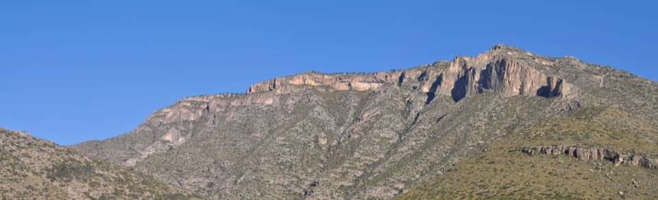
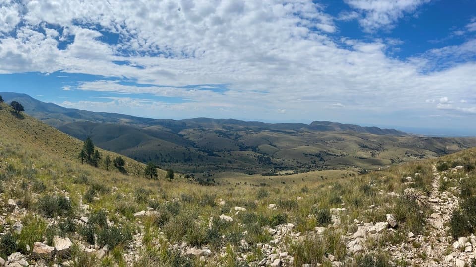
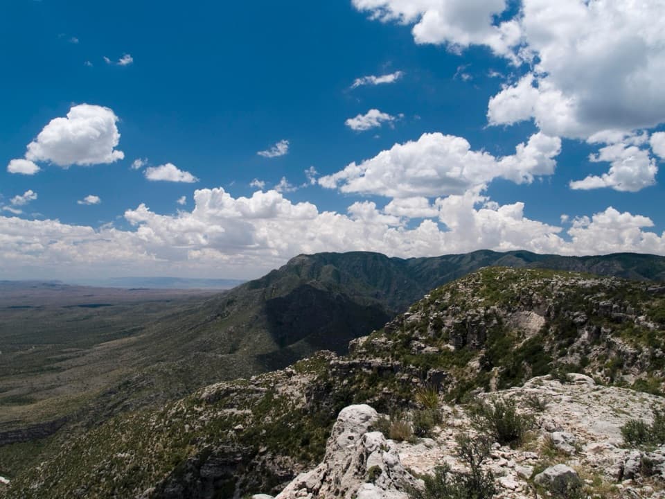
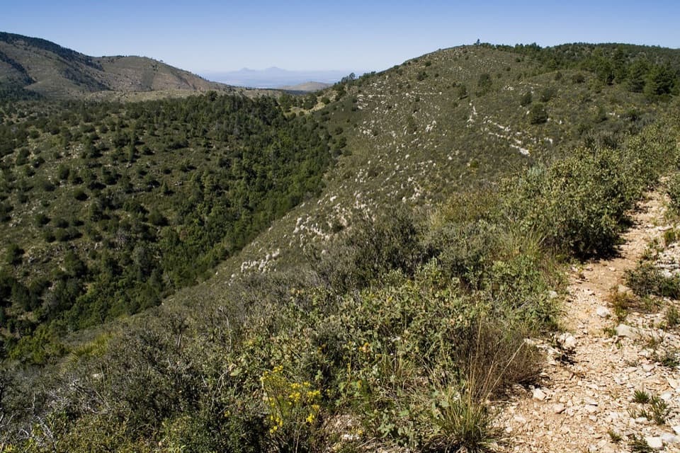
After The Notch, the route climbs about 2,380 feet in roughly two miles over loose or hardened rock. Poles help on this sustained ascent. Views open back into South McKittrick Canyon and across its bordering ridges; false summits can make the top seem nearer than it is. From The Notch, look both ways down the canyon for the defining view of the wooded floor between steep walls. The ridge reaches 7,916 feet before the gradual descent toward Tejas Trail.

Cross the northern high countryThe trail passes the saddle at Lost Peak, not its summit; no trail reaches the top.

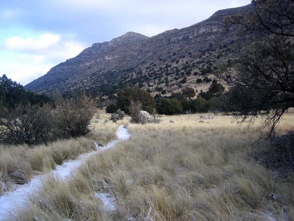
The trail passes the saddle at Lost Peak, not its summit; no trail reaches the top. Beyond the saddle the landscape opens into the grassy northern part of the park. At the Tejas junction, turn north for the final 4.0 miles to Dog Canyon Trailhead. Dog Canyon sits at about 6,300 feet, so the endpoint is still high country, not a low desert exit.

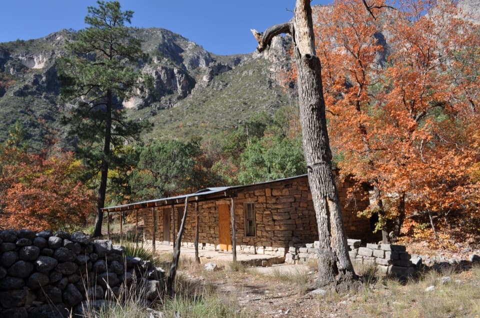
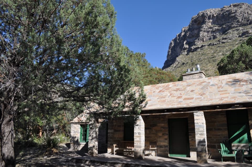
Pratt Cabin and the park's beginningsPratt Cabin, also called the Stone Cabin, stands along the canyon route.

Pratt Cabin, also called the Stone Cabin, stands along the canyon route. Petroleum geologist Wallace Pratt became captivated by McKittrick Canyon in 1921 and later used the cabin as a summer home with his family. He donated nearly 6,000 acres of canyon land, which became the nucleus of the national park. Houston architect John F. Staub designed the cabin, built mostly from local limestone and pine.

A shorter canyon walkIf you want the canyon without the ridge traverse and its transport problem, turn around at The…

If you want the canyon without the ridge traverse and its transport problem, turn around at The Grotto for about 7 miles round trip, or at The Notch for about 9 miles round trip. Both use the same opening section, but neither includes the route to Dog Canyon.

Wildlife

Wildlife in Guadalupe Mountains

All Guadalupe Mountains wildlife maps

Sighting maps show where each species has been reported across Guadalupe Mountains. Wildlife moves, so no sighting is guaranteed.

Keep exploring

Near McKittrick Canyon to Dog Canyon

See it all on the map

Trails that start nearby

Places near the trailhead

Parkwolf’s Guadalupe Mountains ranking

Top-rated trails in Guadalupe Mountains

All 32 trails
  1. 1Guadalupe Peak TrailChallenging · 8.4 mi
  2. 2The Grotto and Hunter Line ShackModerate · 7 mi
  3. 3McKittrick Canyon Trail to The NotchChallenging · 9 mi
  4. 4Hunter Peak LoopChallenging · 8.7 mi
  5. 5Devil's Hall TrailChallenging · 4.2 mi
  6. 6Smith Spring Trail LoopModerate · 2.3 mi

Take Parkwolf to Guadalupe Mountains.

The audio tour guide for the drive, plus offline maps, trails, and wildlife heatmaps for when the signal drops.

4.7 from 8,600+ ratings

Download Parkwolf on the App StoreGet Parkwolf on Google Play