Pros & cons
PROS
- Gypsum sand tends to stay cooler than typical quartz, improving comfort on hot days.
- Remote trailhead still offers shade structures and pit toilets—rare in such a quiet corner.
CONS
- Clay access road can become impassable when wet, stranding vehicles.
- Multiple two-tracks near the trailhead make it easy to pick the wrong return route.
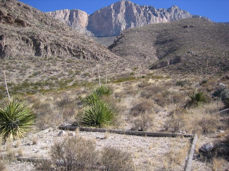
Park at the Salt Basin Dunes trailhead at the end of Williams Road; large lot with accessible and RV/bus spaces, shade structures, and pit toilets. No water available.
Remote, hot, and exposed; carry ample water and sun protection. Clay access road becomes dangerously slick when wet. Mind multiple two-tracks to avoid getting off-route. Avoid stepping on fragile soil crusts; wildlife (including rattlesnakes and scorpions) is present.
Overview
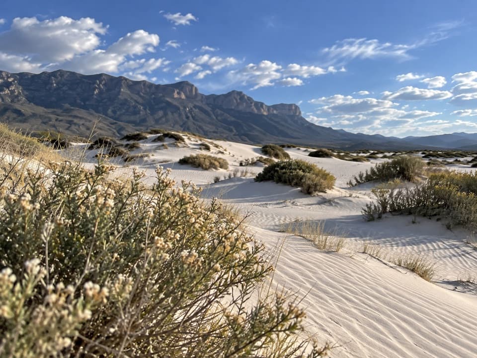
A rare gypsum dune field in Texas, the Salt Basin Dunes delivers a big visual payoff for modest effort. Figure on roughly 3.0 miles total out-and-back to the edge of the dunes (about 1.5 miles each way on an old road); exploring the dune field itself adds optional wandering. Expect soft, bright-white sand, sweeping views of the Guadalupe Mountains’ western escarpment, and a surprisingly quiet, remote vibe.
What the Hike Is Like
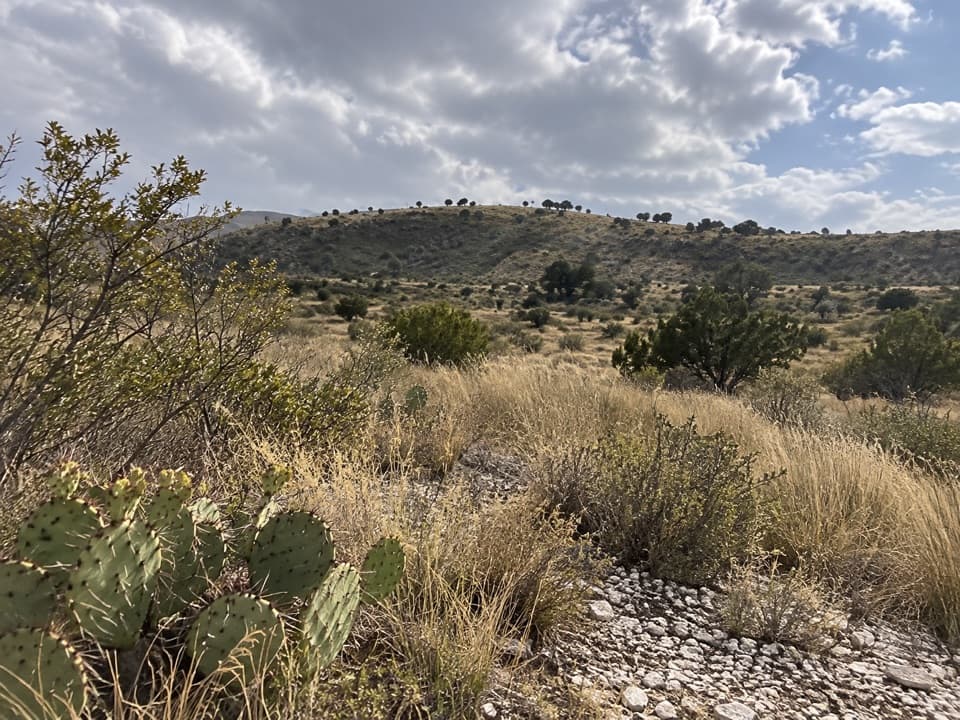
From the signed trailhead, follow the flat, old two-track across desert scrub toward the shimmering dune line. The road-walk is easy, but the last stretch transitions to sand where your pace slows. The tallest, largely unvegetated dunes sit to the north (some up to about 60 feet); lower, more vegetated dunes lie to the south. Navigation is straightforward out, but multiple two-tracks intersect—drop a pin and make a mental note of junctions so you don’t follow the wrong spur on the way back.
Highlights and Nature Notes
You’re walking on gypsum, not typical quartz sand—so it’s softer underfoot and tends to stay cooler. The dune field spans roughly 2,000 acres and feels otherworldly under low-angle light. Keep an eye out for gypsum-adapted plants and the white color variant of the lesser earless lizard. Rattlesnakes and scorpions are present; give wildlife space and watch your footing in open sand. Views from the dunes sweep across the basin to the high peaks of the Guadalupe range.
Access, Facilities, and Rules
This is a day-use area only: open from sunrise to 30 minutes after sunset, no camping. The trailhead offers accessible and RV/bus parking, shade structures, and pit toilets—but no water. The nearest services are in Dell City. The approach road is clay-based and can become dangerously slick and impassable when wet; avoid the drive during/after rain. Watch for livestock and obey the low speed limits on the approach roads.
Best Time to Hike
Late fall through early spring brings the most comfortable temperatures and clearer air. In summer, start at first light or go late afternoon to dodge heat and get soft, photogenic light on the ripples. Winter and spring can be windy. After summer rains, nearby flats may briefly hold shallow water that makes for dramatic reflections at sunrise or sunset.
Tips and Ethics
Deep sand makes this outing more effort than the mileage suggests—carry more water than you think (aim for roughly a quart per hour in heat), sun protection, and a wind layer. Stay on the old road and non-vegetated dunes; avoid the dark, fragile soil crusts. Pack out all trash, and skip glass containers. If you’re pushing close to sunset, bring a headlamp and track your route so you return to the correct two-track.
Is It Worth It?
Yes—if you’re after solitude, big desert skies, and unique geology. The drive is long, and conditions can shut down access when wet, but on a calm, cool day this is one of the park’s most distinctive experiences. If you want a loftier perspective instead of sand walking, consider the park’s high-country trails; for a grand basin panorama from above, the Salt Basin Overlook via a longer day hike is a strong alternative.
Elevation
3 mi · 2 hrWhere it starts
31.9236, -105.0062Wildlife on this trail
Near Salt Basin Dunes Trail
All places →All trails →
1.1 mi awaySalt Basin DunesQuiet white gypsum dunes with big mountain viewsParking · Restroom
7.4 mi awayBush MountainRemote second-highest Texas peak with big ridge viewsScenic Viewpoint · Campground
7.6 mi awayBush Mountain Wilderness CampgroundHike-in ridge camp with big western sunsets and solitudeCampground · Scenic Viewpoint
7.6 mi awayWilliams Ranch HouseRemote 1908 ranch under towering cliffs with big salt flat viewsScenic Viewpoint
10.6 mi awayGuadalupe Ridge TrailRemote, 100-mile desert-to-skyline traverse ending on Guadalupe PeakChallenging · 100 mi · 144 hr
10.6 mi awayGuadalupe Peak TrailStrenuous climb to the Top of Texas with sweeping desert viewsChallenging · 8.4 mi · 7 hr
10.6 mi awayHunter Peak via Bear Canyon and Tejas LoopSteep climb, huge views, and cool pine forests in one loopChallenging · 8.7 mi · 7 hr
10.6 mi awayBush Mountain TrailRemote ridge climb to Texas's second-highest summit with big viewsChallenging · 13.2 mi · 7.5 hr