Bow Lake Viewpoint and Day-use Area in Icefields Parkway (Highway 93)

Picnic area · Icefields Parkway (Highway 93)

Bow Lake Viewpoint and Day-use Area

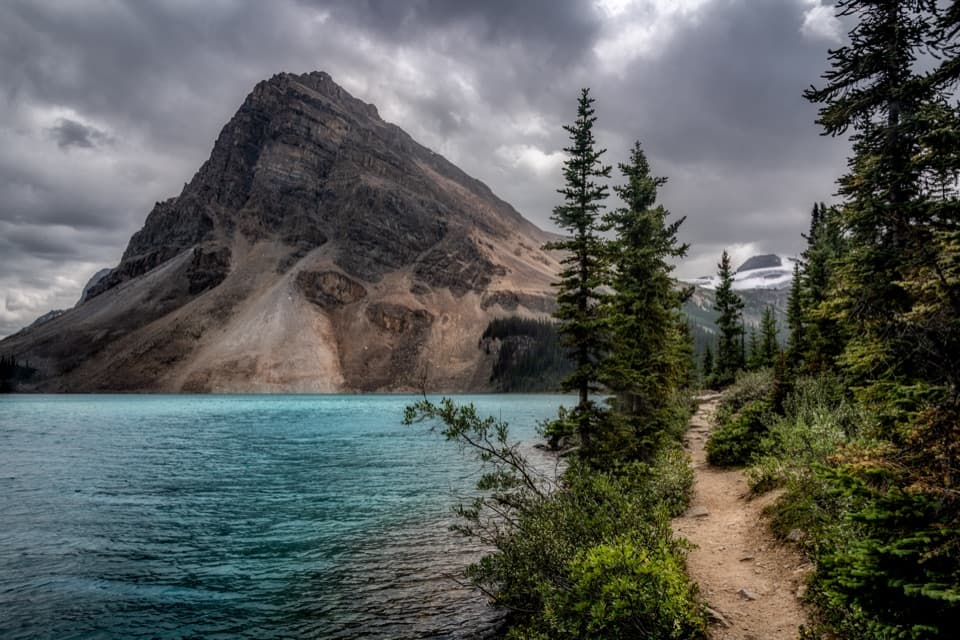
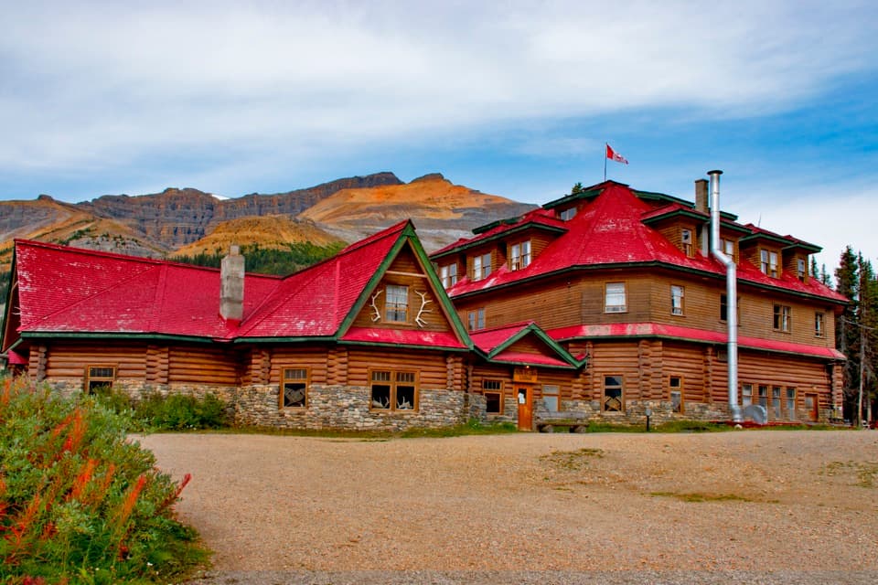
A glacial lake view, with a lakeside picnic stop below.

Photo: Wikimedia Commons
Type
Picnic area
Nearest trail
1.2 km
Audio stories
4 nearby
  • Scenic viewpoint
  • Parking
  • Picnic tables
  • Restrooms

Hear the audio tour

Bow Lake Day-use Area: A Lakeside Picnic

Overview

About Bow Lake Viewpoint and Day-use Area

Why stop

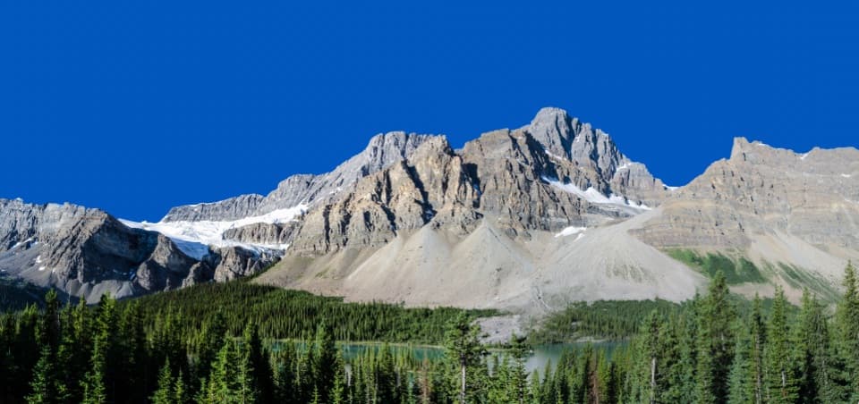
  • A wide Bow Lake and mountain view, with reflections on calm days.

Heads up

  • The picnic facilities are down a separate gravel road from the highway viewpoint.

Map

Where it is

Loading the Icefields Parkway map
Full map
Picnic areaBow Lake Viewpoint and Day-use Area51.67356, -116.45000
Keep this map with you offline in the Parkwolf app

Plan your stop

Before you go

2 active Icefields Parkway alerts

  • ClosureWildfire-impacted area closures in JasperStay out of the closed wildfire-impacted areas in Jasper National Park; access is prohibited or restricted to protect public safety.Official details
  • ClosureOpal Hills hiking area closed for grizzly bearThe Opal Hills hiking area is closed because a female grizzly bear with two offspring is in the area. - The closure took effect September 25, 2026, and remains in effect until further notice.Official details

Icefields Parkway alerts
A park ranger sits on a dash-mounted phone, talking, as Parkwolf’s Tour Guide plays “Army Cutworm Moths: A Grizzly Bear Buffet” on Grand Loop Road below Dunraven Pass in Yellowstone
Parkwolf Tour GuideThe highest, rockiest slopes around here are a summer buffet for grizzly bears.

Icefields Parkway Tour Guide

Your drive to Bow Lake Viewpoint and Day-use Area, narrated.

Parkwolf is a GPS audio tour guide for Icefields Parkway (Highway 93). As you drive, it chimes in with what’s ahead: hidden gems, upcoming stops, history, geology, and wildlife, right through your car’s speakers.

See the Icefields Parkway audio tour

Recorded for this place

Bow Lake Day-use Area: A Lakeside Picnic
0:00 / 0:17
“Up ahead is Bow Lake's viewpoint and day-use area, a handy summer stop for a picnic with the lake and mountains in view.”

Plays as you drive up to Bow Lake Viewpoint and Day-use Area in the Parkwolf Icefields Parkway Tour Guide.

More stories near here in the app

  • Bow Lake: Shore Walk and a Bite
  • Crowfoot Glacier: The Missing Toe
  • Crowfoot Pass: The River-Crossing Decision
  • When Snow Turns Pink
  • 141 audio storiesacross Icefields Parkway’s roads, triggered by GPS as you drive
  • Wildlife heatmapsfor Grizzly Bear, Black Bear, Moose, and 13 more
  • Works offlinemaps, 54 trails, 57 places, and audio download before you lose signal
  • CarPlay readysimple controls built for the drive
★★★★★
“Fantastic app with many points of information… It’s great to just turn on while you’re driving and it gives you an audio tour of the national Park. We love it!!!!”
JMJamesApp Store review
Download Parkwolf on the App StoreGet Parkwolf on Google Play

4.7 from 8,600+ ratings

Guide

More about Bow Lake Viewpoint and Day-use Area

Pick the quick view or the lakeside stopBow Lake Viewpoint and Day-use Area is a roadside lookout with a separate lakeside picnic area,…

Bow Lake Viewpoint and Day-use Area is a roadside lookout with a separate lakeside picnic area, 1.3 km south of the main Bow Lake access. Stop at the upper viewpoint for the broad lake-and-mountain view; for the picnic area, watch for its small sign and keep left down the gravel road. If you have time, take the spur to the water rather than treating the viewpoint as the whole stop.

Take a break by the waterThe lower day-use area has picnic tables, shelters with wood stoves and outhouses, plus access…

The lower day-use area has picnic tables, shelters with wood stoves and outhouses, plus access to the lake. A drinking-water source is not confirmed, so bring your own water. The picnic lots can fill quickly; use designated parking spaces.

Why the lake is turquoiseBow Lake sits at 1,920 m and is fed by meltwater from Bow Glacier.

Bow Lake sits at 1,920 m and is fed by meltwater from Bow Glacier. Fine glacial sediment gives the water its turquoise color, set against the steep peaks around the shore. From the upper viewpoint, look for the peaks reflected in the lake on calm days.

Plan for summerThis is a summer-only stop, and winter snow can limit access and services.

This is a summer-only stop, and winter snow can limit access and services. The roadside viewpoint is a quick photo stop; the lower gravel spur is where the picnic facilities and lakeside break are.

Wildlife

Wildlife in Icefields Parkway

All Icefields Parkway wildlife maps

Sighting maps show where each species has been reported across Icefields Parkway. Wildlife moves, so no sighting is guaranteed.

Keep exploring

Near Bow Lake Viewpoint and Day-use Area

See it all on the map

Trails nearby

More stops nearby

Parkwolf’s Icefields Parkway ranking

Top sights in Icefields Parkway

All 57 places
  1. 1Athabasca GlacierSight
  2. 2Peyto Lake ViewpointSight
  3. 3Athabasca FallsSight
  4. 4Bow LakeSight
  5. 5Sunwapta FallsSight
  6. 6Mistaya CanyonSight

Take Parkwolf to Icefields Parkway.

The audio tour guide for the drive, plus offline maps, trails, and wildlife heatmaps for when the signal drops.

4.7 from 8,600+ ratings

Download Parkwolf on the App StoreGet Parkwolf on Google Play