Parking
Use the Helen Lake/Dolomite Pass trailhead parking area on Icefields Parkway, across from Crowfoot Glacier Viewpoint. Park in the designated lot; roadside parking is prohibited.
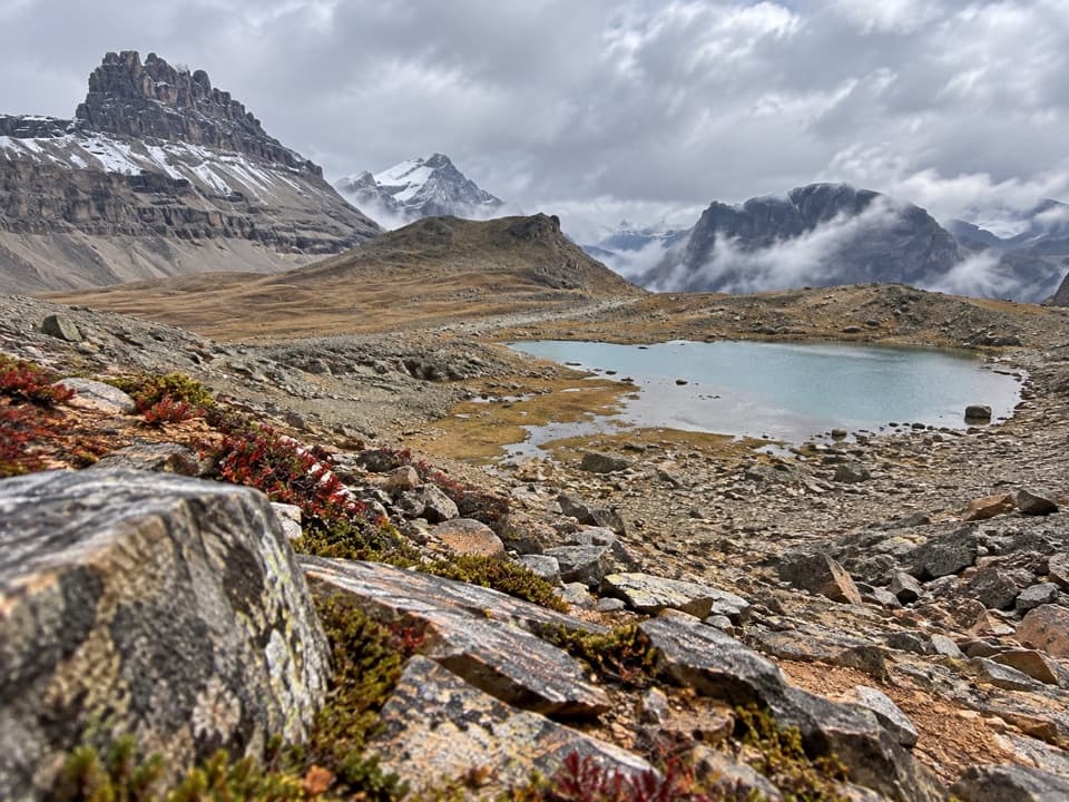
Icefields Parkway (Highway 93), AB
A long alpine climb to two lakes and an unmarked pass.
Overview
Map & elevation
Plan your hike

The highest, rockiest slopes around here are a summer buffet for grizzly bears.
Icefields Parkway Tour Guide
Parkwolf is a GPS audio tour guide for Icefields Parkway (Highway 93). As you drive, it chimes in with what’s ahead: hidden gems, upcoming stops, history, geology, and wildlife, right through your car’s speakers.
See the Icefields Parkway audio tourRecorded for this trailhead
Crowfoot Glacier: The Missing Toe“Crowfoot Glacier Viewpoint is coming up, an easy stop if you want to see a glacier without a hike. From the pullout, look high on Crowfoot Mountain for the ice hanging above the forest.”
Plays as you drive up to this trailhead in the Parkwolf Icefields Parkway Tour Guide.
More stories near here in the app
“Fantastic app with many points of information… It’s great to just turn on while you’re driving and it gives you an audio tour of the national Park. We love it!!!!”


Trail guide
Dolomite Pass Trail is an 11-mile (17.7 km) out-and-back from the Helen Lake/Dolomite Pass trailhead. Plan on 6 to 7 hours. It climbs through forest and meadows to Helen Lake, crosses a rocky ridge, drops to Katherine Lake, then follows a faint alpine path to a small tarn at the unmarked pass. The route is classed as difficult. If that full day is too much, Helen Lake makes a worthwhile shorter turnaround: about 7.2 miles round trip.
The trail leaves the Icefields Parkway and gains height through spruce and fir, with exposed roots and some steep stretches underfoot. The trees open around 1.3 miles for views south toward Bowcrow Peak and Bow Peak. Near 1.6 miles, open meadows bring Bow Lake, Crowfoot Mountain, Mount Andromache and Mount Hector into view. At about 2 miles the route enters the Helen Creek drainage; this is where the forest gives way to more open alpine country.
The trail skirts a rockslide, crosses Helen Creek and continues through a broad meadow to Helen Lake, about 3.6 miles from the trailhead. The lake sits below Cirque Peak, with a steep headwall rising beyond its eastern end. On a calm day, look back across the water for a reflection of the peak. The lake is a satisfying end in its own right, and the 7.2-mile return is a good choice if you want the scenery without the pass extension.
For the full route, follow the east side of the lake and climb the rocky slope to the ridge. Near the top, a branch left heads toward Cirque Peak; stay on the main route for Dolomite Pass. The ridge is reached at roughly 4.3 miles one way. From here the route drops more than 300 feet in about half a mile to Katherine Lake, so remember that the climb comes back on your return.
At Katherine Lake, pause on the north shore and look south across the water toward the low ridge and the distant peaks. Mount Assiniboine can appear in the gap between Bow Peak and Crowfoot Mountain. Continue beyond the lake on a boot-beaten path through alpine tundra to a small tarn near Dolomite Pass, roughly 5.5 miles from the start. The pass has no marker and can be hard to pinpoint, so use the tarn and the surrounding ridge as your turn-around rather than following the separate descent toward Dolomite Creek. That continuation is a backcountry route with deep creek crossings, not part of this day hike.
Start from the Helen Lake/Dolomite Pass parking area on Icefields Parkway, across from Crowfoot Glacier Viewpoint. Use the designated lot; roadside parking is prohibited. A valid national park entry pass is required to drive the Icefields Parkway. Dogs are allowed on Banff trails in summer unless a trail restriction says otherwise, and must stay leashed and under control.
Wildlife
 12 sightingsGrizzly BearMost seen around 6 AMSighting map
 127 sightingsBlack BearMost seen around 7 PMSighting map
 16 sightingsMooseMost seen around 6 AMSighting map
 100 sightingsElkMost seen around 8 PMSighting map
 34 sightingsMountain GoatMost seen around 7 PMSighting map
 53 sightingsBighorn SheepMost seen around 6 PMSighting map
Sighting maps show where each species has been reported across Icefields Parkway. Wildlife moves, so no sighting is guaranteed.
Keep exploring
 ModerateHelen Lake Trail11.8 km · 4.5 hr · At the trailheadA long climb opens to a high meadow beneath Dolomite Peak.
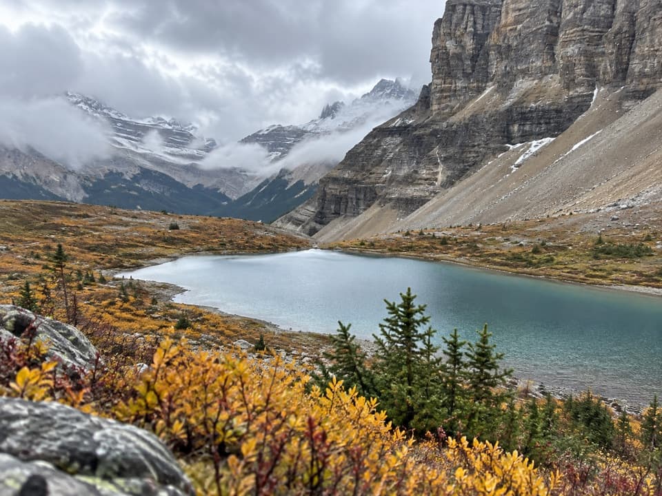 ChallengingCrowfoot Pass and Balfour Viewpoint Trail15.4 km · 6 hr · 1.1 km awayA river ford leads to pass tarns and a tucked-away ridge view.
 ModerateBow Glacier Falls Trail9.1 km · 4 hr · 2.4 km awayBow Lake’s shore opens to a steep climb beneath the glacier.
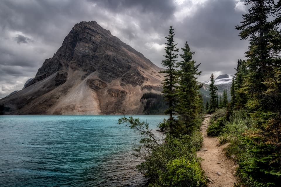 EasyBow Lake Lakeshore Trail3.8 km · 1 hr · 2.4 km awayAn easy lakeshore walk with Bow Lake and Crowfoot Mountain in view.
 ChallengingBow Hut Route15.6 km · 5.5 hr · 2.4 km awayA rough alpine approach to a hut above Bow Lake.
 EasyPeyto Lake Lookout Trail1.2 km · 30 min · 7.2 km awayThe lake’s turquoise outline comes into view after a short climb.
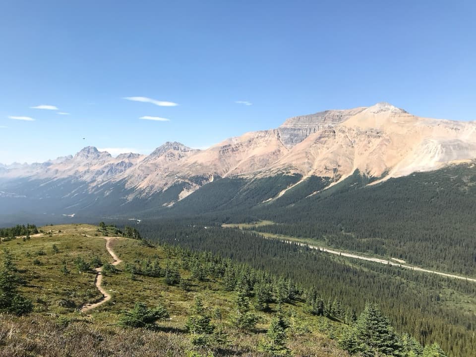 ModerateBow Summit Viewpoint Trail6.8 km · 2.5 hr · 7.2 km awayContinue past Peyto Lake for Bow Lake and wider mountain views.
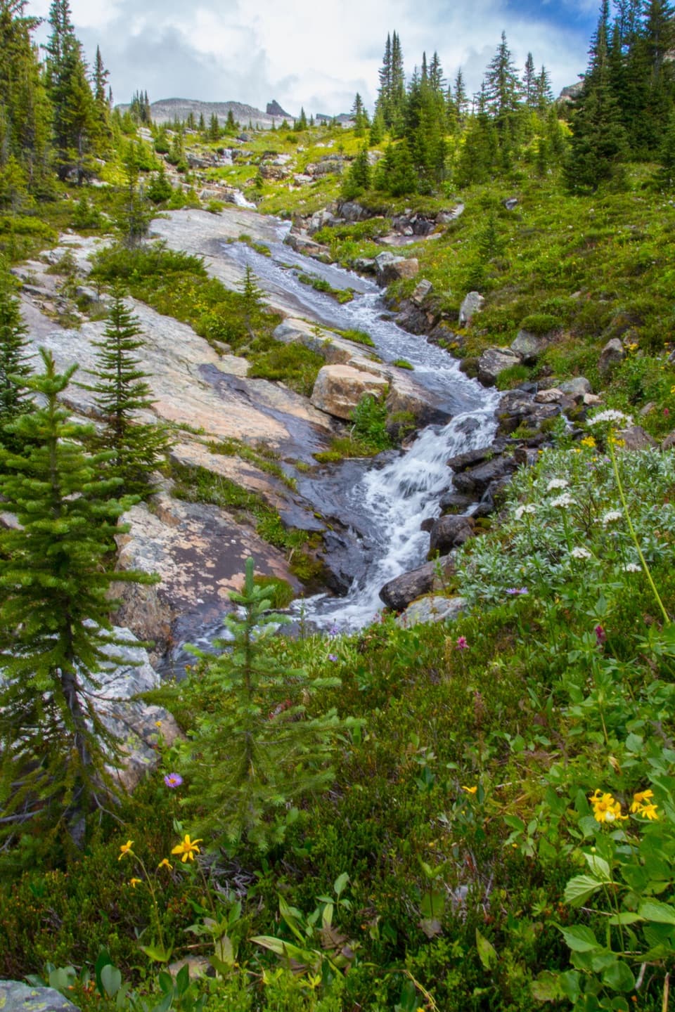 ChallengingNorth Molar Pass Trail24 km · 7.5 hr · 8.5 km awayA full-day climb to alpine flowers and a high, rocky pass.
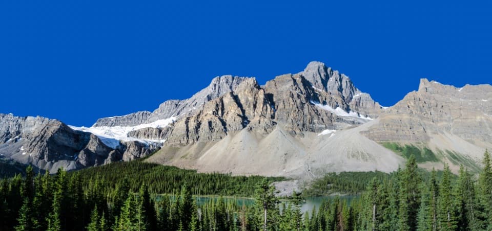 Scenic pullout · 0.1 km awayCrowfoot Glacier ViewpointA roadside glacier view with a vanished third toe.
 Picnic area · 1.3 km awayBow Lake Viewpoint and Day-use AreaA glacial lake view, with a lakeside picnic stop below.
 Sight · 2.4 km awayBow LakeA short shore walk gets you to turquoise water beneath glaciers.
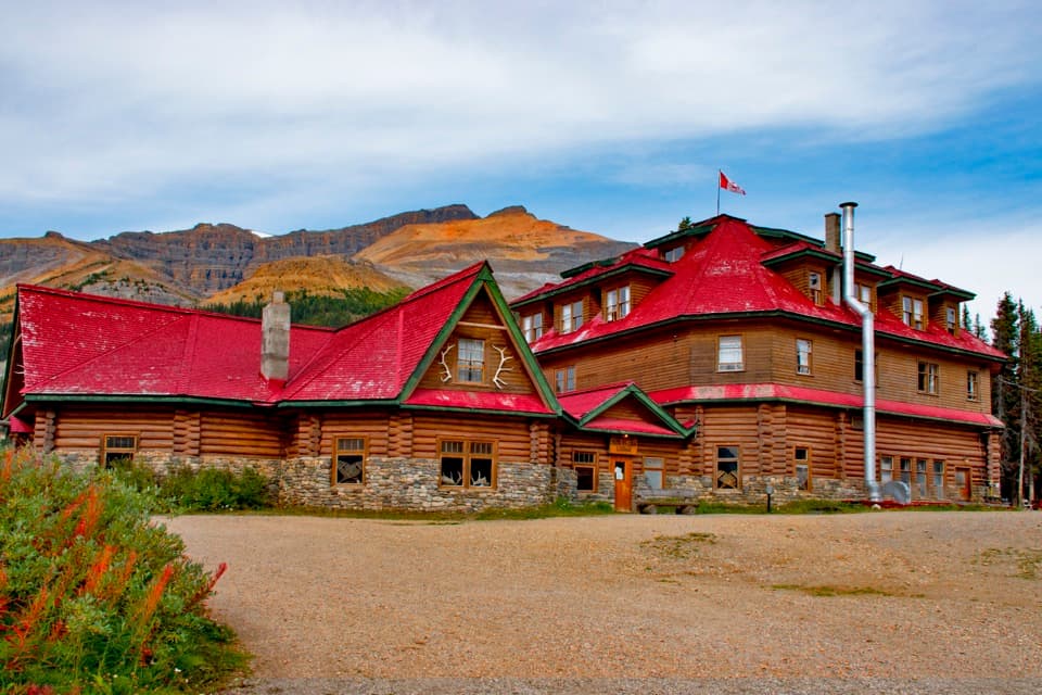 Lodging · 2.5 km awayThe Lodge at Bow LakeA historic red-roofed lodge with a day-visitor shop by the lake.Sight · 4.2 km awayBow Glacier FallsA glacier-fed cascade at the end of a half-day hike.
 Sight · 5.8 km awayBow Summit ViewpointA longer hike beyond Peyto's platform into a high alpine lookout.
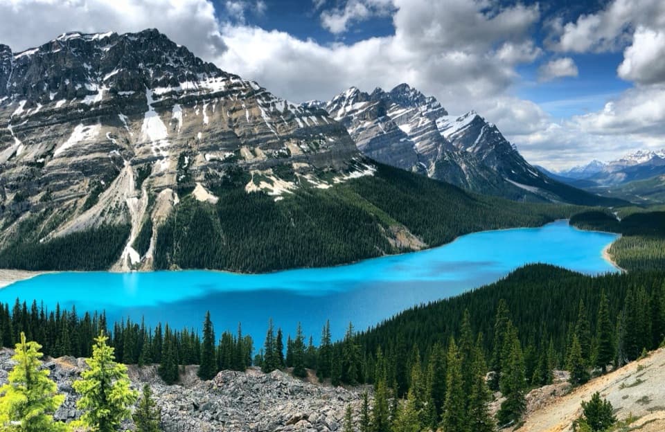 Sight · 7.6 km awayPeyto Lake ViewpointLook for a wolf's head in the turquoise lake below.
 Campground · 8.2 km awayMosquito Creek CampgroundA 38-site unserviced campground with water, shelters and food lockers.
Parkwolf’s Icefields Parkway ranking

The audio tour guide for the drive, plus offline maps, trails, and wildlife heatmaps for when the signal drops.


