Cavell Meadows Trail in Jasper National Park

#2 of 74 trails in Jasper

Jasper National Park, AB

Cavell Meadows Trail

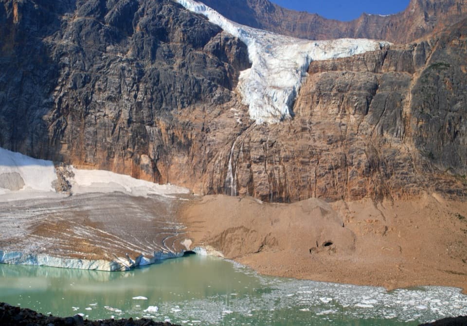
Rocky climb, alpine flowers, and Angel Glacier from above.

Photo: 潘世博, CC BY-SA 2.0, via Wikimedia Commons; crop and exposure adjustment by Ron Clausen

Length
6.4km
Time
4hr
Elev. change
423m
Difficulty
Moderate
  • Loop
  • No dogs
  • High point 2,161 m

Hear the audio tour

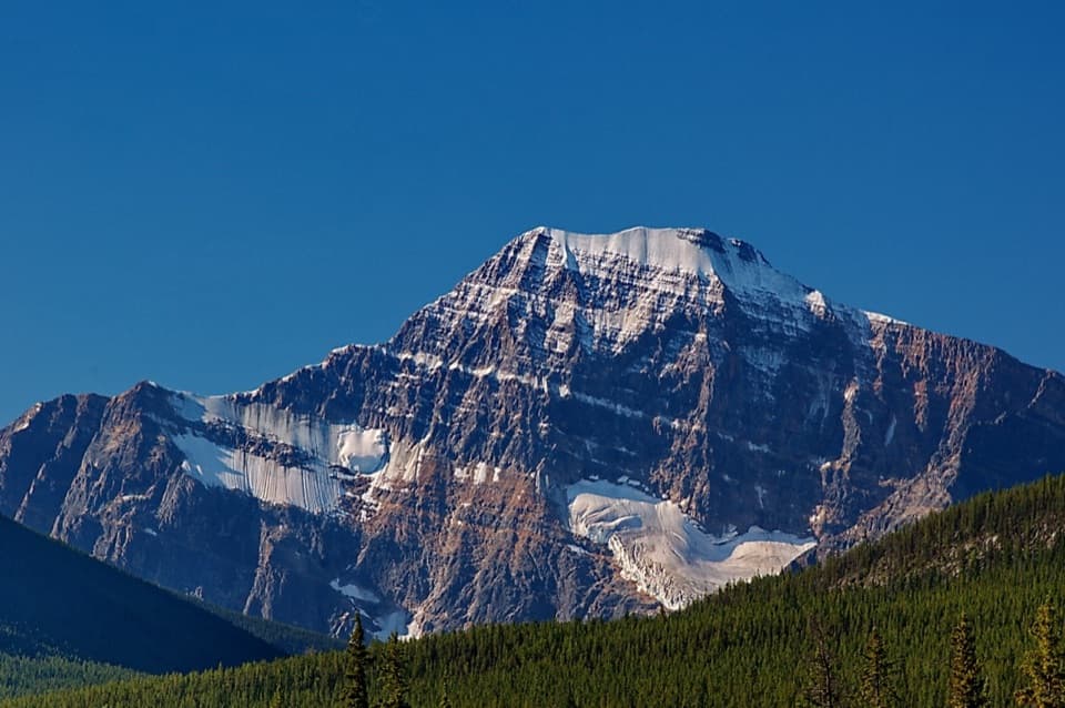
Mount Edith Cavell and Angel Glacier

Overview

About Cavell Meadows Trail

Why go

  • Angel Glacier views from moraine and open alpine ground
  • A distinct climb from forest into wildflower meadows

Heads up

  • A sustained 500 m climb with rocky footing
Cavell Meadows is a 6.5 km (4.0 mile) round-trip hike in Jasper’s Mount Edith Cavell area. It follows the lower Path of the Glacier approach, climbs through a bouldery moraine and subalpine forest, then circles through open alpine meadows before retracing its lower stem. Expect about 500 m of climbing and allow three to five hours. It is a rewarding choice if you want a sustained uphill walk and a high, open view of the glaciers and surrounding peaks. For a much shorter outing from the same lot, Path of the Glacier continues to a viewpoint over Cavell Pond.
Parkwolf’s verdictIs this hike for you?

Map & elevation

The route

Loading the Jasper map
Full map
Elevation1,738–2,161 m
TrailheadMount Edith Cavell trailhead at the far end of the parking lot52.68711, -118.05517
Keep this map with you offline in the Parkwolf app

Plan your hike

Before you go

Parking

The trailhead is at the far end of the parking lot at the end of the 14 km Cavell Road. The road is narrow and winding; trailers, large motorhomes, and vehicles longer than 7.5 m are not permitted. A drop-off area is available at the start of Cavell Road on 93A.

Safety

Expect a sustained climb over rocky moraine and keep well back from cliffs and the slopes beneath Angel Glacier, where rock and ice can fall. Stay on the marked tread through fragile alpine vegetation. Dogs are prohibited on Trail 42 and the adjacent alpine meadows under Parks Canada’s sensitive-habitat order; check the current rules before setting out.

4 active Jasper alerts

  • ClosureCavell Road and Maligne Canyon closedMentions Cavell Road, referenced in this guideCavell Road and Maligne Canyon are closed; do not plan access to these areas.Official details
  • Caution93A construction restricts cyclistsConstruction on Highway 93A between the north end of 93N and Marmot Road means single-lane vehicle access and no cycling from November 2026 through spring 2027.Official details
See all 4 alerts
A park ranger sits on a dash-mounted phone, talking, as Parkwolf’s Tour Guide plays “Army Cutworm Moths: A Grizzly Bear Buffet” on Grand Loop Road below Dunraven Pass in Yellowstone
Parkwolf Tour GuideThe highest, rockiest slopes around here are a summer buffet for grizzly bears.

Jasper Tour Guide

Your drive to Cavell Meadows Trail, narrated.

Parkwolf is a GPS audio tour guide for Jasper National Park. As you drive, it chimes in with what’s ahead: hidden gems, upcoming stops, history, geology, and wildlife, right through your car’s speakers.

See the Jasper audio tour

Recorded for this trailhead

Mount Edith Cavell and Angel Glacier
0:00 / 0:35
“You're nearing the Mount Edith Cavell day-use area, where the short Path of the Glacier walk brings the pond, hanging Angel Glacier and mountain wall into view together.”

Plays as you drive up to this trailhead in the Parkwolf Jasper Tour Guide.

More stories near here in the app

  • Astoria Trailhead and Cavell Lake
  • The Mountains That Were Too Tall
  • The Night Ghost Glacier Fell
  • The Bluebird That Hovers to Hunt
  • 170 audio storiesacross Jasper’s roads, triggered by GPS as you drive
  • Wildlife heatmapsfor Grizzly Bear, Caribou, Gray Wolf, and 13 more
  • Works offlinemaps, 74 trails, 189 places, and audio download before you lose signal
  • CarPlay readysimple controls built for the drive
★★★★★
“Fantastic app with many points of information… It’s great to just turn on while you’re driving and it gives you an audio tour of the national Park. We love it!!!!”
JMJamesApp Store review
Download Parkwolf on the App StoreGet Parkwolf on Google Play

4.7 from 8,600+ ratings

Trail guide

Hiking Cavell Meadows Trail

Find the meadow turnStart by the Edith Cavell display at the far end of the parking lot and take the short stairs…

Start by the Edith Cavell display at the far end of the parking lot and take the short stairs to the paved path. It climbs steadily for about half a kilometre. When the paving ends, Trail 41 continues toward the lower glacier viewpoint; turn sharply left soon after for Trail 42. It is easy to keep walking straight if you are following the glacier view. The meadow hike returns along the same lower approach, so the upper loop is the part that changes direction.

Climb through the moraineBeyond the junction, the grade steepens as the route works across bouldery moraine.

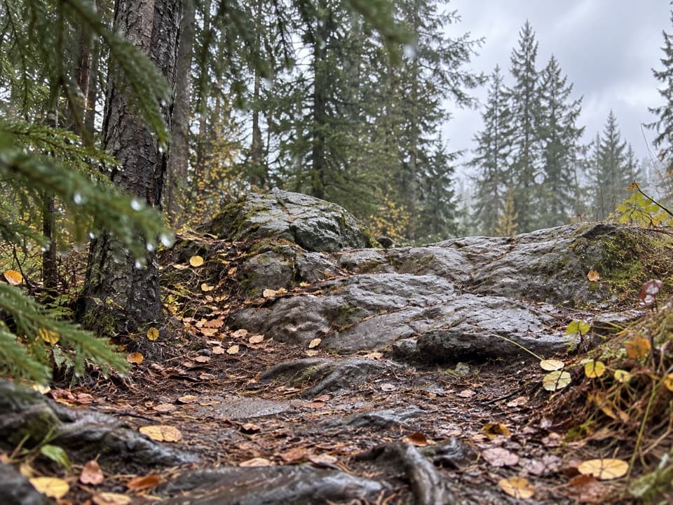
Beyond the junction, the grade steepens as the route works across bouldery moraine. The footing asks for attention, but the well-graded path keeps the climb straightforward. Views of Angel Glacier and Astoria Valley open between the rocks. Look for little gray pikas and golden-mantled ground squirrels around the boulder piles; they are easy to miss if you hurry through this stretch.

Forest gives way to meadowThe route passes through upper-subalpine forest before easing near treeline.

The route passes through upper-subalpine forest before easing near treeline. It then angles left across alpine ground and loops back down to meet the ascent route at the forest edge. From there, retrace the climb and the paved approach to the lot. Early in summer the upper tread is often wet and especially easy to damage. By mid-July, mountain wildflowers usually add color across the meadows. Keep to the path even where the ground looks open.

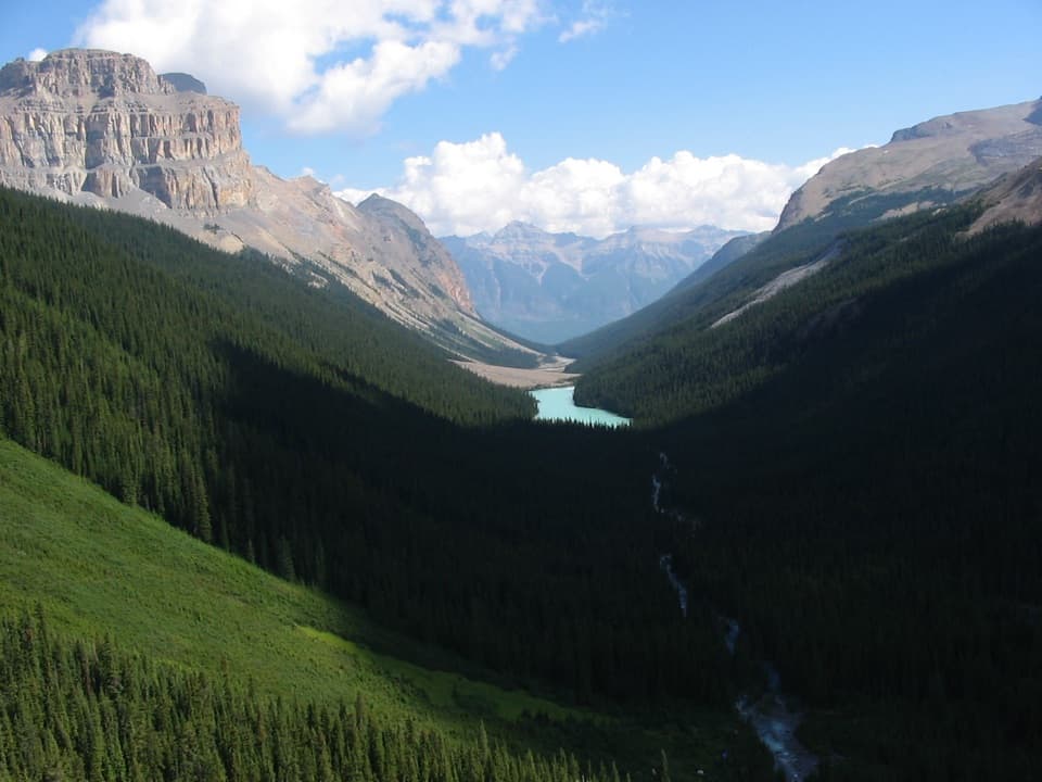
Look out across the valleyThe open upper slopes give you the broadest panorama, with jagged peaks beyond a dark forested…

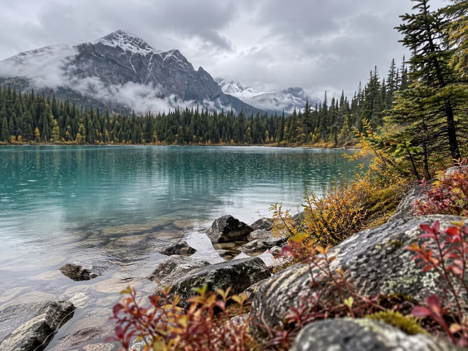
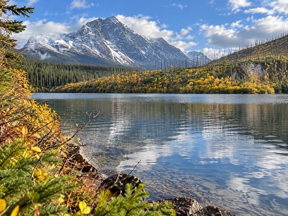
The open upper slopes give you the broadest panorama, with jagged peaks beyond a dark forested valley. From the meadow, frame the peaks with the valley below rather than filling the picture with sky; that foreground gives the mountain wall scale. The changing view is part of the hike: the lower moraine brings Angel Glacier into view, while the upper meadow opens the scene wider.

A landscape still changingMuch of the pale, rocky terrain here was exposed as glacial ice retreated.

Much of the pale, rocky terrain here was exposed as glacial ice retreated. New plants and animals are recolonizing the ground, which makes the meadow more than a viewpoint. In 2012 Ghost Glacier collapsed from Mount Edith Cavell and sent a debris flood down the valley. Rock and ice can still fall from the steep slopes below Angel Glacier, so admire it from the trail and marked viewpoints and stay well back from cliffs.

Protect the alpine groundThe meadow vegetation is fragile, and dogs are prohibited on Trail 42 and the surrounding…

The meadow vegetation is fragile, and dogs are prohibited on Trail 42 and the surrounding alpine meadows under Parks Canada’s sensitive-habitat rules. Check the current rules before a later visit. The same trailhead also serves the shorter Path of the Glacier walk, but the two routes split near the end of the paved section; do not use the shorter route’s pond viewpoint as a substitute for the meadow loop.

Wildlife

Wildlife in Jasper

All Jasper wildlife maps

Sighting maps show where each species has been reported across Jasper. Wildlife moves, so no sighting is guaranteed.

Keep exploring

Near Cavell Meadows Trail

See it all on the map

Trails that start nearby

Places near the trailhead

Parkwolf’s Jasper ranking

Top-rated trails in Jasper

All 74 trails
  1. 1Skyline TrailChallenging · 44.1 km
  2. 3Sulphur Skyline TrailChallenging · 8.8 km
  3. 4Bald Hills TrailChallenging · 10.4 km
  4. 5Wilcox Pass TrailChallenging · 6.8 km
  5. 6Tonquin Valley TrailChallenging · 43.1 km
  6. 7Path of the Glacier TrailModerate · 1.6 km

Take Parkwolf to Jasper.

The audio tour guide for the drive, plus offline maps, trails, and wildlife heatmaps for when the signal drops.

4.7 from 8,600+ ratings

Download Parkwolf on the App StoreGet Parkwolf on Google Play