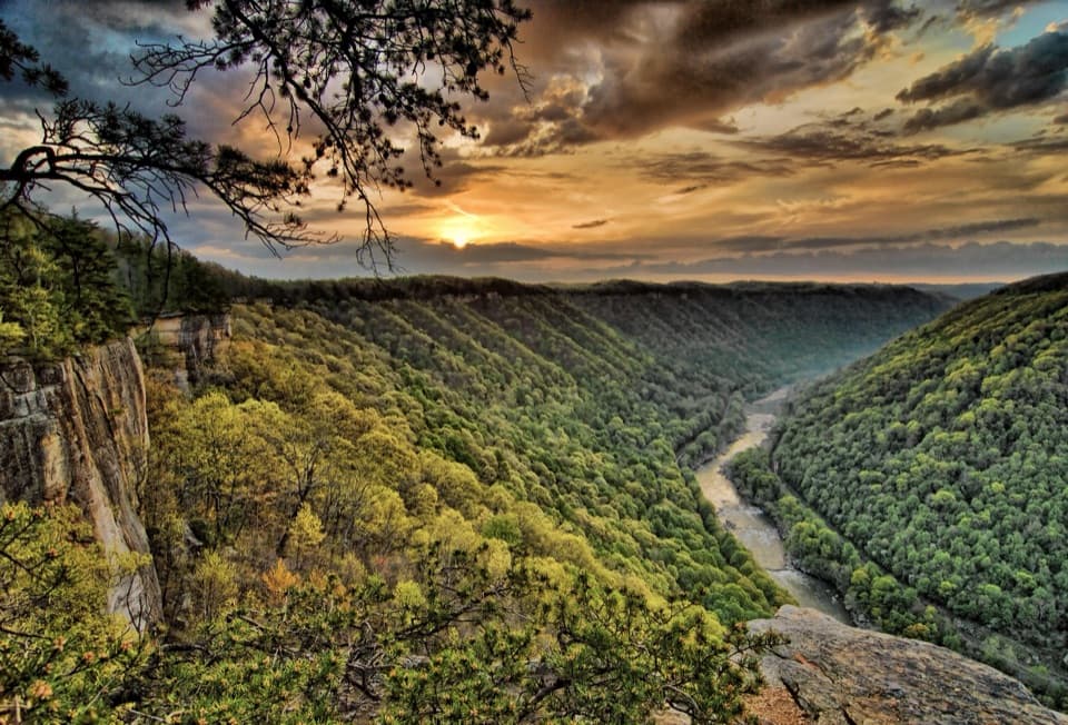
Sandstone Visitor Center in New River Gorge National Park

Visitor center · New River Gorge National Park

Sandstone Visitor Center

Start here for southern park advice, exhibits and a floor map.

Photo: National Park Service
Type
Visitor center
Nearest trail
1.7 mi
Audio stories
8 nearby
  • Exhibit
  • Parking
  • Restrooms
  • Picnic tables

Hear the audio tour

Sandstone Visitor Center and the Native Garden

Overview

About Sandstone Visitor Center

Why stop

  • The watershed map, interactive exhibits and short film make the park easier to understand.

Heads up

  • Sandstone Falls is a separate drive away, despite the similar name.

Map

Where it is

Loading the New River Gorge map
Full map
Visitor centerSandstone Visitor Center37.78320, -80.89785
Keep this map with you offline in the Parkwolf app

Plan your stop

Before you go

5 active New River Gorge alerts

  • ClosureRend and Church Loop trails closedRend Trail is closed from both trailheads through approximately December 2027; Church Loop Trail is also closed because its only access is from Rend.Official details
  • ClosureKaymoor Miners Trail weekday closureThe upper Kaymoor Miners Trail is closed Monday–Thursday through November 19 for trail rehabilitation.Official details
See all 5 alerts
A park ranger sits on a dash-mounted phone, talking, as Parkwolf’s Tour Guide plays “Army Cutworm Moths: A Grizzly Bear Buffet” on Grand Loop Road below Dunraven Pass in Yellowstone
Parkwolf Tour GuideThe highest, rockiest slopes around here are a summer buffet for grizzly bears.

New River Gorge Tour Guide

Your drive to Sandstone Visitor Center, narrated.

Parkwolf is a GPS audio tour guide for New River Gorge National Park. As you drive, it chimes in with what’s ahead: hidden gems, upcoming stops, history, geology, and wildlife, right through your car’s speakers.

See the New River Gorge audio tour

Recorded for this place

Sandstone Visitor Center and the Native Garden
0:00 / 0:33
“You're coming up on Sandstone Visitor Center, a useful stop for getting to know the southern end of the park. Start with the big watershed map on the floor, then ask a ranger about the places you're considering.”

Plays as you drive up to Sandstone Visitor Center in the Parkwolf New River Gorge Tour Guide.

More stories near here in the app

  • Following the Rivers Home
  • Why Park and Preserve?
  • Two Slopes, Different Woods
  • A Journey Across Generations
  • 92 audio storiesacross New River Gorge’s roads, triggered by GPS as you drive
  • Wildlife heatmapsfor Black Bear, White-tailed Deer, Pileated Woodpecker, and 13 more
  • Works offlinemaps, 49 trails, 55 places, and audio download before you lose signal
  • CarPlay readysimple controls built for the drive
★★★★★
“Fantastic app with many points of information… It’s great to just turn on while you’re driving and it gives you an audio tour of the national Park. We love it!!!!”
JMJamesApp Store review
Download Parkwolf on the App StoreGet Parkwolf on Google Play

4.7 from 8,600+ ratings

Guide

More about Sandstone Visitor Center

Start on the southern endSandstone Visitor Center is the National Park Service’s gateway for the southern end of New…

Sandstone Visitor Center is the National Park Service’s gateway for the southern end of New River Gorge, just north of I-64’s Exit 139 on Meadow Creek Road. It’s a useful first stop if you’re exploring this side of the park: use the watershed floor map and ask a ranger to help shape your day before you start driving. This is not Sandstone Falls. The falls are a separate drive through Hinton and along River Road, with no falls overlook or boardwalk at the center.

What to do insideInteractive displays cover the New River watershed and its natural and cultural history.

Interactive displays cover the New River watershed and its natural and cultural history. The big floor map helps make the watershed’s scale click, and a 12-minute film gives a quick overview. The bookstore carries park maps, nature and history books, and children’s titles. Ask at the ranger desk for help sorting out the longer drives between southern stops.

There are public flush restrooms, drinking water, and accessible and family restroom facilities; NPS also lists wheelchairs available. Outside, picnic tables and a shelter make this a practical place to pause with a packed lunch.

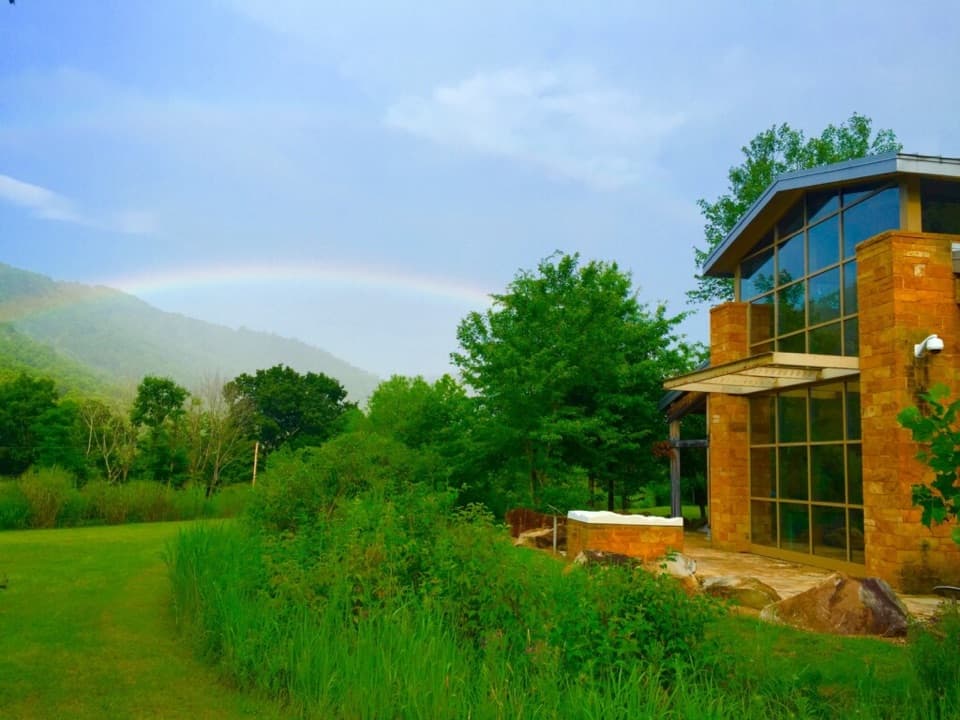
Built on a worked-over siteThe center opened in 2003 on a former quarry and school site.

The center opened in 2003 on a former quarry and school site. Its design uses regional materials, geothermal heating and cooling, and planted basins that catch and filter runoff. That environmental story fits the exhibits, which explain how people have shaped the watershed and ways to lessen their impact.

A small native gardenThe grounds are planted with native grasses and wildflowers, including milkweed.

The grounds are planted with native grasses and wildflowers, including milkweed. The site is a registered Monarch Waystation, providing milkweed, nectar and shelter for migrating butterflies. NPS has observed monarchs and caterpillars here, though a sighting is never guaranteed. It’s a quick wander around the grounds rather than a trail.

Wildlife

Wildlife in New River Gorge

All New River Gorge wildlife maps

Sighting maps show where each species has been reported across New River Gorge. Wildlife moves, so no sighting is guaranteed.

Parkwolf’s New River Gorge ranking

Top sights in New River Gorge

All 55 places
  1. 1New River Gorge BridgeSight
  2. 2Sandstone FallsSight
  3. 3Grandview Main OverlookSight
  4. 4Diamond Point OverlookSight
  5. 5Long Point OverlookSight
  6. 6Nuttallburg Historic SiteSight

Take Parkwolf to New River Gorge.

The audio tour guide for the drive, plus offline maps, trails, and wildlife heatmaps for when the signal drops.

4.7 from 8,600+ ratings

Download Parkwolf on the App StoreGet Parkwolf on Google Play