Bogachiel River Trail in Olympic National Park

Olympic National Park, WA

Bogachiel River Trail

A rainforest approach turns into a remote, rough river trek.

Photo: National Park Service
Length
48.8mi
Time
1.3days
Elev. change
3,625ft
Difficulty
Challenging
  • No dogs
  • High point 4,065 ft
Parkwolf audio tour204 stories across Olympic’s roads

Overview

About Bogachiel River Trail

Why go

  • A long rainforest approach reaches remote river gravel bars and high country.

Heads up

  • The full out-and-back is nearly 49 miles and takes several days.
  • High-water crossings and difficult upper route-finding can stop the trip.

Map & elevation

The route

Loading the Olympic map
Full map
Elevation440–4,065 ft
TrailheadBogachiel Rain Forest River Trailhead47.88203, -124.27557
Keep this map with you offline in the Parkwolf app

Plan your hike

Before you go

Parking

Start at Bogachiel Rain Forest River Trailhead at the end of Undi Road southeast of Forks. The trailhead has ample parking, an information board and a vault toilet. The final primitive-road section is rough; all-wheel drive or four-wheel drive is best. The river route follows the lower Bogachiel Rain Forest Trail for about 1.5 miles before reaching the park boundary.

Safety

This is a remote multi-day route with multiple creek crossings, exposed eroded-bank sections and difficult route-finding above 15-Mile. Creeks can be ankle- to knee-deep and unsafe or impassable in high water. Overnight trips require wilderness permits and reservations; bear canisters are required for food, garbage and scented items in the Mink Lake area. There are no toilets on the route, and all water must be treated. Dogs are prohibited inside Olympic National Park.

6 active Olympic alerts

  • CautionUS 101 Hoh River Bridge reduced to one laneUS 101 at the Hoh River Bridge is restricted to one lane of alternating traffic; obey the signals and 25 mph speed limit.Official details
  • ClosureStaircase wilderness trails and campsites remain closedWilderness trails and campsites around Staircase remain closed during recovery from the Bear Gulch Fire; the developed Staircase area, including the Rapids Loop, campground, and ranger station, is…Official details
See all 6 alerts
A park ranger sits on a dash-mounted phone, talking, as Parkwolf’s Tour Guide plays “Army Cutworm Moths: A Grizzly Bear Buffet” on Grand Loop Road below Dunraven Pass in Yellowstone
Parkwolf Tour GuideThe highest, rockiest slopes around here are a summer buffet for grizzly bears.

Olympic Tour Guide

Your drive to Bogachiel River Trail, narrated.

Parkwolf is a GPS audio tour guide for Olympic National Park. As you drive, it chimes in with what’s ahead: hidden gems, upcoming stops, history, geology, and wildlife, right through your car’s speakers.

See the Olympic audio tour

More stories near here in the app

  • The Cedar’s Tiny Scales
  • The Clam That Drills Rock
  • A New Rack Every Year
  • The Ocean’s Glass-Shelled Food Makers
  • 204 audio storiesacross Olympic’s roads, triggered by GPS as you drive
  • Wildlife heatmapsfor Olympic Marmot, Humpback Whale, Grey Whale, and 13 more
  • Works offlinemaps, 148 trails, 94 places, and audio download before you lose signal
  • CarPlay readysimple controls built for the drive
★★★★★
“Fantastic app with many points of information… It’s great to just turn on while you’re driving and it gives you an audio tour of the national Park. We love it!!!!”
JMJamesApp Store review
Download Parkwolf on the App StoreGet Parkwolf on Google Play

4.7 from 8,600+ ratings

Trail guide

Hiking Bogachiel River Trail

A multi-day river-valley routeThe Bogachiel River Trail is a 48.

The Bogachiel River Trail is a 48.8-mile out-and-back from Bogachiel Rain Forest River Trailhead to the Mink Lake Trail junction. The selected mileage is 24.4 miles each way from the trailhead, including roughly 1.5 miles on the lower approach before the park boundary. A separate park trail-conditions table lists 21.6 miles from the boundary, so published figures do not line up exactly; use 24.4 miles each way as the planning figure, not an averaged distance. The route ends at the junction, not at Mink Lake, which is farther along another trail. This is a multi-day wilderness trip, not a long day hike; plan on several days for the rough tread and repeated crossings.

Start on the lower rainforest trailThe shared trailhead also serves short loop hikes, but those are different outings.

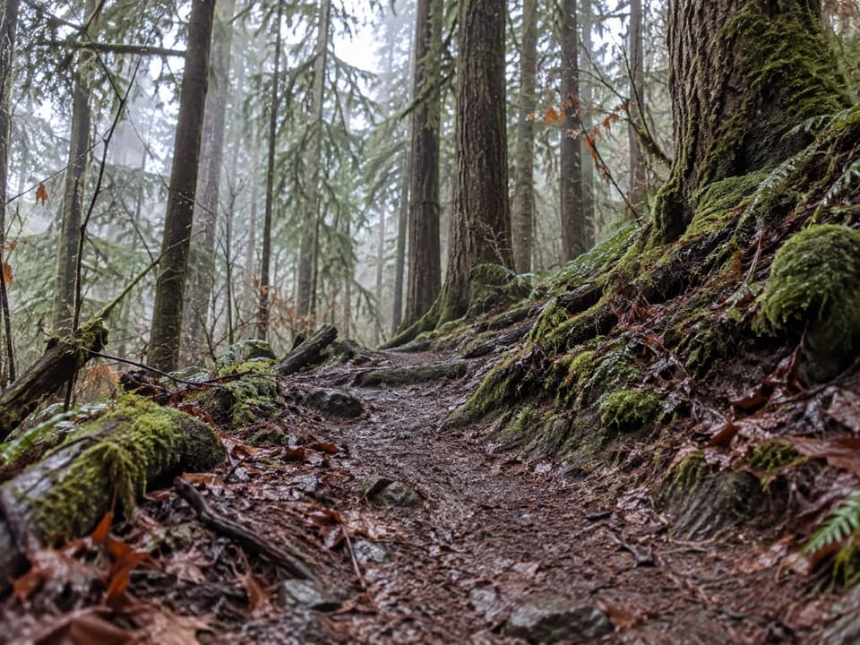
The shared trailhead also serves short loop hikes, but those are different outings. For the river route, descend through spruce and alder to the valley floor, then stay with the main trail as it follows an old road grade through mossy alders and sword fern. The approach is about 1.5 miles to the park boundary. Expect wet, muddy footing in this lowland forest, especially around the creeks.

Follow the river, not the bankOnce inside the park, the trail keeps to the rainforest valley, with spruce, hemlock, cedar,…

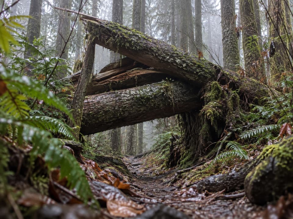
Once inside the park, the trail keeps to the rainforest valley, with spruce, hemlock, cedar, ferns and hanging moss. Riverbank erosion has forced sections away from the water and onto higher ground. At one exposed cut bank, the route climbs above the river before dropping toward Mosquito Creek. The trail is low-maintenance, and its tread becomes rougher and less distinct farther in.

Crossings and the upper valleySeveral creeks cross the route.

Several creeks cross the route. They can be ankle- to knee-deep and may become unsafe or impossible during high water, so this hike can turn around on river conditions even when the trail itself is passable. Above the 15-Mile area, the route is harder to follow. It also climbs out of the low river corridor toward the Mink Lake and Little Divide junction, finishing around 4,130 feet. The mileage and route-finding make a map and a careful backcountry plan essential.

Bogi Camp and a vanished ranger stationBroad gravel bars open beside the river at Bogi Camp, one of the few places where the forest…

Broad gravel bars open beside the river at Bogi Camp, one of the few places where the forest briefly gives way to a wider river view. Around six miles in, the old Snider-Jackson junction marks the former Bogachiel Ranger Station, shelter and horse stable. A 1989 flood swept those structures away along with many large trees. Bogachiel is often translated as “muddy waters,” which fits both the river valley and the trail’s damp character.

Backcountry logisticsOvernight travel requires a wilderness permit and reservations under the park’s backcountry…

Overnight travel requires a wilderness permit and reservations under the park’s backcountry rules. Bear canisters are required for food, garbage and scented items in the Mink Lake area. There are no toilets along the wilderness route; treat water from the river or side streams. Dogs are prohibited on the park portion, so pets cannot accompany you on this full route. The trailhead has a vault toilet and ample parking, but the last stretch of access road is primitive; a higher-clearance, all-wheel-drive or four-wheel-drive vehicle is the safer choice.

Wildlife

Wildlife in Olympic

All Olympic wildlife maps

Sighting maps show where each species has been reported across Olympic. Wildlife moves, so no sighting is guaranteed.

Parkwolf’s Olympic ranking

Top-rated trails in Olympic

All 148 trails
  1. 1Hall of Mosses TrailEasy · 0.8 mi
  2. 2Hurricane Hill TrailModerate · 3.3 mi
  3. 3Sol Duc Falls Nature TrailEasy · 1.6 mi
  4. 4High Divide Loop (Seven Lakes Basin)Challenging · 19 mi
  5. 5Hoh River TrailChallenging · 34.8 mi
  6. 6Shi Shi Beach and Point of Arches TrailModerate · 8 mi

Take Parkwolf to Olympic.

The audio tour guide for the drive, plus offline maps, trails, and wildlife heatmaps for when the signal drops.

4.7 from 8,600+ ratings

Download Parkwolf on the App StoreGet Parkwolf on Google Play