Shi Shi Beach and Point of Arches Trail in Olympic National Park

#6 of 148 trails in Olympic

Olympic National Park, WA

Shi Shi Beach and Point of Arches Trail

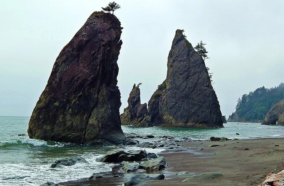
A muddy, steep descent opens onto tide pools and sea stacks.

Photo: National Park Service
Length
8mi
Time
5hr
Elev. change
203ft
Difficulty
Moderate
  • No dogs
  • High point 203 ft

Hear the audio tour

Shi Shi Beach: The Walk to Point of Arches

Overview

About Shi Shi Beach and Point of Arches Trail

Why go

  • Forest, beach, sea stacks and tide pools make this a varied coast hike.
  • Point of Arches rewards the extra beach miles with tide pools and natural arches.

Heads up

  • The approach is frequently muddy, with a steep eroded descent.
  • The long sandy stretch and tides make timing less forgiving than the elevation suggests.

Map & elevation

The route

Loading the Olympic map
Full map
Elevation0–203 ft
TrailheadShi Shi Beach Trailhead by the Makah Fish Hatchery48.29368, -124.66521
Keep this map with you offline in the Parkwolf app

Plan your hike

Before you go

Parking

Use the day-use lot at Shi Shi Beach Trailhead by the Makah fish hatchery. Overnight hikers use designated private lots about 0.6 mile back. The day-use lot can fill early. Buy the Makah Recreation Pass in Neah Bay before driving to the reservation trailhead.

Safety

Tides govern beach passage: high water can force headland detours, and some headlands cannot be rounded even at the lowest tides. The bluff descent is steep and the trail is often muddy; Petroleum Creek can be difficult after heavy winter rain. A Makah Recreation Pass is required before arrival. Pets and wheeled devices are prohibited on the coastal trail and beach.

6 active Olympic alerts

  • CautionUS 101 Hoh River Bridge reduced to one laneUS 101 at the Hoh River Bridge is restricted to one lane of alternating traffic; obey the signals and 25 mph speed limit.Official details
  • ClosureStaircase wilderness trails and campsites remain closedWilderness trails and campsites around Staircase remain closed during recovery from the Bear Gulch Fire; the developed Staircase area, including the Rapids Loop, campground, and ranger station, is…Official details
See all 6 alerts
A park ranger sits on a dash-mounted phone, talking, as Parkwolf’s Tour Guide plays “Army Cutworm Moths: A Grizzly Bear Buffet” on Grand Loop Road below Dunraven Pass in Yellowstone
Parkwolf Tour GuideThe highest, rockiest slopes around here are a summer buffet for grizzly bears.

Olympic Tour Guide

Your drive to Shi Shi Beach and Point of Arches Trail, narrated.

Parkwolf is a GPS audio tour guide for Olympic National Park. As you drive, it chimes in with what’s ahead: hidden gems, upcoming stops, history, geology, and wildlife, right through your car’s speakers.

See the Olympic audio tour

Recorded for this trailhead

Shi Shi Beach: The Walk to Point of Arches
0:00 / 0:29
“You're nearing the Shi Shi Beach trailhead, for a hike to Point of Arches and its long line of sea stacks. Allow four to six hours for the eight-mile round trip, with frequent mud and a steep descent to the sand.”

Plays as you drive up to this trailhead in the Parkwolf Olympic Tour Guide.

  • 204 audio storiesacross Olympic’s roads, triggered by GPS as you drive
  • Wildlife heatmapsfor Olympic Marmot, Humpback Whale, Grey Whale, and 13 more
  • Works offlinemaps, 148 trails, 94 places, and audio download before you lose signal
  • CarPlay readysimple controls built for the drive
★★★★★
“Fantastic app with many points of information… It’s great to just turn on while you’re driving and it gives you an audio tour of the national Park. We love it!!!!”
JMJamesApp Store review
Download Parkwolf on the App StoreGet Parkwolf on Google Play

4.7 from 8,600+ ratings

Trail guide

Hiking Shi Shi Beach and Point of Arches Trail

The full walkShi Shi Beach and Point of Arches is an 8-mile round-trip out-and-back from the Shi Shi Beach…

Shi Shi Beach and Point of Arches is an 8-mile round-trip out-and-back from the Shi Shi Beach Trailhead by the Makah fish hatchery, across Makah Reservation and into Olympic's wilderness coast. The first roughly two miles pass through forest before a steep descent to the beach; the rest is a long walk over sand to the rock stacks and back. Do the full route if tide pools and sea stacks are your goal: the beach begins well before the destination. Allow about four to six hours for the muddy approach, slower sand and time to look around. You may see a 2–4.5-mile figure for Shi Shi Beach, but it does not name a turnaround or distance convention. For Point of Arches, plan on the full 8-mile round trip.

Work out the tideTides shape the route.

Tides shape the route. Carry a tide chart and plan to reach the arches when the beach is passable; high water can send you onto headland trails, and some headlands cannot be rounded even at the lowest tides. Petroleum Creek lies about 1.3 beach miles from the access and can be difficult to cross after heavy winter rain. Sand and driftwood make the shore slower than a packed trail, so leave enough time for the return rather than counting on a precise pace.

The forest approachFrom the fish-hatchery trailhead, the first mile passes brushy clearings and Sitka spruce, with…

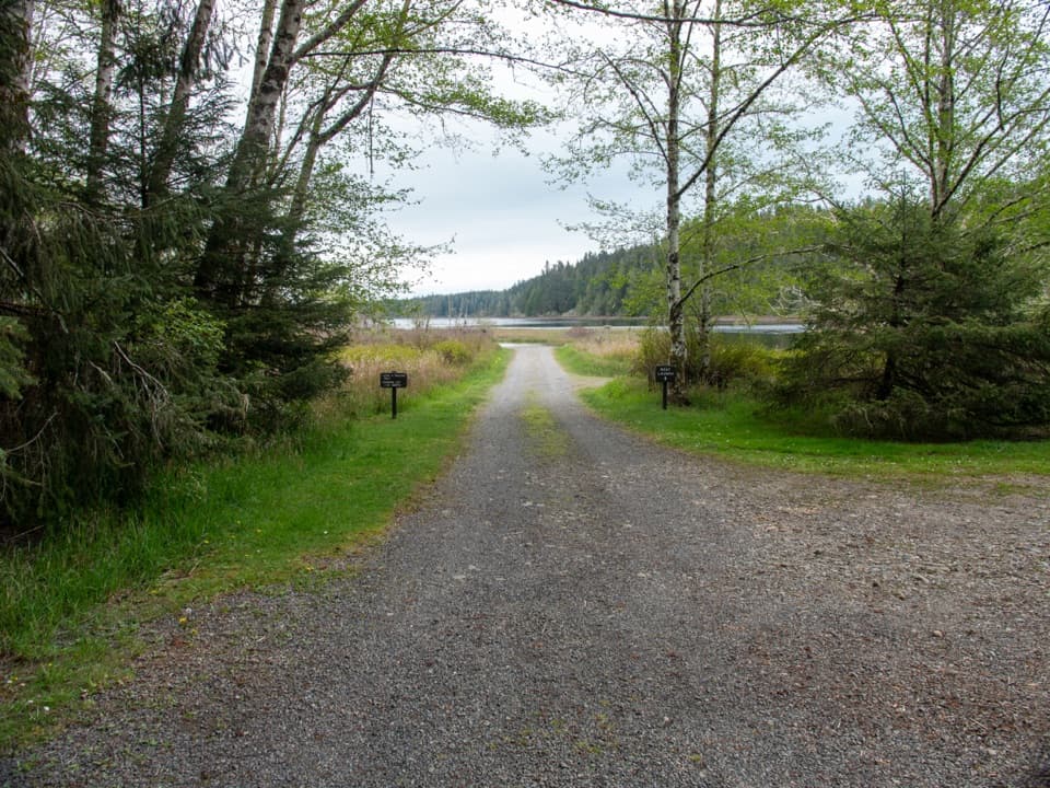
From the fish-hatchery trailhead, the first mile passes brushy clearings and Sitka spruce, with several bridges and boardwalks. The next stretch is wetter and often muddy, then drops steeply down an eroded bluff to the beach. That descent is the part most likely to feel rough underfoot. Hikers repeatedly mention that improvised detours around mud can be confusing; stay with the main tread when it is clear rather than following every sidetrack.

Along the beachOnce you reach the sand, head south.

Once you reach the sand, head south. The route goes past driftwood and surf before the beach opens toward Point of Arches. This is not just a short walk down to the water: reaching the rock stacks adds several miles on sand, and the beach itself changes with the tide. Petroleum Creek is the main named crossing on the way. The NPS also lists Willoughby Creek as a water source farther along the coast; treat or boil stream water because coastal sources can carry parasites.

At Point of ArchesPoint of Arches is a long cluster of offshore stacks, narrow pinnacles and natural arches, with…

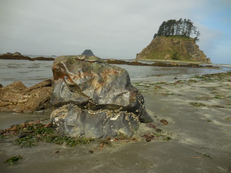
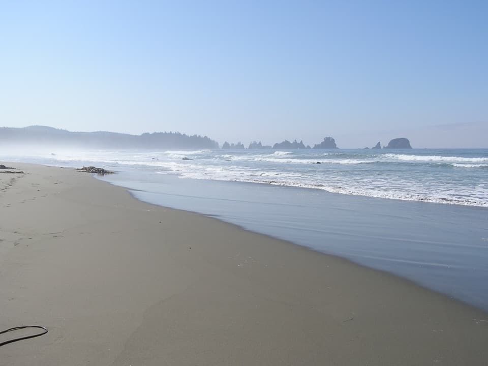
Point of Arches is a long cluster of offshore stacks, narrow pinnacles and natural arches, with tide pools along the rocky edges. At a low tide, look for barnacles, mussels and branching seaweed on the wet rocks. The stacks make a striking silhouette at sunset, but tide timing and the return walk matter more than staying for the last light; don't let a photo plan push you into a risky crossing.

Wildlife on the coastThe park highlights bald eagles and tide pools here, and seabirds are part of the beach…

The park highlights bald eagles and tide pools here, and seabirds are part of the beach experience. Scan the water and shoreline for birds as you walk, then slow down at the pools around the arches to notice how much life is packed into the rocks.

Access and facilitiesThe day-use lot is at the trailhead; overnight visitors use designated private parking areas…

The day-use lot is at the trailhead; overnight visitors use designated private parking areas farther back. The trailhead has a toilet, and three more pit toilets are spaced near beach campsites and creeks. A Makah Recreation Pass is required and must be bought in Neah Bay before reaching the reservation trailhead. The separate NPS wilderness camping permit applies to overnight stays. Pets and wheeled devices are prohibited on the coastal trails and beach. The park lists April through October as the best season; summer brings more visitors and campers.
Choose the outing you wantIf you want a short beach visit, turn around closer to the access and treat it as a different,…

If you want a short beach visit, turn around closer to the access and treat it as a different, shorter outing. The full Point of Arches hike is the better choice for the sea stacks and tide pools, but it takes real time on wet trail and sand and demands a tide plan. If you are short on time or unsure about the beach crossing, don't set out assuming the arches are just beyond the trail's final descent.

Wildlife

Wildlife in Olympic

All Olympic wildlife maps

Sighting maps show where each species has been reported across Olympic. Wildlife moves, so no sighting is guaranteed.

Parkwolf’s Olympic ranking

Top-rated trails in Olympic

All 148 trails
  1. 1Hall of Mosses TrailEasy · 0.8 mi
  2. 2Hurricane Hill TrailModerate · 3.3 mi
  3. 3Sol Duc Falls Nature TrailEasy · 1.6 mi
  4. 4High Divide Loop (Seven Lakes Basin)Challenging · 19 mi
  5. 5Hoh River TrailChallenging · 34.8 mi
  6. 7Rialto Beach to Hole-in-the-Wall TrailModerate · 3.3 mi

Take Parkwolf to Olympic.

The audio tour guide for the drive, plus offline maps, trails, and wildlife heatmaps for when the signal drops.

4.7 from 8,600+ ratings

Download Parkwolf on the App StoreGet Parkwolf on Google Play