Cape Beale Lighthouse in Pacific Rim National Park Reserve

Sight · Pacific Rim National Park Reserve

Cape Beale Lighthouse

A 19th-century lightstation at the end of a tide-timed coastal hike

Photo: Wikimedia Commons
Type
Sight
Nearest trail
5.4 km
  • Trailhead
  • Parking
Parkwolf audio tour34 stories across Pacific Rim’s roads

Overview

About Cape Beale Lighthouse

Why stop

  • A 19th-century light station at a rugged Pacific headland

Heads up

  • A strenuous 14 km return hike with rough footing and tide-limited access

Map

Where it is

Loading the Pacific Rim map
Full map
SightCape Beale Lighthouse48.78643, -125.21552
Keep this map with you offline in the Parkwolf app

Plan your stop

Before you go

7 active Pacific Rim alerts

  • ClosureWest Coast Trail winter access restrictionMentions West Coast Trail, referenced in this guideFrom October 7 through April 30, only day use between Pachena Bay trailhead and km 8 is permitted; overnight use and the remainder of the West Coast Trail are closed.Official details
  • ClosureWest Coast Trail lightstations closedMentions West Coast Trail, referenced in this guideCarmanah Point and Pachena Point Lightstations and their surrounding grounds in the West Coast Trail Unit are closed to public use at all times; do not enter.Official details

See all 7 alerts
A park ranger sits on a dash-mounted phone, talking, as Parkwolf’s Tour Guide plays “Army Cutworm Moths: A Grizzly Bear Buffet” on Grand Loop Road below Dunraven Pass in Yellowstone
Parkwolf Tour GuideThe highest, rockiest slopes around here are a summer buffet for grizzly bears.

Pacific Rim Tour Guide

Your drive to Cape Beale Lighthouse, narrated.

Parkwolf is a GPS audio tour guide for Pacific Rim National Park Reserve. As you drive, it chimes in with what’s ahead: hidden gems, upcoming stops, history, geology, and wildlife, right through your car’s speakers.

See the Pacific Rim audio tour

More stories near here in the app

  • Pachena Bay Campground
  • Pachena Bay West Coast Trail Orientation Centre
  • A Wave Across the Pacific
  • 34 audio storiesacross Pacific Rim’s roads, triggered by GPS as you drive
  • Wildlife heatmapsfor Orca, Humpback Whale, Black Bear, and 13 more
  • Works offlinemaps, 19 trails, 52 places, and audio download before you lose signal
  • CarPlay readysimple controls built for the drive
★★★★★
“Fantastic app with many points of information… It’s great to just turn on while you’re driving and it gives you an audio tour of the national Park. We love it!!!!”
JMJamesApp Store review
Download Parkwolf on the App StoreGet Parkwolf on Google Play

4.7 from 8,600+ ratings

Guide

More about Cape Beale Lighthouse

Reach it on a long coastal hikeCape Beale Lighthouse is a historic light station on a rugged headland near Bamfield, in…

Cape Beale Lighthouse is a historic light station on a rugged headland near Bamfield, in Pacific Rim National Park Reserve’s West Coast Trail unit. Getting there means a 7 km hike each way, so plan a full-day outing. The lighthouse is the trail’s destination, but public access into the light station grounds or tower isn’t confirmed; plan around the hike and shoreline views rather than a tower visit.

Time both crossings with the tideThe last stretch crosses tidal sand flats that require a tide of 1.8 m or lower.

The last stretch crosses tidal sand flats that require a tide of 1.8 m or lower. Check the timing for both directions before you leave. The route starts at the end of South Bamfield Road; marked parking is 400 m up the road from the trailhead. Day and overnight users of Cape Beale Headlands must register at the West Coast Trail Information Office at Pachena Bay, and a National Park Entry Pass is required. There are no outhouses or dependable fresh-water sources along the route, so bring enough water and plan ahead.

Expect slow, rough footingThe 14 km return hike is strenuous even though much of the terrain is fairly flat.

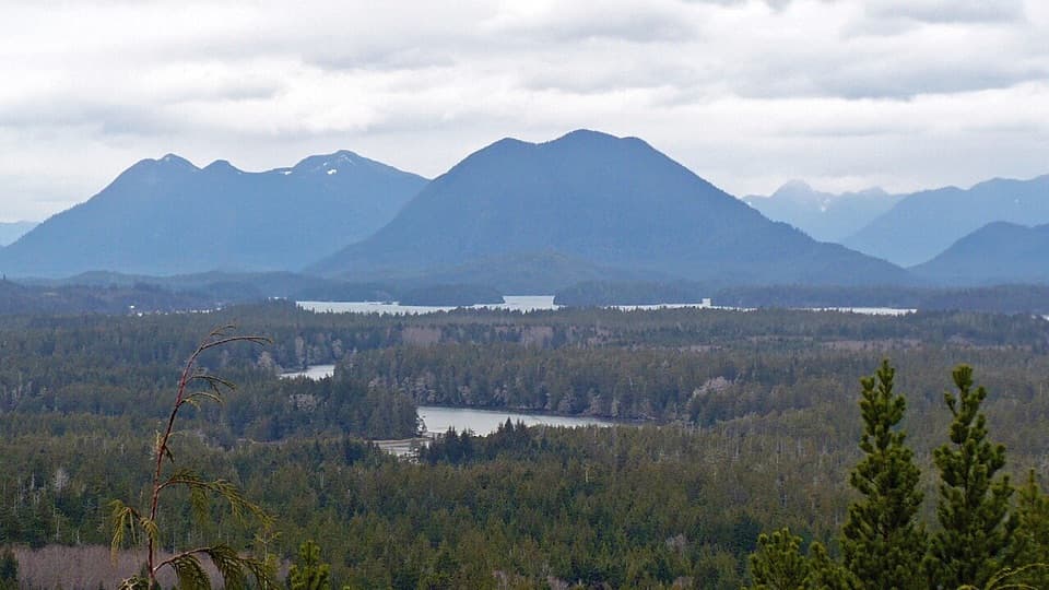
The 14 km return hike is strenuous even though much of the terrain is fairly flat. Expect mud, bare roots, log crossings and slippery sections. The walk goes from Topaltos Beach through a swampy bog, up a steep rocky hill with drier vegetation and stunted trees, then over the sand flats to the light station. Check current trail conditions before setting out.

A light here since 1874Cape Beale’s light first went into service on July 1, 1874.

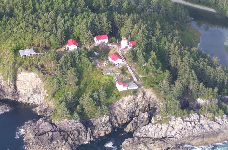
Cape Beale’s light first went into service on July 1, 1874. The present steel skeleton tower, topped by an aluminum lantern, replaced an earlier wooden lighthouse in 1958. Keepers watched the dangerous reef waters for vessels in distress, and the station’s exposed Pacific setting makes that purpose easy to understand.

A name from an early voyageThe cape is named for John Beale, purser aboard the Imperial Eagle during Captain Charles…

The cape is named for John Beale, purser aboard the Imperial Eagle during Captain Charles Barkley’s 1787 voyage. Beale and other crew members later died near the Hoh River. It’s a stark early maritime story for a coast where ships had to pick their way past reefs and exposed headlands.

The telegraph trail’s rescue storyPart of the route follows the old telegraph line between Bamfield and the lighthouse, and…

Part of the route follows the old telegraph line between Bamfield and the lighthouse, and traces remain along the way. In 1906, when a storm broke the line during trouble with the bark Coloma, keeper Thomas Patterson’s wife Minnie walked the rough trail to Bamfield to get help. The rescued ship later broke on a reef.

Frame the approachTopaltos Beach, its lagoon, the bog-to-headland transition and the rocky shore all give the…

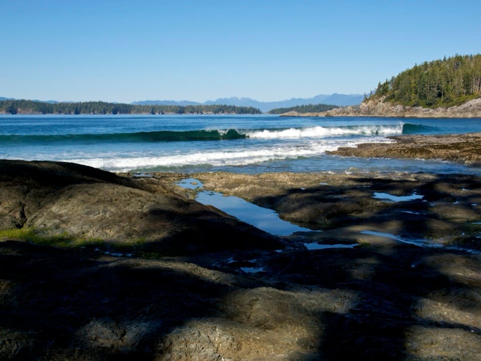
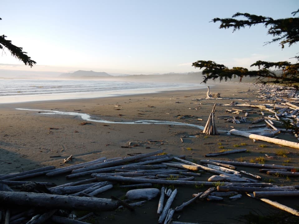
Topaltos Beach, its lagoon, the bog-to-headland transition and the rocky shore all give the walk different scenes. In fog or drizzle, wet sand at the beach can reflect the coast, a worthwhile moment to watch for if the weather turns misty. The station’s white tower and red roofs stand out against the dark evergreens and pale rocks.

Wildlife

Wildlife in Pacific Rim

All Pacific Rim wildlife maps

Sighting maps show where each species has been reported across Pacific Rim. Wildlife moves, so no sighting is guaranteed.

Parkwolf’s Pacific Rim ranking

Top sights in Pacific Rim

All 52 places
  1. 1Long BeachBeach
  2. 2Wickaninnish BeachBeach
  3. 3Tsusiat FallsSight
  4. 4Incinerator RockSight
  5. 5Owen Point Sea CavesSight
  6. 6Radar HillSight

Take Parkwolf to Pacific Rim.

The audio tour guide for the drive, plus offline maps, trails, and wildlife heatmaps for when the signal drops.

4.7 from 8,600+ ratings

Download Parkwolf on the App StoreGet Parkwolf on Google Play