Pachena Bay Campground in Pacific Rim National Park Reserve

Campground · Pacific Rim National Park Reserve

Pachena Bay Campground

A beachside staging camp for West Coast Trail hikers.

Type
Campground
Nearest trail
0.6 km
Audio stories
3 nearby
  • Restrooms
  • Parking
  • Wi-Fi

Hear the audio tour

Pachena Bay Campground

Overview

About Pachena Bay Campground

Why stop

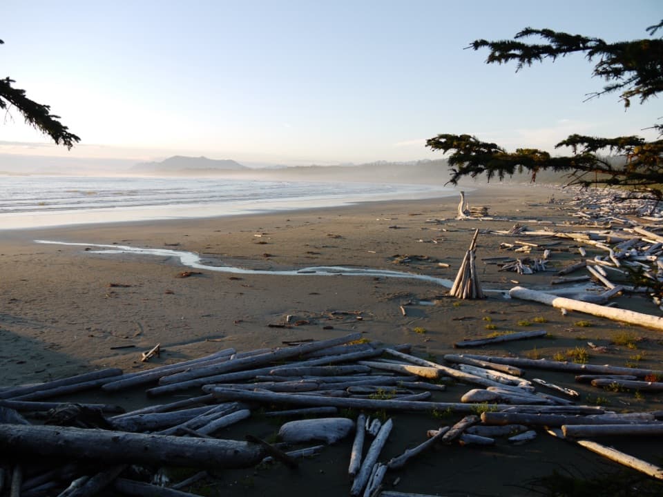
  • A long sandy beach sits beside the forested campsites.

Heads up

  • Getting there involves a long drive on active logging roads.

Map

Where it is

Loading the Pacific Rim map
Full map
CampgroundPachena Bay Campground48.79626, -125.12140
Keep this map with you offline in the Parkwolf app

Plan your stop

Before you go

7 active Pacific Rim alerts

  • ClosureWest Coast Trail winter access restrictionMentions West Coast Trail, referenced in this guideFrom October 7 through April 30, only day use between Pachena Bay trailhead and km 8 is permitted; overnight use and the remainder of the West Coast Trail are closed.Official details
  • ClosureWest Coast Trail lightstations closedMentions West Coast Trail, referenced in this guideCarmanah Point and Pachena Point Lightstations and their surrounding grounds in the West Coast Trail Unit are closed to public use at all times; do not enter.Official details

See all 7 alerts
A park ranger sits on a dash-mounted phone, talking, as Parkwolf’s Tour Guide plays “Army Cutworm Moths: A Grizzly Bear Buffet” on Grand Loop Road below Dunraven Pass in Yellowstone
Parkwolf Tour GuideThe highest, rockiest slopes around here are a summer buffet for grizzly bears.

Pacific Rim Tour Guide

Your drive to Pachena Bay Campground, narrated.

Parkwolf is a GPS audio tour guide for Pacific Rim National Park Reserve. As you drive, it chimes in with what’s ahead: hidden gems, upcoming stops, history, geology, and wildlife, right through your car’s speakers.

See the Pacific Rim audio tour

Recorded for this place

Pachena Bay Campground
0:00 / 0:29
“Pachena Bay Campground is coming up, a Huu-ay-aht First Nations-operated camp beside a long sandy beach. If you're starting or finishing the West Coast Trail at its northern end, this is a handy place to spend a night.”

Plays as you drive up to Pachena Bay Campground in the Parkwolf Pacific Rim Tour Guide.

More stories near here in the app

  • Pachena Bay West Coast Trail Orientation Centre
  • A Wave Across the Pacific
  • 34 audio storiesacross Pacific Rim’s roads, triggered by GPS as you drive
  • Wildlife heatmapsfor Orca, Humpback Whale, Black Bear, and 13 more
  • Works offlinemaps, 19 trails, 52 places, and audio download before you lose signal
  • CarPlay readysimple controls built for the drive
★★★★★
“Fantastic app with many points of information… It’s great to just turn on while you’re driving and it gives you an audio tour of the national Park. We love it!!!!”
JMJamesApp Store review
Download Parkwolf on the App StoreGet Parkwolf on Google Play

4.7 from 8,600+ ratings

Guide

More about Pachena Bay Campground

Camp beside the trail’s north endPachena Bay Campground is a Huu-ay-aht First Nations-operated RV and tent campground in coastal…

Pachena Bay Campground is a Huu-ay-aht First Nations-operated RV and tent campground in coastal forest beside Pachena Bay, near Anacla and about five kilometres south of Bamfield. The operator estimates roughly 70 sites, with beachside and forest-side options and some power-and-water hookups. If you are starting or finishing the West Coast Trail at Pachena Bay, this is a handy night on either end. Parks Canada recommends it for those hikers; the campground is a separate Huu-ay-aht operation, not part of the trail’s registration or orientation services.

Give the tide roomThe campground fronts about 1,200 metres of sandy beach on a bay facing southwest toward the…

The campground fronts about 1,200 metres of sandy beach on a bay facing southwest toward the open Pacific. At low tide, the sand can spread to nearly 200 metres, leaving room to beachcomb, stretch your legs, or wander along the shore. The beach is the main draw. Trees screen many campsites, but a beachside site does not always have a direct view of the water.

Campground basicsA central wash house has flush toilets and six coin-operated hot showers; the wash house is…

A central wash house has flush toilets and six coin-operated hot showers; the wash house is described as wheelchair-accessible. Potable water is available at marked taps, Wi-Fi works best around the office, and cell service is very limited. Firewood and ice are sold at the office. There is no laundry or restaurant on site; the operator points visitors to a café, store, and gas bar in Bamfield.

Plan the driveFrom Port Alberni, allow at least an hour and a half for about 83 kilometres on chip-sealed…

From Port Alberni, allow at least an hour and a half for about 83 kilometres on chip-sealed active logging roads toward Bamfield and Pachena Bay. Watch for logging trucks, then follow the campground access road’s posted 10 km/h limit. Bring supplies for the stay rather than counting on a meal stop at camp.

Wildlife

Wildlife in Pacific Rim

All Pacific Rim wildlife maps

Sighting maps show where each species has been reported across Pacific Rim. Wildlife moves, so no sighting is guaranteed.

Parkwolf’s Pacific Rim ranking

Top sights in Pacific Rim

All 52 places
  1. 1Long BeachBeach
  2. 2Wickaninnish BeachBeach
  3. 3Tsusiat FallsSight
  4. 4Incinerator RockSight
  5. 5Owen Point Sea CavesSight
  6. 6Radar HillSight

Take Parkwolf to Pacific Rim.

The audio tour guide for the drive, plus offline maps, trails, and wildlife heatmaps for when the signal drops.

4.7 from 8,600+ ratings

Download Parkwolf on the App StoreGet Parkwolf on Google Play