Onyx Bridge Hike in Petrified Forest National Park

#7 of 16 trails in Petrified Forest

Petrified Forest National Park, AZ

Onyx Bridge Hike

An unmarked wash route to a 210-million-year-old petrified conifer.

Length
4mi
Time
2.5hr
Elev. change
335ft
Difficulty
Moderate
  • High point 5,797 ft

Hear the audio tour

Painted Desert Inn and Kachina Point

Overview

About Onyx Bridge Hike

Why go

  • A rare, exposed Triassic conifer at the end of a remote badlands walk.

Heads up

  • The route becomes unmarked after the steep descent.
  • Its approximate distance varies with the line followed through the washes.

Map & elevation

The route

Loading the Petrified Forest map
Full map
Elevation5,463–5,797 ft
TrailheadWilderness Access Trail at Painted Desert Inn35.08362, -109.78935
Keep this map with you offline in the Parkwolf app

Plan your hike

Before you go

Parking

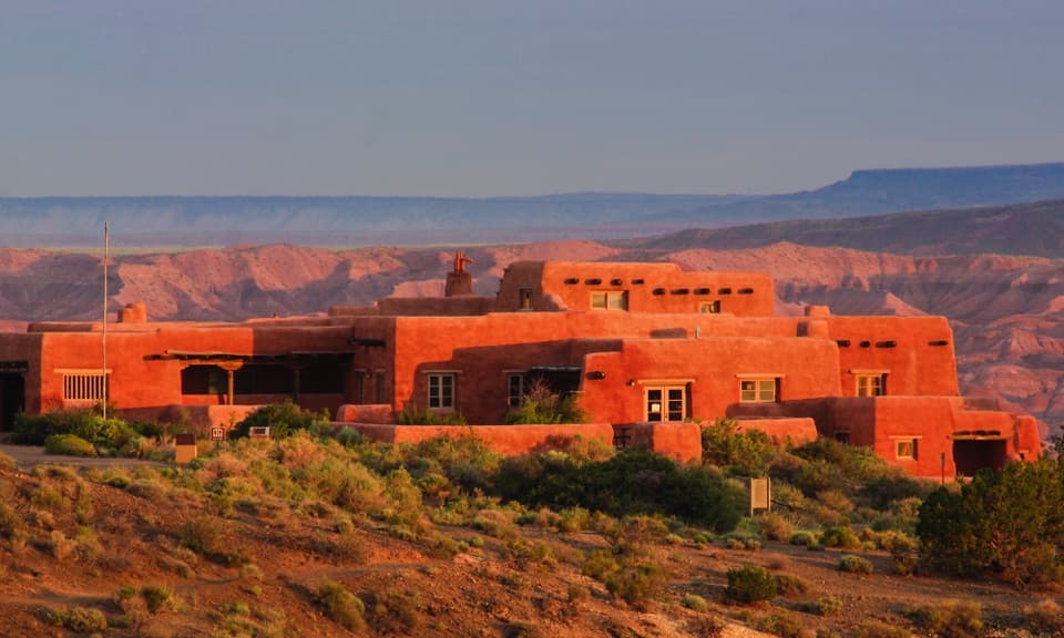
Use the Kachina Point parking area beside Painted Desert Inn, about two miles from the north entrance. The Wilderness Access Trail begins at the steps on the Inn’s left side, behind the upright display signs. Restrooms and potable water are listed at the lot.

Safety

The developed trail ends at the valley floor; the rest is route-finding over loose, uneven ground and boulders. The park warns against hiking when lightning is nearby and warns that spring snowmelt and summer monsoon can bring high water, mud and quicksand to the washes. Carry at least one gallon of water per person per day.

2 active Petrified Forest alerts

  • ClosurePainted Desert Visitor Center closed for constructionThe Painted Desert Visitor Center is closed for construction; visitor-center operations are at the Painted Desert Inn, two miles past the north entrance station.Official details
  • ClosureAgate House closed to visitorsAgate House is closed to the public because of physical safety concerns; stay at least 15 feet from the structure. - The closure remains in effect until terminated in writing by the park.Official details
Petrified Forest alerts
A park ranger sits on a dash-mounted phone, talking, as Parkwolf’s Tour Guide plays “Army Cutworm Moths: A Grizzly Bear Buffet” on Grand Loop Road below Dunraven Pass in Yellowstone
Parkwolf Tour GuideThe highest, rockiest slopes around here are a summer buffet for grizzly bears.

Petrified Forest Tour Guide

Your drive to Onyx Bridge Hike, narrated.

Parkwolf is a GPS audio tour guide for Petrified Forest National Park. As you drive, it chimes in with what’s ahead: hidden gems, upcoming stops, history, geology, and wildlife, right through your car’s speakers.

See the Petrified Forest audio tour

Recorded for this trailhead

Painted Desert Inn and Kachina Point
0:00 / 0:33
“Painted Desert Inn is coming up, with Hopi murals inside and the broad Kachina Point view just behind it.”

Plays as you drive up to this trailhead in the Parkwolf Petrified Forest Tour Guide.

More stories near here in the app

  • Hózhó Point Picnic Stop
  • Tawa Point and the Rim Walk
  • Pintado Point's Wide Desert View
  • Tiponi Point’s Basin View
  • 35 audio storiesacross Petrified Forest’s roads, triggered by GPS as you drive
  • Wildlife heatmapsfor Pronghorn, Mule Deer, Coyote, and 13 more
  • Works offlinemaps, 16 trails, 33 places, and audio download before you lose signal
  • CarPlay readysimple controls built for the drive
★★★★★
“Fantastic app with many points of information… It’s great to just turn on while you’re driving and it gives you an audio tour of the national Park. We love it!!!!”
JMJamesApp Store review
Download Parkwolf on the App StoreGet Parkwolf on Google Play

4.7 from 8,600+ ratings

Trail guide

Hiking Onyx Bridge Hike

The decisionOnyx Bridge Hike is an approximately four-mile out-and-back from Painted Desert Inn to an…

Onyx Bridge Hike is an approximately four-mile out-and-back from Painted Desert Inn to an exposed petrified conifer in the Black Forest. The walk begins on a developed descent, then becomes a route-finding hike through sandy washes and small drainages. Choose it for a remote geology-focused outing; skip it if you need a continuous, signed trail. The namesake is a fossil log, not a footbridge to cross. The park's estimate is about two hours, but leave extra time for the unmarked terrain. This is separate from the seven-mile Wilderness Loop, though both enter the northern wilderness.

Start at Painted Desert InnPark at Kachina Point beside the Inn, about two miles from the park's north entrance.

Park at Kachina Point beside the Inn, about two miles from the park's north entrance. The Wilderness Access Trail starts at steps on the building's left side, just behind the upright display signs. Those switchbacks drop roughly 300 feet to the valley floor. Loose pebbles make the descent awkward, and the climb back up is moderately difficult. The Inn stays visible from many points along the hike and can help you orient on the return.

Through the washesThe developed path ends at the bottom.

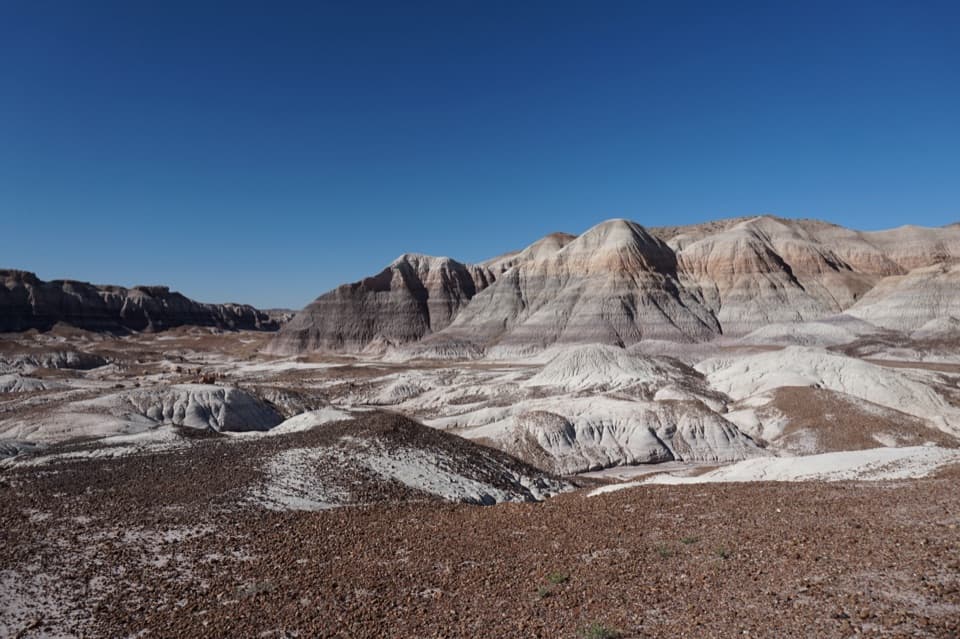
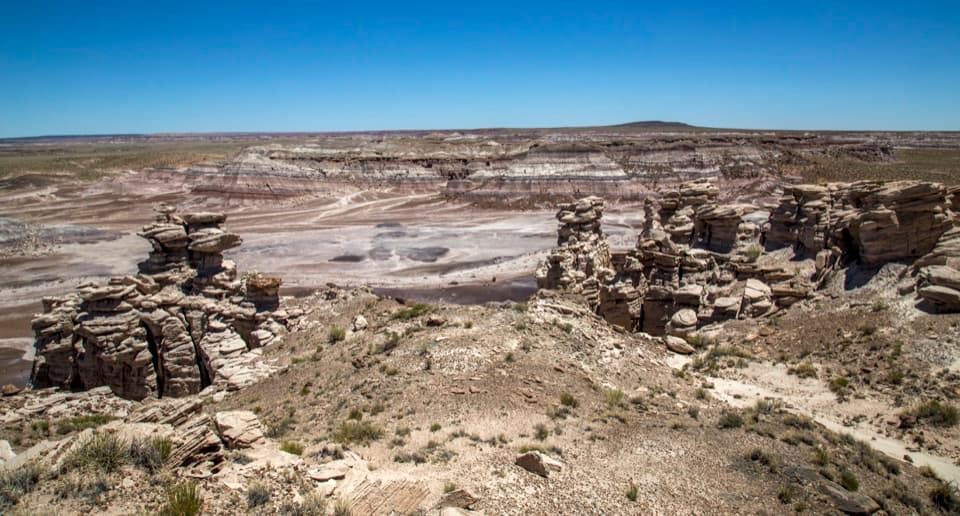
The developed path ends at the bottom. The suggested route continues north toward Lithodendron Wash, following or crossing it to a bend, then turns west into a smaller drainage. At its splits, stay on the right side until a rockfall; climb its left side, where the log lies above and to the right. There is no continuous tread to follow through this section. Branching washes can look alike, so expect to stop and check your line rather than simply follow footprints. The route shown in the app is one mapped outbound corridor; the park's own directions describe it as a suggested line, and other walked tracks are longer.

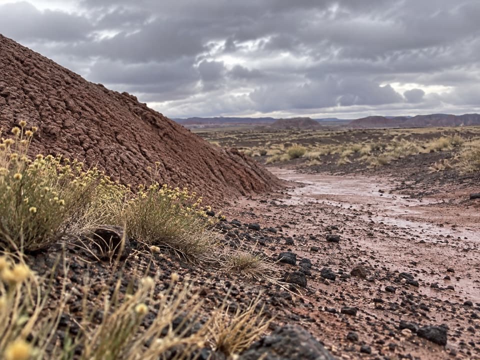
What remains of Onyx BridgeThe feature is an exposed Triassic conifer from the Black Forest Bed of the Chinle Formation,…

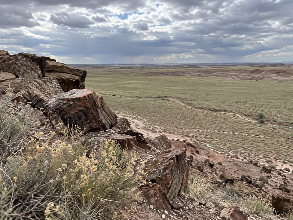
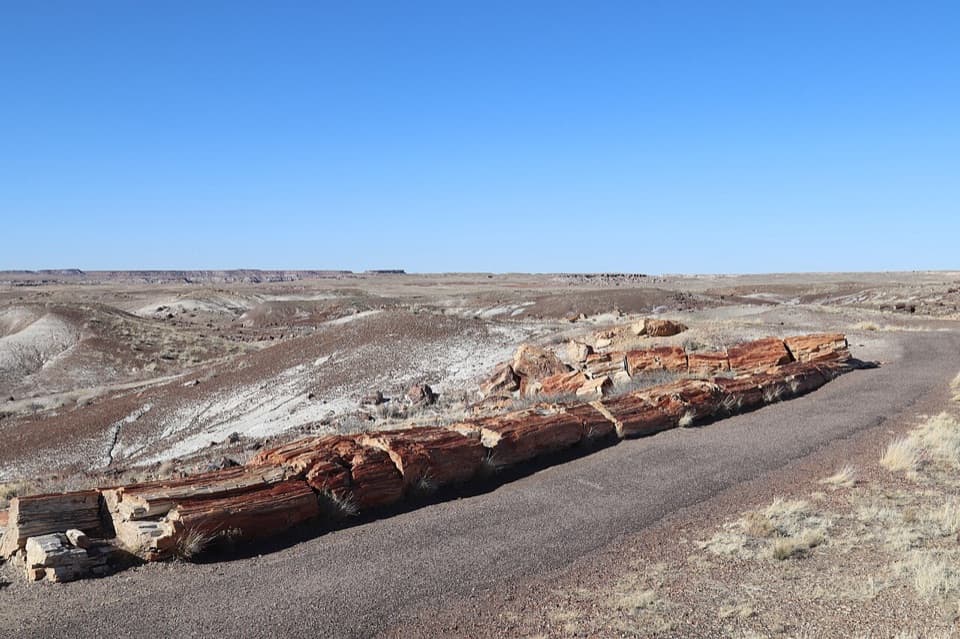
The feature is an exposed Triassic conifer from the Black Forest Bed of the Chinle Formation, about 210 million years old. An older park handout describes roughly 30 feet of exposed fossil wood. Erosion continues to reveal and reshape the Black Forest's logs. A more recent field report says this log has broken into pieces and no longer spans the wash, so do not count on the intact bridge shape shown in older pictures; its present appearance has not been confirmed in a recent park account. Look for the petrified log and surrounding wash, and leave all fossil wood where it lies.

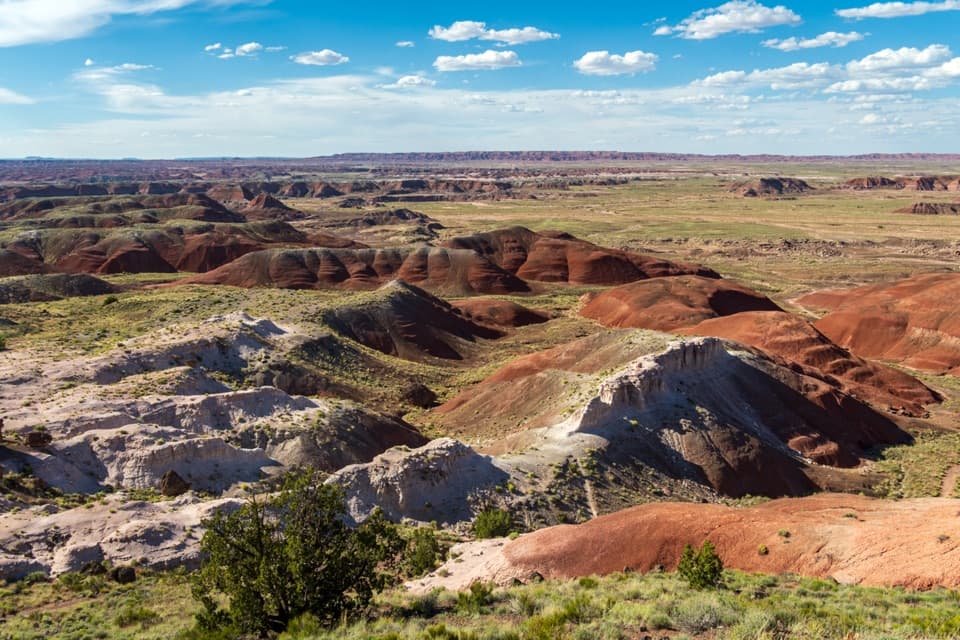
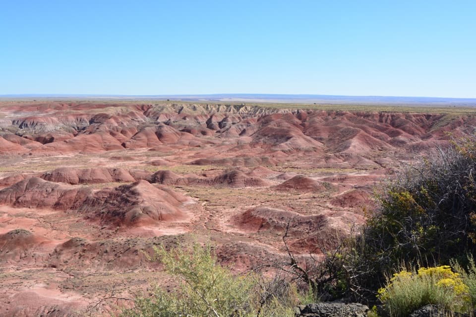
The landscape and the viewThe hike reaches the Black Forest, where many petrified logs erode from the same geologic bed.

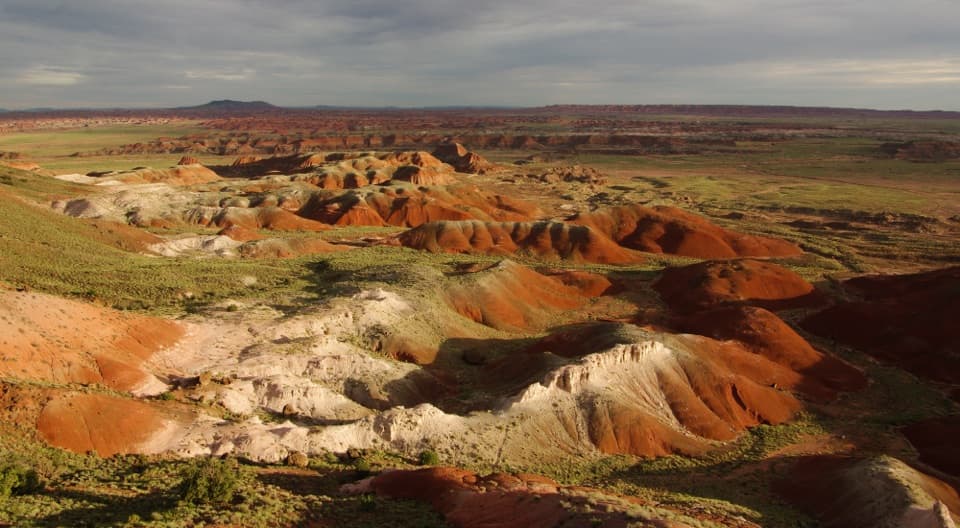
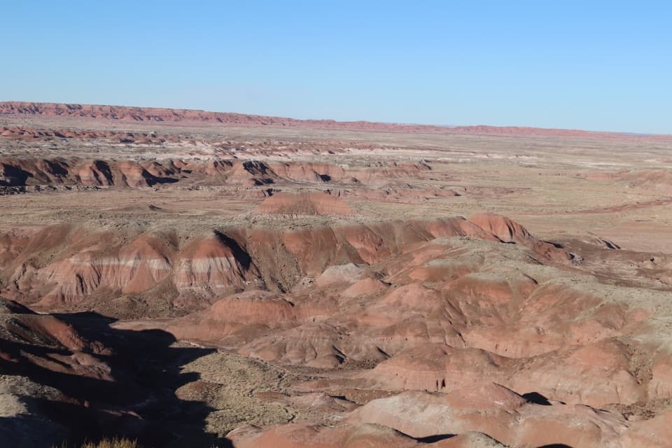
The hike reaches the Black Forest, where many petrified logs erode from the same geologic bed. The exposed conifer is the main reason to take this route, while the washes and colored badland slopes are part of the journey rather than a paved approach to a single viewpoint. From the Kachina Point overlook, the log can be seen if you know where to look; that view is useful for orienting yourself before descending, but it does not replace the route-finding hike.

Water, weather and petsThe park warns that spring snowmelt and summer monsoon storms can bring high water, thick mud…

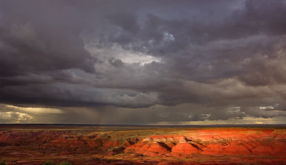
The park warns that spring snowmelt and summer monsoon storms can bring high water, thick mud or quicksand to the washes, and says not to attempt the hike when lightning is nearby. Its route handout recommends at least a gallon of water per person per day. Restrooms and potable water are listed at the trailhead parking area, but no on-route water is documented. Pet guidance is unclear for the unmarked section: an older route handout permits leashed dogs, while current park guidance addresses developed trails. Check with the park before bringing a pet.

Wildlife

Wildlife in Petrified Forest

All Petrified Forest wildlife maps

Sighting maps show where each species has been reported across Petrified Forest. Wildlife moves, so no sighting is guaranteed.

Keep exploring

Near Onyx Bridge Hike

See it all on the map

Trails that start nearby

Places near the trailhead

Parkwolf’s Petrified Forest ranking

Top-rated trails in Petrified Forest

All 16 trails
  1. 1Blue Mesa TrailEasy · 1 mi
  2. 2Crystal Forest TrailEasy · 0.9 mi
  3. 3Painted Desert Rim TrailEasy · 1 mi
  4. 4Blue Forest TrailChallenging · 1.2 mi
  5. 5Giant Logs TrailEasy · 0.4 mi
  6. 6Long Logs and Agate House TrailsEasy · 2.6 mi

Take Parkwolf to Petrified Forest.

The audio tour guide for the drive, plus offline maps, trails, and wildlife heatmaps for when the signal drops.

4.7 from 8,600+ ratings

Download Parkwolf on the App StoreGet Parkwolf on Google Play