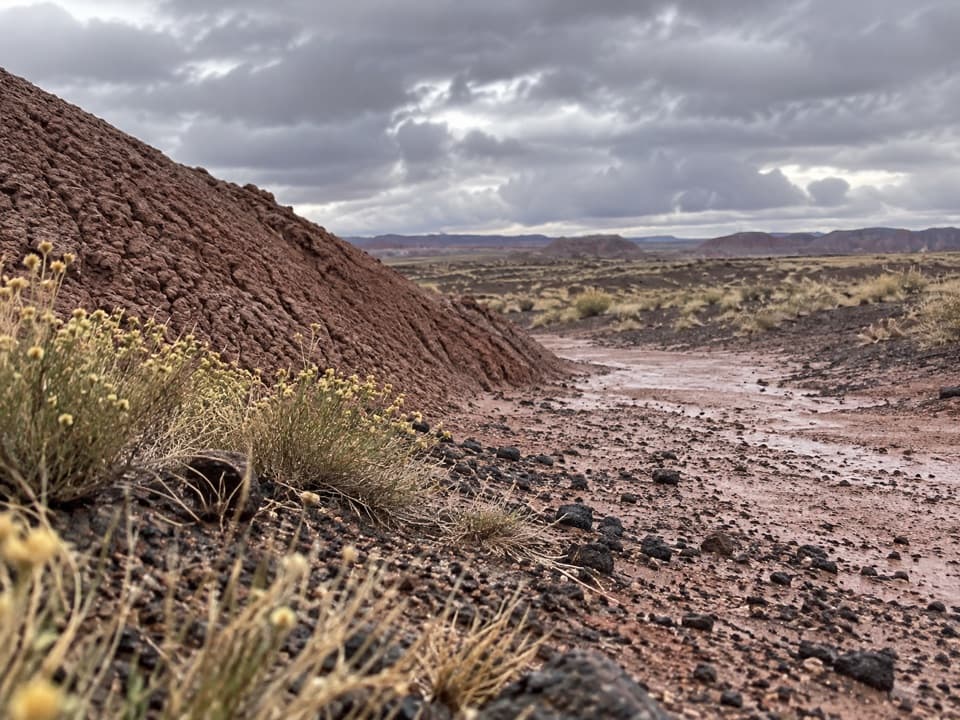
Blue Forest Trail in Petrified Forest National Park

#4 of 16 trails in Petrified Forest

Petrified Forest National Park, AZ

Blue Forest Trail

A rough old trail through blue badlands and exposed petrified wood.

Photo: CC BY-SA 2.0
Length
1.2mi
Time
1.5hr
Elev. change
197ft
Difficulty
Challenging
  • Dogs allowed
  • High point 5,597 ft

Hear the audio tour

The Tepees Roadside Views

Overview

About Blue Forest Trail

Why go

  • Historic route through Blue Mesa’s banded badlands
  • Close views of petrified wood emerging from eroding slopes

Heads up

  • Loose gravel, slick clay and exposed ridge sections
  • Faint tread makes route-finding part of the hike
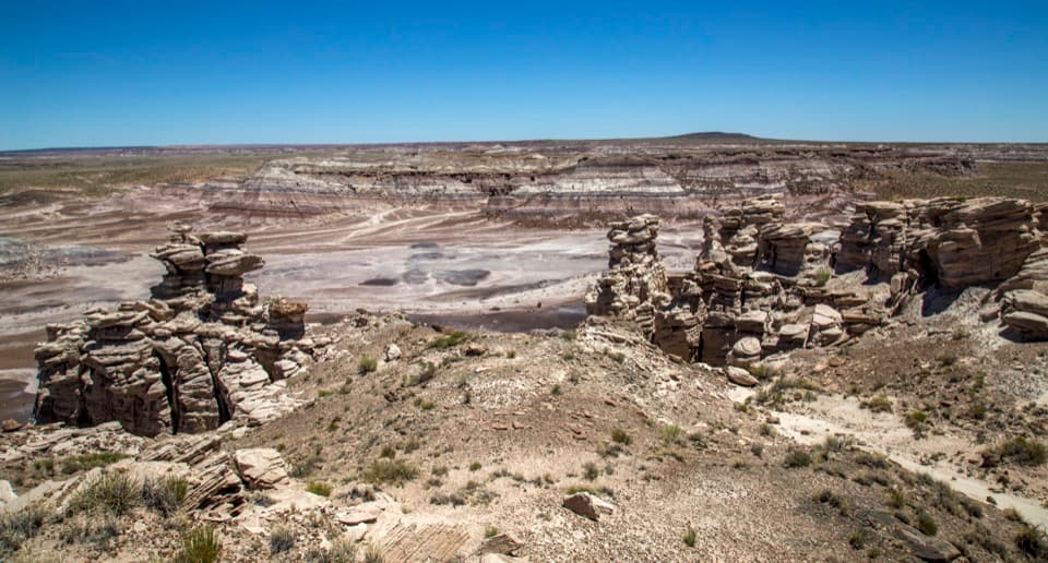
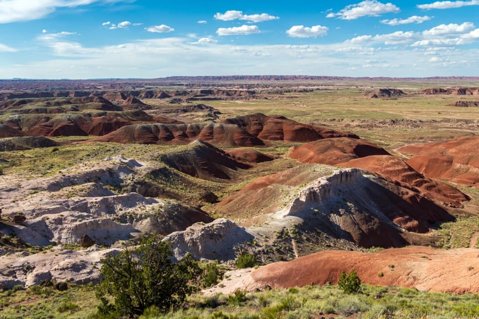
Blue Forest Trail is a rugged 1.2-mile point-to-point connector from the South Teepees pullout to the paved Blue Mesa Trail. It cuts across blue and white badland hills, with petrified wood showing through the eroding slopes. The park estimates about 200 feet of gain and loss. The short mileage is deceptive: loose footing, narrow ridges and tricky route-finding make this a hike for steady, experienced walkers. Allow about an hour and a half for the one-way walk. Without a shuttle, retrace the connector for a 2.4-mile round trip.
Parkwolf’s verdictIs this the hike for you?

Map & elevation

The route

Loading the Petrified Forest map
Full map
Elevation5,400–5,597 ft
TrailheadSouth Teepees pullout (Petrified Forest Road)34.94302, -109.77785
Keep this map with you offline in the Parkwolf app

Plan your hike

Before you go

Parking

Start at the South Teepees roadside pullout on Petrified Forest Road. The far end joins the paved Blue Mesa Trail; roadside parking on Blue Mesa Loop Road is another 0.3 mile along it, so a one-way hike needs a shuttle. Without one, retrace the connector for about 2.4 miles total.

Safety

For experienced, sure-footed hikers. Expect loose ball-bearing gravel, slippery clay, steep spots, narrow exposed ridges and tread that can be hard to follow. Wet or icy footing can be treacherous.

2 active Petrified Forest alerts

  • ClosurePainted Desert Visitor Center closed for constructionThe Painted Desert Visitor Center is closed for construction; visitor-center operations are at the Painted Desert Inn, two miles past the north entrance station.Official details
  • ClosureAgate House closed to visitorsAgate House is closed to the public because of physical safety concerns; stay at least 15 feet from the structure. - The closure remains in effect until terminated in writing by the park.Official details
Petrified Forest alerts
A park ranger sits on a dash-mounted phone, talking, as Parkwolf’s Tour Guide plays “Army Cutworm Moths: A Grizzly Bear Buffet” on Grand Loop Road below Dunraven Pass in Yellowstone
Parkwolf Tour GuideThe highest, rockiest slopes around here are a summer buffet for grizzly bears.

Petrified Forest Tour Guide

Your drive to Blue Forest Trail, narrated.

Parkwolf is a GPS audio tour guide for Petrified Forest National Park. As you drive, it chimes in with what’s ahead: hidden gems, upcoming stops, history, geology, and wildlife, right through your car’s speakers.

See the Petrified Forest audio tour

Recorded for this trailhead

The Tepees Roadside Views
0:00 / 0:29
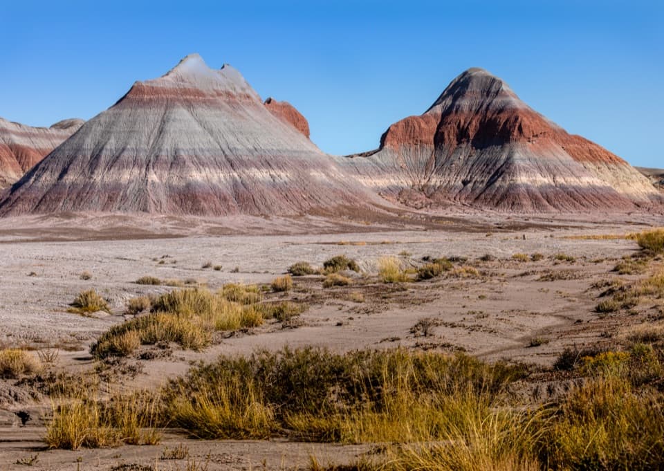
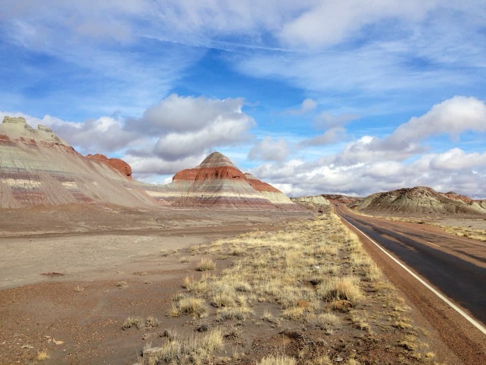
“The Tepees are coming up, a cluster of cone-shaped hills striped in gray-blue, purple, green, and rust. Their shape gave them their name.”

Plays as you drive up to this trailhead in the Parkwolf Petrified Forest Tour Guide.

More stories near here in the app

  • Puerco Pueblo’s Sun Marker
  • Ravens at Play
  • Blue Mesa's Banded Hills
  • The Logs’ Clean Breaks
  • 35 audio storiesacross Petrified Forest’s roads, triggered by GPS as you drive
  • Wildlife heatmapsfor Pronghorn, Mule Deer, Coyote, and 13 more
  • Works offlinemaps, 16 trails, 33 places, and audio download before you lose signal
  • CarPlay readysimple controls built for the drive
★★★★★
“Fantastic app with many points of information… It’s great to just turn on while you’re driving and it gives you an audio tour of the national Park. We love it!!!!”
JMJamesApp Store review
Download Parkwolf on the App StoreGet Parkwolf on Google Play

4.7 from 8,600+ ratings

Trail guide

Hiking Blue Forest Trail

The first half-mileThe route begins on the old lower Blue Mesa road, nearly level for about half a mile.

The route begins on the old lower Blue Mesa road, nearly level for about half a mile. Its broad, road-like tread can look as if it continues as a drive track. Then the trail climbs the badlands by switchbacks, crosses a few rolling hills and climbs again toward the ridge. It follows the crest before dropping to the paved Blue Mesa Trail. The tread is not always obvious, and erosion can leave tempting false paths; keep the route description handy and follow the actual line.

Take the footing seriouslyLoose, ball-bearing gravel and slippery clay are the main challenge, with steep spots and…

Loose, ball-bearing gravel and slippery clay are the main challenge, with steep spots and narrow, exposed ridges. Wet or icy ground can make the tread treacherous. The park recommends this route for experienced hikers who are sure-footed; if exposed edges or uncertain paths make you uneasy, choose the separate Blue Mesa loop instead. It is only a mile and alternates pavement and gravel, though its first descent is steep.

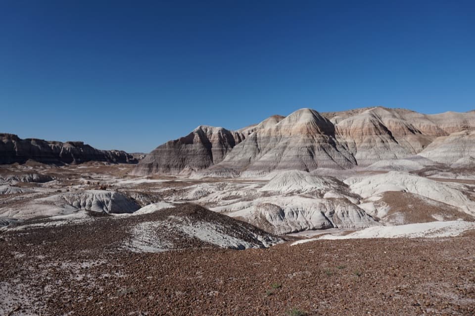
Read the badlands as you walkThe hills shift between blue-gray, white, purple and mauve, and the view changes at each turn.

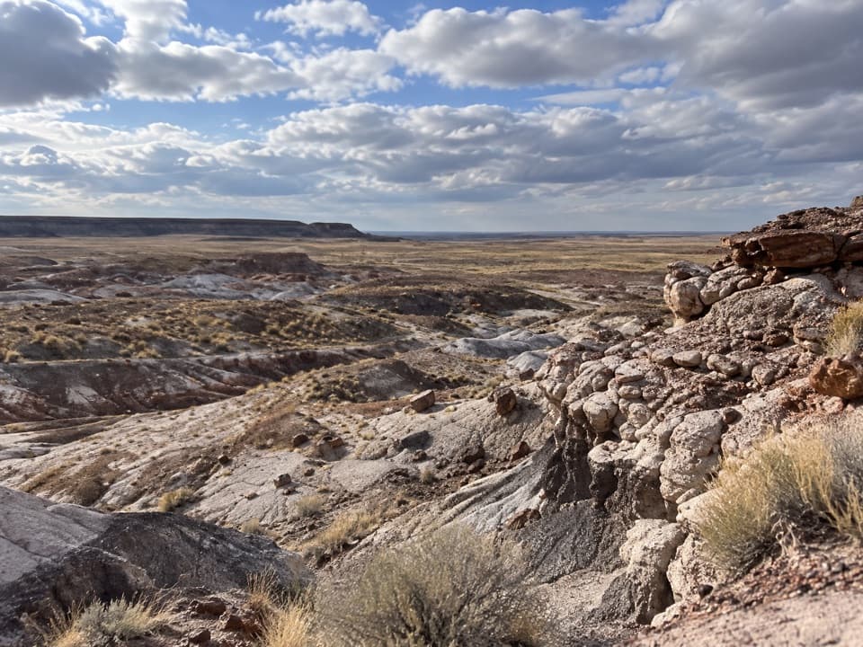
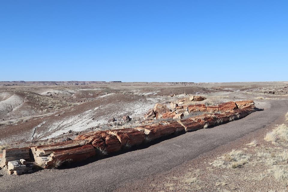
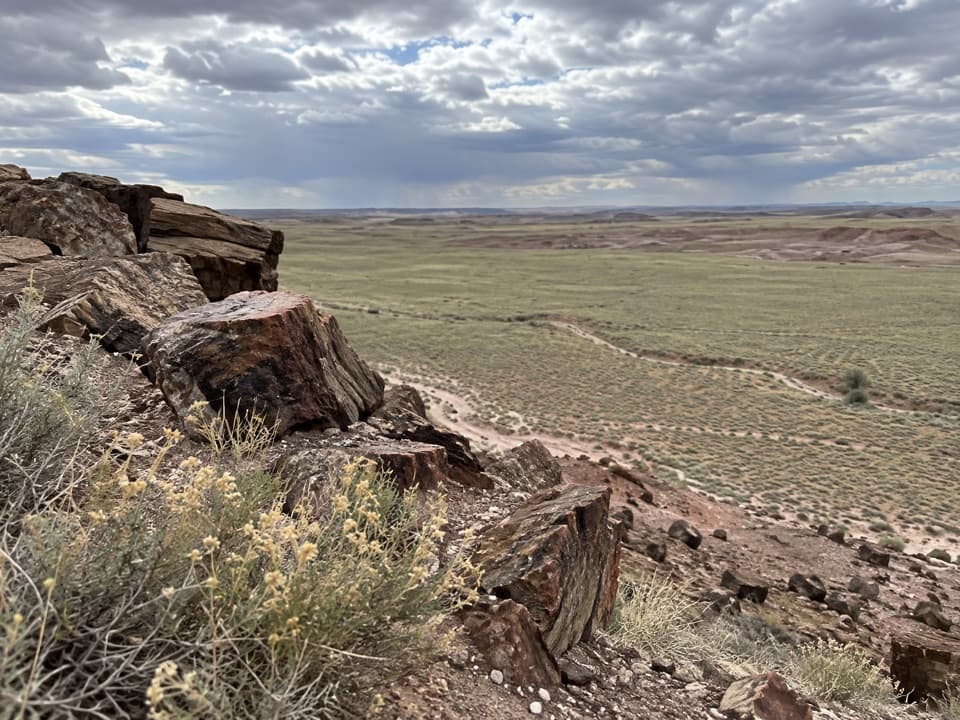
The hills shift between blue-gray, white, purple and mauve, and the view changes at each turn. As erosion strips away the slopes, petrified wood emerges close to the route. The ridge looks out toward the Billings Gap area and the broad badland basin. A long petrified log perched on a natural pedestal is a reported landmark along the ridges. Light changes the colors, and monsoon season can bring patches of green and wildflowers. For a photo, use one of the low mounds in the foreground with the layered hills behind it; it shows the depth of the country better than a flat horizon shot.

An old connection brought backThe Civilian Conservation Corps built the Blue Forest route between 1934 and 1937 to connect…

The Civilian Conservation Corps built the Blue Forest route between 1934 and 1937 to connect the lower and upper Blue Mesa roads. The trail and lower road closed in 1955, when the Blue Mesa Loop replaced them. The park re-established the historic path in 2013 for adventurous hikers. That history explains why the route feels different from the paved loop: it follows an older crossing through the badlands rather than circling the mesa on the modern developed trail.

Plan both endsStart at the South Teepees roadside pullout on Petrified Forest Road.

Start at the South Teepees roadside pullout on Petrified Forest Road. The far end joins the paved Blue Mesa Trail; it is another 0.3 mile along that trail to roadside parking on Blue Mesa Loop Road, so a shuttle makes the point-to-point route work as intended. The park also lists a 3-mile round trip. That longer figure is consistent with counting the 0.3-mile paved access leg in each direction; from the South Teepees pullout alone, retracing the connector is about 2.4 miles. Dogs are allowed on a leash no longer than six feet.

Wildlife

Wildlife in Petrified Forest

All Petrified Forest wildlife maps

Sighting maps show where each species has been reported across Petrified Forest. Wildlife moves, so no sighting is guaranteed.

Keep exploring

Near Blue Forest Trail

See it all on the map

Trails that start nearby

Places near the trailhead

Parkwolf’s Petrified Forest ranking

Top-rated trails in Petrified Forest

All 16 trails
  1. 1Blue Mesa TrailEasy · 1 mi
  2. 2Crystal Forest TrailEasy · 0.9 mi
  3. 3Painted Desert Rim TrailEasy · 1 mi
  4. 5Giant Logs TrailEasy · 0.4 mi
  5. 6Long Logs and Agate House TrailsEasy · 2.6 mi
  6. 7Onyx Bridge HikeModerate · 4 mi

Take Parkwolf to Petrified Forest.

The audio tour guide for the drive, plus offline maps, trails, and wildlife heatmaps for when the signal drops.

4.7 from 8,600+ ratings

Download Parkwolf on the App StoreGet Parkwolf on Google Play