Baker Gulch to Parika Lake in Rocky Mountain National Park

Rocky Mountain National Park, CO

Baker Gulch to Parika Lake

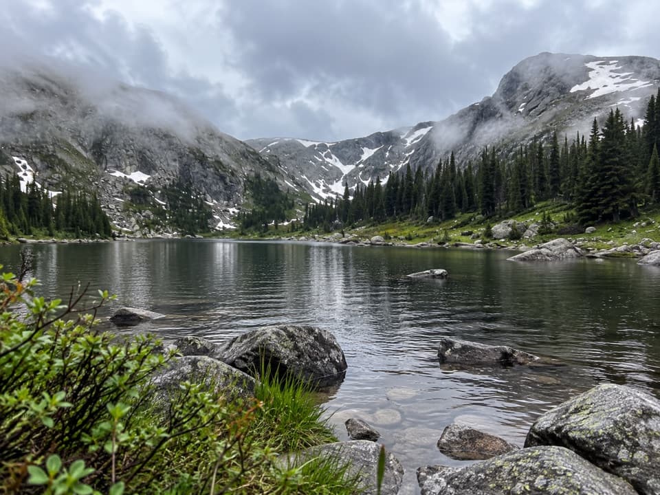
A strenuous climb ends at an alpine lake in a deep cirque.

Length
11.1mi
Time
6.5hr
Elev. change
2,526ft
Difficulty
Challenging
  • No dogs
  • High point 11,375 ft

Hear the audio tour

Bowen-Baker Trailhead: Baker Pass

Overview

About Baker Gulch to Parika Lake

Why go

  • A high lake beneath a striking rocky cirque
  • Varied approach through meadow, forest, boulder field, and alpine terrain

Heads up

  • Long, rough route with a steep high-altitude finish
  • Two unbridged stream crossings and a short unmapped access connection

Map & elevation

The route

Loading the Rocky Mountain map
Full map
Elevation8,848–11,375 ft
TrailheadBowen/Baker Trailhead40.35476, -105.85769
Keep this map with you offline in the Parkwolf app

Plan your hike

Before you go

Parking

Bowen/Baker Trailhead parking area on Trail Ridge Road, 6.4 miles beyond Rocky Mountain National Park’s west entrance. Follow the signed gravel-road and river approach to Baker Gulch; the mapped trail line begins a short walk beyond the parking point.

Safety

The steep finish is above 11,000 feet, and two stream crossings are unbridged; runoff can make them wet. Pets are prohibited on the Rocky Mountain National Park trail approach, and park entry requires a fee. Group size is limited to 15 people and livestock.

3 active Rocky Mountain alerts

  • ClosureOld Fall River Road closed to vehiclesOld Fall River Road is closed to motor vehicles for the season.Official details
  • ClosureSun Valley burn-area access remains closedThe area and trail west of Sun Valley Trail remain closed, including the route used for angler access to the Colorado River, because of impacts from the 2020 East Troublesome and Cameron Peak Fires;…Official details
See all 3 alerts
A park ranger sits on a dash-mounted phone, talking, as Parkwolf’s Tour Guide plays “Army Cutworm Moths: A Grizzly Bear Buffet” on Grand Loop Road below Dunraven Pass in Yellowstone
Parkwolf Tour GuideThe highest, rockiest slopes around here are a summer buffet for grizzly bears.

Rocky Mountain Tour Guide

Your drive to Baker Gulch to Parika Lake, narrated.

Parkwolf is a GPS audio tour guide for Rocky Mountain National Park. As you drive, it chimes in with what’s ahead: hidden gems, upcoming stops, history, geology, and wildlife, right through your car’s speakers.

See the Rocky Mountain audio tour

Recorded for this trailhead

Bowen-Baker Trailhead: Baker Pass
0:00 / 0:27
“You're approaching Bowen-Baker Trailhead, where Baker Pass offers a long climb to a wide view across the Never Summer peaks.”

Plays as you drive up to this trailhead in the Parkwolf Rocky Mountain Tour Guide.

More stories near here in the app

  • Coyote Valley: A Riverside Picnic
  • Holzwarth Historic Site: From Homestead to Guest Ranch
  • How Moose Reached Kawuneeche Valley
  • Elizabeth Burnell Leads the Way
  • 79 audio storiesacross Rocky Mountain’s roads, triggered by GPS as you drive
  • Wildlife heatmapsfor Elk, Moose, Mountain Goat, and 13 more
  • Works offlinemaps, 136 trails, 88 places, and audio download before you lose signal
  • CarPlay readysimple controls built for the drive
★★★★★
“…No cell service for majority of the day but had continuous access to the app - the maps, the tour guide as you drive is amazing. Highly recommend purchasing the subscription.”
jkatnerApp Store review
Download Parkwolf on the App StoreGet Parkwolf on Google Play

4.7 from 8,600+ ratings

Trail guide

Hiking Baker Gulch to Parika Lake

A long out-and-back to a high lakeThis is the full hike from Bowen/Baker Trailhead to Parika Lake and back: about 11.

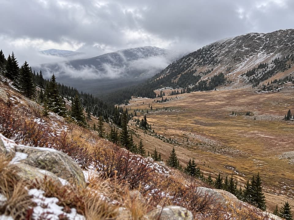
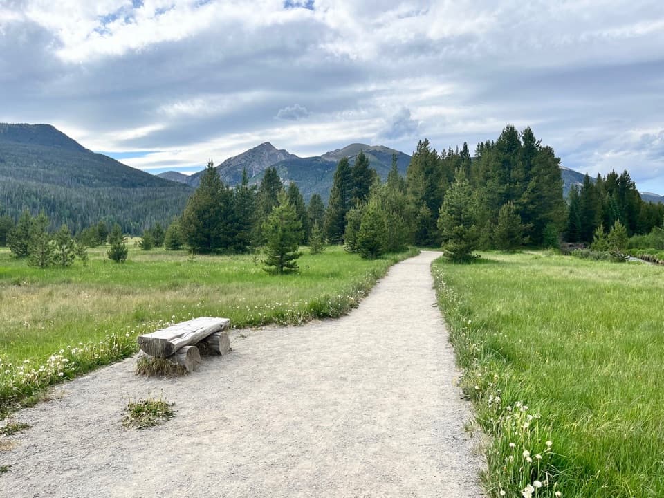
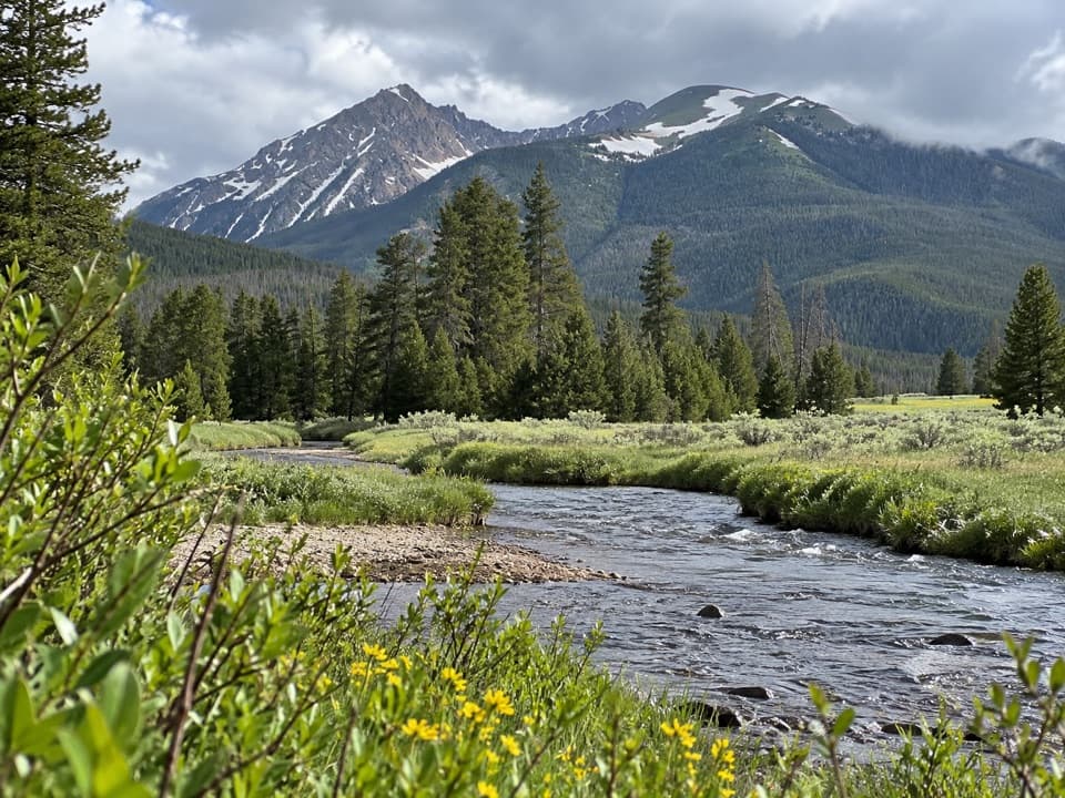
This is the full hike from Bowen/Baker Trailhead to Parika Lake and back: about 11.1 miles round trip with 2,510 feet of climbing. Allow six to seven hours. The lower valley is a gentle warm-up, but the upper trail gets rocky and the last climb is steep at more than 11,000 feet. The reward is a small alpine lake tucked beneath a high cirque, after a route that moves from river meadow to forest, boulder field, and open mountain terrain.

Finding the lake routeFrom the trailhead, follow the signed approach across the Colorado River and along the gravel…

From the trailhead, follow the signed approach across the Colorado River and along the gravel road through Kawuneeche Valley to Baker Gulch. The mapped trail line begins about a quarter-mile beyond the parking point, so use the trailhead signs to find the first leg rather than treating the map’s starting dot as the lot itself. The early miles climb gradually through lodgepole pine; around three-quarters of a mile, the route leaves Rocky Mountain National Park and enters Never Summer Wilderness in Arapaho National Forest, where a registration kiosk stands.

In the upper valley the tread becomes rougher through a boulder field, with more open views toward Peak 12,442 and nearby aspen. At the upper junction with Baker Pass Trail #29.1, stay on Baker Gulch; the Parika Lake Trail #29.2 branches farther on.

Crossing the Grand DitchAt roughly 3.4 miles, the route reaches the Grand Ditch.

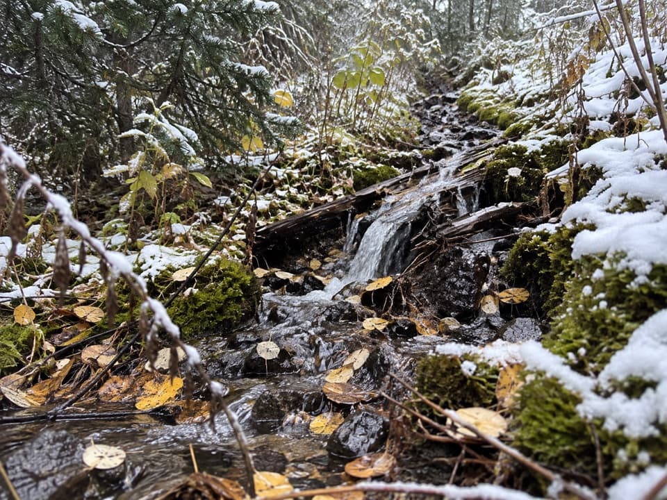
At roughly 3.4 miles, the route reaches the Grand Ditch. Follow the service-road and footbridge crossing, then turn back onto Baker Gulch. A short stretch around the crossing is not fully joined in the mapped trail data, although the footbridge and continuous tread are visible on the ground map. Farther up, expect two unbridged stream crossings; the first can be wet during spring runoff.

The final climb and the lakeBeyond the Parika junction, the trail climbs steeply toward treeline.

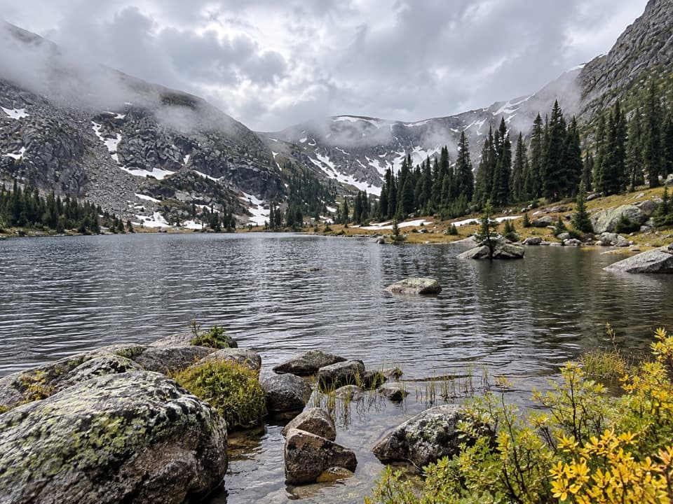
Beyond the Parika junction, the trail climbs steeply toward treeline. The trees thin and the surrounding peaks open up before a shorter final rise reaches the lake’s eastern shore. Fairview Mountain, Parika Peak, and Peak 12,253 frame the basin. After snowmelt, alpine wildflowers add color along the water. For a photo, include the shoreline boulders in the foreground with the cirque behind the lake; the low basin view gives the water and steep walls useful scale.

A ditch across the DivideThe Grand Ditch is an irrigation diversion built from 1890 to 1936.

The Grand Ditch is an irrigation diversion built from 1890 to 1936. It carries water from the Never Summer Mountains across the Continental Divide toward the Cache la Poudre River and farms on the eastern plains. The trail’s footbridge crosses a working piece of infrastructure in the middle of an otherwise remote wilderness approach.

Access and limitsThe Bowen/Baker Trailhead is on Trail Ridge Road, 6.

The Bowen/Baker Trailhead is on Trail Ridge Road, 6.4 miles beyond Rocky Mountain National Park’s west entrance. An RMNP entrance fee is required. Pets are prohibited on every RMNP trail, including this approach, even though most of the hike continues into Never Summer Wilderness. Groups are limited to 15 people and livestock. The lake route is a poor choice when the final climb or stream fords are beyond your comfort level.

Wildlife

Wildlife in Rocky Mountain

All Rocky Mountain wildlife maps

Sighting maps show where each species has been reported across Rocky Mountain. Wildlife moves, so no sighting is guaranteed.

Keep exploring

Near Baker Gulch to Parika Lake

See it all on the map

Trails that start nearby

Places near the trailhead

Parkwolf’s Rocky Mountain ranking

Top-rated trails in Rocky Mountain

All 136 trails
  1. 1Emerald Lake TrailModerate · 3.4 mi
  2. 2Sky Pond TrailChallenging · 9 mi
  3. 3Chasm Lake TrailChallenging · 8.4 mi
  4. 4Bear Lake LoopEasy · 0.6 mi
  5. 5Dream Lake TrailModerate · 2.2 mi
  6. 6Alberta Falls TrailEasy · 1.7 mi

Take Parkwolf to Rocky Mountain.

The audio tour guide for the drive, plus offline maps, trails, and wildlife heatmaps for when the signal drops.

4.7 from 8,600+ ratings

Download Parkwolf on the App StoreGet Parkwolf on Google Play